Meeker Island Lock and Dam
|
Lock and Dam No. 2 | |
|
The Meeker Island Lock and Dam c. 1910 | |
| Location | Minneapolis and Saint Paul, Minnesota |
|---|---|
| Built | 1899–1907 |
| Architect | U.S. Army Corps of Engineers |
| NRHP Reference # | 03000522 [1] |
| Added to NRHP | June 13, 2003 |
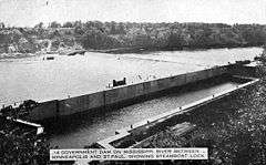
The Meeker Island Lock and Dam (originally known as Lock and Dam No. 2) was the first lock and dam facility built on the Upper Mississippi River. After a construction period lasting eight years, the site was only in operation for five years from 1907 to 1912 when the growing interest in hydroelectric power led to design and construction of today's Lock and Dam No. 1 a few miles downriver.[2] It was realized that the new dam could take over the function provided by this first site and another small dam a short distance downriver.
Lock and Dam No. 1 opened in 1917, and a hydroelectric plant was added there in the 1920s to power the Ford Motor Company's Twin Cities Assembly Plant. The Meeker Island dam was demolished, although some ruins of the lock remain. Tops of the old lock walls become visible during low water periods on the river. It is located in the Desnoyer Park neighborhood, north of the Lake Street-Marshall Bridge connecting Minneapolis and Saint Paul, Minnesota.
The Meeker Island Lock and Dam ruins were added to the National Register of Historic Places in 2003.
Each year, National Park Service historian Dr. John Anfinson and the Friends of the Mississippi River lead a tour of the lock and dam ruins.
In 2005 a $380,000 restoration project began to create a public park near the dam. It was finished in 2007.[3]
References
- ↑ National Park Service (2006-03-15). "National Register Information System". National Register of Historic Places. National Park Service.
- ↑ Anfinson, John O. (Summer 1995). "The secret history of the Mississippi's earliest locks and dams". Minnesota History Magazine. Minnesota Historical Society. 54 (6): 254–267.
- ↑ Nelson, Time (August 24, 2007), "RIVER HISTORY RECLAIMED - A NEW ST. PAUL PARK MAKES ACCESSIBLE THE REMAINS OF THE HISTORIC MEEKER ISLAND LOCK AND DAM." Saint Paul Pioneer Press
External links
![]() Media related to Meeker Island Lock and Dam at Wikimedia Commons
Media related to Meeker Island Lock and Dam at Wikimedia Commons
| Locks and dams of the Upper Mississippi River | ||
|---|---|---|
| Upstream: Upper and lower Saint Anthony Falls dams |
Downstream: Lock and Dam No. 1 | |
Coordinates: 44°57′14″N 93°12′28″W / 44.95389°N 93.20778°W
| Topics | |
|---|---|
| Lists by states |
|
| Lists by insular areas | |
| Lists by associated states | |
| Other areas | |
| |