Mewat district
| Nuh District district | |
|---|---|
| District of Haryana | |
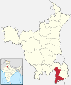 Location of Nuh District district in Haryana | |
| Country | India |
| State | Haryana |
| Headquarters | Nuh |
| Tehsils | Nuh, Firozpur Jhirka, Punahana, Taoru |
| Government | |
| • Lok Sabha constituencies | Gurgaon |
| • Assembly seats | Nuh, Ferozepur Jhirka, Punahana |
| Area | |
| • Total | 1,860 km2 (720 sq mi) |
| Population (2011) | |
| • Total | 10,89,406 |
| • Density | 590/km2 (1,500/sq mi) |
| • Urban | 4.64% |
| Demographics | |
| • Literacy | 56 |
| • Sex ratio | 906 |
| Major highways | National Highway 248-A (Gurgaon-Sohna-Alwar), KMP (Western Peripheral) Expressway |
| Average annual precipitation | 594 mm |
Nuh district (Hindi: Nuh ज़िला) (Urdu: ضِلع ميوات) is one of the 22 districts of Haryana state in northern India. The district was created as the 20th district of Haryana from erstwhile Gurgaon and the Hathin Block of Faridabad districts on 4 April 2005. However, Hathin sub-division was moved to the new district of Palwal in 2008. It is bounded by Gurgaon district on the north, Rewari district on the west and Faridabad and Palwal districts on the east. Nuh is the headquarters town of this district, which occupies an area of 1,859.61 square kilometres (718.00 sq mi) and as of the 2011 India census had a population of 10,89,406. Mewat is predominantly populated by the Meos, who are agriculturalists along with Hindus.
In 2016, the government of Haryana began proceedings to change the name of the district to Nuh district.[1]
History
Mewat district was carved from erstwhile Gurgoan and Hathin sub-division of Faridabad district and came into existence on 4 April 2005 as the 20th district of the Haryana State. After the formation of Palwal district, Hathin sub-division was transferred to Palwal district. Nuh town is Mewat district's headquarters. The district comprises Nuh, Taoru, Nagina, Firozpur Jhirka and Punhana blocks, 431 villages and 297 panchayats. There were 512 villages and 365 panchayats in Mewat district before Hathin Block was transferred to Palwal district.
Geography
The soil of Mewat is light in texture, particularly sandy, sandy loam and clay loam. The upper hills are mostly barren.The total area of Mewat district is 1507 km2.
Towns
- Ferozepur Jhirka
- Nagina
- Pinangwan
- Punahana
- Tauru
Demography
According to the 2011 census Mewat District has a population of 1,089,406,[2] roughly equal to the nation of Cyprus[3] or the US state of Rhode Island.[4] This gives it a ranking of 420th in India (out of a total of 640).[2] The district has a population density of 729 inhabitants per square kilometre (1,890/sq mi) .[2] Its population growth rate over the decade 2001-2011 was 37.94%.[2] Mewat has a sex ratio of 906 females for every 1000 males,[2] and a literacy rate of 56.1%.
According to the Census of India 2001, the total population of Mewat was 9,93,617 (including Hathin Block of district Palwal) of which 46,122 (4.64%) lived in urban areas and the major chunk 9,47,495 (95.36%) of the population lived in rural areas. Out of the total population of 9,93,617, there are 5,24,872 males and 4,68,745 females. The SC population is around 78,802. The total numbers of households are 1,42,822 out of which 1,35,253 (95%) are in rural areas and remaining 7569 (5%) are in urban areas. The total number of BPL households are 53125 including Hathin Block.

Economy
The main occupation in Mewat is agriculture along with allied and agro-based activities. The Meos are the predominant population group and are all agriculturists. Agriculture is mostly rain fed except in small pockets where canal irrigation is available. Agriculture production measured in terms of crop yield per hectare is low in comparison to the other districts of the State. Animal husbandry, particularly dairy, is the secondary source of income for the people and those who live closer to the hilly ranges of Aravali also keep sheep and goats. Milk yields are not so low, however, due to heavy indebtedness most of the farmers are forced to sell the milk to the lenders at lower than normal price, which drastically reduces their income from the milk. The poultry population in Mewat is much less in comparison to other districts of Haryana State.
Mewat has remained a region of backwardness even after independence. The area lags behind the rest of Haryana on almost every yardstick of development indices, even though the farthest point of Mewat is no more than 145 kilometres (90 mi) from the National Capital.
Mewat also has a MMTC factory located in the Rojka-Meo industrial estate.
Climate
Mewat falls under the Sub-Tropical, Semi-arid climatic zone with extremely hot temperature in summer. Dryness of air is standard feature in Mewat except during the monsoon season. May and June are the hottest months of the year with the temperature ranging from 30C to 48C. January, on the other hand is the coldest month with temperature ranging between 2 °C to 25 °C. Strong dusty winds are conspicuous during summer.
Rainfall
The annual rainfall varies considerably from year to year. The maximum rainfall is experienced during the monsoon season, which reaches its peak in the month of July. The principal precipitation occurs during monsoon period from June to September when about 80% of the rainfall is received. The average rainfall varies from 336 mm to 440 mm in the district.
Humidity
Humidity is considerably low during the greater part of the year. The Mewat experiences high humidity only during the monsoon period. The period of minimum humidity (less than 20%) is between April and May.
Wind
During the monsoon, the sky is heavily clouded, and winds are strong during this period. Winds are generally light during the post-monsoon and winter months.
Region Specific Weather Phenomena
Mewat experiences a high incidence of thunderstorms and dust storms, often accompanied by violent squalls (andhar) during the period April to June. Sometimes the thunderstorms are accompanied by heavy rain and occasionally by hailstorms. In the winter months, fog sometimes appears in the district.
References
- ↑ "Gurgaon is now 'Gurugram', Mewat renamed Nuh: Haryana government". The Indian Express. 12 April 2016. Retrieved 12 April 2016.
- 1 2 3 4 5 "District Census 2011". Census2011.co.in. 2011. Retrieved 2011-09-30.
- ↑ US Directorate of Intelligence. "Country Comparison:Population". Retrieved 2011-10-01.
Cyprus 1,120,489 July 2011 est.
- ↑ "2010 Resident Population Data". U. S. Census Bureau. Retrieved 2011-09-30.
Rhode Island 1,052,567
- ↑ "Population by religion community - 2011". Census of India, 2011. The Registrar General & Census Commissioner, India. Archived from the original on 25 August 2015.
External links
 |
Rewari district | Gurgaon district | | |
| Alwar district, Rajasthan | |
Palwal district | ||
| ||||
| | ||||
| Bharatpur district, Rajasthan | Mathura district, Uttar Pradesh |
Coordinates: 28°06′N 77°00′E / 28.100°N 77.000°E