Millers, Missouri
| Millers, Missouri | |
|---|---|
| unincorporated community | |
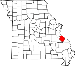 Location of Ste. Genevieve County, Missouri | |
| Coordinates: 37°51′38″N 90°16′13″W / 37.86056°N 90.27028°WCoordinates: 37°51′38″N 90°16′13″W / 37.86056°N 90.27028°W | |
| Country | United States |
| State | Missouri |
| County | Sainte Genevieve |
| Township | Union [1] |
| Elevation | 896 [2] ft (273 m) |
| Time zone | Central (CST) (UTC-6) |
| • Summer (DST) | CDT (UTC-5) |
| ZIP code | 63670 |
| Area code(s) | 573 |
| FIPS code | 29-48325 [3] |
| GNIS feature ID | 741068 |
Millers is an unincorporated community in Union Township in western Sainte Genevieve County, Missouri, in the United States. It is situated about 15 miles southwest of Ste. Genevieve.[4] The community started out as a switch spur of the Missouri-Illinois Railroad between Weingarten and Sprott, Missouri on the property of L. R. Miller.[5]
References
- ↑ "hometownlocator.com". Retrieved October 2, 2016.
- ↑ "mytopo.com". Retrieved October 2, 2016.
- ↑ "Roadsidethoughts.com". Retrieved October 2, 2016.
- ↑ "Maplandia". November 30, 2016.
- ↑ "State Historical Society of Missouri – Ste. Genevieve Place Names, 1928-1945". Retrieved October 1, 2016.
Municipalities and communities of Sainte Genevieve County, Missouri, United States | ||
|---|---|---|
| Cities | | |
| Townships | ||
| CDPs |
| |
| Other communities |
| |
| Ghost towns | ||
This article is issued from Wikipedia - version of the 12/1/2016. The text is available under the Creative Commons Attribution/Share Alike but additional terms may apply for the media files.