Ste. Genevieve, Missouri
| Ste. Genevieve, Missouri | |
|---|---|
| City | |
|
Maison Bequette-Ribault c. 1805 privately owned | |
| Nickname(s): "The Mother City of the West"[1] | |
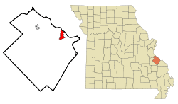 Location of Ste. Genevieve, Missouri | |
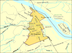 U.S. Census Map | |
| Coordinates: 37°58′37″N 90°2′55″W / 37.97694°N 90.04861°WCoordinates: 37°58′37″N 90°2′55″W / 37.97694°N 90.04861°W | |
| Country | United States |
| State | Missouri |
| County | Ste. Genevieve |
| Township | Ste. Genevieve |
| Incorporated | 1805 |
| Named for | Saint Genevieve |
| Area[2] | |
| • Total | 4.11 sq mi (10.64 km2) |
| • Land | 4.10 sq mi (10.62 km2) |
| • Water | 0.01 sq mi (0.03 km2) |
| Elevation | 560 ft (170.7 m) |
| Population (2010)[3] | |
| • Total | 4,410 |
| • Estimate (2012[4]) | 4,316 |
| • Density | 1,075.6/sq mi (415.3/km2) |
| Time zone | Central (CST) (UTC-6) |
| • Summer (DST) | CDT (UTC-5) |
| Zip code | 63670 |
| Area code(s) | 573 |
| FIPS code | 29-64180[5] |
| GNIS feature ID | 0727043[6] |
| Website | http://www.stegenevieve.org/ |
Ste. Genevieve (Ste-Geneviève with French spelling) is a city in Ste. Genevieve Township and is the county seat of Ste. Genevieve County, Missouri, United States.[7] The population was 4,410 at the 2010 census. Founded in 1735 by French Canadian colonists and settlers from east of the river, it was the first organized European settlement west of the Mississippi River in present-day Missouri.
History
Founded around 1735 by Canadien settlers and migrants from settlements in the Illinois Country just east of the Mississippi River, Ste. Geneviève is the oldest permanent European settlement in Missouri. It was named for Saint Genevieve (who lived in the 5th century AD), the patron saint of Paris, the capital of France. While most residents were of French-Canadian descent, many of the founding families had been in the Illinois Country for two or three generations. It is one of the oldest colonial settlements west of the Mississippi River.[8] This area was known as New France, Illinois Country, or the Upper Louisiana territory. Traditional accounts suggested a founding of 1735 or so, but the historian Carl Ekberg has documented a more likely founding about 1750. The population to the east of the river needed more land, as the soils in the older villages had become exhausted. Improved relations with hostile Native Americans, such as the Osage, made settlement possible.[9]
Prior to the French Canadian settlers, indigenous peoples known as the Mississippian culture and earlier cultures had been living in the region for more than a thousand years. At the time of settlement, however, no Indian tribe lived nearby on the west bank. Jacques-Nicolas Bellin's map of 1755, the first to show Ste. Genevieve in the Illinois Country, showed the Kaskaskia natives on the east side of the river, but no Indian village on the west side within 100 miles of Ste. Genevieve.[10] Osage hunting and war parties did enter the area from the north and west. The region had been relatively abandoned by 1500, likely due to environmental exhaustion, after the peak of Mississippian-culture civilization at Cahokia, the center of the mounds culture.
At the time of its founding, Ste. Genevieve was the last of a triad of French Canadian settlements in this area of the mid-Mississippi Valley region. About five miles northeast of Ste. Genevieve on the east side of the river was Fort de Chartres (in the Illinois Country); it stood as the official capital of the area. Kaskaskia, which became Illinois’ first capital upon statehood, was located about five miles southeast. Prairie du Rocher and Cahokia, Illinois were also early local French colonial settlements on the east side of the river.
Following defeat by the British in the French and Indian War, in 1762 with the Treaty of Fontainebleau, France secretly ceded the area of the west bank of the Mississippi River to Spain, which formed Louisiana (New Spain). The Spanish moved the capital of Upper Louisiana from Fort de Chartres fifty miles upriver to St. Louis. They ruled with a light hand and often through mostly French-speaking officials. Although under Spanish control for more than 40 years, Ste. Genevieve retained its French language, customs and character.
In 1763, the French ceded the land east of the Mississippi to Great Britain in the Treaty of Paris that ended Europe's Seven Years' War, also known on the North American front as the French and Indian War. French-speaking people from Canada and settlers east of the Mississippi went west to escape British rule; they also flocked to Ste. Genevieve after George III issued the Royal Proclamation of 1763. This transformed all of the captured French land between the Mississippi and the Appalachian Mountains, except Quebec, into an Indian Reserve. The king required settlers to leave or get British permission to stay. These requirements were regularly violated by European-American settlers, who resented efforts to restrict their expansion.
During the 1770s, Little Osage and Missouri tribes repeatedly raided Ste. Genevieve to steal settlers' horses. But the fur trade, marriage of French-Canadian men with Native American women, and other commercial dealings created many ties between Native Americans and the Canadiens. During the 1780s, some Shawnee and Lenape (Delaware) migrated to the west side of the Mississippi following American victory in its Revolutionary War. The tribes established villages south of Ste. Genevieve. The Peoria also moved near Ste. Genevieve in the 1780s but had a peaceful relationship with the village. It was not until the 1790s that the Big Osage pressed the settlement harder; they conducted repeated raids and killed some settlers. In addition, they attacked the Peoria and Shawnee.[11]
While at one point Spanish administrators wanted to attack the Big Osage, there were not sufficient French settlers to recruit for a militia to do so. The Big Osage had 1250 men in their village, and lived in the prairie. In 1794 Francisco Luis Héctor de Carondelet, the Spanish governor at New Orleans, appointed brothers Pierre Chouteau and Auguste Chouteau of St. Louis to have exclusive trading privileges with the Big Osage. They built a fort and trading post on the Osage River in Big Osage territory. While the natives did not entirely cease their raids on Ste. Genevieve, commercial diplomacy and rewards of the fur trade eased some relations.[11]
Le Vieux Village (Old Ste. Genevieve c. 1750)
Following the great flood of 1785, the town moved from its initial location on the floodplain of the Mississippi River, to its present location two miles north and about a half mile inland. It continued to prosper as a village devoted to agriculture, especially wheat, maize and tobacco production. Most of the families were yeomen farmers, although there was a wealthier level among the residents. The village raised sufficient grain to send many tons of flour annually for sale to Lower Louisiana and New Orleans. This was essential to the survival of the southern colonies, which could not grow sufficient grain in their climate. In 1807, Frederick Bates, the secretary of the Louisiana Territory after the United States made the Louisiana Purchase, noted Ste. Genevieve was "the most wealthy village in Louisiana" (meaning the full Territory).[12]
Architecture
The oldest buildings of Ste. Genevieve, described as "French Creole colonial", were all built during Spanish rule of the late 18th century. The most distinctive buildings of this period were the "vertical wooden post" constructions where walls of buildings were built based on wood "posts" either dug into the ground (poteaux en terre) or set on a raised stone or brick foundation (poteaux sur solle). This was different from the log cabin style associated with the Anglo-American frontier settlements of the United States northeast, mid-Atlantic and Upper South, for which logs are stacked horizontally.
The most distinctive of the vertical post houses are poteaux en terre ("posts-in-the-ground") where the walls made of upright wooden posts do not support the floor. The floor is supported by separate stone pillars. Partially set into dirt, the walls of such buildings were extremely vulnerable to flood damage, termites and rot. Three of the five surviving poteaux en terre houses in the nation are in Ste. Genevieve. The other two are located in Pascagoula, Mississippi and near Natchitoches, Louisiana.
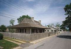
Most of the oldest buildings in the city are poteaux sur solle ("posts-on-a-sill"). One of the oldest structures is the Louis Bolduc House built in 1792, which has been designated as a National Historic Landmark. The Louis Bolduc originally built a smaller house in 1770 at Ste. Genevieve's first riverfront location. Although much of the house was severely damaged by flooding, parts were dismantled and moved north as the community developed the new site in 1785. Bolduc incorporated these materials into his new and larger house, built in 1792–1793. The three large ground-floor rooms expressed Bolduc's wealth. Other structures of note are the 1806 La Maison de Guibourd Historic House, the 1818 Felix Vallé House State Historic Site, the 1792 Beauvais-Amoureux House, the 1790s Bequette-Ribault House, and the 1808 Old Louisiana Academy, all of which are listed on the National Register of Historic Places.
Culture
For decades, Ste. Genevieve was chiefly an agricultural community. The habitants raised chiefly wheat and corn (maize), as well as tobacco. They produced more wheat than residents of St. Louis, and their grain products were critical to survival of the French community at New Orleans.
The village followed traditional practices: most of the townspeople lived on lots in town. They farmed land held in a common large field. This land was assigned and cultivated in the French style, in long, narrow strips that extended back from the river to the hills (at the first location) so that each settler would have some waterfront. Only the exterior of the Grand Champ (Big Field) was fenced, but each owner of land was responsible for fencing his portion, to keep out livestock.[13] The habitants used the same types of implements and plows as did farmers in 18th-century France. They used teams of oxen to pull the wheeled plows.
After the Louisiana Purchase in 1804, Anglo-Americans as well as German immigrants migrated to the village. It became more oriented to trade and merchants, but villagers retained many of their French cultural ways. The Sisters of St. Joseph, a French teaching order, established a convent in the town, whose sisters taught in a Catholic school. The current Ste. Genevieve Catholic Church was built in 1876 and modeled after the Gothic style of those in France. It was the third Catholic church built by the villagers.
Ste. Genevieve continues to celebrate its French cultural heritage with numerous annual events. Among them are: La Guiannée, a celebration associated with Christmas; French Fest, Jour de Fête, King's Ball and many others.
The "French Connection"
The Ste. Genevieve-Modoc Ferry across the Mississippi River to Illinois is nicknamed the "French Connection" because of its link to other French colonial sites in the area. It runs daily unless the river is flooding.
Government
Notable people
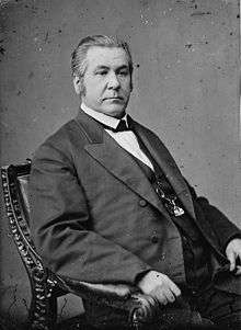
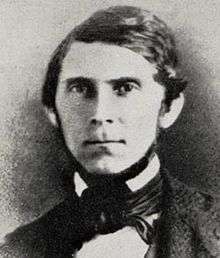
- Lewis Vital Bogy - U.S. Senator from Missouri
- Henry Brackenridge - lived here as a boy with an ethnic French family, and wrote about them, the town and the Osage in his memoir.
- Firmin Rene Desloge - nephew of Jean Ferdinand Rozier, arrived 1822, progenitor of the Desloge Family in America[14]
- Augustus Caesar Dodge - US Senator from Iowa
- Henry Dodge - US Senator from Wisconsin
- Pierre Gibault - 18th-century French Jesuit priest and missionary
- Lewis Fields Linn - U.S. Senator from Missouri
- William Pope McArthur - American naval officer and hydrologist
- Robert Moore - Oregon pioneer and founder of Linn City, Oregon
- Charles Nerinckx - founder of the Sisters of Loretto religious order
- Nathaniel Pope - US Representative from the Illinois Territory
- Philippe-François de Rastel de Rocheblave - Canadian military and political figure in the 18th century
- Prospect K. Robbins - Surveyor who established the Fifth Principal Meridian[15]
- Jean Ferdinand Rozier - 19th-century businessman and partner of artist and naturalist John James Audubon
- François Vallé - 18th-century pioneer, mine owner, and land-holder
- John Hardeman Walker - US Congressman
- Frank Rolfe - Real Estate Investor and Owner Of The Ste. Genevieve Academy
Notable figures gallery


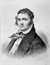

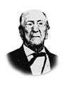 Felix Rozier
(1822–1908)
Prominent business figure whose father, Jean Ferdinand Rozier, became business partners with John James Audubon
Geography
Ste. Genevieve is located at 37°58′37″N 90°2′55″W / 37.97694°N 90.04861°W (37.976960, -90.048672).[16] The city is located along the west bank of the Mississippi River near the Illinois state line along Interstate 55, U.S. Route 61, and Missouri Route 32 approximately 46 mi (74 km) south-southeast of St. Louis and 196 mi (315 km) north-northwest of Memphis, Tennessee.
According to the United States Census Bureau, the city has a total area of 4.11 square miles (10.64 km2), of which, 4.10 square miles (10.62 km2) is land and 0.01 square miles (0.03 km2) is water.[2]
Media
The Ste. Genevieve Herald is a weekly newspaper that has served Ste. Genevieve County since May 1882.
Nearby communities
Demographics
| Historical population | |||
|---|---|---|---|
| Census | Pop. | %± | |
| 1850 | 718 | — | |
| 1860 | 1,277 | 77.9% | |
| 1870 | 1,521 | 19.1% | |
| 1880 | 1,422 | −6.5% | |
| 1890 | 1,586 | 11.5% | |
| 1900 | 1,707 | 7.6% | |
| 1910 | 1,967 | 15.2% | |
| 1920 | 2,046 | 4.0% | |
| 1930 | 2,662 | 30.1% | |
| 1940 | 2,787 | 4.7% | |
| 1950 | 3,992 | 43.2% | |
| 1960 | 4,443 | 11.3% | |
| 1970 | 4,468 | 0.6% | |
| 1980 | 4,481 | 0.3% | |
| 1990 | 4,411 | −1.6% | |
| 2000 | 4,476 | 1.5% | |
| 2010 | 4,410 | −1.5% | |
| Est. 2015 | 4,472 | [17] | 1.4% |
2010 census
As of the census[3] of 2010, there were 4,410 people, 1,824 households, and 1,087 families residing in the city. The population density was 1,075.6 inhabitants per square mile (415.3/km2). There were 2,018 housing units at an average density of 492.2 per square mile (190.0/km2). The racial makeup of the city was 95.78% White, 1.59% Black or African American, 0.39% Native American, 0.63% Asian, 0.02% Native Hawaiian or Pacific Islander, 0.18% from other races, and 1.41% from two or more races. Hispanic or Latino of any race were 1.18% of the population.
There were 1,824 households of which 27.2% had children under the age of 18 living with them, 43.6% were married couples living together, 11.5% had a female householder with no husband present, 4.4% had a male householder with no wife present, and 40.4% were non-families. 34.8% of all households were made up of individuals and 16.9% had someone living alone who was 65 years of age or older. The average household size was 2.28 and the average family size was 2.94.
The median age in the city was 43 years. 21.8% of residents were under the age of 18; 8.2% were between the ages of 18 and 24; 22.2% were from 25 to 44; 27.3% were from 45 to 64; and 20.5% were 65 years of age or older. The gender makeup of the city was 48.4% male and 51.6% female.
2000 census
As of the census[5] of 2000, there were 4,476 people, 1,818 households, and 1,154 families residing in the city. The population density was 1,076.7 people per square mile (415.4/km2). There were 1,965 housing units at an average density of 472.7 per square mile (182.4/km2). The racial makeup of the city was 96.07% White, 2.14% African American, 0.58% Native American, 0.31% Asian, 0.25% from other races, and 0.65% from two or more races. Hispanic or Latino of any race were 1.12% of the population.
There were 1,818 households out of which 27.6% had children under the age of 18 living with them, 49.7% were married couples living together, 10.6% had a female householder with no husband present, and 36.5% were non-families. 32.8% of all households were made up of individuals and 19.1% had someone living alone who was 65 years of age or older. The average household size was 2.29 and the average family size was 2.90.
In the city the population was spread out with 21.9% under the age of 18, 7.7% from 18 to 24, 25.0% from 25 to 44, 21.8% from 45 to 64, and 23.6% who were 65 years of age or older. The median age was 42 years. For every 100 females there were 92.7 males. For every 100 females age 18 and over, there were 89.8 males.
The median income for a household in the city was $33,929, and the median income for a family was $43,125. Males had a median income of $31,546 versus $19,804 for females. The per capita income for the city was $17,361. About 7.8% of families and 9.6% of the population were below the poverty line, including 18.8% of those under age 18 and 10.2% of those age 65 or over.
Sister (twin) cities
Historic flags of Ste. Genevieve
 Flag of New France
to 1763 Flag of New Spain
1763–1803 15 star-15 stripe US flag
1804–1818 Flag of Missouri
from 1913
Galleries
Recent
 Louis Bolduc House Museum
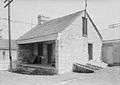
c. 1785 NSCDA/MO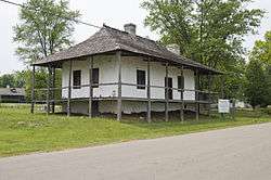 Maison Bequette-Ribault
c. 1789 privately owned Jacques Guibourd Historic House
c. 1806 FRSG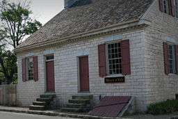 Felix Vallé State Historic Site
c. 1818 MDNR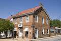 John Price 'Old Brick' Bldg
c. 1804 Joseph Bogy House
c. 1870 Dr Fenwick House
c. 1805 Southern Hotel
c. 1820 Jesse Robbins house
c. 1867 A German style building
 A Victorian house
 A small shop
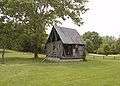 The Lasource-Durand Cabin
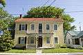 An interesting house
 A house near Gabouri Creek
 An old house
 A 19th-century house
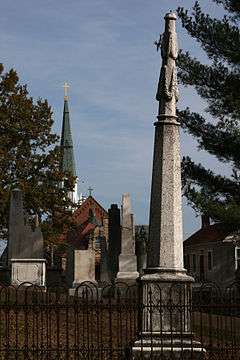 Memorial Cemetery
Est 1787
'Missouri's Oldest' The tug Holly J
Archival
 Indian trading post
Shaw House
MDNR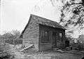 Cabin c. 1936
Bauvais-Amoureux House
MDNR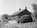 circa 1937
Maison Bequette-Ribault Sleeping quarters
Bolduc House
NSCDA/MO French style barn
Jean Baptiste Vallé House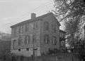 City's first post office
See also
- Louisiana (New France)
- Louisiana Purchase
- Illinois Country
- Ohio Country
- New France
- New Spain
- French in the United States
- Timeline of New France history
- Three Flags Day
- A few acres of snow
- French colonization of the Americas
- French colonial empire
- List of North American cities founded in chronological order
- Sainte Geneviève
- List of commandants of the Illinois Country
- Historic regions of the United States
References
- ↑ "The Ste. Genevieve Herald tagline "Printed in the Mother City of the West since 1882"". Retrieved 2014-09-10.
- 1 2 "US Gazetteer files 2010". United States Census Bureau. Retrieved 2012-07-08.
- 1 2 "American FactFinder". United States Census Bureau. Retrieved 2012-07-08.
- ↑ "Population Estimates". United States Census Bureau. Retrieved 2013-05-30.
- 1 2 "American FactFinder". United States Census Bureau. Retrieved 2008-01-31.
- ↑ "US Board on Geographic Names". United States Geological Survey. 2007-10-25. Retrieved 2008-01-31.
- ↑ "Find a County". National Association of Counties. Retrieved 2011-06-07.
- ↑ Carl J. Ekberg, Colonial Ste. Genevieve: An Adventure on the Mississippi Frontier, Gerald, MO: The Patrice Press, 1985, pp. 15-20
- ↑ Ekberg (1985), Colonial Ste. Genevieve, p. 25
- ↑ Ekberg (1985), Colonial Ste. Genevieve, p. 87
- 1 2 Ekberg (1985), Colonial Ste. Genevieve, pp. 87-104
- ↑ Ekberg (1985), Colonial Ste. Genevieve, p. 177
- ↑ Ekberg (1985), Colonial Ste. Genevieve, p. 130-132
- ↑ Christopher Desloge, Desloge Chronicles - Tale of Two Continents, lulu, 2010
- ↑ "Surveyors Challenge", Big Muddy, Southeastern Missouri University
- ↑ "US Gazetteer files: 2010, 2000, and 1990". United States Census Bureau. 2011-02-12. Retrieved 2011-04-23.
- ↑ "Annual Estimates of the Resident Population for Incorporated Places: April 1, 2010 to July 1, 2015". Retrieved July 2, 2016.
- ↑ "Census of Population and Housing". Census.gov. Retrieved 2015-06-04.
Further reading
- Ekberg, Carl J. Colonial Ste. Genevieve: An Adventure on the Mississippi Frontier (Gerald, MO: The Patrice Press, 1985)
- Ekberg, Carl J. François Vallé And His World: Upper Louisiana Before Louis and Clark (University of Missouri Press, 2002) 316 pp.
- Stepenoff, Bonnie. From French Community to Missouri Town: Ste. Genevieve in the Nineteenth Century (University of Missouri Press, 2006) 232 pp.
External links
| Wikimedia Commons has media related to Ste. Geneviève. |
| Wikimedia Commons has media related to New France. |
- United states 2010 census map
- Foundation for Restoration of Ste. Genevieve, Inc. Guibourd Historic House & Mecker Research Library
- Ste. Genevieve County Historical and Genealogical Resources
- Sainte Genevieve Chamber of Commerce
- Felix Vallé State Historic Site Missouri Department of Natural Resources
- Ste. Genevieve Herald
- Historic maps of Ste. Genevieve in the Sanborn Maps of Missouri Collection at the University of Missouri
Municipalities and communities of Sainte Genevieve County, Missouri, United States | ||
|---|---|---|
| Cities |  | |
| Townships | ||
| CDPs |
| |
| Other communities |
| |
| Ghost towns | ||