Millwood Township, Guernsey County, Ohio
| Millwood Township, Guernsey County, Ohio | |
|---|---|
| Township | |
|
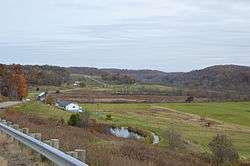
Fields just east of Quaker City | |
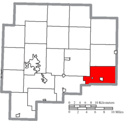 Location of Millwood Township in Guernsey County | |
| Coordinates: 39°58′36″N 81°18′40″W / 39.97667°N 81.31111°WCoordinates: 39°58′36″N 81°18′40″W / 39.97667°N 81.31111°W | |
| Country | United States |
| State | Ohio |
| County | Guernsey |
| Area | |
| • Total | 27.2 sq mi (70.4 km2) |
| • Land | 27.2 sq mi (70.4 km2) |
| • Water | 0.0 sq mi (0.0 km2) |
| Elevation[1] | 1,184 ft (361 m) |
| Population (2000) | |
| • Total | 1,318 |
| • Density | 48.5/sq mi (18.7/km2) |
| Time zone | Eastern (EST) (UTC-5) |
| • Summer (DST) | EDT (UTC-4) |
| FIPS code | 39-50568[2] |
| GNIS feature ID | 1086186[1] |
Millwood Township is one of the nineteen townships of Guernsey County, Ohio, United States. The 2000 census found 1,318 people in the township, 601 of whom lived in the unincorporated portions of the township.[3]
Geography
Located in the southeastern corner of the county, it borders the following townships:
- Oxford Township - north
- Warren Township, Belmont County - east
- Somerset Township, Belmont County - southeast
- Beaver Township, Noble County - south
- Wayne Township, Noble County - southwest
- Richland Township - west
- Wills Township - northwest
Two incorporated villages are located in Millwood Township: Quaker City in the center, and Salesville in the west. Leatherwood Creek flows through the township.[4]
Name and history
Millwood Township was established around 1834.[5] It is the only Millwood Township statewide.[6]
Government
The township is governed by a three-member board of trustees, who are elected in November of odd-numbered years to a four-year term beginning on the following January 1. Two are elected in the year after the presidential election and one is elected in the year before it. There is also an elected township fiscal officer,[7] who serves a four-year term beginning on April 1 of the year after the election, which is held in November of the year before the presidential election. Vacancies in the fiscal officership or on the board of trustees are filled by the remaining trustees.
References
- 1 2 "US Board on Geographic Names". United States Geological Survey. 2007-10-25. Retrieved 2008-01-31.
- ↑ "American FactFinder". United States Census Bureau. Retrieved 2008-01-31.
- ↑ Guernsey County, Ohio — Population by Places Estimates Ohio State University, 2007. Accessed 15 May 2007.
- ↑ Ohio Atlas & Gazetteer. Yarmouth, Me.: DeLorme. 1991. p. 72. ISBN 0-89933-233-1.
- ↑ Sarchet, Cyrus Parkinson Beatty (1911). History of Guernsey County, Ohio, Volume 1. B.F. Bowen & Company. p. 311.
- ↑ "Detailed map of Ohio" (PDF). United States Census Bureau. 2000. Retrieved 2007-02-16.
- ↑ §503.24, §505.01, and §507.01 of the Ohio Revised Code. Accessed 4/30/2009.
External links
Municipalities and communities of Guernsey County, Ohio, United States | ||
|---|---|---|
| City | 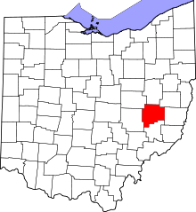 | |
| Villages | ||
| Townships | ||
| CDPs | ||
| Unincorporated communities | ||
| Footnotes | ‡This populated place also has portions in an adjacent county or counties | |