Quaker City, Ohio
| Quaker City, Ohio | |
|---|---|
| Village | |
|
Houses on South Street | |
| Nickname(s): Millwood and Leatherwood | |
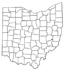 Location of Quaker City, Ohio | |
 Location of Quaker City in Guernsey County | |
| Coordinates: 39°58′11″N 81°17′56″W / 39.96972°N 81.29889°WCoordinates: 39°58′11″N 81°17′56″W / 39.96972°N 81.29889°W | |
| Country | United States |
| State | Ohio |
| County | Guernsey |
| Township | Millwood |
| Government | |
| • Founder | John Hall (a pioneer Quaker) |
| Area[1] | |
| • Total | 0.53 sq mi (1.37 km2) |
| • Land | 0.53 sq mi (1.37 km2) |
| • Water | 0 sq mi (0 km2) |
| Elevation[2] | 853 ft (260 m) |
| Population (2010)[3] | |
| • Total | 502 |
| • Estimate (2012[4]) | 498 |
| • Density | 947.2/sq mi (365.7/km2) |
| Time zone | Eastern (EST) (UTC-5) |
| • Summer (DST) | EDT (UTC-4) |
| ZIP codes | 43736, 43773 |
| Area code(s) | 740 |
| FIPS code | 39-65116[5] |
| GNIS feature ID | 1061578[2] |

Quaker City is a village in Guernsey County, Ohio, United States. The population was 502 at the 2010 census.
Geography
Quaker City is located at 39°58′11″N 81°17′56″W / 39.969740°N 81.298988°W,[6] along Leatherwood Creek.[7]
According to the United States Census Bureau, the village has a total area of 0.53 square miles (1.37 km2), all land.[1]
Demographics
| Historical population | |||
|---|---|---|---|
| Census | Pop. | %± | |
| 1880 | 594 | — | |
| 1890 | 845 | 42.3% | |
| 1900 | 878 | 3.9% | |
| 1910 | 746 | −15.0% | |
| 1920 | 732 | −1.9% | |
| 1930 | 613 | −16.3% | |
| 1940 | 634 | 3.4% | |
| 1950 | 655 | 3.3% | |
| 1960 | 583 | −11.0% | |
| 1970 | 510 | −12.5% | |
| 1980 | 698 | 36.9% | |
| 1990 | 560 | −19.8% | |
| 2000 | 563 | 0.5% | |
| 2010 | 502 | −10.8% | |
| Est. 2015 | 490 | [8] | −2.4% |
2010 census
As of the census[3] of 2010, there were 502 people, 202 households, and 142 families residing in the village. The population density was 947.2 inhabitants per square mile (365.7/km2). There were 233 housing units at an average density of 439.6 per square mile (169.7/km2). The racial makeup of the village was 99.0% White, 0.4% Asian, 0.4% from other races, and 0.2% from two or more races. Hispanic or Latino of any race were 0.8% of the population.
There were 202 households of which 32.7% had children under the age of 18 living with them, 52.5% were married couples living together, 14.4% had a female householder with no husband present, 3.5% had a male householder with no wife present, and 29.7% were non-families. 24.3% of all households were made up of individuals and 9.9% had someone living alone who was 65 years of age or older. The average household size was 2.49 and the average family size was 2.98.
The median age in the village was 37.8 years. 25.5% of residents were under the age of 18; 9.5% were between the ages of 18 and 24; 25% were from 25 to 44; 24.8% were from 45 to 64; and 15.5% were 65 years of age or older. The gender makeup of the village was 48.6% male and 51.4% female.
2000 census
As of the census[5] of 2000, there were 563 people, 220 households, and 159 families residing in the village. The population density was 1,063.6 people per square mile (410.1/km2). There were 241 housing units at an average density of 455.3 per square mile (175.6/km2). The racial makeup of the village was 99.29% White, 0.18% African American, 0.36% from other races, and 0.18% from two or more races. Hispanic or Latino of any race were 0.36% of the population.
There were 220 households out of which 36.4% had children under the age of 18 living with them, 57.3% were married couples living together, 9.1% had a female householder with no husband present, and 27.3% were non-families. 25.0% of all households were made up of individuals and 13.2% had someone living alone who was 65 years of age or older. The average household size was 2.56 and the average family size was 3.04.
In the village the population was spread out with 27.4% under the age of 18, 8.7% from 18 to 24, 29.5% from 25 to 44, 19.7% from 45 to 64, and 14.7% who were 65 years of age or older. The median age was 34 years. For every 100 females there were 94.1 males. For every 100 females age 18 and over, there were 89.4 males.
The median income for a household in the village was $22,176, and the median income for a family was $28,750. Males had a median income of $24,583 versus $15,865 for females. The per capita income for the village was $11,148. About 16.3% of families and 16.0% of the population were below the poverty line, including 18.7% of those under age 18 and 27.5% of those age 65 or over.
History
The first settlement at Quaker City was made ca. 1850, but growth remained static until a store opened at the site in 1870.[10] A post office called Quaker City has been in operation until 1872.[11]
References
- 1 2 "US Gazetteer files 2010". United States Census Bureau. Archived from the original on January 24, 2012. Retrieved 2013-01-06.
- 1 2 "US Board on Geographic Names". United States Geological Survey. 2007-10-25. Retrieved 2008-01-31.
- 1 2 "American FactFinder". United States Census Bureau. Retrieved 2013-01-06.
- ↑ "Population Estimates". United States Census Bureau. Archived from the original on June 17, 2013. Retrieved 2013-06-17.
- 1 2 "American FactFinder". United States Census Bureau. Archived from the original on September 11, 2013. Retrieved 2008-01-31.
- ↑ "US Gazetteer files: 2010, 2000, and 1990". United States Census Bureau. 2011-02-12. Retrieved 2011-04-23.
- ↑ Ohio Atlas & Gazetteer. Yarmouth, Me.: DeLorme. 1991. p. 72. ISBN 0-89933-233-1.
- ↑ "Annual Estimates of the Resident Population for Incorporated Places: April 1, 2010 to July 1, 2015". Retrieved July 2, 2016.
- ↑ "Census of Population and Housing". Census.gov. Archived from the original on May 11, 2015. Retrieved June 4, 2015.
- ↑ Overman, William Daniel (1958). Ohio Town Names. Akron, OH: Atlantic Press. p. 115.
- ↑ "Post offices". Jim Forte Postal History. Retrieved 19 June 2016.
Municipalities and communities of Guernsey County, Ohio, United States | ||
|---|---|---|
| City | 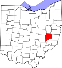 | |
| Villages | ||
| Townships | ||
| CDPs | ||
| Unincorporated communities | ||
| Footnotes | ‡This populated place also has portions in an adjacent county or counties | |