Mitchelton, Queensland
| Mitchelton Brisbane, Queensland | |||||||||||||
|---|---|---|---|---|---|---|---|---|---|---|---|---|---|
| Coordinates | 27°24′36″S 152°58′23″E / 27.41000°S 152.97306°ECoordinates: 27°24′36″S 152°58′23″E / 27.41000°S 152.97306°E | ||||||||||||
| Population | 8,012 (2011)[1] | ||||||||||||
| • Density | 1,821/km2 (4,720/sq mi) | ||||||||||||
| Postcode(s) | 4053 | ||||||||||||
| Area | 4.4 km2 (1.7 sq mi) | ||||||||||||
| Location | 8 km (5 mi) from Brisbane CBD | ||||||||||||
| LGA(s) | City of Brisbane | ||||||||||||
| State electorate(s) | Ashgrove, Everton | ||||||||||||
| Federal Division(s) | Brisbane | ||||||||||||
| |||||||||||||
Mitchelton is a suburb of the City of Brisbane, in Queensland, Australia.[2]
Geography
The suburb is located 8 kilometres (5.0 mi) from the Brisbane central business district some areas of Mitchelton can be 6 kilometres (3.7 mi) to the Brisbane central business district. Mitchelton is part of the northwestern suburbs. It is a growing suburb with many Queenslander style houses and leafy streets. The area is quite hilly and most of the suburb is on a north-facing slope.
Demographics
In the 2011 census the population of Mitchelton was 8,012, 52.8% female and 47.2% male.
The median age of the Mitchelton population was 35 years of age, 2 years below the Australian median.
79.9% of people living in Mitchelton were born in Australia, compared to the national average of 69.8%; the next most common countries of birth were England 3.6%, New Zealand 2.6%, Scotland 0.7%, United States of America 0.7%, India 0.6%.
89.8% of people spoke only English at home; the next most common languages were 0.5% Italian, 0.5% Mandarin, 0.4% Japanese, 0.4% Spanish, 0.3% German.
History
Mitchelton is an area with a long history. Mitchelton's name comes from one particular family of the first settlers in the area. The Mitchell family emigrated from England in the 1850s. Nicolas Mitchell purchased an estate he named "Mitchelton" by 1875. This area was subdivided in the 1890s.[2]
Heritage listings

Mitchelton has a number of heritage-listed sites, including:
- 35 Church Road: St Matthews Anglican Church, Grovely[3]
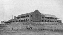
- 67 Osborne Road: Good Shepherd Home, Mt Maria College[4]
Facilities
Mitchelton is now filled with many shops, schools and facilities, such as the Brookside Shopping Centre. Mitchelton is also home to many sporting teams in state competition.
Transport
Via train, Oxford Park Railway Station and Mitchelton Railway Station provide access to regular Queensland Rail City network services on the Ferny Grove railway line arranging travel to the Brisbane CBD, Beenleigh and Ferny Grove.
Via bus, Mitchelton is served by Brisbane Transport buses to the Brisbane CBD, Chermside, Toowong and Ferny Grove.
Via road, Mitchelton's main arterials are Samford Road, which is the main corridor for motorists travelling to The City and Samford, as well as Osborne Road which is the main corridor for motorists travelling to the outer Northern suburbs such as Aspley.
Education
Mitchelton is home to numerous schools, which include Mitchelton State School, Mitchelton State High School, Mitchelton Special School, Our Lady of Dolours Primary School and Mt Maria College, which is based in the old Sisters of the Good Shepherd home for troubled girls.
References
- ↑ ABS Statistics
- 1 2 "Mitchelton (entry 44885)". Queensland Place Names. Queensland Government. Retrieved 21 February 2014.
- ↑ "St Matthews Anglican Church (entry 600256)". Queensland Heritage Register. Queensland Heritage Council. Retrieved 6 July 2013.
- ↑ "Good Shepherd Home (former)". Brisbane Heritage Register. Brisbane City Council. Retrieved 26 September 2013.
External links
| Wikimedia Commons has media related to Mitchelton, Queensland. |
- University of Queensland: Queensland Places: Mitchelton
- "Mitchelton". BRISbites. Brisbane City Council. Archived from the original on 20 July 2008.
- "Mitchelton". Our Brisbane. Brisbane City Council. Archived from the original on 17 September 2007.
- Randall, Brian. "Mitchelton". Local History. Australian Broadcasting Corporation.