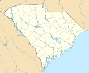
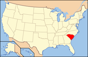
Mulberry Plantation (James and Mary Boykin Chesnut House)
|
Mulberry Plantation (James and Mary Boykin Chesnut House) | |
|
Mulberry Plantation | |
  | |
| Nearest city | 559 Sumter Highway, Camden, South Carolina |
|---|---|
| Coordinates | 34°12′23.5″N 80°35′31″W / 34.206528°N 80.59194°WCoordinates: 34°12′23.5″N 80°35′31″W / 34.206528°N 80.59194°W |
| Area |
4,100 acres (1,700 ha) (size of NHL-listed area) 4,800 acres (1,900 ha) (size of plantation) |
| Built | 1820 |
| Architect | Unknown |
| Architectural style | Federal |
| NRHP Reference # | 80003673 |
| Significant dates | |
| Added to NRHP | November 25, 1980[1] |
| Designated NHL | February 16, 2000[2] |
Mulberry Plantation, also known as the James and Mary Boykin Chesnut House is a historic plantation at 559 Sumter Highway (United States Route 521) south of Camden, South Carolina. Declared a National Historic Landmark in 2000, it is significant as the home of American Civil War chronicler Mary Boykin Chesnut, who produced some of the most important written accounts of the war from a Confederate perspective. The main house, built about 1820, is a fine example of Federal period architecture.[2][3]
Description and history
Mulberry Plantation is located about 3 miles (4.8 km) south of downtown Camden, and occupies more than 4,800 acres (1,900 ha) of land bordering the Wateree River. The main plantation house is located on a high point of the property, about 0.25 miles (0.40 km) east of Sumter Highway, and is accessed via a drive from that road. An early 20th-century wrought iron gate, spelling "Mulberry" within its elements, stands across the road between brick piers. The main house is a handsome Federal period brick house, 3-1/2 stories in height, that was built about 1820, with possible design input from the noted South Carolina architect Robert Mills.[3]
The plantation has a documented history of human habitation dating back as far as about 1250 CE, based on archaeological research of platform mounds found on the property. It is believed to be the site of Cofitachequi, a major chiefdom visited by the explorer Hernando de Soto in the 16th century, and is also the location of a second archaeological site, the McDowell Site.[3]
The plantation was established in the 1760s by James Chesnut, and passed first to his brother John, and then to John's son, James II. Under James II's stewardship, the plantation was one of the largest and most successful inland plantations in the state, growing to a maximum size of more than 12,000 acres (4,900 ha). He was politically active, serving in the state legislature, and he and his wife Mary moved in the highest circles of South Carolina society. When the American Civil War broke out, Mulberry was the couple's principal residence, and accounts of this place predominate in Mary Chesnut's detailed diary of the war years. Her diary, refined and published by her in the 1870s, remains a major historical work of the period, chronicling the rise and fall of the Confederacy.[3]
See also
| Wikimedia Commons has media related to Mulberry Plantation (Kershaw County, South Carolina). |
- List of National Historic Landmarks in South Carolina
- National Register of Historic Places listings in Kershaw County, South Carolina
References
- ↑ National Park Service (2007-01-23). "National Register Information System". National Register of Historic Places. National Park Service.
- 1 2 "Mulberry Plantation (James and Mary Boykin Chesnut House)". National Historic Landmark summary listing. National Park Service. Retrieved 2008-03-10.
- 1 2 3 4 Stephen Olausen (July 15, 1978). "National Historic Landmark Nomination: Mulberry Plantation (James and Mary Boykin Chesnut House)" (pdf). National Park Service. and Accompanying eight photos, exterior and interior, from 1997 (32 KB)
External links
- Mulberry Plantation, Kershaw County (U.S. Hwy. 521, Camden vicinity), at South Carolina Department of Archives and History
- "Writings of Mary Chesnut", broadcast from Mulberry Plantation from C-SPAN's American Writers
- Historic American Buildings Survey (HABS) No. SC-343, "Mulberry, U.S. Route 521, Camden, Kershaw County, SC", 9 photos, 1 photo caption page
.jpg)

