Nagari, Andhra Pradesh
| Nagari నగరి | |
|---|---|
| Town | |
|
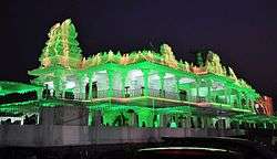
Sai Baba Temple in Nagari,Chittoor | |
 Nagari Location in Andhra Pradesh, India | |
| Coordinates: 13°19′17″N 79°35′08″E / 13.3214°N 79.5856°ECoordinates: 13°19′17″N 79°35′08″E / 13.3214°N 79.5856°E | |
| Country | India |
| State | Andhra Pradesh |
| District | Chittoor |
| Mandal | Nagari |
| Government | |
| • Type | Legislative assembly of Andhra Pradesh |
| • Body | Municipality |
| • MLA | R K Roja |
| Area[1] | |
| • Total | 35.45 km2 (13.69 sq mi) |
| Elevation | 115 m (377 ft) |
| Population (2011)[2] | |
| • Total | 62,253 |
| • Density | 1,800/km2 (4,500/sq mi) |
| Languages | |
| • Official | Telugu |
| Time zone | IST (UTC+5:30) |
| PIN | 517590 |
| Telephone code | 91-8577 |
| Vehicle registration | AP-03 |
| Website | Nagari Municipality |
Nagari is a town in Chittoor district of the Indian state of Andhra Pradesh. It is the mandal headquarters of Nagari mandal in Chittoor revenue division.[3][4]
Geography
Nagari is located at 13°20′N 79°35′E / 13.33°N 79.58°E.[5] It has an average elevation of 116 metres (380 feet).
Climate
Nagari experiences tropical climatic conditions and due to the close proximity of the Bay of Bengal the humidity is extremely high. Summers are long and hot. Monsoon season brings substantial rainfall and temperatures reduce during this period. Winters are much milder and the temperatures drop considerably.
Summer season starts in March and can last till June. Temperatures gradually increase over the summer and it reaches the peak level in May. Temperatures vary from a minimum of 35 °C and can rise up to a maximum of 45 °C. Monsoon season is from June to October.
Winter season is from December to February. Temperatures range between 20 °C and 27 °C during the winter season. December is usually the coolest month of the year.
| Climate data for Nagari, India | |||||||||||||
|---|---|---|---|---|---|---|---|---|---|---|---|---|---|
| Month | Jan | Feb | Mar | Apr | May | Jun | Jul | Aug | Sep | Oct | Nov | Dec | Year |
| Average high °C (°F) | 29.9 (85.8) |
32.8 (91) |
36.7 (98.1) |
40.3 (104.5) |
43.3 (109.9) |
40.8 (105.4) |
35.7 (96.3) |
34.8 (94.6) |
34.8 (94.6) |
32.7 (90.9) |
30.1 (86.2) |
28.9 (84) |
35.07 (95.11) |
| Average low °C (°F) | 18.7 (65.7) |
20.1 (68.2) |
22.6 (72.7) |
26.2 (79.2) |
27.9 (82.2) |
27.2 (81) |
25.9 (78.6) |
25.5 (77.9) |
25.1 (77.2) |
23.5 (74.3) |
21.7 (71.1) |
19.9 (67.8) |
23.69 (74.66) |
| Average precipitation mm (inches) | 22.0 (0.866) |
19.7 (0.776) |
2.9 (0.114) |
13.9 (0.547) |
45.7 (1.799) |
69.7 (2.744) |
113.0 (4.449) |
118.6 (4.669) |
119.1 (4.689) |
157.5 (6.201) |
218.7 (8.61) |
130.5 (5.138) |
1,031.3 (40.602) |
| Source: Indian Meteorological Department[6] | |||||||||||||
Demographics
As of 2011 Census of India, the town had a population of 96,152. The total population constitute, 48,058 males and 48,094 females —a sex ratio of 1000 females per 1000 males, higher than the national average of 940 per 1000.[2][7] 10,518 children are in the age group of 0–6 years, of which 5,471 are boys and 5,047 are girls—a ratio of 922 per 1000. The average literacy rate stands at 65.14% with 62,640 literates, lower than the national average of 73.00%.[2][8]
Official language is Telugu. Being a border town, people here understand and speak both Telugu and Tamil.
Economy
Nagari is a semi-agrarian and semi-industrialised town, Half of the population here own cottage industry of weaving looms. Although the town's history of handloom and agriculture dates back before independence, until the 1960s it had less than a handful of textile cottage industry. After 1960 private handloom weaving began to increase in the region, along with large-scale cooperative handloom weaving and marketing units. Small-scale hand-dying units began in the region to support the industry. During the 1980s the textile industry grew, and few weaving mills were built to support the industry. Power-loom units increased in Pudupet, Ekambaramkuppam, chindlapatari and surrounding areas.
Education
The primary and secondary school education is imparted by government, aided and private schools, under the School Education Department of the state.[9][10] The medium of instruction followed by different schools are English, Telugu.
References
| Wikimedia Commons has media related to Nagari, Andhra Pradesh. |
- ↑ "Municipalities, Municipal Corporations & UDAs" (PDF). Directorate of Town and Country Planning. Government of Andhra Pradesh. Archived from the original (PDF) on 28 January 2016. Retrieved 29 January 2016.
- 1 2 3 "Census 2011". The Registrar General & Census Commissioner, India. Retrieved 1 September 2014.
- ↑ "Chittoor District Mandals" (PDF). Census of India. pp. 482, 516. Retrieved 19 June 2015.
- ↑ "District Census Handbook - Chittoor" (PDF). Census of India. pp. 22–23. Retrieved 20 January 2016.
- ↑ "Maps, Weather, and Airports for Nagari, India". fallingrain.com.
- ↑ "Climatological Data of Important Cities" (PDF). Indian Meteorological Department. Retrieved 2012-03-27.
- ↑ "Sex Ratio". The Registrar General & Census Commissioner, India. Retrieved 1 September 2014.
- ↑ "Chapter–3 (Literates and Literacy rate)" (PDF). Registrar General and Census Commissioner of India. Retrieved 1 September 2014.
- ↑ "School Eduvation Department" (PDF). School Education Department, Government of Andhra Pradesh. Retrieved 7 November 2016.
- ↑ "The Department of School Education - Official AP State Government Portal | AP State Portal". www.ap.gov.in. Retrieved 7 November 2016.