Nasushiobara
| Nasushiobara 那須塩原市 | |||
|---|---|---|---|
| City | |||
|
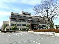
Nasushiobara City Hall | |||
| |||
 Location of Nasushiobara in Tochigi Prefecture | |||
 Nasushiobara
| |||
| Coordinates: 36°57′42.2″N 140°2′45.8″E / 36.961722°N 140.046056°ECoordinates: 36°57′42.2″N 140°2′45.8″E / 36.961722°N 140.046056°E | |||
| Country | Japan | ||
| Region | Kantō | ||
| Prefecture | Tochigi Prefecture | ||
| Area | |||
| • Total | 592.74 km2 (228.86 sq mi) | ||
| Population (May 2015) | |||
| • Total | 116,813 | ||
| • Density | 197/km2 (510/sq mi) | ||
| Time zone | Japan Standard Time (UTC+9) | ||
| - Tree | Pine | ||
| - Flower | Yatsuo Tsutsuji (Rhododendron pentaphyllum var. nikoense) | ||
| Phone number | 0287-62-7117 | ||
| Address | 108-2, Kyōkonsha, Nasushiobara-shi, Tochigi-ken 325-8501 | ||
| Website | Official website | ||


Nasushiobara (那須塩原市 Nasushiobara-shi) is a city located in Tochigi Prefecture, in the northern Kantō region of Japan. As of May 2015, the city had an estimated population of 116,813 and a population density of 197 persons per km². Its total area was 592.74 km².
Geography
Nasushiobara is the northernmost city in the Kantō region of Japan, bordering Fukushima Prefecture to the north. It is located in the northern portion of Tochigi Prefecture, in the mountains.
Surrounding municipalities
History
The modern city of Nasushiobara was established on January 1, 2005, from the merger of the former city of Kuroiso, and the towns of Nishinasuno and Shiobara (both previously constituent towns of the separate Nasu District).
Economy
Nasushiobara relies heavily on seasonal tourism to its hot spring and ski resorts. Agriculture is centered on dairy production.
Education
- Utsunomiya Kyowa University
- Nasushiobara has 22 primary schools, ten middle schools and four high schools.
Transportation
Railway
Highway
- Tōhoku Expressway – Nishinasuno IC, Kuroiso IC
- Japan National Route 4
- Japan National Route 400
- Japan National Route 461
Local attractions
Nasushiobara serves as a gateway for tourism in northern Tochigi.
- Shiobara onsen
- Itamuro onsen
- former house of Aoki Shuzo
- Nogi Jinja (former residence of General Nogi Maresuke
- Hunter Mountain Shiobara
Noted people
- Hiromi Hara – professional football player
- Yoko Shibui – Olympic runner [1]
- Aya Hirayama – actress
- Yoshimi Watanabe - politician
References
- ↑ Sports-Reference.com
External links
![]() Media related to Nasushiobara, Tochigi at Wikimedia Commons
Media related to Nasushiobara, Tochigi at Wikimedia Commons
- Official website (Japanese)