| [3] |
Name on the Register[4] |
Image |
Date listed[5] |
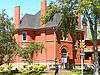
Location |
Neighborhood |
Description |
|---|
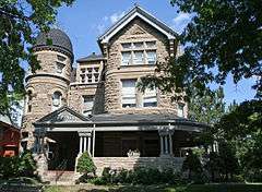
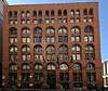
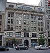
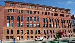
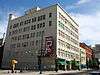
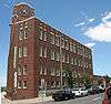
| 1 |
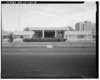
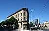
19th Street Bridge |
|
000000001985-02-04-0000February 4, 1985
(#85000201) |
19th St.
39°45′36″N 105°00′12″W / 39.76°N 105.003333°W / 39.76; -105.003333 (19th Street Bridge) |
Union Station |
Extends into Highland in West Denver
|
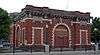
| 2 |
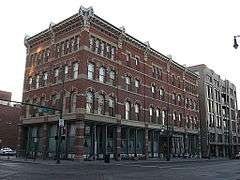
Arcanum Apartments |
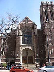
|
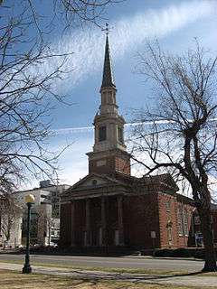
000000001999-01-21-0000January 21, 1999
(#98001629) |
1904 Logan St.
39°44′47″N 104°58′54″W / 39.746389°N 104.981667°W / 39.746389; -104.981667 (Arcanum Apartments) |
North Capitol Hill |
|
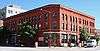
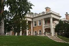
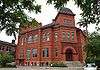
| 3 |
Arno Apartments |
|
000000001987-02-05-0000February 5, 1987
(#87000009) |
325 E. 18th Ave.
39°44′42″N 104°58′55″W / 39.745°N 104.981944°W / 39.745; -104.981944 (Arno Apartments) |
North Capitol Hill |
|
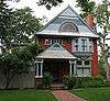
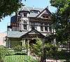
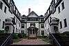
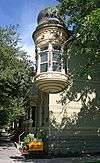
| 4 |
Bailey House |
|
000000001978-09-18-0000September 18, 1978
(#78000840) |
1600 Ogden St.
39°44′31″N 104°58′26″W / 39.741944°N 104.973889°W / 39.741944; -104.973889 (Bailey House) |
North Capitol Hill |
|
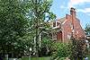
| 5 |
Caroline Bancroft House |
|
000000001990-08-29-0000August 29, 1990
(#90001086) |
1079-81 Downing St. and 1180 E. 11th
39°44′33″N 104°58′22″W / 39.7425°N 104.972778°W / 39.7425; -104.972778 (Caroline Bancroft House) |
Capitol Hill |
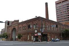
|
| 6 |
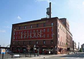
Baur Confectionery Company |
|
000000002006-07-06-0000July 6, 2006
(#06000590) |
1512-14 Curtis St.
39°44′46″N 104°59′42″W / 39.746111°N 104.995°W / 39.746111; -104.995 (Baur Confectionery Company) |
Central Business District |
|
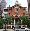
| 7 |
Bennett-Field House |
|
000000002010-07-08-0000July 8, 2010
(#10000435) |
740 Clarkson St.
39°44′49″N 104°59′30″W / 39.746944°N 104.991667°W / 39.746944; -104.991667 (Bennett-Field House) |
Capitol Hill |
|
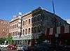
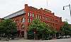
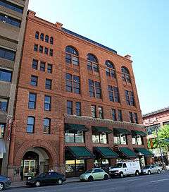
| 8 |
Boston Building |
|
000000001978-09-18-0000September 18, 1978
(#78000841) |
828 17th St.
39°44′49″N 104°59′30″W / 39.746944°N 104.991667°W / 39.746944; -104.991667 (Boston Building) |
Central Business District |
|
| 9 |
Bouvier-Lothrop House |
|
000000001980-09-04-0000September 4, 1980
(#80000886) |
1600 Emerson St.
39°44′31″N 104°58′31″W / 39.741944°N 104.975278°W / 39.741944; -104.975278 (Bouvier-Lothrop House) |
North Capitol Hill |
|
| 10 |
Brinker Collegiate Institute |
|
000000001977-10-28-0000October 28, 1977
(#77000365) |
1725-1727 Tremont Pl.
39°44′36″N 104°59′15″W / 39.743333°N 104.9875°W / 39.743333; -104.9875 (Brinker Collegiate Institute) |
Central Business District |
|
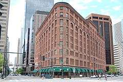
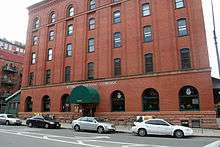
| 11 |
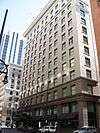
Brown Palace Hotel |
|
000000001970-04-28-0000April 28, 1970
(#70000157) |
17th St. and Tremont Pl.
39°44′39″N 104°59′14″W / 39.744167°N 104.987222°W / 39.744167; -104.987222 (Brown Palace Hotel) |
Central Business District |
|
| 12 |
J.S. Brown Mercantile Building |
|
000000001988-11-03-0000November 3, 1988
(#88002375) |
1634 18th St.
39°45′12″N 104°59′52″W / 39.753333°N 104.997778°W / 39.753333; -104.997778 (J.S. Brown Mercantile Building) |
Union Station |
|
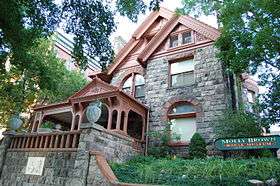
| 13 |
Molly Brown House |
|
000000001972-02-01-0000February 1, 1972
(#72000269) |
1340 Pennsylvania St.
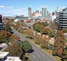
39°44′14″N 104°58′49″W / 39.737222°N 104.980278°W / 39.737222; -104.980278 (Molly Brown House) |
Capitol Hill |
|
| 14 |
Buerger Brothers Building and Annex |
|
000000001998-09-25-0000September 25, 1998
(#98001198) |
1732-1740 Champa St.
39°44′53″N 104°59′28″W / 39.748056°N 104.991111°W / 39.748056; -104.991111 (Buerger Brothers Building and Annex) |
Central Business District |
|
| 15 |
Burlington Hotel |
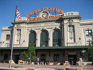
|
000000001998-04-23-0000April 23, 1998
(#98000373) |
2205 Larimer St.
39°45′19″N 104°59′23″W / 39.755278°N 104.989722°W / 39.755278; -104.989722 (Burlington Hotel) |
Five Points |
|
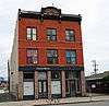
| 16 |
Alfred Butters House |
|
000000001982-10-29-0000October 29, 1982
(#82004913) |
1129 Pennsylvania
39°44′04″N 104°58′47″W / 39.734444°N 104.979722°W / 39.734444; -104.979722 (Alfred Butters House) |
Capitol Hill |
|
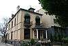
| 17 |
Byers-Evans House |
|
000000001970-08-25-0000August 25, 1970
(#70000158) |
1310 Bannock St.
39°44′14″N 104°59′22″W / 39.737222°N 104.989444°W / 39.737222; -104.989444 (Byers-Evans House) |
Civic Center |
|
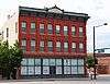
| 18 |
Capitol Life Insurance Building |
|
000000001997-12-01-0000December 1, 1997
(#97000556) |
1600 Sherman St. and 225 E. 16th St.
39°44′31″N 104°59′02″W / 39.741944°N 104.983889°W / 39.741944; -104.983889 (Capitol Life Insurance Building) |
North Capitol Hill |
|
| 19 |
Carter-Rice Building |
|
000000001984-09-20-0000September 20, 1984
(#84000805) |
1623-1631 Blake St.
39°45′04″N 104°59′55″W / 39.751111°N 104.998611°W / 39.751111; -104.998611 (Carter-Rice Building) |
Union Station |
|
| 20 |
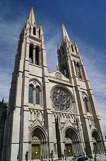
Cathedral of the Immaculate Conception |
|
000000001975-03-03-0000March 3, 1975
(#75000506) |
Northeastern corner of Colfax Ave. and Logan St.
39°44′26″N 104°58′53″W / 39.740556°N 104.981389°W / 39.740556; -104.981389 (Cathedral of the Immaculate Conception) |
North Capitol Hill |
|
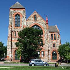
| 21 |
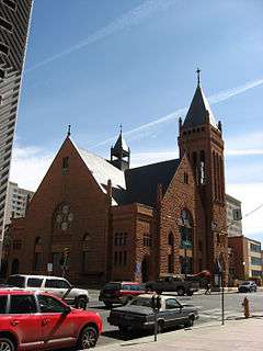
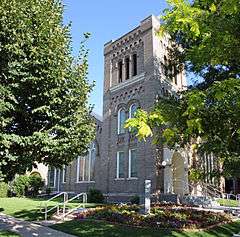
Central Presbyterian Church |
|
000000001974-11-21-0000November 21, 1974
(#74000565) |
1660 Sherman St.
39°44′35″N 104°59′02″W / 39.743056°N 104.983889°W / 39.743056; -104.983889 (Central Presbyterian Church) |
North Capitol Hill |
|
| 22 |
Chamber of Commerce Building |
|
000000002001-01-16-0000January 16, 2001
(#00001647) |
1726 Champa St.
39°44′53″N 104°59′29″W / 39.748056°N 104.991389°W / 39.748056; -104.991389 (Chamber of Commerce Building) |
Central Business District |
|
| 23 |
The Chateau |
|
000000002007-01-25-0000January 25, 2007
(#06001288) |
900 Sherman St.
39°43′50″N 104°59′02″W / 39.730556°N 104.983889°W / 39.730556; -104.983889 (The Chateau) |
Capitol Hill |
|
| 24 |
Christ Methodist Episcopal Church |
|
000000001976-11-07-0000November 7, 1976
(#76000549) |
2201 Ogden St.
39°44′59″N 104°58′28″W / 39.749722°N 104.974444°W / 39.749722; -104.974444 (Christ Methodist Episcopal Church) |
Five Points |
|
| 25 |
Civic Center Historic District |
|
000000001974-02-27-0000February 27, 1974
(#74002348) |
Roughly bounded by W. Colfax, E. Colfax, Grant, E. 14th, Broadway, E. 13th, W. 13th, Bannock, W. 14th, and Delaware
39°44′22″N 104°59′16″W / 39.739444°N 104.987778°W / 39.739444; -104.987778 (Civic Center Historic District) |
Civic Center |
Part of the district, the buildings associated with the City Beautiful period, was designated a National Historic Landmark on 000000002012-10-16-0000October 16, 2012; documentation
|
| 26 |
Clements Rowhouse |
|
000000001980-09-12-0000September 12, 1980
(#80000888) |
2201-2217 Glenarm Pl.
39°44′59″N 104°58′57″W / 39.749722°N 104.9825°W / 39.749722; -104.9825 (Clements Rowhouse) |
Five Points |
|
| 27 |
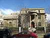
Colorado Governor's Mansion |
|
000000001969-12-03-0000December 3, 1969
(#69000039) |
400 E. 8th Ave.
39°43′43″N 104°58′53″W / 39.728611°N 104.981389°W / 39.728611; -104.981389 (Colorado Governor's Mansion) |
Capitol Hill |
|
| 28 |
Colorado National Bank Building |
|
000000002010-04-27-0000April 27, 2010
(#10000215) |
918 17th St.
39°44′51″N 104°59′36″W / 39.7474°N 104.993286°W / 39.7474; -104.993286 (Colorado National Bank Building) |
Central Business District |
|
| 29 |
Colorado State Capitol Annex Building and Boiler Plant |
|
000000001991-06-24-0000June 24, 1991
(#91000824) |
1341 Sherman St.
39°44′17″N 104°59′05″W / 39.738056°N 104.984722°W / 39.738056; -104.984722 (Colorado State Capitol Annex Building and Boiler Plant) |
Capitol Hill |
|
| 30 |
Cornwall Apartments |
|
000000001976-10-08-0000October 8, 1976
(#76000550) |
1317 Ogden St., 912 E. 13th Ave.
39°44′13″N 104°57′49″W / 39.736944°N 104.963611°W / 39.736944; -104.963611 (Cornwall Apartments) |
Capitol Hill |
|
| 31 |
Crawford Hill Mansion |
|
000000001990-09-13-0000September 13, 1990
(#90001417) |
969 Sherman St.
39°43′54″N 104°59′05″W / 39.731667°N 104.984722°W / 39.731667; -104.984722 (Crawford Hill Mansion) |
Capitol Hill |
|
| 32 |
Creswell Mansion |
|
000000001977-11-25-0000November 25, 1977
(#77000366) |
1244 Grant St.
39°44′11″N 104°58′58″W / 39.736389°N 104.982778°W / 39.736389; -104.982778 (Creswell Mansion) |
Capitol Hill |
|
| 33 |
F.W. Crocker and Company Steam Cracker Factory |
|
000000001984-06-21-0000June 21, 1984
(#84000808) |
1862 Blake St.
39°45′11″N 104°59′42″W / 39.753056°N 104.995°W / 39.753056; -104.995 (F.W. Crocker and Company Steam Cracker Factory) |
Union Station |
|
| 34 |
Croke-Patterson-Campbell Mansion |
|
000000001973-09-19-0000September 19, 1973
(#73000467) |
428-430 E. 11th Ave.
39°44′00″N 104°58′52″W / 39.733333°N 104.981111°W / 39.733333; -104.981111 (Croke-Patterson-Campbell Mansion) |
Capitol Hill |
|
| 35 |
Curry-Chucovich House |
|
000000001978-06-09-0000June 9, 1978
(#78000842) |
1439 Court Pl.
39°44′29″N 104°59′24″W / 39.741389°N 104.99°W / 39.741389; -104.99 (Curry-Chucovich House) |
Central Business District |
|
| 36 |
Curtis-Champa Streets District |
|
000000001975-04-01-0000April 1, 1975
(#75000507) |
Roughly bounded by Arapahoe, 30th, California, and 24th Sts.; also roughly 30th, Stout, Downing and Arapahoe Sts.
39°45′29″N 104°58′43″W / 39.758056°N 104.978611°W / 39.758056; -104.978611 (Curtis-Champa Streets District) |
Five Points |
Second set of addresses represents a boundary increase
|
| 37 |
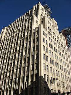
Daniels and Fisher Tower |
|
000000001969-12-03-0000December 3, 1969
(#69000040) |
1101 16th St.
39°44′54″N 104°59′43″W / 39.748333°N 104.995278°W / 39.748333; -104.995278 (Daniels and Fisher Tower) |
Central Business District |
|
| 38 |
Denver Athletic Club |
|
000000001979-11-14-0000November 14, 1979
(#79000580) |
1325 Glenarm Pl.
39°44′30″N 104°59′35″W / 39.741667°N 104.993056°W / 39.741667; -104.993056 (Denver Athletic Club) |
Central Business District |
|
| 39 |
Denver City Cable Railway Building |
|
000000001979-07-02-0000July 2, 1979
(#79000581) |
1801 Lawrence St.
39°45′02″N 104°59′38″W / 39.750556°N 104.993889°W / 39.750556; -104.993889 (Denver City Cable Railway Building) |
Union Station |
|
| 40 |
Denver City Railway Company Building |
|
000000001984-06-04-0000June 4, 1984
(#84000810) |
1635 17th St., 1734-1736 Wynkoop St.
39°45′10″N 104°59′56″W / 39.752778°N 104.998889°W / 39.752778; -104.998889 (Denver City Railway Company Building) |
Union Station |
designed by Viggo Baerresen and Harold Baerressen, architects[6]
|
| 41 |
Denver Civic Center Classroom Building |
|
000000001990-12-06-0000December 6, 1990
(#90001346) |
1445 Cleveland Pl.
39°44′26″N 104°59′21″W / 39.740556°N 104.989167°W / 39.740556; -104.989167 (Denver Civic Center Classroom Building) |
Civic Center |
|
| 42 |
Denver Dry Goods Company Building |
|
000000001978-01-09-0000January 9, 1978
(#78000843) |
16th and California Sts.
39°44′42″N 104°59′33″W / 39.745°N 104.9925°W / 39.745; -104.9925 (Denver Dry Goods Company Building) |
Central Business District |
|
| 43 |
Denver Mint |
|
000000001972-02-01-0000February 1, 1972
(#72000270) |
W. Colfax Ave. and Delaware St.
39°44′23″N 104°59′30″W / 39.739722°N 104.991667°W / 39.739722; -104.991667 (Denver Mint) |
Civic Center |
|
| 44 |
Denver Municipal Auditorium |
|
000000001991-10-16-0000October 16, 1991
(#91001531) |
1323 Champa St.
39°44′41″N 104°59′47″W / 39.744722°N 104.996389°W / 39.744722; -104.996389 (Denver Municipal Auditorium) |
Central Business District |
|
| 45 |
Denver Public Library |
|
000000001990-12-06-0000December 6, 1990
(#90001345) |
1357 Broadway
39°44′15″N 104°59′17″W / 39.7375°N 104.988056°W / 39.7375; -104.988056 (Denver Public Library) |
Civic Center |
|
| 46 |
Downtown Denver Central YMCA and Annex |
|
000000002004-07-30-0000July 30, 2004
(#04000736) |
25 E. 16th Ave.
39°44′31″N 104°59′11″W / 39.74183°N 104.98634°W / 39.74183; -104.98634 (Downtown Denver Central YMCA and Annex) |
North Capitol Hill |
|
| 47 |
Dunning-Benedict House |
|
000000001984-09-20-0000September 20, 1984
(#84000811) |
1200 Pennsylvania St.
39°44′08″N 104°58′49″W / 39.735556°N 104.980278°W / 39.735556; -104.980278 (Dunning-Benedict House) |
Capitol Hill |
|
| 48 |
John Elsner House |
|
000000001979-12-17-0000December 17, 1979
(#79000583) |
2810 Arapahoe St.
39°45′33″N 104°58′49″W / 39.759167°N 104.980278°W / 39.759167; -104.980278 (John Elsner House) |
Five Points |
|
| 49 |
Emerson School |
|
000000001997-09-26-0000September 26, 1997
(#97001169) |
1420 Ogden St.
39°44′20″N 104°58′28″W / 39.738889°N 104.974444°W / 39.738889; -104.974444 (Emerson School) |
Capitol Hill |
|
| 50 |
Enterprise Hill Historic District |
|
000000001979-08-09-0000August 9, 1979
(#79000584) |
Bounded by 21st and 22nd Sts. and Tremont and Glenarm Pls.
39°44′55″N 104°58′58″W / 39.748611°N 104.982778°W / 39.748611; -104.982778 (Enterprise Hill Historic District) |
Five Points |
|
| 51 |
Eppich Apartments |
|
000000001984-01-05-0000January 5, 1984
(#84000813) |
1266 Emerson St.
39°44′11″N 104°58′32″W / 39.736389°N 104.975556°W / 39.736389; -104.975556 (Eppich Apartments) |
Capitol Hill |
|
| 52 |
Equitable Building |
|
000000001978-01-09-0000January 9, 1978
(#78000845) |
730 17th St.
39°44′47″N 104°59′28″W / 39.746389°N 104.991111°W / 39.746389; -104.991111 (Equitable Building) |
Central Business District |
|
| 53 |
Evans School |
|
000000001980-10-03-0000October 3, 1980
(#80000889) |
1115 Acoma St.
39°44′04″N 104°59′20″W / 39.734444°N 104.988889°W / 39.734444; -104.988889 (Evans School) |
Civic Center |
|
| 54 |
Fire Station No. 1 |
|
000000001979-11-14-0000November 14, 1979
(#79000586) |
1326 Tremont Pl.
39°44′27″N 104°59′31″W / 39.740833°N 104.991944°W / 39.740833; -104.991944 (Fire Station No. 1) |
Central Business District |
|
| 55 |
First Baptist Church of Denver |
|
000000002005-09-28-0000September 28, 2005
(#05001088) |
230 E. 14th Ave.-1373 Grant St.
39°44′18″N 104°59′01″W / 39.738333°N 104.983611°W / 39.738333; -104.983611 (First Baptist Church of Denver) |
Capitol Hill |
|
| 56 |
First Congregational Church |
|
000000001987-11-16-0000November 16, 1987
(#87002011) |
980 Clarkson St.
39°43′54″N 104°58′36″W / 39.731667°N 104.976667°W / 39.731667; -104.976667 (First Congregational Church) |
Capitol Hill |
|
| 57 |
First National Bank Building |
|
000000001996-02-23-0000February 23, 1996
(#96000165) |
818 17th St.
39°44′49″N 104°59′31″W / 39.746944°N 104.991944°W / 39.746944; -104.991944 (First National Bank Building) |
Central Business District |
|
| 58 |
William G. Fisher House |
|
000000001974-11-20-0000November 20, 1974
(#74000569) |
1600 Logan St.
39°44′31″N 104°58′55″W / 39.741944°N 104.981944°W / 39.741944; -104.981944 (William G. Fisher House) |
North Capitol Hill |
|
| 59 |
Fleming-Hanington House |
|
000000001982-10-29-0000October 29, 1982
(#82001009) |
1133 Pennsylvania
39°44′03″N 104°58′47″W / 39.734167°N 104.979722°W / 39.734167; -104.979722 (Fleming-Hanington House) |
Capitol Hill |
|
| 60 |
John S. Flower House |
|
000000001980-09-04-0000September 4, 1980
(#80000890) |
1618 Ogden St.
39°44′32″N 104°58′26″W / 39.742222°N 104.973889°W / 39.742222; -104.973889 (John S. Flower House) |
North Capitol Hill |
|
| 61 |
Flower-Vaile House |
|
000000001982-10-21-0000October 21, 1982
(#82001010) |
1610 Emerson St.
39°44′32″N 104°58′31″W / 39.742222°N 104.975278°W / 39.742222; -104.975278 (Flower-Vaile House) |
North Capitol Hill |
|
| 62 |
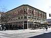
Barney L. Ford Building |
|
000000001976-06-24-0000June 24, 1976
(#76000551) |
1514 Blake St.
39°45′00″N 105°00′04″W / 39.75°N 105.001111°W / 39.75; -105.001111 (Barney L. Ford Building) |
Union Station |
|
| 63 |
Justina Ford House |
|
000000001984-11-23-0000November 23, 1984
(#84000244) |
3091 California St.
39°45′33″N 104°58′26″W / 39.759167°N 104.973889°W / 39.759167; -104.973889 (Justina Ford House) |
Five Points |
|
| 64 |
A.C. Foster Building |
|
000000001978-01-09-0000January 9, 1978
(#78000846) |
912 16th St.
39°44′47″N 104°59′37″W / 39.746389°N 104.993611°W / 39.746389; -104.993611 (A.C. Foster Building) |
Central Business District |
|
| 65 |
Gebhard Mansion |
|
000000001992-10-01-0000October 1, 1992
(#92001254) |
2253 Downing St.
39°45′02″N 104°58′23″W / 39.750556°N 104.973056°W / 39.750556; -104.973056 (Gebhard Mansion) |
Five Points |
|
| 66 |
General Electric Building |
|
000000001983-08-25-0000August 25, 1983
(#83001308) |
1441 18th St.
39°45′10″N 104°59′46″W / 39.752778°N 104.996111°W / 39.752778; -104.996111 (General Electric Building) |
Union Station |
|
| 67 |
Glenarm Place Historic Residential District |
|
000000001983-08-25-0000August 25, 1983
(#83001309) |
2417-2462 Glenarm Pl.
39°45′07″N 104°58′46″W / 39.751944°N 104.979444°W / 39.751944; -104.979444 (Glenarm Place Historic Residential District) |
Five Points |
|
| 68 |
The Grafton |
|
000000001982-10-21-0000October 21, 1982
(#82001011) |
1001-1020 E. 17th Ave.
39°44′37″N 104°58′25″W / 39.743611°N 104.973611°W / 39.743611; -104.973611 (The Grafton) |
North Capitol Hill |
|
| 69 |
Grant-Humphreys Mansion |
|
000000001970-09-30-0000September 30, 1970
(#70000160) |
770 Pennsylvania St.
39°43′42″N 104°58′49″W / 39.728333°N 104.980278°W / 39.728333; -104.980278 (Grant-Humphreys Mansion) |
Capitol Hill |
Neo-classical style mansion
|
| 70 |
S.A. Grimm Block |
|
000000001992-06-25-0000June 25, 1992
(#92000807) |
2031-2033 Curtis St.
39°45′01″N 104°59′21″W / 39.750278°N 104.989167°W / 39.750278; -104.989167 (S.A. Grimm Block) |
Five Points |
|
| 71 |
Guerrieri-Decunto House |
|
000000001979-09-10-0000September 10, 1979
(#79000587) |
1650 Pennsylvania St.
39°44′34″N 104°58′49″W / 39.742778°N 104.980278°W / 39.742778; -104.980278 (Guerrieri-Decunto House) |
North Capitol Hill |
|
| 72 |
George Hamburger Block |
|
000000001990-01-25-0000January 25, 1990
(#89002382) |
2199 Arapahoe St.
39°45′13″N 104°59′18″W / 39.753611°N 104.988333°W / 39.753611; -104.988333 (George Hamburger Block) |
Five Points |
|
| 73 |
Haskell House |
|
000000001983-09-15-0000September 15, 1983
(#83001310) |
1651 Emerson St.
39°44′40″N 104°58′31″W / 39.744444°N 104.975278°W / 39.744444; -104.975278 (Haskell House) |
North Capitol Hill |
|
| 74 |
Helene Apartment Building |
|
000000001998-03-12-0000March 12, 1998
(#98000226) |
1062 Pearl St.
39°43′59″N 104°58′45″W / 39.733056°N 104.979167°W / 39.733056; -104.979167 (Helene Apartment Building) |
Capitol Hill |
|
| 75 |
Hendrie and Bolthoff Warehouse Building |
|
000000001988-02-09-0000February 9, 1988
(#87002544) |
1743 Wazee
39°45′10″N 104°59′52″W / 39.752778°N 104.997778°W / 39.752778; -104.997778 (Hendrie and Bolthoff Warehouse Building) |
Union Station |
|
| 76 |
W.A. Hover and Company Building |
|
000000001999-07-08-0000July 8, 1999
(#99000794) |
1390 Lawrence St.
39°44′47″N 104°59′54″W / 39.746389°N 104.998333°W / 39.746389; -104.998333 (W.A. Hover and Company Building) |
Central Business District |
|
| 77 |
Ideal Building |
|
000000001977-06-09-0000June 9, 1977
(#77000367) |
821 17th St.
39°44′51″N 104°59′31″W / 39.7475°N 104.991944°W / 39.7475; -104.991944 (Ideal Building) |
Central Business District |
The first tall building constructed of reinforced concrete west of the Mississippi[7]
|
| 78 |
Joslin Dry Goods Company Building |
|
000000001997-08-14-0000August 14, 1997
(#97000893) |
934 16th St.
39°44′49″N 104°59′40″W / 39.746944°N 104.994444°W / 39.746944; -104.994444 (Joslin Dry Goods Company Building) |
Central Business District |
|
| 79 |
Jeffery and Mary Keating House |
|
000000001980-10-22-0000October 22, 1980
(#80000892) |
1207 Pennsylvania St.
39°44′08″N 104°58′51″W / 39.735556°N 104.980833°W / 39.735556; -104.980833 (Jeffery and Mary Keating House) |
Capitol Hill |
|
| 80 |
Kistler Stationery Company Building |
|
000000001997-04-14-0000April 14, 1997
(#97000298) |
1636 Champa St.
39°44′49″N 104°59′33″W / 39.746944°N 104.9925°W / 39.746944; -104.9925 (Kistler Stationery Company Building) |
Central Business District |
|
| 81 |
Kistler-Rodriguez House |
|
000000001983-05-27-0000May 27, 1983
(#83001311) |
700 E. 9th Ave.
39°43′48″N 104°58′40″W / 39.73°N 104.977778°W / 39.73; -104.977778 (Kistler-Rodriguez House) |
Capitol Hill |
|
| 82 |
Kittredge Building |
|
000000001977-12-02-0000December 2, 1977
(#77000368) |
511 16th St.
39°44′39″N 104°59′24″W / 39.744167°N 104.99°W / 39.744167; -104.99 (Kittredge Building) |
Central Business District |
|
| 83 |
Kopper's Hotel and Saloon |
|
000000001999-06-04-0000June 4, 1999
(#98001378) |
1215-1219 20th St.
39°45′10″N 104°59′29″W / 39.752778°N 104.991389°W / 39.752778; -104.991389 (Kopper's Hotel and Saloon) |
Five Points |
|
| 84 |
William Lang Townhouse |
|
000000001983-08-18-0000August 18, 1983
(#83001312) |
1626 Washington St.
39°44′32″N 104°58′41″W / 39.742222°N 104.978056°W / 39.742222; -104.978056 (William Lang Townhouse) |
North Capitol Hill |
|
| 85 |
Larimer Square |
|
000000001973-05-07-0000May 7, 1973
(#73000468) |
1400 block of Larimer St.; also 1404 Larimer St.
39°44′56″N 104°59′55″W / 39.748889°N 104.998611°W / 39.748889; -104.998611 (Larimer Square) |
Union Station |
1404 Larimer represents a boundary increase
|
| 86 |
A.T. Lewis and Son Department Store |
|
000000001994-12-23-0000December 23, 1994
(#94001470) |
800-816 16th St.
39°44′45″N 104°59′35″W / 39.745833°N 104.993056°W / 39.745833; -104.993056 (A.T. Lewis and Son Department Store) |
Central Business District |
|
| 87 |
A.T. Lewis New Building |
|
000000001994-08-19-0000August 19, 1994
(#94001006) |
1531 Stout St.
39°44′44″N 104°59′36″W / 39.745556°N 104.993333°W / 39.745556; -104.993333 (A.T. Lewis New Building) |
Central Business District |
|
| 88 |
Littleton Creamery-Beatrice Foods Cold Storage Warehouse |
|
000000001985-09-05-0000September 5, 1985
(#85001952) |
1801 Wynkoop St.
39°45′16″N 104°59′52″W / 39.754444°N 104.997778°W / 39.754444; -104.997778 (Littleton Creamery-Beatrice Foods Cold Storage Warehouse) |
Union Station |
|
| 89 |
Masonic Temple Building |
|
000000001977-11-22-0000November 22, 1977
(#77000369) |
1614 Welton St.
39°44′40″N 104°59′25″W / 39.744444°N 104.990278°W / 39.744444; -104.990278 (Masonic Temple Building) |
Central Business District |
|
| 90 |
McClintock Building |
|
000000002005-01-26-0000January 26, 2005
(#04001554) |
1550-58 California St./622-40 16th St.
39°44′41″N 104°59′29″W / 39.744722°N 104.991389°W / 39.744722; -104.991389 (McClintock Building) |
Central Business District |
|
| 91 |
McPhee and McGinnity Building |
|
000000001984-09-20-0000September 20, 1984
(#84000816) |
2301 Blake St.
39°45′27″N 104°59′25″W / 39.7575°N 104.990278°W / 39.7575; -104.990278 (McPhee and McGinnity Building) |
Five Points |
|
| 92 |
McPhee and McGinnity Paint Factory |
|
000000002003-08-21-0000August 21, 2003
(#03000776) |
2519 Walnut St.
39°45′31″N 104°59′12″W / 39.758611°N 104.986667°W / 39.758611; -104.986667 (McPhee and McGinnity Paint Factory) |
Five Points |
|
| 93 |
Midland Savings Building |
|
000000002001-02-02-0000February 2, 2001
(#01000030) |
444 17th St.
39°44′40″N 104°59′19″W / 39.744444°N 104.988611°W / 39.744444; -104.988611 (Midland Savings Building) |
Central Business District |
|
| 94 |
Moffat Station |
|
000000001976-10-22-0000October 22, 1976
(#76000553) |
2105 15th St.
39°45′16″N 105°00′19″W / 39.754444°N 105.005278°W / 39.754444; -105.005278 (Moffat Station) |
Union Station |
|
| 95 |
Montgomery Court |
|
000000001986-10-02-0000October 2, 1986
(#86002810) |
215 E. 11th Ave.
39°44′02″N 104°59′02″W / 39.733889°N 104.983889°W / 39.733889; -104.983889 (Montgomery Court) |
Capitol Hill |
|
| 96 |
Dora Moore Elementary School |
|
000000001978-06-09-0000June 9, 1978
(#78000849) |
846 Corona St.[8]
39°43′47″N 104°58′22″W / 39.729722°N 104.972778°W / 39.729722; -104.972778 (Dora Moore Elementary School) |
Capitol Hill |
|
| 97 |
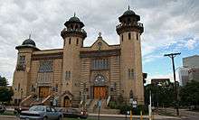
Mosque of the El Jebel Shrine |
|
000000001997-10-24-0000October 24, 1997
(#97001235) |
1770 Sherman St.
39°44′41″N 104°59′02″W / 39.744722°N 104.983889°W / 39.744722; -104.983889 (Mosque of the El Jebel Shrine) |
North Capitol Hill |
|
| 98 |
Neusteter Building |
|
000000001987-11-30-0000November 30, 1987
(#87002070) |
720 16th St.
39°44′44″N 104°59′33″W / 39.745556°N 104.9925°W / 39.745556; -104.9925 (Neusteter Building) |
Central Business District |
|
| 99 |
New Terrace |
|
000000001987-02-05-0000February 5, 1987
(#87000008) |
900-914 E. 20th Ave.
39°44′50″N 104°58′30″W / 39.747222°N 104.975°W / 39.747222; -104.975 (New Terrace) |
Five Points |
|
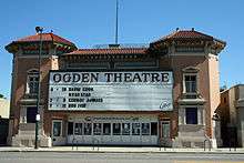
| 100 |
Ogden Theatre |
|
000000001995-08-31-0000August 31, 1995
(#95001055) |
935 E. Colfax Ave.
39°44′25″N 104°58′29″W / 39.740278°N 104.974722°W / 39.740278; -104.974722 (Ogden Theatre) |
North Capitol Hill |
|
| 101 |
Orlando Flats |
|
000000001984-02-16-0000February 16, 1984
(#84000818) |
2330 Washington St.
39°45′05″N 104°58′38″W / 39.751389°N 104.977222°W / 39.751389; -104.977222 (Orlando Flats) |
Five Points |
|
| 102 |
Oxford Hotel |
|
000000001979-04-17-0000April 17, 1979
(#79000590) |
1612 17th St.
39°45′07″N 104°59′55″W / 39.751944°N 104.998611°W / 39.751944; -104.998611 (Oxford Hotel) |
Union Station |
|
| 103 |
Pacific Express Stable |
|
000000001984-09-20-0000September 20, 1984
(#84000821) |
2363 Blake St.
39°45′29″N 104°59′22″W / 39.758056°N 104.989444°W / 39.758056; -104.989444 (Pacific Express Stable) |
Five Points |
|
| 104 |
Judge Peter L. Palmer House |
|
000000001982-10-21-0000October 21, 1982
(#82001012) |
1250 Ogden St.
39°44′09″N 104°58′28″W / 39.735833°N 104.974444°W / 39.735833; -104.974444 (Judge Peter L. Palmer House) |
Capitol Hill |
|
| 105 |
Palmer-Ferril House |
|
000000001992-11-03-0000November 3, 1992
(#92001408) |
2123 Downing St.
39°45′02″N 104°58′31″W / 39.750556°N 104.975278°W / 39.750556; -104.975278 (Palmer-Ferril House) |
Five Points |
|
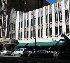
| 106 |
Paramount Theater |
|
000000001980-11-21-0000November 21, 1980
(#80000893) |
519 16th St.
39°44′38″N 104°59′26″W / 39.74401°N 104.99046°W / 39.74401; -104.99046 (Paramount Theater) |
Central Business District |
|
| 107 |
Peters Paper Company Warehouse |
|
000000001988-06-16-0000June 16, 1988
(#88000757) |
1625-1631 Wazee St.
39°45′06″N 104°59′56″W / 39.751667°N 104.998889°W / 39.751667; -104.998889 (Peters Paper Company Warehouse) |
Union Station |
|
| 108 |
Pierce-Haley House |
|
000000001984-10-03-0000October 3, 1984
(#84000583) |
857 Grant St.
39°43′49″N 104°59′00″W / 39.730278°N 104.983333°W / 39.730278; -104.983333 (Pierce-Haley House) |
Capitol Hill |
|
| 109 |
Pride of the Rockies Flour Mill |
|
000000001995-12-07-0000December 7, 1995
(#95001420) |
2100 20th St.
39°45′36″N 104°59′58″W / 39.76°N 104.999444°W / 39.76; -104.999444 (Pride of the Rockies Flour Mill) |
Union Station |
|
| 110 |
Public Service Building |
|
000000001978-07-20-0000July 20, 1978
(#78000851) |
910 15th St.
39°44′44″N 104°59′42″W / 39.745556°N 104.995°W / 39.745556; -104.995 (Public Service Building) |
Central Business District |
former Gas & Electric Building, 1910
|
| 111 |
Railway Exchange Addition and Railway Exchange New Building |
|
000000001997-10-17-0000October 17, 1997
(#97001213) |
1715 Champa St. and 909 17th St.
39°44′53″N 104°59′31″W / 39.748056°N 104.991944°W / 39.748056; -104.991944 (Railway Exchange Addition and Railway Exchange New Building) |
Central Business District |
Designed by Fisher and Fisher, architects[6]
|
| 112 |
Ray Apartments Buildings |
|
000000002001-02-02-0000February 2, 2001
(#01000029) |
1550 and 1560 Ogden St.
39°44′29″N 104°58′26″W / 39.741389°N 104.973889°W / 39.741389; -104.973889 (Ray Apartments Buildings) |
North Capitol Hill |
|
| 113 |
Rocky Mountain Bank Note Company Building |
|
000000001999-07-01-0000July 1, 1999
(#99000766) |
1080 Delaware St.
39°44′02″N 104°59′32″W / 39.733889°N 104.992222°W / 39.733889; -104.992222 (Rocky Mountain Bank Note Company Building) |
Civic Center |
|
| 114 |
Rossonian Hotel |
|
000000001995-08-15-0000August 15, 1995
(#95001009) |
2650 Welton St.
39°45′15″N 104°58′40″W / 39.754167°N 104.977778°W / 39.754167; -104.977778 (Rossonian Hotel) |
Five Points |
|
| 115 |
St. Andrew's Episcopal Church |
|
000000001975-03-18-0000March 18, 1975
(#75000512) |
2015 Glenarm Pl.
39°44′53″N 104°59′05″W / 39.748056°N 104.984722°W / 39.748056; -104.984722 (St. Andrew's Episcopal Church) |
Five Points |
|
| 116 |
St. John's Cathedral |
|
000000001975-08-01-0000August 1, 1975
(#75000513) |
14th and Washington Sts.
39°44′16″N 104°58′39″W / 39.737778°N 104.9775°W / 39.737778; -104.9775 (St. John's Cathedral) |
Capitol Hill |
|
| 117 |
St. Mark's Parish Church |
|
000000001975-09-18-0000September 18, 1975
(#75000514) |
1160 Lincoln St.
39°44′06″N 104°59′05″W / 39.735°N 104.984722°W / 39.735; -104.984722 (St. Mark's Parish Church) |
Capitol Hill |
|
| 118 |
St. Paul's English Evangelical Lutheran Church |
|
000000001997-09-30-0000September 30, 1997
(#97001191) |
1600 Grant St.
39°44′31″N 104°58′58″W / 39.741944°N 104.982778°W / 39.741944; -104.982778 (St. Paul's English Evangelical Lutheran Church) |
North Capitol Hill |
|
| 119 |
San Rafael Historic District |
|
000000001986-06-20-0000June 20, 1986
(#86001353) |
Roughly bounded by E. 26th Ave., Downing St., E. 20th Ave., and Washington St.
39°45′03″N 104°58′30″W / 39.750833°N 104.975°W / 39.750833; -104.975 (San Rafael Historic District) |
Five Points |
|
| 120 |
George Schleier Mansion |
|
000000001977-11-17-0000November 17, 1977
(#77000370) |
1665 Grant St.
39°44′35″N 104°58′59″W / 39.743056°N 104.983056°W / 39.743056; -104.983056 (George Schleier Mansion) |
North Capitol Hill |
|
| 121 |
Sheedy Mansion |
|
000000002004-08-04-0000August 4, 2004
(#04000780) |
1115-1121 Grant St.
39°44′03″N 104°59′00″W / 39.734167°N 104.983333°W / 39.734167; -104.983333 (Sheedy Mansion) |
Capitol Hill |
|
| 122 |
Sherman Street Historic District |
|
000000002004-10-27-0000October 27, 2004
(#04001178) |
Approximately 1000 to 1099 Sherman St.
39°43′58″N 104°59′04″W / 39.732778°N 104.984444°W / 39.732778; -104.984444 (Sherman Street Historic District) |
Capitol Hill |
|
| 123 |
Speer Boulevard |
|
000000001986-09-17-0000September 17, 1986
(#86002240) |
Speer Boulevard from W. Colfax Ave. to Downing St.
39°43′42″N 104°59′09″W / 39.728333°N 104.985833°W / 39.728333; -104.985833 (Speer Boulevard) |
Civic Center |
Extends into Lincoln Park in Northeast Denver and Speer in Southeast Denver
|
| 124 |
Spratlen-Anderson Wholesale Grocery Company-Davis Brothers Warehouse |
|
000000001985-12-03-0000December 3, 1985
(#85003061) |
1450 Wynkoop St.
39°45′02″N 105°00′06″W / 39.750556°N 105.001667°W / 39.750556; -105.001667 (Spratlen-Anderson Wholesale Grocery Company-Davis Brothers Warehouse) |
Union Station |
|
| 125 |
Stearns House |
|
000000001982-06-03-0000June 3, 1982
(#82002296) |
1030 Logan St.
39°43′58″N 104°58′54″W / 39.732778°N 104.981667°W / 39.732778; -104.981667 (Stearns House) |
Capitol Hill |
|
| 126 |
Sugar Building |
|
000000001978-02-17-0000February 17, 1978
(#78000852) |
1530 16th St.
39°45′03″N 104°59′58″W / 39.750833°N 104.999444°W / 39.750833; -104.999444 (Sugar Building) |
Union Station |
|
| 127 |
Swallow Hill Historic District |
|
000000001988-01-07-0000January 7, 1988
(#87002295) |
Roughly bounded by Clarkson St., E. 17th Ave., Downing St., and E. Colfax Ave.
39°44′33″N 104°58′28″W / 39.7425°N 104.974444°W / 39.7425; -104.974444 (Swallow Hill Historic District) |
North Capitol Hill |
|
| 128 |
Telephone Building |
|
000000002005-01-26-0000January 26, 2005
(#04001555) |
931 14th St.
39°44′43″N 104°59′49″W / 39.745278°N 104.996944°W / 39.745278; -104.996944 (Telephone Building) |
Central Business District |
|
| 129 |
Temple Emanuel |
|
000000001978-10-10-0000October 10, 1978
(#78000853) |
24 Curtis St.
39°45′16″N 104°59′03″W / 39.754444°N 104.984167°W / 39.754444; -104.984167 (Temple Emanuel) |
Five Points |
|
| 130 |
Temple Emanuel |
|
000000001987-11-25-0000November 25, 1987
(#87001554) |
1595 Pearl St.
39°44′29″N 104°58′47″W / 39.741389°N 104.979722°W / 39.741389; -104.979722 (Temple Emanuel) |
North Capitol Hill |
|
| 131 |
H.H. Thomas House |
|
000000001975-05-30-0000May 30, 1975
(#75000515) |
2104 Glenarm Pl.
39°44′54″N 104°59′01″W / 39.748333°N 104.983611°W / 39.748333; -104.983611 (H.H. Thomas House) |
Five Points |
|
| 132 |
Tramway Building |
|
000000001978-01-05-0000January 5, 1978
(#78000854) |
1100 14th St.
39°44′44″N 104°59′54″W / 39.745556°N 104.998333°W / 39.745556; -104.998333 (Tramway Building) |
Central Business District |
|
| 133 |
Trinity United Methodist Church |
|
000000001970-07-28-0000July 28, 1970
(#70000161) |
E. 18th Ave. and Broadway
39°44′43″N 104°59′11″W / 39.745278°N 104.986389°W / 39.745278; -104.986389 (Trinity United Methodist Church) |
North Capitol Hill |
|
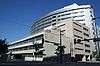
| 134 |
U.S. Courthouse and Federal Office Building |
|
000000002016-10-17-0000October 17, 2016
(#16000723) |
1929-1961 Stout St.
39°44′57″N 104°59′20″W / 39.749283°N 104.988971°W / 39.749283; -104.988971 (U.S. Courthouse and Federal Office Building) |
|
|
| 135 |
U.S. Customhouse |
|
000000001979-10-16-0000October 16, 1979
(#79000594) |
721 19th St.
39°44′55″N 104°59′18″W / 39.748611°N 104.988333°W / 39.748611; -104.988333 (U.S. Customhouse) |
Central Business District |
|
| 136 |
U.S. Post Office and Federal Building |
|
000000001973-03-20-0000March 20, 1973
(#73000470) |
18th and Stout Sts.
39°44′55″N 104°59′23″W / 39.748611°N 104.989722°W / 39.748611; -104.989722 (U.S. Post Office and Federal Building) |
Central Business District |
|
| 137 |
Union Station |
|
000000001974-11-20-0000November 20, 1974
(#74000571) |
17th St. at Wynkoop
39°45′12″N 104°59′57″W / 39.753333°N 104.999167°W / 39.753333; -104.999167 (Union Station) |
Union Station |
|
| 138 |
Union Warehouse |
|
000000001982-06-03-0000June 3, 1982
(#82002297) |
1514 17th St.
39°45′06″N 104°59′52″W / 39.751667°N 104.997778°W / 39.751667; -104.997778 (Union Warehouse) |
Union Station |
Now an assisted-living facility
|
| 139 |
US National Bank |
|
000000001994-03-25-0000March 25, 1994
(#94000264) |
817 17th St.
39°44′49″N 104°59′28″W / 39.746944°N 104.991111°W / 39.746944; -104.991111 (US National Bank) |
Central Business District |
|
| 140 |
Wood-Morris-Bonfils House |
|
000000001974-12-04-0000December 4, 1974
(#74000573) |
707 Washington St.
39°43′39″N 104°58′43″W / 39.7275°N 104.978611°W / 39.7275; -104.978611 (Wood-Morris-Bonfils House) |
Capitol Hill |
|
| 141 |
Adolph J. Zang House |
|
000000001979-11-14-0000November 14, 1979
(#79000596) |
1532 Emerson St.
39°44′27″N 104°58′31″W / 39.740833°N 104.975278°W / 39.740833; -104.975278 (Adolph J. Zang House) |
North Capitol Hill |
|
| 142 |
Adolph Zang Mansion |
|
000000001977-11-23-0000November 23, 1977
(#77000371) |
709 Clarkson St.
39°43′39″N 104°58′39″W / 39.7275°N 104.9775°W / 39.7275; -104.9775 (Adolph Zang Mansion) |
Capitol Hill |
|


.jpg)