| [3] |
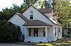
Name on the Register[4] |
Image |
Date listed[5] |
Location |
City or town |
Description |
|---|
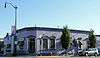
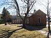
| 1 |
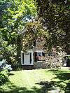
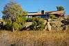
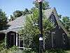
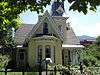
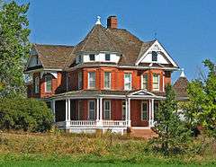
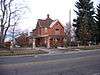
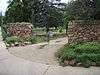
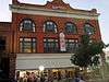
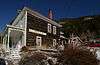
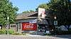
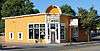
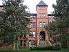
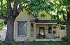
Arnett-Fullen House |
|
000000002009-01-29-0000January 29, 2009
(#08001376) |
646 Pearl St.
40°00′58″N 105°17′12″W / 40.016194°N 105.286664°W / 40.016194; -105.286664 (Arnett-Fullen House) |
Boulder |
|
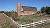
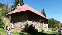
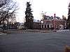
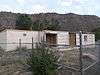
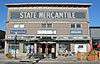
| 2 |
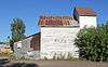
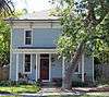
Boulder County Poor Farm |
|
000000002001-09-13-0000September 13, 2001
(#01000969) |
63rd St. near its junction with Jay Rd.[6]
40°02′44″N 105°12′23″W / 40.045556°N 105.206333°W / 40.045556; -105.206333 (Boulder County Poor Farm) |
Boulder |
|
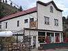
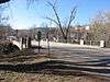
| 3 |
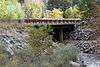
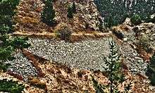
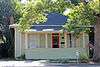
Boulder Creek Bridge |
|
000000002003-03-11-0000March 11, 2003
(#03000103) |
State Highway 119 at milepost 39.13
40°00′52″N 105°19′12″W / 40.014444°N 105.320000°W / 40.014444; -105.320000 (Boulder Creek Bridge) |
Boulder |
|
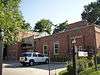
| 4 |
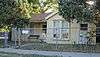
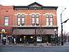
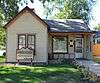
Boulder Valley Grange No. 131 |
|
000000001987-12-07-0000December 7, 1987
(#87002009) |
3400 N. 95th St.
40°02′13″N 105°07′48″W / 40.036944°N 105.130000°W / 40.036944; -105.130000 (Boulder Valley Grange No. 131) |
Lafayette |
|
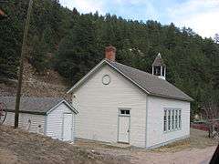
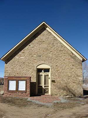
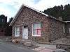
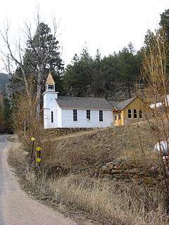
| 5 |
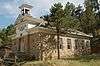
Bunce School |
|
000000001986-05-22-0000May 22, 1986
(#86001109) |
State Highway 7 south of Allenspark
40°10′24″N 105°28′06″W / 40.173300°N 105.468300°W / 40.173300; -105.468300 (Bunce School) |
Allenspark |
|
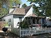
| 6 |
T.M. Callahan House |
|
000000001985-05-16-0000May 16, 1985
(#85001064) |
312 Terry St.
40°09′51″N 105°06′15″W / 40.164167°N 105.104167°W / 40.164167; -105.104167 (T.M. Callahan House) |
Longmont |
|
| 7 |
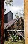
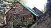
Cardinal Mill |
|
000000002011-12-22-0000December 22, 2011
(#11000945) |
Along Coon Track Creek at Cardinal[7]
39°58′08″N 105°33′00″W / 39.968888°N 105.550000°W / 39.968888; -105.550000 (Cardinal Mill) |
Nederland |
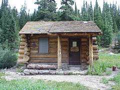
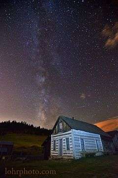
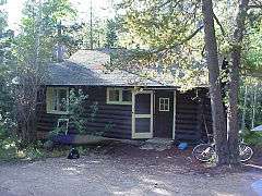
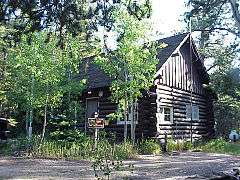
|
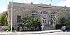
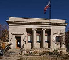
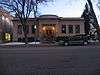
| 8 |
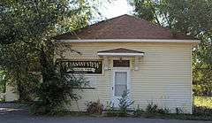
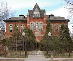
Carnegie Library |
|
000000001979-02-16-0000February 16, 1979
(#79000573) |
1125 Pine St.
40°01′12″N 105°16′52″W / 40.020000°N 105.281111°W / 40.020000; -105.281111 (Carnegie Library) |
Boulder |
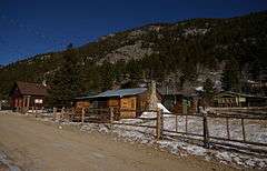
|
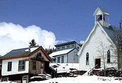
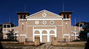
| 9 |
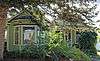
Chautauqua Auditorium |
|
000000001974-01-21-0000January 21, 1974
(#74000562) |
Chautauqua Park
39°59′51″N 105°16′47″W / 39.997500°N 105.279722°W / 39.997500; -105.279722 (Chautauqua Auditorium) |
Boulder |
|
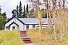
| 10 |
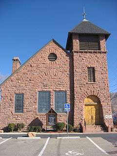
Church of the Brethren |
|
000000001984-01-05-0000January 5, 1984
(#84000794) |
17th Ave.
40°11′19″N 105°10′06″W / 40.188611°N 105.168333°W / 40.188611; -105.168333 (Church of the Brethren) |
Hygiene |
|
| 11 |
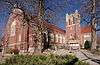
Colorado Chautauqua |
|
000000001978-03-21-0000March 21, 1978
(#78000830) |
900 Baseline Rd., Chautauqua Park
39°59′52″N 105°16′50″W / 39.997778°N 105.280556°W / 39.997778; -105.280556 (Colorado Chautauqua) |
Boulder |
|
| 12 |
Columbia Cemetery |
|
000000001997-08-01-0000August 1, 1997
(#97000792) |
Along 9th St., bounded by Pleasant and College Aves.
40°00′30″N 105°16′58″W / 40.008333°N 105.282778°W / 40.008333; -105.282778 (Columbia Cemetery) |
Boulder |
|
| 13 |
Congregational Church |
|
000000001983-05-20-0000May 20, 1983
(#83001298) |
300 E. Simpson St.
39°59′53″N 105°05′15″W / 39.998056°N 105.087500°W / 39.998056; -105.087500 (Congregational Church) |
Lafayette |
|
| 14 |
Denver Elevator-Grain Elevator |
|
000000001986-02-14-0000February 14, 1986
(#86000212) |
Tract 712 near State Highway 42
39°58′36″N 105°07′45″W / 39.976667°N 105.129167°W / 39.976667; -105.129167 (Denver Elevator-Grain Elevator) |
Louisville |
|
| 15 |
Denver, Boulder and Western Railway Historic District |
|
000000001980-09-18-0000September 18, 1980
(#80000882) |
State Highway 72
40°00′27″N 105°29′58″W / 40.007500°N 105.499444°W / 40.007500; -105.499444 (Denver, Boulder and Western Railway Historic District) |
Ward |
Also known as the Switzerland Trail.
|
| 16 |
Denver, Northwestern and Pacific Railway Historic District |
|
000000001980-09-30-0000September 30, 1980
(#80000881) |
Southwest of Eldora
39°54′52″N 105°41′10″W / 39.914400°N 105.686111°W / 39.914400; -105.686111 (Denver, Northwestern and Pacific Railway Historic District) |
Eldora |
Historic railroad route over Rollins Pass; extends into Gilpin and Grand counties.
|
| 17 |
Dickens Opera House |
|
000000001987-07-28-0000July 28, 1987
(#87000702) |
300 Main St.
40°09′52″N 105°06′06″W / 40.164444°N 105.101667°W / 40.164444; -105.101667 (Dickens Opera House) |
Longmont |
|
| 18 |
Downtown Boulder Historic District |
|
000000001980-12-03-0000December 3, 1980
(#80000878) |
State Highway 119
40°01′07″N 105°16′43″W / 40.018611°N 105.278611°W / 40.018611; -105.278611 (Downtown Boulder Historic District) |
Boulder |
|
| 19 |
East Side Historic District |
Upload image |
000000001986-10-02-0000October 2, 1986
(#86002812) |
Roughly bounded by Long's Peak Ave., Collyer St., Fourth Ave., and Emery St.
40°10′00″N 105°05′56″W / 40.166667°N 105.098889°W / 40.166667; -105.098889 (East Side Historic District) |
Longmont |
|
| 20 |
Eldora Historic District |
|
000000001989-10-04-0000October 4, 1989
(#89000978) |
Roughly Eaton Pl., 6th, Pearl, and 4th Sts., Huron Ave., 6th St., Eldorado Ave., and 7th St., Klondyke Ave., and 10th St.
39°57′01″N 105°34′17″W / 39.950278°N 105.571389°W / 39.950278; -105.571389 (Eldora Historic District) |
Eldora |
|
| 21 |
Empson Cannery |
|
000000001984-01-05-0000January 5, 1984
(#84000796) |
15 3rd Ave.
40°09′49″N 105°05′37″W / 40.163611°N 105.093611°W / 40.163611; -105.093611 (Empson Cannery) |
Longmont |
|
| 22 |
First Baptist Church of Boulder |
|
000000002004-04-14-0000April 14, 2004
(#04000275) |
1237 Pine St.
40°01′13″N 105°16′45″W / 40.020278°N 105.279167°W / 40.020278; -105.279167 (First Baptist Church of Boulder) |
Boulder |
|
| 23 |
First Congregational Church of Lyons |
|
000000001976-12-12-0000December 12, 1976
(#76000547) |
High and 4th Sts.
40°13′33″N 105°16′11″W / 40.225833°N 105.269722°W / 40.225833; -105.269722 (First Congregational Church of Lyons) |
Lyons |
|
| 24 |
Fox Mine Office |
Upload image |
000000001996-02-23-0000February 23, 1996
(#96000168) |
1226 S. Cherryvale Rd.
39°58′06″N 105°12′51″W / 39.968333°N 105.214167°W / 39.968333; -105.214167 (Fox Mine Office) |
Boulder |
|
| 25 |
Fox Stone Barn |
|
000000001996-02-16-0000February 16, 1996
(#96000070) |
S. Cherryvale Rd., 0.5 miles south of U.S. Highway 36
39°58′10″N 105°12′46″W / 39.969444°N 105.212778°W / 39.969444; -105.212778 (Fox Stone Barn) |
Boulder |
|
| 26 |
Ginacci House |
|
000000001986-02-14-0000February 14, 1986
(#86000213) |
1116 LaFarge St.
39°58′52″N 105°07′57″W / 39.981111°N 105.132500°W / 39.981111; -105.132500 (Ginacci House) |
Louisville |
|
| 27 |
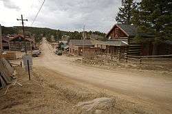
Gold Hill Historic District |
|
000000001989-08-03-0000August 3, 1989
(#89000979) |
Roughly bounded by North St., Pine St., Boulder St., Gold Run St., and College St.
40°03′43″N 105°24′26″W / 40.061944°N 105.407222°W / 40.061944; -105.407222 (Gold Hill Historic District) |
Gold Hill |
|
| 28 |
Gold Miner Hotel |
|
000000001997-07-03-0000July 3, 1997
(#97000657) |
601 Klondyke Ave.
39°57′01″N 105°34′10″W / 39.950278°N 105.569444°W / 39.950278; -105.569444 (Gold Miner Hotel) |
Eldora |
|
| 29 |
Highland School |
|
000000001978-12-18-0000December 18, 1978
(#78000831) |
885 Arapahoe Ave.
40°00′48″N 105°17′01″W / 40.013333°N 105.283611°W / 40.013333; -105.283611 (Highland School) |
Boulder |
|
| 30 |
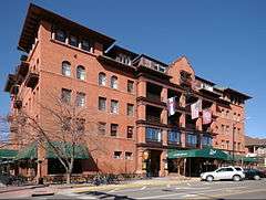
Hotel Boulderado |
|
000000001994-11-03-0000November 3, 1994
(#94001226) |
2115 13th St.
40°01′09″N 105°16′43″W / 40.019167°N 105.278611°W / 40.019167; -105.278611 (Hotel Boulderado) |
Boulder |
|
| 31 |
Hoverhome and Hover Farmstead |
|
000000001999-01-15-0000January 15, 1999
(#98001555) |
1303-1309 Hover Rd.
40°10′55″N 105°07′53″W / 40.181944°N 105.131389°W / 40.181944; -105.131389 (Hoverhome and Hover Farmstead) |
Longmont |
|
| 32 |
Jacoe Store |
|
000000001986-02-14-0000February 14, 1986
(#86000215) |
1001 Main St.
39°58′47″N 105°07′53″W / 39.979722°N 105.131389°W / 39.979722; -105.131389 (Jacoe Store) |
Louisville |
|
| 33 |
Jamestown Mercantile Building |
|
000000001989-08-03-0000August 3, 1989
(#89000985) |
Main St.
40°06′57″N 105°23′18″W / 40.115833°N 105.388333°W / 40.115833; -105.388333 (Jamestown Mercantile Building) |
Jamestown |
|
| 34 |
Jamestown Town Hall |
|
000000002003-07-10-0000July 10, 2003
(#03000615) |
118 Main St.
40°06′58″N 105°23′15″W / 40.116111°N 105.387500°W / 40.116111; -105.387500 (Jamestown Town Hall) |
Jamestown |
|
| 35 |
Kullgren House |
|
000000001983-05-20-0000May 20, 1983
(#83001299) |
209 E. Cleveland St.
39°59′51″N 105°05′17″W / 39.997500°N 105.088056°W / 39.997500; -105.088056 (Kullgren House) |
Lafayette |
|
| 36 |
Lackner's Tavern |
|
000000001986-02-14-0000February 14, 1986
(#86000220) |
1006 Pine
39°58′31″N 105°07′45″W / 39.975278°N 105.129167°W / 39.975278; -105.129167 (Lackner's Tavern) |
Louisville |
|
| 37 |
Lafayette House |
|
000000001983-05-20-0000May 20, 1983
(#83001300) |
600 E. Simpson St.
39°59′53″N 105°05′01″W / 39.998056°N 105.083611°W / 39.998056; -105.083611 (Lafayette House) |
Lafayette |
|
| 38 |
LaSalla House |
|
000000001986-02-14-0000February 14, 1986
(#86000217) |
1124 Main St.
39°58′53″N 105°07′52″W / 39.981389°N 105.131111°W / 39.981389; -105.131111 (LaSalla House) |
Louisville |
|
| 39 |
Lewis House |
|
000000001983-05-20-0000May 20, 1983
(#83001301) |
108 E. Simpson St.
39°59′53″N 105°05′21″W / 39.998056°N 105.089167°W / 39.998056; -105.089167 (Lewis House) |
Lafayette |
|
| 40 |
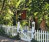
Little Church in the Pines |
|
000000001989-08-03-0000August 3, 1989
(#89000983) |
414 Gold Run Rd.
40°03′12″N 105°22′33″W / 40.053333°N 105.375833°W / 40.053333; -105.375833 (Little Church in the Pines) |
Salina |
|
| 41 |
Longmont Carnegie Library |
|
000000001992-11-03-0000November 3, 1992
(#92001406) |
457 4th Ave.
40°09′56″N 105°06′01″W / 40.165556°N 105.100278°W / 40.165556; -105.100278 (Longmont Carnegie Library) |
Longmont |
|
| 42 |
Longmont College |
|
000000001987-08-12-0000August 12, 1987
(#87001285) |
546 Atwood St.
40°10′08″N 105°05′45″W / 40.168889°N 105.095833°W / 40.168889; -105.095833 (Longmont College) |
Longmont |
|
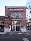
| 43 |
Longmont Fire Department |
|
000000001985-05-16-0000May 16, 1985
(#85001063) |
667 4th Ave.
40°09′56″N 105°06′10″W / 40.165556°N 105.102778°W / 40.165556; -105.102778 (Longmont Fire Department) |
Longmont |
|
| 44 |
Longmont Power Plant |
|
000000001987-09-10-0000September 10, 1987
(#87001553) |
Old Apple Valley Rd.
40°14′01″N 105°17′38″W / 40.233611°N 105.293889°W / 40.233611; -105.293889 (Longmont Power Plant) |
Lyons |
|
| 45 |
Lyons Railroad Depot |
|
000000001974-12-02-0000December 2, 1974
(#74000563) |
400 block of Broadway
40°13′27″N 105°16′14″W / 40.224167°N 105.270556°W / 40.224167; -105.270556 (Lyons Railroad Depot) |
Lyons |
|
| 46 |
Lyons Sandstone Buildings |
|
000000001980-04-29-0000April 29, 1980
(#80000880) |
U.S. Highway 36 and State Highway 7
40°13′05″N 105°15′16″W / 40.218056°N 105.254444°W / 40.218056; -105.254444 (Lyons Sandstone Buildings) |
Lyons |
|
| 47 |
McKenzie Well |
|
000000002005-01-26-0000January 26, 2005
(#04001553) |
Near Independence Rd. and State Highway 119
40°02′36″N 105°14′27″W / 40.043333°N 105.240833°W / 40.043333; -105.240833 (McKenzie Well) |
Boulder |
|
| 48 |
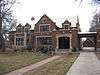
Miller House |
|
000000001983-05-20-0000May 20, 1983
(#83001291) |
409 E. Cleveland St.
39°59′51″N 105°05′08″W / 39.997500°N 105.085556°W / 39.997500; -105.085556 (Miller House) |
Lafayette |
|
| 49 |
Modoc Mill |
Upload image |
000000001978-12-27-0000December 27, 1978
(#78000833) |
North of Ward
40°04′50″N 105°30′39″W / 40.080556°N 105.510833°W / 40.080556; -105.510833 (Modoc Mill) |
Ward |
|
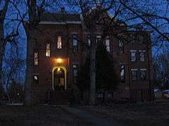
| 50 |
Mount St. Gertrude Academy |
|
000000001994-11-03-0000November 3, 1994
(#94001227) |
970 Aurora St.
40°00′13″N 105°16′51″W / 40.003611°N 105.280833°W / 40.003611; -105.280833 (Mount St. Gertrude Academy) |
Boulder |
|
| 51 |
National Fuel Company Store |
|
000000001986-02-14-0000February 14, 1986
(#86000222) |
801 Main St.
39°58′09″N 105°07′53″W / 39.969167°N 105.131389°W / 39.969167; -105.131389 (National Fuel Company Store) |
Louisville |
|
| 52 |
Norlin Quadrangle Historic District |
|
000000001980-03-27-0000March 27, 1980
(#80000879) |
University of Colorado campus
40°00′32″N 105°16′20″W / 40.008889°N 105.272222°W / 40.008889; -105.272222 (Norlin Quadrangle Historic District) |
Boulder |
|
| 53 |
North St. Vrain Creek Bridge |
|
000000002002-10-15-0000October 15, 2002
(#02001159) |
State Highway 7 at milepost 32.98, over the North St. Vrain Creek
40°13′22″N 105°16′17″W / 40.222778°N 105.271389°W / 40.222778; -105.271389 (North St. Vrain Creek Bridge) |
Lyons |
|
| 54 |
Northern Colorado Power Company Substation |
|
000000001986-05-22-0000May 22, 1986
(#86001108) |
1590 Broadway
40°00′40″N 105°16′36″W / 40.011111°N 105.276667°W / 40.011111; -105.276667 (Northern Colorado Power Company Substation) |
Boulder |
|
| 55 |
Petrelli-DelPizzo House |
|
000000001986-02-14-0000February 14, 1986
(#86000224) |
1016 Main St.
39°58′48″N 105°07′52″W / 39.980000°N 105.131111°W / 39.980000; -105.131111 (Petrelli-DelPizzo House) |
Louisville |
|
| 56 |
Rhoades House |
|
000000001986-02-14-0000February 14, 1986
(#86000226) |
1024 Grant
39°58′49″N 105°08′06″W / 39.980278°N 105.135000°W / 39.980278; -105.135000 (Rhoades House) |
Louisville |
|
| 57 |
Robinson House |
|
000000001986-02-14-0000February 14, 1986
(#86000228) |
301 Spruce
39°58′41″N 105°07′51″W / 39.978056°N 105.130833°W / 39.978056; -105.130833 (Robinson House) |
Louisville |
|
| 58 |
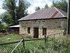
Rocky Mountain Mammoth Mine |
|
000000002010-07-06-0000July 6, 2010
(#10000422) |
4879 Magnolia Dr.
39°59′08″N 105°24′01″W / 39.985556°N 105.400278°W / 39.985556; -105.400278 (Rocky Mountain Mammoth Mine) |
Nederland |
|
| 59 |
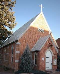
St. Stephen's Episcopal Church, 1881 |
|
000000001975-02-24-0000February 24, 1975
(#75000501) |
470 Main St.
40°10′03″N 105°06′06″W / 40.167500°N 105.101667°W / 40.167500; -105.101667 (St. Stephen's Episcopal Church, 1881) |
Longmont |
|
| 60 |
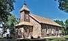
Salina School |
|
000000001989-08-03-0000August 3, 1989
(#89000984) |
536 Gold Run Rd.
40°03′15″N 105°22′37″W / 40.054167°N 105.376944°W / 40.054167; -105.376944 (Salina School) |
Salina |
|
| 61 |
Sandbeach Lake Trail |
Upload image |
000000002008-01-29-0000January 29, 2008
(#07001471) |
South of Lookout Mountain
40°13′14″N 105°32′12″W / 40.220556°N 105.536667°W / 40.220556; -105.536667 (Sandbeach Lake Trail) |
Meeker Park |
|
| 62 |
Shannon Farm |
|
000000002003-10-17-0000October 17, 2003
(#03001047) |
1341 N. 95th St.
40°00′39″N 105°07′51″W / 40.010833°N 105.130833°W / 40.010833; -105.130833 (Shannon Farm) |
Lafayette |
|
| 63 |
Squires-Tourtellot House |
|
000000001978-08-10-0000August 10, 1978
(#78000832) |
1019 Spruce St.
40°01′07″N 105°16′55″W / 40.018611°N 105.281944°W / 40.018611; -105.281944 (Squires-Tourtellot House) |
Boulder |
|
| 64 |
Stolmes House |
|
000000001986-02-14-0000February 14, 1986
(#86000229) |
616 Front St.
39°58′35″N 105°07′47″W / 39.976389°N 105.129722°W / 39.976389; -105.129722 (Stolmes House) |
Louisville |
|
| 65 |
Sunshine School |
|
000000001989-07-27-0000July 27, 1989
(#89000982) |
355 County Road 83
40°03′42″N 105°21′54″W / 40.061529°N 105.364986°W / 40.061529; -105.364986 (Sunshine School) |
Sunshine |
|
| 66 |
Swedish Evangelical Lutheran Church of Ryssby |
|
000000001984-02-16-0000February 16, 1984
(#84000797) |
N. 63rd St.
40°08′23″N 105°12′20″W / 40.139700°N 105.205600°W / 40.139700; -105.205600 (Swedish Evangelical Lutheran Church of Ryssby) |
Boulder |
|
| 67 |
Tego Brothers Drugstore-State National Bank of Louisville |
|
000000001986-02-14-0000February 14, 1986
(#86000230) |
700 Main St.
39°58′37″N 105°07′51″W / 39.976944°N 105.130833°W / 39.976944; -105.130833 (Tego Brothers Drugstore-State National Bank of Louisville) |
Louisville |
|
| 68 |
The Terrace |
|
000000001987-11-03-0000November 3, 1987
(#87001287) |
207 E. Cleveland St.
39°59′54″N 105°05′17″W / 39.998333°N 105.088056°W / 39.998333; -105.088056 (The Terrace) |
Lafayette |
|
| 69 |
Thomas House |
|
000000001986-02-14-0000February 14, 1986
(#86000231) |
700 Lincoln
39°58′40″N 105°08′09″W / 39.977778°N 105.135833°W / 39.977778; -105.135833 (Thomas House) |
Louisville |
|
| 70 |
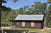
Thunder Lake Patrol Cabin |
|
000000001988-01-29-0000January 29, 1988
(#87001124) |
Thunder Lake
40°13′20″N 105°38′39″W / 40.222222°N 105.644167°W / 40.222222; -105.644167 (Thunder Lake Patrol Cabin) |
Estes Park |
In Rocky Mountain National Park
|
| 71 |
Thunder Lake Trail-Bluebird Lake Trail |
Upload image |
000000002008-01-29-0000January 29, 2008
(#07001472) |
Roughly along the North St. Vrain Creek, west of Wild Basin Ranger Station
40°11′34″N 105°39′07″W / 40.192778°N 105.651944°W / 40.192778; -105.651944 (Thunder Lake Trail-Bluebird Lake Trail) |
Allenspark |
|
| 72 |
US Post Office-Boulder Main |
|
000000001986-01-22-0000January 22, 1986
(#86000164) |
1905 15th St.
40°01′42″N 105°16′31″W / 40.028333°N 105.275278°W / 40.028333; -105.275278 (US Post Office-Boulder Main) |
Boulder |
|
| 73 |
Walker Ranch Historic District |
|
000000001984-06-14-0000June 14, 1984
(#84000798) |
West of Boulder; also 7.5 miles west of Boulder off Flagstaff Rd.
39°57′14″N 105°20′03″W / 39.953889°N 105.334167°W / 39.953889; -105.334167 (Walker Ranch Historic District) |
Boulder |
Second location represents a boundary increase
|
| 74 |
Wall Street Assay Office |
|
000000001989-08-03-0000August 3, 1989
(#89000986) |
6352 Four Mile Canyon Dr.
40°02′24″N 105°23′21″W / 40.040000°N 105.389167°W / 40.040000; -105.389167 (Wall Street Assay Office) |
Wallstreet |
Assay Office for the Storm King Mine located in Wall Street, CO
|
| 75 |
Ward Congregational Church |
|
000000001989-08-03-0000August 3, 1989
(#89000981) |
41 Modoc
40°04′22″N 105°30′29″W / 40.072778°N 105.508056°W / 40.072778; -105.508056 (Ward Congregational Church) |
Ward |
|
| 76 |
Ward School |
|
000000001989-08-03-0000August 3, 1989
(#89000980) |
66 Columbia
40°04′18″N 105°30′28″W / 40.071667°N 105.507778°W / 40.071667; -105.507778 (Ward School) |
Ward |
|
| 77 |
Martha Weiser House |
|
000000002013-10-16-0000October 16, 2013
(#13000825) |
4020 N. 75th St.
40°03′11″N 105°10′42″W / 40.052946°N 105.178256°W / 40.052946; -105.178256 (Martha Weiser House) |
Boulder |
|
| 78 |
West Side Historic District |
|
000000001987-01-07-0000January 7, 1987
(#86002846) |
Roughly bounded by 5th, Terry, 3rd, and Grant
40°09′57″N 105°06′32″W / 40.165833°N 105.108889°W / 40.165833; -105.108889 (West Side Historic District) |
Longmont |
|
| 79 |
Wild Basin House |
|
000000001988-01-29-0000January 29, 1988
(#87001125) |
Wild Basin
40°12′29″N 105°33′56″W / 40.208056°N 105.565556°W / 40.208056; -105.565556 (Wild Basin House) |
Estes Park |
|
| 80 |
Wild Basin Ranger Station and House |
|
000000001988-01-29-0000January 29, 1988
(#87001126) |
Wild Basin
40°12′32″N 105°33′55″W / 40.208889°N 105.565278°W / 40.208889; -105.565278 (Wild Basin Ranger Station and House) |
Estes Park |
|
| 81 |
Woodward-Baird House |
|
000000001979-02-15-0000February 15, 1979
(#79000574) |
1733 Canyon Boulevard
40°01′03″N 105°16′16″W / 40.017500°N 105.271111°W / 40.017500; -105.271111 (Woodward-Baird House) |
Boulder |
|
.JPG)

.JPG)

.JPG)

.JPG)