National Register of Historic Places listings in St. Louis south and west of downtown
This is a list of properties and historic districts on the National Register of Historic Places within the city limits of St. Louis, Missouri, south of Interstate 64 and west of Downtown St. Louis. For listings in Downtown St. Louis, see National Register of Historic Places listings in Downtown and Downtown West St. Louis. For those north of I-64 and west of downtown, see National Register of Historic Places listings in St. Louis north and west of downtown. For listings in St. Louis County and outside the city limits of St. Louis, see National Register of Historic Places listings in St. Louis County, Missouri.
Current listings
| [1] | Name on the Register | Image | Date listed[2] | Location | Description |
|---|---|---|---|---|---|
| 1 | Alligator Oil Clothing Company Building |  |
(#12001243) |
4153-71 Bingham Ave. 38°35′18″N 90°15′39″W / 38.58833°N 90.26095°W |
|
| 2 | American Furnace Company |  |
(#15001019) |
1300 Hampton Ave. 38°37′36″N 90°17′16″W / 38.626576°N 90.287648°W |
|
| 3 | Anheuser-Busch Brewery | .jpg) |
(#66000945) |
721 Pestalozzi St. 38°35′51″N 90°12′44″W / 38.5975°N 90.212222°W |
|
| 4 | B'nai El Temple |  |
(#83001042) |
3666 Flad Ave. 38°36′24″N 90°13′56″W / 38.606667°N 90.232222°W |
|
| 5 | Barr Branch Library Historic District | |
(#82004731) |
2500-2630 Lafayette Ave. 38°36′54″N 90°13′16″W / 38.615°N 90.221111°W |
|
| 6 | Benton Park District |  |
(#85003232) |
Bounded by Gravois Ave., Interstate 55, S. Broadway, and Jefferson St. 38°35′52″N 90°13′09″W / 38.597778°N 90.219167°W |
|
| 7 | Bevo Mill Commercial Historic District |  |
(#13000568) |
4648-5003 Gravois Ave., 4719-4767 Morganford Rd. 38°34′54″N 90°16′01″W / 38.58178°N 90.266914°W |
|
| 8 | Brahm-Mitchellette Motor Car Company |  |
(#15000442) |
3537 S. Kingshighway Blvd. 38°35′41″N 90°16′17″W / 38.5946°N 90.2713°W |
|
| 9 | Brown Shoe Company's Homes-Take Factory | 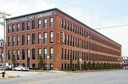 |
(#80004503) |
1201 Russell Boulevard 38°36′29″N 90°12′36″W / 38.608056°N 90.21°W |
Built in 1904 by St. Louis architects Weber and Groves, the Brown Shoe Company owned and operated the facility until the 1930s. The International Hat Company converted the building into a warehouse in 1954, until selling the property in 1976. In 1980, the building was converted into 100 apartments for assisted senior living. |
| 10 | William Buehler House |  |
(#00001550) |
2610 Tennessee Ave. 38°36′32″N 90°14′16″W / 38.608889°N 90.237778°W |
|
| 11 | Buildings at 2327-31 and 2333-35 Rutger Street |  |
(#84002620) |
2327-31 and 2333-35 Rutger St. 38°37′09″N 90°13′07″W / 38.619167°N 90.218611°W |
|
| 12 | Carlin-Rathgeber House | Upload image | (#80004554) |
122 Davis St. 38°32′36″N 90°15′47″W / 38.543283°N 90.263072°W |
part of the Carondelet, East of Broadway, St. Louis Multiple Resource Area (MRA) |
| 13 | Carondelet School | Upload image | (#07000171) |
8221 Minnesota 38°32′48″N 90°15′50″W / 38.546667°N 90.263889°W |
|
| 14 | Central Carondelet Historic District | 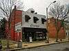 |
(#06000064) |
Roughly bounded by Koeln Ave., Loughborough Ave., S. Broadway and Alabama Ave.; also roughly bounded by Loughborough Ave., Holly Hills Ave., Idaho Ave., and S. Broadway; also bounded by Iron St., Minnesota Ave., Pennsylvania Ave., and Holly Hills Ave.; also roughly bounded by Bates St. on the north, Interstate 55 on the west, S. Broadway on the east, and Holly Hills Ave. on the south; also roughly bounded by S. Broadway, Pennsylvania Ave., Interstate 55, Bates St., and Delor St. 38°33′14″N 90°15′27″W / 38.553889°N 90.2575°W |
Additional sets of boundaries represent boundary increases of December 20, 2007, February 18, 2009, January 25, 2010, and July 14, 2011 |
| 15 | Central Institute for the Deaf Clinic and Research Building | Upload image | (#04001163) |
909 S. Taylor Ave. 38°37′52″N 90°15′44″W / 38.631111°N 90.262222°W |
|
| 16 | Chatillon-DeMenil House | .jpg) |
(#78001673) |
3352 DeMenil Pl. 38°35′32″N 90°12′57″W / 38.592222°N 90.215833°W |
|
| 17 | Chippewa Trust Company Building | 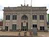 |
(#10000538) |
3801-05 S. Broadway 38°35′09″N 90°13′40″W / 38.585833°N 90.227778°W |
part of the South St. Louis Historic Working and Middle Class Streetcar Suburbs Multiple Property Submission (MPS) |
| 18 | Chouteau Building | 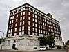 |
(#06000220) |
4030 Chouteau (also 1029 S. Vandeventer) 38°37′46″N 90°14′57″W / 38.629444°N 90.249167°W |
|
| 19 | City Hospital Historic District | 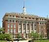 |
(#01000036) |
Roughly bounded by Lafayette Ave., Grattan St., Carroll St., Dillon St., St. Ange St., 14th St., and Carroll St. 38°36′50″N 90°12′28″W / 38.613889°N 90.207778°W |
|
| 20 | Coca-Cola Syrup Plant | 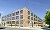 |
(#08000359) |
8125 Michigan Ave. 38°32′45″N 90°15′57″W / 38.545708°N 90.265836°W |
|
| 21 | Compton Hill Water Tower | 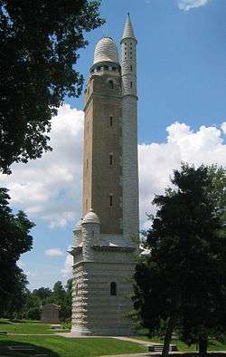 |
(#72001555) |
Reservoir Park, Grant and Russell Boulevards, and Lafayette Ave. 38°36′51″N 90°14′19″W / 38.614167°N 90.238611°W |
|
| 22 | Convent of the Sisters of St. Joseph Carondelet |  |
(#80004505) |
6400 Minnesota Ave. 38°33′23″N 90°15′00″W / 38.556389°N 90.25°W |
|
| 23 | Crittenden Historic District | Upload image | (#83001044) |
3401 Arsenal, 3400 and 3500 blocks of Crittenden 38°36′12″N 90°14′24″W / 38.603333°N 90.24°W |
|
| 24 | Delaney School | Upload image | (#04001385) |
6138 Virginia Ave. 38°33′44″N 90°15′00″W / 38.562222°N 90.25°W |
part of the St. Louis Public Schools of William B. Ittner MPS |
| 25 | Des Peres School |  |
(#82004735) |
6307 Michigan Ave. 38°33′32″N 90°15′00″W / 38.558889°N 90.25°W |
|
| 26 | Dickmann Building | 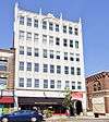 |
(#99001616) |
3115 S. Grand Boulevard 38°36′14″N 90°14′33″W / 38.603889°N 90.2425°W |
|
| 27 | Dolman Row | 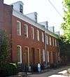 |
(#84002629) |
1424-1434 Dolman St. 38°36′56″N 90°12′36″W / 38.615556°N 90.21°W |
|
| 28 | Dutchtown South Historic District | Upload image | (#15000555) |
Bounded by S. Grand Blvd., Delor & Liberty Sts., Alabama, Virginia & Bingham Aves. 38°34′29″N 90°14′44″W / 38.5746°N 90.2456°W |
|
| 29 | Forest Park Southeast Historic District | Upload image | (#01001360) |
Roughly bounded by Chouteau Ave., Manchester and Cadet Aves., Kingshighway Boulevard, and S. Sarah St.; also 4170-4370 and 4229-4341 Manchester Ave.; also 4121-25, 4127-29, 4131, 4133, 4137, 4139-41, 4143, 4145, 4501-07, 4509-11, 4510, and 4512-14 Manchester Ave.; also 4100-4162 and 4151-4201 Manchester, and 4216 Gibson; also portions of Boyle, Chouteau, Kentucky, Norfolk, Swawn, Talmadge, Tower Grove, Vandeventer, and Vista 38°37′43″N 90°15′33″W / 38.628611°N 90.259167°W |
Additional sets of boundaries represent boundary increases of June 16, 2005, February 7, 2007, August 5, 2009, and December 19, 2012 |
| 30 | Grand-Bates Suburb Historic District | Upload image | (#09000719) |
Roughly bounded by Bates St., Grand Boulevard, Interstate 55, Alaska Ave., and Fillmore and Iron Sts. 38°33′53″N 90°15′08″W / 38.564711°N 90.252092°W |
|
| 31 | Grand-Over Park Historic District | Upload image | (#15000896) |
Bounded by S. Grand Blvd., Bates St. & alleys W. of Dewey Ave. & S. of Bowen St. 38°34′03″N 90°15′31″W / 38.567595°N 90.258678°W |
|
| 32 | Grant School |  |
(#06000037) |
3009 Pennsylvania Ave. 38°36′07″N 90°13′55″W / 38.602048°N 90.232045°W |
|
| 33 | Gratiot School |  |
(#16000184) |
1615 Hampton Ave. 38°37′22″N 90°17′20″W / 38.622653°N 90.288778°W |
|
| 34 | Gravois-Jefferson Streetcar Suburb Historic District |  |
(#05000115) |
Gravois and S. Jefferson, S. Jefferson and S. Broadway, Meramac, S. Gran and Gravois; also 2644-54 Gravois Ave. 38°35′28″N 90°14′03″W / 38.591111°N 90.234167°W |
part of the South St. Louis Historic Working and Middle Class Streetcar Suburbs MPS; second set of addresses represents a boundary increase July 15, 2016 |
| 35 | C. Hager and Sons Hinge Co. | Upload image | (#87000508) |
139 Victor St. 38°35′58″N 90°12′04″W / 38.599444°N 90.201111°W |
|
| 36 | Hamiltonian Federal Savings and Loan Association Building |  |
(#13001088) |
3150 S. Grand Blvd. 38°36′04″N 90°14′32″W / 38.601113°N 90.242131°W |
|
| 37 | Harris Teachers College |  |
(#04000787) |
1517 South Theresa 38°37′19″N 90°14′13″W / 38.621944°N 90.236944°W |
part of the St. Louis Public Schools of William B. Ittner MPS |
| 38 | Hickory Street District |  |
(#85000107) |
Bounded roughly by Lasalle, Missouri, Rutger, and Jefferson Sts., and along Hickory St. 38°37′12″N 90°13′03″W / 38.62°N 90.2175°W |
|
| 39 | Holly Hills Historic District |  |
(#16000102) |
Bounded by Holly Hills Blvd., MPRR, alley N. of Dover Pl., Leona St. & Ray Ave. 38°34′06″N 90°16′04″W / 38.568219°N 90.267761°W |
|
| 40 | The Home of the Friendless |  |
(#15000773) |
4431 S. Broadway 38°34′30″N 90°14′07″W / 38.5751°N 90.2352°W |
|
| 41 | Immaculate Conception Church and Rectory |  |
(#08000031) |
3120 Lafayette Ave. 38°37′04″N 90°14′32″W / 38.617778°N 90.242222°W |
|
| 42 | Immaculate Conception School | 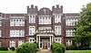 |
(#85000995) |
2912 Lafayette 38°36′55″N 90°13′41″W / 38.615278°N 90.228056°W |
|
| 43 | Jefferson Barracks VA Hospital | Upload image | (#15000419) |
1 Jefferson Barracks Dr. 38°29′38″N 90°16′58″W / 38.4939°N 90.2828°W |
|
| 44 | Koken Barbers' Supply Co. Historic District | 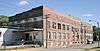 |
(#07000023) |
Bounded by Ohio, Sidney and Victor Sts., and alley east of Texas Ave. 38°36′28″N 90°13′28″W / 38.607778°N 90.224444°W |
|
| 45 | Laclede Gas Light Company Pumping Station G | Upload image | (#07000020) |
4401 Chouteau Ave. 38°37′49″N 90°15′31″W / 38.630278°N 90.258611°W |
|
| 46 | Lafayette Garage and Repair Company Building | 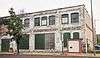 |
(#11000737) |
2710-2716 Lafayette 38°36′54″N 90°13′26″W / 38.615°N 90.223889°W |
part of the Auto-Related Resources of St. Louis, Missouri MPS |
| 47 | Lafayette Square Historic District |  |
(#72001557) |
Roughly bounded by Hickory and 18th Sts., Jefferson and Lafayette Aves.; also roughly bounded by Chouteau Ave., Dolman, Lafayette Ave., S. 18th St., Vail Pl., and McKay Pl. 38°37′00″N 90°12′55″W / 38.616667°N 90.215278°W |
Second set of boundaries represents a boundary increase of July 24, 1986 |
| 48 | Lambskin Temple | Upload image | (#87001361) |
1054 S. Kingshighway Boulevard 38°37′47″N 90°15′49″W / 38.629722°N 90.263611°W |
|
| 49 | Liggett & Myers Historic District | Upload image | (#09000441) |
Roughly bounded by Vandeventer, Park, Thurman, and Lafayette Aves. 38°37′12″N 90°15′12″W / 38.62°N 90.253333°W |
|
| 50 | Lindenwood School | 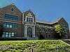 |
(#05000371) |
3815 McCausland Ave. 38°35′46″N 90°18′45″W / 38.59617°N 90.312511°W |
|
| 51 | Loretto Academy | |
(#92000079) |
3407 Lafayette Avenue 38°37′01″N 90°14′07″W / 38.616954°N 90.235199°W |
|
| 52 | Horace Mann School | |
(#92001095) |
4047 Juniata 38°36′08″N 90°15′16″W / 38.602222°N 90.254444°W |
part of the St. Louis Public Schools of William B. Ittner MPS |
| 53 | Marine Villa Neighborhood Historic District | Upload image | (#09001099) |
Roughly bounded by S. Broadway, Chippewa, Cahokia, Kosciusko, and Winnebago 38°35′12″N 90°13′24″W / 38.586644°N 90.223347°W |
part of the South St. Louis Historic Working and Middle Class Streetcar Suburbs MPS |
| 54 | McKinley Fox District | Upload image | (#84002655) |
Roughly bounded by 18th St., Interstate 44, and Jefferson and Gravois Aves. 38°36′33″N 90°13′06″W / 38.609167°N 90.218333°W |
|
| 55 | Eugene and Mary A. Miltenberger House |  |
(#02000471) |
3218 Osceola St. 38°34′43″N 90°14′28″W / 38.578611°N 90.241111°W |
|
| 56 | Missouri Botanical Gardens | 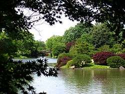 |
(#71001065) |
2345 Tower Grove Ave. 38°36′45″N 90°15′33″W / 38.6125°N 90.259167°W |
|
| 57 | Moloney Electric Company Building | Upload image | (#02000270) |
1141-1151 S. 7th St. 38°37′03″N 90°11′47″W / 38.6175°N 90.196389°W |
|
| 58 | Mount Pleasant School |  |
(#85000943) |
4528 Nebraska Ave. 38°34′24″N 90°14′12″W / 38.573342°N 90.236616°W |
|
| 59 | National Candy Company Factory |  |
(#09000889) |
4230 Gravois Ave. 38°35′18″N 90°15′30″W / 38.588233°N 90.258408°W |
|
| 60 | Nooter Corporation Building | Upload image | (#08000404) |
1400 S. 3rd St. 38°36′48″N 90°11′39″W / 38.613403°N 90.194028°W |
|
| 61 | Oak Hill Historic District | Upload image | (#10001120) |
Roughly bounded by Gustine St, Arsenal St, alley west of Portis Ave, Humphrey St 38°36′06″N 90°15′30″W / 38.601667°N 90.258333°W |
|
| 62 | Oakview Place Apartments |  |
(#08000508) |
1014-1038 Oakview Pl. 38°37′49″N 90°17′06″W / 38.630283°N 90.285044°W |
|
| 63 | Oehler Brick Buildings | Upload image | (#08000749) |
3542-48 S. Broadway 38°35′24″N 90°13′05″W / 38.589889°N 90.218167°W |
|
| 64 | Otzenberger House | Upload image | (#80004515) |
7827 Reilly St. 38°32′37″N 90°15′27″W / 38.543653°N 90.257511°W |
part of the Carondelet, East of Broadway, St. Louis MRA |
| 65 | Pevely Dairy Company Buildings |  |
(#06000628) |
3301 and 3305 Park Ave. 38°37′19″N 90°13′59″W / 38.621944°N 90.233056°W |
|
| 66 | Pevely Dairy Company Plant | |
(#09000937) |
1001 S. Grand, 3626 Chouteau, and 1101 Motard 38°37′31″N 90°14′15″W / 38.625308°N 90.237561°W |
Demolished in February 2012.[3] |
| 67 | Pundt Brothers-Garavaglia Grocery Buildings |  |
(#10000117) |
2857 Lafayette Ave. 38°36′57″N 90°13′39″W / 38.615867°N 90.227558°W |
part of the South St. Louis Historic Working and Middle Class Streetcar Suburbs MPS |
| 68 | Quinn Chapel AME Church |  |
(#74002277) |
227 Bowen St. 38°33′32″N 90°14′51″W / 38.558889°N 90.2475°W |
|
| 69 | Reber Place Historic District |  |
(#12000100) |
Roughly bounded by Arsenal St., Kingshighway Blvd., Southwest Ave. and the alley east of Hereford St. 38°36′32″N 90°16′14″W / 38.608822°N 90.27052°W |
|
| 70 | Riggio Building |  |
(#04000428) |
5145-5149 Shaw Ave. 38°37′12″N 90°16′19″W / 38.62°N 90.271944°W |
|
| 71 | Roberts, Johnson and Rand-International Shoe Company Complex |  |
(#84002670) |
Mississippi and Hickory Sts. 38°37′10″N 90°12′47″W / 38.619444°N 90.213056°W |
|
| 72 | Rock Spring School | Upload image | (#92001097) |
3974 Sarpy Ave. 38°37′50″N 90°14′46″W / 38.630556°N 90.246111°W |
part of the St. Louis Public Schools of William B. Ittner MPS |
| 73 | St. Boniface Neighborhood Historic District | Upload image | (#01000948) |
Roughly bounded by Koeln and Tesson Sts., Broadway, and Alabama Ave. 38°32′59″N 90°15′41″W / 38.549722°N 90.261389°W |
|
| 74 | St. Cecilia Historic District | Upload image | (#08001286) |
Bounded by S. Grand Boulevard, Delor St., Virginia Ave., and Bates St. 38°34′09″N 90°14′58″W / 38.569125°N 90.249361°W |
part of the South St. Louis Historic Working and Middle Class Streetcar Suburbs MPS |
| 75 | St. Francis de Sales' Church |  |
(#78003393) |
2653 Ohio St. 38°36′15″N 90°13′33″W / 38.604167°N 90.225833°W |
|
| 76 | St. Francis de Sales Historic District | |
(#12000979) |
Bounded by Nebraska, Jefferson, & Victor Aves., Gravois Rd., & Pestalozzi St. 38°36′15″N 90°13′33″W / 38.604167°N 90.225833°W |
|
| 77 | St. John Nepomuk Parish Historic District |  |
(#72001558) |
11th and 12th Sts. between Carroll St. and Lafayette Ave. 38°36′45″N 90°12′17″W / 38.6125°N 90.204722°W |
part of the LaSalle Park MRA |
| 78 | St. Louis Air Force Station | Upload image | (#75002139) |
2nd and Arsenal Sts. 38°35′38″N 90°12′32″W / 38.593848°N 90.209021°W |
|
| 79 | Sanford Avenue Historic District |  |
(#04001559) |
1000 block of Sanford Ave. 38°37′50″N 90°17′42″W / 38.630556°N 90.295°W |
|
| 80 | Schlichtig House | Upload image | (#80004516) |
8402 Vulcan St. 38°32′25″N 90°15′44″W / 38.540256°N 90.262353°W |
part of the Carondelet, East of Broadway, St. Louis MRA |
| 81 | Anton Schmitt House |  |
(#98001600) |
7727 S. Broadway 38°32′47″N 90°15′33″W / 38.546389°N 90.259167°W |
Originally listed 1992 at 8000 Alaska St., delisted December 19, 1994 |
| 82 | Schollmeyer Building | Upload image | (#84002683) |
1976-1982 Arsenal St. 38°35′52″N 90°13′13″W / 38.597778°N 90.220278°W |
|
| 83 | Seventh District Police Station |  |
(#84002685) |
2800 S. Grand Ave. 38°36′21″N 90°14′29″W / 38.605833°N 90.241389°W |
|
| 84 | Shaw Avenue Place | Upload image | (#82004741) |
Roughly bounded by De Tanty St. and S. Spring, Shaw, and S. Grand Aves. 38°36′57″N 90°14′30″W / 38.615833°N 90.241667°W |
|
| 85 | Shaw's Garden Historic District |  |
(#12000207) |
Roughly bounded by DeTonty, Tower Grove, Shaw, Alfred, Magnolia, Kingshighway, & Vandeventer Aves. 38°36′47″N 90°15′40″W / 38.613182°N 90.26119°W |
|
| 86 | Soulard Neighborhood Historic District |  |
(#72001559) |
Roughly bounded by 7th Boulevard and Soulard, Lynch, and 12th Sts. 38°36′20″N 90°12′27″W / 38.605556°N 90.2075°W |
|
| 87 | Soulard-Page District |  |
(#83004515) |
Roughly bounded by Soulard, 8th, 12th, and LaSalle Sts. 38°36′49″N 90°12′02″W / 38.613686°N 90.200433°W |
part of the LaSalle Park MRA |
| 88 | South Side National Bank |  |
(#00001010) |
3606 Gravois Ave. 38°35′31″N 90°14′38″W / 38.591944°N 90.243889°W |
|
| 89 | Speck District |  |
(#83004516) |
Roughly bounded by S. 11th, Park, Rutger, and S. 12th Sts. 38°36′53″N 90°12′11″W / 38.614844°N 90.203°W |
part of the LaSalle Park MRA |
| 90 | Steelcote Manufacturing Company Paint Factory | Upload image | (#07000620) |
801 Edwin 38°37′43″N 90°14′02″W / 38.628611°N 90.233889°W |
|
| 91 | Steins Street District | Upload image | (#80004514) |
Steins St. 38°32′31″N 90°15′29″W / 38.541944°N 90.258056°W |
part of the Carondelet, East of Broadway, St. Louis MRA |
| 92 | Jacob Steins House |  |
(#80004517) |
7600 Reilly St. 38°32′43″N 90°15′17″W / 38.545333°N 90.254847°W |
part of the Carondelet, East of Broadway, St. Louis MRA |
| 93 | Stone Houses |  |
(#80004511) |
200-204 Stein St. 38°32′53″N 90°15′32″W / 38.548056°N 90.258889°W |
|
| 94 | Stork Inn | Upload image | (#00000440) |
4527 Virginia Ave, 3301 Taft Ave., and 4526 Idaho Ave. 38°34′29″N 90°14′34″W / 38.574722°N 90.242778°W |
|
| 95 | Strassberger's Conservatory |  |
(#80004512) |
2302-2306 S. Grand St. 38°36′35″N 90°14′25″W / 38.609722°N 90.240278°W |
|
| 96 | Sugar Loaf Mound | 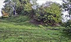 |
(#84002689) |
4420 Ohio St.[4] 38°34′30″N 90°13′52″W / 38.575°N 90.231111°W |
|
| 97 | Thurman Station | Upload image | (#13000537) |
2232 Thurman Ave. 38°36′40″N 90°15′04″W / 38.611229°N 90.251153°W |
|
| 98 | Tiffany Neighborhood District | Upload image | (#83001052) |
Roughly bounded by 39th St., Lafayette Ave., Vandeventer Ave. and Folsom Ave. 38°37′07″N 90°14′31″W / 38.618611°N 90.241944°W |
Boundaries reflect changes made by boundary increases of July 26, 1985 and February 26, 1987 and modified by a boundary decrease of June 18, 2009 |
| 99 | Tower Grove East Historic District | Upload image | (#13000114) |
Roughly bounded by S. Grand, Louisiana, Nebraska, Gravois & Shenandoah Aves. 38°36′11″N 90°14′10″W / 38.603054°N 90.236213°W |
|
| 100 | Tower Grove Heights Historic District |  |
(#01000947) |
Bounded by Arsenal St., Grand Blvd., McDonald Ave., and Gustine Ave.; also roughly bounded by Magnolia Ave., Louisiana Ave., Cherokee St., Gravois Ave., and Grand Blvd. 38°36′01″N 90°14′46″W / 38.600278°N 90.246111°W |
Second set of boundaries represents a boundary increase of April 16, 2004 |
| 101 | Tower Grove Park |  |
(#72001556) |
Bounded by Magnolia Ave. on the north, Grand Boulevard on the east, Arsenel St. on the south, and Kings Highway Boulevard on the west 38°36′22″N 90°15′16″W / 38.606111°N 90.254444°W |
|
| 102 | George F., Jr. and Carrie Tower House | Upload image | (#05001034) |
1520 S. Grand Ave. 38°37′18″N 90°14′17″W / 38.621667°N 90.238056°W |
|
| 103 | Union Depot Railroad Co. Building |  |
(#05001549) |
2727 S. Jefferson Ave. 38°36′19″N 90°13′25″W / 38.605278°N 90.223611°W |
part of the South St. Louis Historic Working and Middle Class Streetcar Suburbs MPS |
| 104 | Wachter Motor Car Company Building | |
(#07000463) |
2600-2614 Nebraska Ave. 38°36′30″N 90°13′45″W / 38.608333°N 90.229167°W |
part of the Auto-Related Resources of St. Louis, Missouri MPS |
| 105 | Woodward and Tiernan Printing Company Building | Upload image | (#15000174) |
1519 Tower Grove Ave. 38°37′22″N 90°15′22″W / 38.6227°N 90.2561°W |
|
| 106 | Edward Wyman School |  |
(#92001096) |
1547 S. Teresa 38°37′08″N 90°14′12″W / 38.618889°N 90.236667°W |
part of the St. Louis Public Schools of William B. Ittner MPS |
| 107 | Zeiss Houses |  |
(#80004518) |
7707-7713 Vulcan St. 38°32′43″N 90°15′26″W / 38.545197°N 90.257161°W |
part of the Carondelet, East of Broadway, St. Louis MRA |
Former listings
| [1] | Name on the Register | Image | Date listed | Date removed | Location | Summary |
|---|---|---|---|---|---|---|
| 1 | Lincoln Trust Building | Upload image | (#82004736) | 706 Chestnut St. |
Demolished in 1983.[5] | |
| 2 | The Olympia | Upload image | (#86002088) | 3863 W. Pine and 200 N. Vandeventer |
Demolished in 1993.[5] | |
| 3 | Unitarian Church of the Messiah | Upload image | (#80004513) | Locust and Garrison Sts. |
Demolished in 1987 following damage from a 1982 fire.[5] |
References
| Wikimedia Commons has media related to National Register of Historic Places in St. Louis, Missouri. |
- 1 2 Numbers represent an ordering by significant words. Various colorings, defined here, differentiate National Historic Landmarks and historic districts from other NRHP buildings, structures, sites or objects.
- ↑ The eight-digit number below each date is the number assigned to each location in the National Register Information System database, which can be viewed by clicking the number.
- ↑ http://www.stltoday.com/business/local/a-year-later-still-no-construction-at-pevely-site/article_54b7f78d-9da8-5db9-afec-e2fd589d9413.html
- ↑ Location derived from Interest abounds in Sugar Loaf Mound, St. Louis Post-Dispatch, 2009-06-17. Accessed 2010-07-05. The NRIS lists the site as "Address Restricted".
- 1 2 3 http://www.dnr.mo.gov/shpo/StLouisCity.htm
| Topics | |
|---|---|
| Lists by states |
|
| Lists by insular areas | |
| Lists by associated states | |
| Other areas | |
| |
|
This article is issued from Wikipedia - version of the 10/12/2016. The text is available under the Creative Commons Attribution/Share Alike but additional terms may apply for the media files.