| [3] |
Name on the Register[4] |
Image |
Date listed[5] |
Location |
City or town |
Description |
|---|
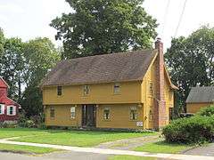
| 1 |
Capt. Benjamin Allyn II House |
|
000000001979-06-26-0000June 26, 1979
(#79002633) |
119 Deerfield Rd.
41°49′17″N 72°39′13″W / 41.821389°N 72.653611°W / 41.821389; -72.653611 (Capt. Benjamin Allyn II House) |
|
|
| 2 |
Giles Barber House |
|
000000001988-09-15-0000September 15, 1988
(#88001498) |
411-413 Windsor Ave.
41°48′53″N 72°39′29″W / 41.814722°N 72.658056°W / 41.814722; -72.658056 (Giles Barber House) |
|
|
| 3 |
Bissell Tavern-Bissell's Stage House |
|
000000001985-08-23-0000August 23, 1985
(#85001825) |
1022 Palisado Ave.
41°53′12″N 72°38′02″W / 41.886667°N 72.633889°W / 41.886667; -72.633889 (Bissell Tavern-Bissell's Stage House) |
|
|
| 4 |
Broad Street Green Historic District |
|
000000001999-12-30-0000December 30, 1999
(#99001613) |
Roughly along Broad St. from Batchelder Rd. to Union St.
41°51′01″N 72°38′33″W / 41.850278°N 72.6425°W / 41.850278; -72.6425 (Broad Street Green Historic District) |
|
|
| 5 |
Benomi Case House |
|
000000001988-09-15-0000September 15, 1988
(#88001497) |
436 Rainbow Rd.
41°55′05″N 72°41′35″W / 41.918056°N 72.693056°W / 41.918056; -72.693056 (Benomi Case House) |
|
|
| 6 |
Hezekiah Chaffee House |
|
000000001972-07-31-0000July 31, 1972
(#72001336) |
Meadow Lane off Palisado Green
41°51′28″N 72°38′11″W / 41.857778°N 72.636389°W / 41.857778; -72.636389 (Hezekiah Chaffee House) |
|
|
| 7 |
Taylor Chapman House |
|
000000001988-09-15-0000September 15, 1988
(#88001492) |
407 Palisado Ave.
41°51′59″N 72°37′49″W / 41.866389°N 72.630278°W / 41.866389; -72.630278 (Taylor Chapman House) |
|
|
| 8 |
Horace H. Ellsworth House |
|
000000001988-09-15-0000September 15, 1988
(#88001489) |
316 Palisado Ave.
41°51′49″N 72°37′53″W / 41.863611°N 72.631389°W / 41.863611; -72.631389 (Horace H. Ellsworth House) |
|
|
| 9 |
Oliver Ellsworth Homestead |
|
000000001970-10-06-0000October 6, 1970
(#70000707) |
778 Palisado Ave.
41°52′40″N 72°37′31″W / 41.877778°N 72.625278°W / 41.877778; -72.625278 (Oliver Ellsworth Homestead) |
|
Home of the third Chief Justice of the United States
|
| 10 |
Farmington River Railroad Bridge |
|
000000001972-08-25-0000August 25, 1972
(#72001334) |
Spans the Farmington River and Pleasant St. west of Palisado Ave.
41°51′28″N 72°38′30″W / 41.857778°N 72.641667°W / 41.857778; -72.641667 (Farmington River Railroad Bridge) |
|
|
| 11 |
First Church Parsonage |
|
000000001988-09-15-0000September 15, 1988
(#88001488) |
160 Palisado Ave.
41°52′04″N 72°38′08″W / 41.867778°N 72.635556°W / 41.867778; -72.635556 (First Church Parsonage) |
|
|
| 12 |
John Fitch School |
|
000000001986-12-02-0000December 2, 1986
(#86003326) |
156 Bloomfield Ave.
41°51′10″N 72°39′06″W / 41.852778°N 72.651667°W / 41.852778; -72.651667 (John Fitch School) |
|
|
| 13 |
Former Fire Station |
|
000000001988-09-15-0000September 15, 1988
(#88001485) |
14 Maple Ave.
41°51′05″N 72°38′44″W / 41.851389°N 72.645556°W / 41.851389; -72.645556 (Former Fire Station) |
|
|
| 14 |
Grace Church Rectory |
|
000000001988-09-15-0000September 15, 1988
(#88001477) |
301 Broad St.
41°50′59″N 72°38′37″W / 41.849722°N 72.643611°W / 41.849722; -72.643611 (Grace Church Rectory) |
|
|
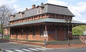
| 15 |
Hartford & New Haven Railroad Depot |
|
000000001988-09-15-0000September 15, 1988
(#88001479) |
Central St.
41°51′08″N 72°38′34″W / 41.852222°N 72.642778°W / 41.852222; -72.642778 (Hartford & New Haven Railroad Depot) |
|
|
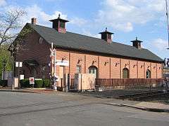
| 16 |
Hartford & New Haven Railroad-Freight Depot |
|
000000001988-09-15-0000September 15, 1988
(#88001505) |
40 Central St.
41°51′06″N 72°38′32″W / 41.851667°N 72.642222°W / 41.851667; -72.642222 (Hartford & New Haven Railroad-Freight Depot) |
|
|
| 17 |
William H. Harvey House |
|
000000001988-09-15-0000September 15, 1988
(#88001503) |
1173 Windsor Ave.
41°50′23″N 72°39′07″W / 41.839722°N 72.651944°W / 41.839722; -72.651944 (William H. Harvey House) |
|
|
| 18 |
Hathaways Store |
|
000000001988-09-15-0000September 15, 1988
(#88001482) |
32 East St.
41°51′25″N 72°38′57″W / 41.856944°N 72.649167°W / 41.856944; -72.649167 (Hathaways Store) |
|
|
| 19 |
Capt. Nathaniel Hayden House |
|
000000001988-09-15-0000September 15, 1988
(#88001483) |
128 Hayden Station Rd.
41°53′31″N 72°37′49″W / 41.891944°N 72.630278°W / 41.891944; -72.630278 (Capt. Nathaniel Hayden House) |
|
|
| 20 |
House at 111 Maple Avenue |
|
000000001988-09-15-0000September 15, 1988
(#88001486) |
111 Maple Ave.
41°51′04″N 72°38′59″W / 41.851111°N 72.649722°W / 41.851111; -72.649722 (House at 111 Maple Avenue) |
|
|
| 21 |
House at 130 Hayden Station Road |
|
000000001988-09-15-0000September 15, 1988
(#88001484) |
130 Hayden Station Rd.
41°53′32″N 72°37′55″W / 41.892222°N 72.631944°W / 41.892222; -72.631944 (House at 130 Hayden Station Road) |
|
|
| 22 |
House at 44 Court Street |
|
000000001988-09-15-0000September 15, 1988
(#88001480) |
44 Court St.
41°51′07″N 72°38′48″W / 41.851944°N 72.646667°W / 41.851944; -72.646667 (House at 44 Court Street) |
|
|
| 23 |
House at 736 Palisado Avenue |
|
000000001988-09-15-0000September 15, 1988
(#88001494) |
736 Palisado Ave.
41°52′37″N 72°37′32″W / 41.876944°N 72.625556°W / 41.876944; -72.625556 (House at 736 Palisado Avenue) |
|
|
| 24 |
Capt. James Loomis House |
|
000000001988-09-15-0000September 15, 1988
(#88001499) |
881 Windsor Ave.
41°49′47″N 72°39′24″W / 41.829722°N 72.656667°W / 41.829722; -72.656667 (Capt. James Loomis House) |
|
|
| 25 |
Col. James Loomis House |
|
000000001988-09-15-0000September 15, 1988
(#88001476) |
208-210 Broad St.
41°51′07″N 72°38′41″W / 41.851944°N 72.644722°W / 41.851944; -72.644722 (Col. James Loomis House) |
|
|
| 26 |
George G. Loomis House |
|
000000001988-09-15-0000September 15, 1988
(#88001500) |
1003 Windsor Ave.
41°50′03″N 72°39′18″W / 41.834167°N 72.655°W / 41.834167; -72.655 (George G. Loomis House) |
|
|
| 27 |
Gordon Loomis House |
|
000000001988-09-15-0000September 15, 1988
(#88001501) |
1021 Windsor Ave.
41°50′05″N 72°39′18″W / 41.834722°N 72.655°W / 41.834722; -72.655 (Gordon Loomis House) |
|
|
| 28 |
Ira Loomis, Jr. House |
|
000000001988-09-15-0000September 15, 1988
(#88001502) |
1053 Windsor Ave.
41°50′08″N 72°39′17″W / 41.835556°N 72.654722°W / 41.835556; -72.654722 (Ira Loomis, Jr. House) |
|
|
| 29 |
Henry Magill House |
|
000000001988-09-15-0000September 15, 1988
(#88001491) |
390 Palisado Ave.
41°51′57″N 72°37′48″W / 41.865833°N 72.63°W / 41.865833; -72.63 (Henry Magill House) |
|
|
| 30 |
Elijah Mills House |
|
000000001985-08-23-0000August 23, 1985
(#85001829) |
45 Deerfield Rd.
41°49′06″N 72°39′20″W / 41.818333°N 72.655556°W / 41.818333; -72.655556 (Elijah Mills House) |
|
|
| 31 |
Oliver W. Mills House |
|
000000001982-02-19-0000February 19, 1982
(#82004443) |
148 Deerfield Rd.
41°49′16″N 72°39′09″W / 41.821111°N 72.6525°W / 41.821111; -72.6525 (Oliver W. Mills House) |
|
|
| 32 |
Timothy Dwight Mills House |
|
000000001988-09-15-0000September 15, 1988
(#88001481) |
184 Deerfield Rd.
41°49′20″N 72°39′11″W / 41.822222°N 72.653056°W / 41.822222; -72.653056 (Timothy Dwight Mills House) |
|
|
| 33 |
Deacon John Moore House |
|
000000001977-07-29-0000July 29, 1977
(#77001416) |
37 Elm St.
41°51′05″N 72°38′45″W / 41.851389°N 72.645833°W / 41.851389; -72.645833 (Deacon John Moore House) |
|
|
| 34 |
Edward and Ann Moore House |
|
000000001988-09-15-0000September 15, 1988
(#88001478) |
464 Broad St.
41°50′42″N 72°38′54″W / 41.845°N 72.648333°W / 41.845; -72.648333 (Edward and Ann Moore House) |
|
|
| 35 |
Patrick Murphy House |
|
000000001988-09-15-0000September 15, 1988
(#88001490) |
345 Palisado Ave.
41°51′53″N 72°37′53″W / 41.864722°N 72.631389°W / 41.864722; -72.631389 (Patrick Murphy House) |
|
|
| 36 |
Palisado Avenue Historic District |
|
000000001987-08-25-0000August 25, 1987
(#87000799) |
Palisado Ave. (signed as Connecticut Route 159) between the Farmington River and Bissell Ferry Rd.
41°51′35″N 72°38′10″W / 41.859722°N 72.636111°W / 41.859722; -72.636111 (Palisado Avenue Historic District) |
|
|
| 37 |
Daniel Payne House |
|
000000001988-09-15-0000September 15, 1988
(#88001495) |
27 Park Ave.
41°50′20″N 72°39′14″W / 41.838889°N 72.653889°W / 41.838889; -72.653889 (Daniel Payne House) |
|
|
| 38 |
Eli Phelps House |
|
000000001988-09-15-0000September 15, 1988
(#88001487) |
18 Marshall Phelps Rd.
41°53′24″N 72°40′35″W / 41.89°N 72.676389°W / 41.89; -72.676389 (Eli Phelps House) |
|
|
| 39 |
William Shelton House |
|
000000001988-09-15-0000September 15, 1988
(#88001496) |
40 Pleasant St.
41°51′29″N 72°38′58″W / 41.858056°N 72.649444°W / 41.858056; -72.649444 (William Shelton House) |
|
|
| 40 |
Stony Hill School |
|
000000001988-09-15-0000September 15, 1988
(#88001504) |
1195 Windsor Ave.
41°50′25″N 72°39′04″W / 41.840278°N 72.651111°W / 41.840278; -72.651111 (Stony Hill School) |
|
|
| 41 |
Sophia Sweetland House |
|
000000001988-09-15-0000September 15, 1988
(#88001493) |
458 Palisado Ave.
41°52′04″N 72°37′45″W / 41.867778°N 72.629167°W / 41.867778; -72.629167 (Sophia Sweetland House) |
|
|


