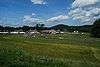
| [3] |
Name on the Register[4] |
Image |
Date listed[5] |
Location |
City or town |
Description |
|---|
| 1 |
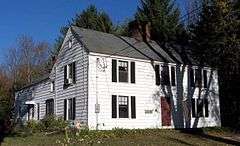
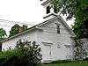
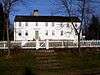
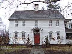
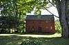
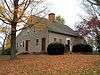
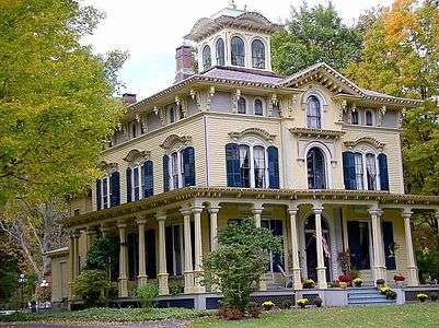
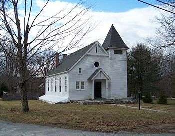
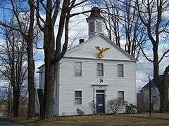
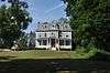
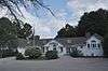
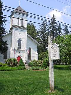
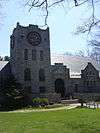
James Alldis House |
|
000000001982-04-29-0000April 29, 1982
(#82004480) |
355 Prospect St.
41°48′16″N 73°07′24″W / 41.804444°N 73.123333°W / 41.804444; -73.123333 (James Alldis House) |
Torrington |
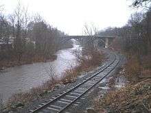
Fine Queen Anne style house from 1895, built for supervisory of the largest industry in Torrington, the needle manufacturing plant which became the Torrington Company.[6]
|
| 2 |
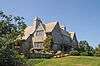
American Legion Forest CCC Shelter |
Upload image |
000000001986-09-04-0000September 4, 1986
(#86001725) |
Western side of West River Rd., American Legion State Forest
41°55′47″N 73°00′15″W / 41.929722°N 73.004167°W / 41.929722; -73.004167 (American Legion Forest CCC Shelter) |
Barkhamsted |
|
| 3 |
Leroy Anderson House |
|
000000002012-12-31-0000December 31, 2012
(#12000361) |
33 Grassy Hill Rd.
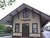
41°32′22″N 73°14′08″W / 41.539319°N 73.235601°W / 41.539319; -73.235601 (Leroy Anderson House) |
Woodbury |
|
| 4 |
Jabez Bacon House |
Upload image |
000000001971-04-16-0000April 16, 1971
(#71000904) |
Hollow Rd. near its junction with U.S. Route 6
41°32′17″N 73°12′32″W / 41.538056°N 73.208889°W / 41.538056; -73.208889 (Jabez Bacon House) |
Woodbury |
|
| 5 |
Amos Baldwin House |
|
000000002016-07-19-0000July 19, 2016
(#16000450) |
92 Goshen St., E.
41°55′20″N 73°12′38″W / 41.922167°N 73.210586°W / 41.922167; -73.210586 (Amos Baldwin House) |
Norfolk |
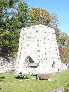
|
| 6 |
Barkhamsted Center Historic District |
|
000000001999-12-22-0000December 22, 1999
(#99001594) |
119, 131 Center Hill Rd. and 2, 5, 6, and 8 Old Town Hall Rd.
41°55′47″N 72°57′59″W / 41.929722°N 72.966389°W / 41.929722; -72.966389 (Barkhamsted Center Historic District) |
Barkhamsted |
|
| 7 |
Capt. Philo Beardsley House |
|
000000001979-07-03-0000July 3, 1979
(#79002616) |
Southeast of Kent on Beardsley Rd.
41°42′04″N 73°23′31″W / 41.701111°N 73.391944°W / 41.701111; -73.391944 (Capt. Philo Beardsley House) |
Kent |
|
| 8 |
Beaver Meadow Complex Prehistoric Archeological District |
Upload image |
000000001988-09-21-0000September 21, 1988
(#88000858) |
Address Restricted
|
Barkhamsted |
|
| 9 |
Beckley Furnace |
|
000000001978-02-14-0000February 14, 1978
(#78002847) |
Southeast of Canaan on Lower Rd.
42°00′39″N 73°17′34″W / 42.010833°N 73.292778°W / 42.010833; -73.292778 (Beckley Furnace) |
North Canaan |
|
| 10 |
Joseph Bellamy House |
|
000000001982-04-12-0000April 12, 1982
(#82004444) |
N. Main and West Sts.
41°38′42″N 73°12′32″W / 41.645°N 73.208889°W / 41.645; -73.208889 (Joseph Bellamy House) |
Bethlehem |
|
| 11 |
Francis Benedict, Jr., House |
|
000000002002-04-11-0000April 11, 2002
(#02000333) |
85 N. Colebrook Rd.
42°01′45″N 73°09′13″W / 42.029167°N 73.153611°W / 42.029167; -73.153611 (Francis Benedict, Jr., House) |
Norfolk |
|
| 12 |
Bethlehem Green Historic District |
|
000000001982-12-16-0000December 16, 1982
(#82001001) |
Parts of N. Main St., S. Main St., East St., West Rd., and Munger Lane
41°38′16″N 73°12′32″W / 41.637778°N 73.208889°W / 41.637778; -73.208889 (Bethlehem Green Historic District) |
Bethlehem |
|
| 13 |
Henry B. Bissell House |
|
000000001990-09-07-0000September 7, 1990
(#90001288) |
202 Maple St.
41°44′24″N 73°14′16″W / 41.74°N 73.237778°W / 41.74; -73.237778 (Henry B. Bissell House) |
Litchfield |
|
| 14 |
Boardman's Bridge |
|
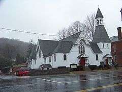
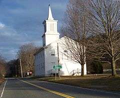
000000001976-05-13-0000May 13, 1976
(#76001983) |
Boardman Rd. at the Housatonic River, northwest of New Milford
41°35′36″N 73°27′02″W / 41.593333°N 73.450556°W / 41.593333; -73.450556 (Boardman's Bridge) |
New Milford |
|
| 15 |
Braman Camp |
Upload image |
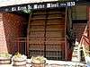
000000001982-08-02-0000August 2, 1982
(#82004451) |
Doolittle Lake
42°00′53″N 73°09′18″W / 42.014722°N 73.155°W / 42.014722; -73.155 (Braman Camp) |
Norfolk |
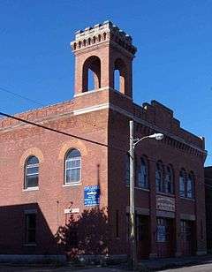
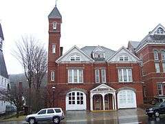
|
| 16 |
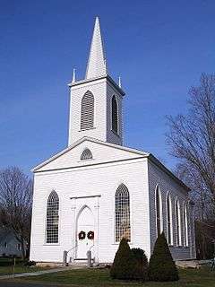
Bridge No. 2305 |
|
000000002007-03-09-0000March 9, 2007
(#07000109) |
Main St. over Burton Brook
41°58′04″N 73°26′22″W / 41.967778°N 73.439444°W / 41.967778; -73.439444 (Bridge No. 2305) |
Salisbury |
|
| 17 |
Bridge No. 560 |
|
000000002004-09-29-0000September 29, 2004
(#04001090) |
US 7 and CT 4 over the Housatonic River
41°49′11″N 73°22′25″W / 41.819722°N 73.373611°W / 41.819722; -73.373611 (Bridge No. 560) |
Cornwall and Sharon |
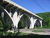
Also known as Cornwall Bridge, crosses the Housatonic River and the Housatonic Railroad. Built in 1930 by C.W. Blakeslee and Sons for the Connecticut Highway Department, it is a fairly large example of concrete open-spandrel construction.[7]
|
| 18 |
Bridgewater Center Historic District |
|
000000002000-07-19-0000July 19, 2000
(#00000816) |
Roughly along Main St., Warner Rd., Clapboard Rd. and Hat Shop Hill
41°32′09″N 73°22′07″W / 41.535833°N 73.368611°W / 41.535833; -73.368611 (Bridgewater Center Historic District) |
Bridgewater |
|
| 19 |
Hervey Brooks Pottery Shop and Kiln Site |
Upload image |
000000001993-12-10-0000December 10, 1993
(#93001362) |
Address Restricted
|
Goshen |
|
| 20 |
Roderick Bryan House |
|
000000002000-12-28-0000December 28, 2000
(#00001563) |
867 Linkfield Rd.
41°38′45″N 73°07′58″W / 41.645833°N 73.132778°W / 41.645833; -73.132778 (Roderick Bryan House) |
Watertown |
|
| 21 |
Bull's Bridge |
|
000000001972-04-26-0000April 26, 1972
(#72001314) |
About 3 miles (4.8 km) southwest of Kent on Bull's Bridge Rd, over the Housatonic River
41°40′32″N 73°30′35″W / 41.675556°N 73.509722°W / 41.675556; -73.509722 (Bull's Bridge) |
Kent |
|
| 22 |
Capt. William Bull Tavern |
|
000000001983-06-30-0000June 30, 1983
(#83001269) |
US 202
41°46′52″N 73°09′43″W / 41.781111°N 73.161944°W / 41.781111; -73.161944 (Capt. William Bull Tavern) |
Litchfield |
|
| 23 |
Burlington-Harmony Hill Roads Historic District |
|
000000001996-12-06-0000December 6, 1996
(#96001364) |
Harmony Hill, Locust Grove, and Burlington Rds.
41°46′33″N 73°02′56″W / 41.775833°N 73.048889°W / 41.775833; -73.048889 (Burlington-Harmony Hill Roads Historic District) |
Harwinton |
|
| 24 |
Calhoun-Ives Historic District |
|
000000001995-11-22-0000November 22, 1995
(#95001344) |
79-262 Calhoun St. and 11 and 12 Ives Rd.
41°39′34″N 73°19′58″W / 41.659444°N 73.332778°W / 41.659444; -73.332778 (Calhoun-Ives Historic District) |
Washington |
|
| 25 |
Moses Camp House |
|
000000001984-05-10-0000May 10, 1984
(#84001060) |
682 Main St.
41°55′21″N 73°04′31″W / 41.9225°N 73.075278°W / 41.9225; -73.075278 (Moses Camp House) |
Winchester* |
|
| 26 |
Canaan Village Historic District |
|
000000001990-12-13-0000December 13, 1990
(#90001800) |
Roughly bounded by W. Main, Bragg, and Orchard Sts. and Granite Ave.
42°01′44″N 73°19′52″W / 42.028889°N 73.331111°W / 42.028889; -73.331111 (Canaan Village Historic District) |
North Canaan |
|
| 27 |
J. Howard Catlin House |
Upload image |
000000001993-08-06-0000August 6, 1993
(#93000672) |
14 Knife Shop Rd.
41°41′50″N 73°06′22″W / 41.697222°N 73.106111°W / 41.697222; -73.106111 (J. Howard Catlin House) |
Litchfield |
|
| 28 |
Philip Chapin House |
|
000000001977-08-29-0000August 29, 1977
(#77001399) |
1 Church St.
41°52′30″N 72°58′08″W / 41.875°N 72.968889°W / 41.875; -72.968889 (Philip Chapin House) |
New Hartford |
|
| 29 |
Starling Childs Camp |
|
000000001982-08-02-0000August 2, 1982
(#82004463) |
Doolittle Lake
42°00′40″N 73°09′23″W / 42.011111°N 73.156389°W / 42.011111; -73.156389 (Starling Childs Camp) |
Norfolk |
|
| 30 |
John C. Coffing House |
|
000000001990-12-18-0000December 18, 1990
(#90001922) |
U.S. Route 44 west of Lime Rock Rd.
41°58′38″N 73°25′34″W / 41.977222°N 73.426111°W / 41.977222; -73.426111 (John C. Coffing House) |
Salisbury |
|
| 31 |
Colebrook Center Historic District |
|
000000001991-07-26-0000July 26, 1991
(#91000953) |
Roughly the junction of Rockwell, Colebrook, Schoolhouse and Smith Hill Rds. and CT 183
41°59′30″N 73°05′52″W / 41.991667°N 73.097778°W / 41.991667; -73.097778 (Colebrook Center Historic District) |
Colebrook |
|
| 32 |
Colebrook Store |
|
000000001976-04-26-0000April 26, 1976
(#76001980) |
CT 183
41°59′22″N 73°05′48″W / 41.989444°N 73.096667°W / 41.989444; -73.096667 (Colebrook Store) |
Colebrook |
|
| 33 |
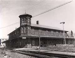
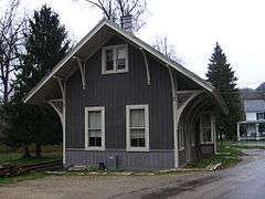
Cornwall Bridge Railroad Station |
|
000000001972-04-26-0000April 26, 1972
(#72001313) |
Junction of Poppleswamp Brook Rd. and Kent Rd.
41°49′11″N 73°22′20″W / 41.819722°N 73.372222°W / 41.819722; -73.372222 (Cornwall Bridge Railroad Station) |
Cornwall |
|
| 34 |
Cream Hill Agricultural School |
|
000000001976-03-26-0000March 26, 1976
(#76001986) |
Northeast of West Cornwall off CT 128 on Cream Hill Rd.
41°53′33″N 73°19′22″W / 41.8925°N 73.322778°W / 41.8925; -73.322778 (Cream Hill Agricultural School) |
Cornwall |
|
| 35 |
Cream Hill Shelter |
Upload image |
000000001986-09-04-0000September 4, 1986
(#86001727) |
Wickwire Rd., Housatonic State Forest
41°54′43″N 73°19′39″W / 41.911944°N 73.3275°W / 41.911944; -73.3275 (Cream Hill Shelter) |
Cornwall |
Incorrectly listed in Sharon.
|
| 36 |
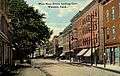
Downtown Torrington Historic District |
|
000000001988-12-22-0000December 22, 1988
(#88002978) |
Roughly bounded by Church and Alvord Sts., Center Cemetery, Willow St., E. Main St., Litchfield St., and Prospect St.
41°48′07″N 73°07′17″W / 41.801944°N 73.121389°W / 41.801944; -73.121389 (Downtown Torrington Historic District) |
Torrington |
A historic district covering historic portion of commercial downtown area
|
| 37 |
East Plymouth Historic District |
|
000000001985-02-21-0000February 21, 1985
(#85000312) |
E. Plymouth and Marsh Rd.
41°41′59″N 72°59′57″W / 41.699592°N 72.999097°W / 41.699592; -72.999097 (East Plymouth Historic District) |
Plymouth |
|
| 38 |
Esperanza |
|
000000002002-04-11-0000April 11, 2002
(#02000334) |
511 Town Hill Rd.
41°51′25″N 73°00′14″W / 41.856944°N 73.003889°W / 41.856944; -73.003889 (Esperanza) |
New Hartford |
|
| 39 |
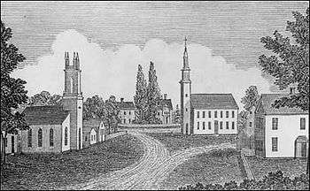
Falls Village District |
|
000000001979-06-14-0000June 14, 1979
(#79002622) |
CT 126
41°57′23″N 73°21′49″W / 41.956389°N 73.363611°W / 41.956389; -73.363611 (Falls Village District) |
Canaan |
Historic district including Greek Revival houses, churches, and the D.M. Hunt Library from 1891.
|
| 40 |
Farnum House |
|
000000001982-08-02-0000August 2, 1982
(#82004449) |
Litchfield Rd.
41°58′59″N 73°12′06″W / 41.983056°N 73.201667°W / 41.983056; -73.201667 (Farnum House) |
Norfolk |
|
| 41 |
Flanders Historic District |
|
000000001979-04-13-0000April 13, 1979
(#79002618) |
U.S. Route 7, Cobble Rd., Cobble Lane, and Studio Hill Rd.
41°44′22″N 73°27′25″W / 41.739444°N 73.456944°W / 41.739444; -73.456944 (Flanders Historic District) |
Kent |
|
| 42 |
Samuel Forbes Homestead |
|
000000001992-11-25-0000November 25, 1992
(#92001578) |
89 Lower Rd.
42°00′46″N 73°19′08″W / 42.012778°N 73.318889°W / 42.012778; -73.318889 (Samuel Forbes Homestead) |
North Canaan |
|
| 43 |
Fyler-Hotchkiss Estate |
|
000000001987-02-12-0000February 12, 1987
(#87000129) |
192 Main St.
41°48′15″N 73°07′19″W / 41.804167°N 73.121944°W / 41.804167; -73.121944 (Fyler-Hotchkiss Estate) |
Torrington |
|
| 44 |
Ebenezer Gay House |
|
000000001979-07-09-0000July 9, 1979
(#79002619) |
Main St.
41°52′37″N 73°28′37″W / 41.876944°N 73.476944°W / 41.876944; -73.476944 (Ebenezer Gay House) |
Sharon |
|
| 45 |
George King House |
|
000000002006-11-06-0000November 6, 2006
(#06000592) |
12 N. Main St.
41°52′57″N 73°28′26″W / 41.882611°N 73.473778°W / 41.882611; -73.473778 (George King House) |
Sharon |
|
| 46 |
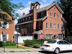
Gilbert Clock Factory |
|
000000001984-12-13-0000December 13, 1984
(#84000494) |
Wallens St.
41°55′49″N 73°03′29″W / 41.930278°N 73.058056°W / 41.930278; -73.058056 (Gilbert Clock Factory) |
Winchester* |
|
| 47 |
Gillette's Grist Mill |
|
000000001977-08-29-0000August 29, 1977
(#77001403) |
East of Torrington on Maple Hollow Rd.
41°50′18″N 73°01′29″W / 41.838333°N 73.024722°W / 41.838333; -73.024722 (Gillette's Grist Mill) |
New Hartford |
|
| 48 |
Glebe House |
|
000000001971-03-11-0000March 11, 1971
(#71000902) |
Hollow Rd.
41°32′18″N 73°12′38″W / 41.538333°N 73.210556°W / 41.538333; -73.210556 (Glebe House) |
Woodbury |
|
| 49 |
Goshen Historic District |
|
000000001982-12-27-0000December 27, 1982
(#82000996) |
CT 63 and 4 and Gifford Rd.
41°49′50″N 73°13′25″W / 41.830556°N 73.223611°W / 41.830556; -73.223611 (Goshen Historic District) |
Goshen |
|
| 50 |
Gould House |
|
000000001982-08-02-0000August 2, 1982
(#82004452) |
Golf Dr.
41°59′08″N 73°12′57″W / 41.985556°N 73.215833°W / 41.985556; -73.215833 (Gould House) |
Norfolk |
|
| 51 |
Gov. Smith Homestead |
|
000000001982-03-25-0000March 25, 1982
(#82004475) |
South Main St.
41°52′09″N 73°28′32″W / 41.869167°N 73.475556°W / 41.869167; -73.475556 (Gov. Smith Homestead) |
Sharon |
|
| 52 |
J. S. Halpine Tobacco Warehouse |
|
000000001982-12-16-0000December 16, 1982
(#82001002) |
West and Mill Sts.
41°34′21″N 73°24′40″W / 41.5725°N 73.411111°W / 41.5725; -73.411111 (J. S. Halpine Tobacco Warehouse) |
New Milford |
|
| 53 |
Haystack Mountain Tower |
|
000000001993-12-02-0000December 2, 1993
(#93001244) |
43 North St.
42°00′17″N 73°12′31″W / 42.004722°N 73.208611°W / 42.004722; -73.208611 (Haystack Mountain Tower) |
Norfolk |
|
| 54 |
Hillside |
|
000000001982-08-02-0000August 2, 1982
(#82004454) |
Litchfield Rd.
41°58′06″N 73°11′28″W / 41.968333°N 73.191111°W / 41.968333; -73.191111 (Hillside) |
Norfolk |
|
| 55 |
Hine-Buckingham Farms |
|
000000002004-05-07-0000May 7, 2004
(#04000413) |
44, 46, and 48 Upland Rd. and 78, 81 Crossman Rd.
41°38′18″N 73°22′57″W / 41.638333°N 73.3825°W / 41.638333; -73.3825 (Hine-Buckingham Farms) |
New Milford |
Now the Hunt Hill Farm.
|
| 56 |
Holabird House |
|
000000001982-06-28-0000June 28, 1982
(#82004445) |
Kellog Rd., corner of CT 126
41°57′14″N 73°20′48″W / 41.953889°N 73.346667°W / 41.953889; -73.346667 (Holabird House) |
Canaan |
|
| 57 |
The Hollister Homestead |
Upload image |
000000002010-06-15-0000June 15, 2010
(#10000350) |
294-300 Nettleton Hollow Rd.
41°37′05″N 73°16′14″W / 41.618061°N 73.270428°W / 41.618061; -73.270428 (The Hollister Homestead) |
Washington |
|
| 58 |
Hose and Hook and Ladder Truck Building |
|
000000001982-01-04-0000January 4, 1982
(#82004479) |
Main St.
41°40′22″N 73°04′33″W / 41.672778°N 73.075833°W / 41.672778; -73.075833 (Hose and Hook and Ladder Truck Building) |
Thomaston |
|
| 59 |
Hotchkissville Historic District |
Upload image |
000000001996-12-06-0000December 6, 1996
(#96001460) |
Roughly bounded by W. Wood, Paper Mill, Weekeepeemee, Washington, and Jack's Bridge Rds.
41°33′46″N 73°13′08″W / 41.562778°N 73.218889°W / 41.562778; -73.218889 (Hotchkissville Historic District) |
Woodbury |
|
| 60 |
Housatonic Railroad Station |
|
000000001984-03-01-0000March 1, 1984
(#84001062) |
Railroad St.
41°34′35″N 73°24′46″W / 41.576389°N 73.412778°W / 41.576389; -73.412778 (Housatonic Railroad Station) |
New Milford |
|
| 61 |
Kent Iron Furnace |
|
000000001977-10-05-0000October 5, 1977
(#77001401) |
North of Kent off U.S. Route 7
41°44′19″N 73°28′12″W / 41.738611°N 73.47°W / 41.738611; -73.47 (Kent Iron Furnace) |
Kent |
|
| 62 |
Lakeville Historic District |
|
000000001996-08-01-0000August 1, 1996
(#96000845) |
Bounded by Millerton Rd., Sharon Rd., Allen St., and Holley St.
41°57′51″N 73°26′31″W / 41.964167°N 73.441944°W / 41.964167; -73.441944 (Lakeville Historic District) |
Salisbury |
|
| 63 |
Lakeville Manor |
|
000000002014-04-08-0000April 8, 2014
(#13000159) |
12 Elm St.;33 Sharon Rd.
41°57′44″N 73°26′27″W / 41.9623°N 73.4407°W / 41.9623; -73.4407 (Lakeville Manor) |
Lakeville |
|
| 64 |
Isaac Lawrence House |
|
000000001983-03-10-0000March 10, 1983
(#83001270) |
Elm St.
42°01′23″N 73°19′33″W / 42.023056°N 73.325833°W / 42.023056; -73.325833 (Isaac Lawrence House) |
North Canaan |
|
| 65 |
Lighthouse Archeological Site (5-37) |
Upload image |
000000001991-04-25-0000April 25, 1991
(#91000445) |
Address Restricted
|
Barkhamsted |
|
| 66 |
Lime Rock Historic District |
|
000000001984-07-05-0000July 5, 1984
(#84001064) |
Roughly White Hollow, Elm, Lime Rock, Norton Hill and Furnace Rds.
41°56′04″N 73°23′27″W / 41.934444°N 73.390833°W / 41.934444; -73.390833 (Lime Rock Historic District) |
Salisbury |
|
| 67 |
Lime Rock Park Race Track |
|
000000002009-10-16-0000October 16, 2009
(#08001380) |
497 Lime Rock Rd.
41°55′40″N 73°23′01″W / 41.927689°N 73.3836°W / 41.927689; -73.3836 (Lime Rock Park Race Track) |
Salisbury |
Unique race track, opened in 1959, has no stands, instead providing open fields for spectators.
|
| 68 |
Litchfield Historic District |
|
000000001968-11-24-0000November 24, 1968
(#68000050) |
Roughly both sides of North and South Sts. between Gallows Lane and Prospect St.; also U.S. Route 202 and Route 63
41°44′40″N 73°11′24″W / 41.744444°N 73.19°W / 41.744444; -73.19 (Litchfield Historic District) |
Litchfield |
Intact village of late 18th- and early 19th-century buildings was state's first historic district. 1978 expansion includes entire borough
|
| 69 |
Litchfield-South Roads Historic District |
|
000000001996-12-06-0000December 6, 1996
(#96001365) |
Roughly Litchfield Rd. from Bridge Park to Harwinton Heights Rds. and South Rd. from Litchfield Rd. to South Cemetery
41°46′05″N 73°03′00″W / 41.768056°N 73.05°W / 41.768056; -73.05 (Litchfield-South Roads Historic District) |
Harwinton |
|
| 70 |
Lover's Leap Bridge |
|
000000001976-05-13-0000May 13, 1976
(#76001982) |
South of New Milford on Pumpkin Hill Rd.
41°32′39″N 73°24′26″W / 41.544167°N 73.407222°W / 41.544167; -73.407222 (Lover's Leap Bridge) |
New Milford |
|
| 71 |
Low House |
|
000000001984-02-17-0000February 17, 1984
(#84001067) |
Highfield Rd.
41°59′06″N 73°11′08″W / 41.985°N 73.185556°W / 41.985; -73.185556 (Low House) |
Norfolk |
|
| 72 |
Caleb Martin House |
|
000000001996-04-18-0000April 18, 1996
(#96000427) |
30 Mill Rd.
41°37′30″N 73°13′19″W / 41.625°N 73.221944°W / 41.625; -73.221944 (Caleb Martin House) |
Bethlehem |
|
| 73 |
Mead Camp |
Upload image |
000000001982-08-02-0000August 2, 1982
(#82004455) |
Doolittle Lake
42°00′44″N 73°09′46″W / 42.012222°N 73.162778°W / 42.012222; -73.162778 (Mead Camp) |
Norfolk |
|
| 74 |
Merritt Beach & Son Building |
|
000000001992-04-28-0000April 28, 1992
(#92000403) |
30 Bridge St.
41°34′35″N 73°24′43″W / 41.576389°N 73.411944°W / 41.576389; -73.411944 (Merritt Beach & Son Building) |
New Milford |
|
| 75 |
Merryall Union Evangelical Society Chapel |
|
000000001986-06-05-0000June 5, 1986
(#86001240) |
Chapel Hill Rd.
41°38′50″N 73°25′11″W / 41.647222°N 73.419722°W / 41.647222; -73.419722 (Merryall Union Evangelical Society Chapel) |
New Milford |
|
| 76 |
Merwinsville Hotel |
|
000000001977-08-29-0000August 29, 1977
(#77001398) |
East of Gaylordsville on Brown's Forge Rd.
41°38′49″N 73°28′44″W / 41.646944°N 73.478889°W / 41.646944; -73.478889 (Merwinsville Hotel) |
New Milford |
|
| 77 |
Migeon Avenue Historic District |
|
000000002002-09-06-0000September 6, 2002
(#02000913) |
Roughly along Migeon Ave. and parts of Forest St.
41°48′31″N 73°07′47″W / 41.808597°N 73.129785°W / 41.808597; -73.129785 (Migeon Avenue Historic District) |
Torrington |
District of 9 contributing buildings, the most salient being Laurelhurst, a Shingle Style architecture work[8]
|
| 78 |
Milton Center Historic District |
|
000000001986-12-23-0000December 23, 1986
(#86003754) |
Roughly bounded by Milton, Shearshop, Headquarters, Sawmill, and Blue Swamp Rds.
41°46′03″N 73°16′22″W / 41.7675°N 73.272778°W / 41.7675; -73.272778 (Milton Center Historic District) |
Litchfield |
|
| 79 |
Minortown Road Bridge |
|
000000002001-08-17-0000August 17, 2001
(#01000883) |
Minortown Rd. over the Nonewaug River
41°34′36″N 73°10′34″W / 41.576667°N 73.176111°W / 41.576667; -73.176111 (Minortown Road Bridge) |
Woodbury |
|
| 80 |
William Moore, Jr., House |
|
000000001999-04-14-0000April 14, 1999
(#99000406) |
5 Mountain Rd.
41°57′47″N 73°00′59″W / 41.963056°N 73.016389°W / 41.963056; -73.016389 (William Moore, Jr., House) |
Barkhamsted |
|
| 81 |
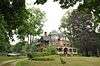
Moseley House-Farm |
|
000000001984-02-17-0000February 17, 1984
(#84001077) |
Greenwoods Rd.
42°00′23″N 73°14′29″W / 42.006389°N 73.241389°W / 42.006389; -73.241389 (Moseley House-Farm) |
Norfolk |
Known as Blackberry River Inn; original part built in 1763; Colonial Revival expansion in 1920; now a bed-and-breakfast.[9]
|
| 82 |
Moss Hill |
|
000000001982-08-02-0000August 2, 1982
(#82004457) |
Litchfield Rd.
41°58′40″N 73°11′57″W / 41.977778°N 73.199167°W / 41.977778; -73.199167 (Moss Hill) |
Norfolk |
|
| 83 |
Mount Riga Ironworks Site |
|
000000001994-12-01-0000December 1, 1994
(#94001417) |
Address Restricted
|
Salisbury |
|
| 84 |
Mount Tom Tower |
|
000000001993-12-02-0000December 2, 1993
(#93001247) |
Off U.S. Route 202 southeast of Woodville, Mount Tom State Park
41°41′39″N 73°16′30″W / 41.694167°N 73.275°W / 41.694167; -73.275 (Mount Tom Tower) |
Litchfield, Morris, and Washington |
|
| 85 |
Mulville House |
|
000000001984-02-17-0000February 17, 1984
(#84001079) |
Mountain Rd.
41°59′15″N 73°12′32″W / 41.9875°N 73.208889°W / 41.9875; -73.208889 (Mulville House) |
Norfolk |
|
| 86 |
Music Mountain |
Upload image |
000000001987-12-18-0000December 18, 1987
(#87001909) |
Music Mountain Rd.
41°55′12″N 73°19′16″W / 41.92°N 73.321111°W / 41.92; -73.321111 (Music Mountain) |
Canaan |
|
| 87 |
New Milford Center Historic District |
|
000000001986-06-13-0000June 13, 1986
(#86001255) |
Bennett and Elm Sts., Center Cemetery, East, S. Main, Mill, and Railroad Sts.
41°34′40″N 73°24′35″W / 41.577778°N 73.409722°W / 41.577778; -73.409722 (New Milford Center Historic District) |
New Milford |
|
| 88 |
New Preston Hill Historic District |
|
000000001985-08-26-0000August 26, 1985
(#85001931) |
New Preston Hill, Findley, and Gunn Hill Rds.
41°40′28″N 73°22′17″W / 41.674444°N 73.371389°W / 41.674444; -73.371389 (New Preston Hill Historic District) |
Washington |
|
| 89 |
Noble House |
|
000000001984-02-17-0000February 17, 1984
(#84001083) |
Highfield Rd.
41°59′09″N 73°11′07″W / 41.985833°N 73.185278°W / 41.985833; -73.185278 (Noble House) |
Norfolk |
|
| 90 |
John Glover Noble House |
|
000000001977-08-29-0000August 29, 1977
(#77001402) |
US 202
41°30′17″N 73°25′09″W / 41.504738°N 73.419112°W / 41.504738; -73.419112 (John Glover Noble House) |
New Milford |
|
| 91 |
Norfolk Country Club House |
|
000000001982-08-02-0000August 2, 1982
(#82004458) |
Golf Dr.
41°58′58″N 73°11′32″W / 41.982778°N 73.192222°W / 41.982778; -73.192222 (Norfolk Country Club House) |
Norfolk |
|
| 92 |
Norfolk Downs Shelter |
|
000000001984-02-22-0000February 22, 1984
(#84001085) |
Gold Rd.
41°58′52″N 73°12′58″W / 41.981111°N 73.216111°W / 41.981111; -73.216111 (Norfolk Downs Shelter) |
Norfolk |
|
| 93 |
Norfolk Historic District |
|
000000001979-10-15-0000October 15, 1979
(#79003749) |
U.S. Route 44 and CT 272
41°59′20″N 73°12′16″W / 41.988889°N 73.204444°W / 41.988889; -73.204444 (Norfolk Historic District) |
Norfolk |
|
| 94 |
Northfield Knife Company Site |
|
000000001997-04-08-0000April 8, 1997
(#97000275) |
Address Restricted
|
Litchfield |
|
| 95 |
Old Riverton Inn |
|
000000001992-07-24-0000July 24, 1992
(#92000906) |
436 E. River Rd.
41°57′46″N 73°01′07″W / 41.962778°N 73.018611°W / 41.962778; -73.018611 (Old Riverton Inn) |
Barkhamsted |
|
| 96 |
James Pardee House |
|
000000002003-08-28-0000August 28, 2003
(#03000813) |
129 N. Main St.
41°53′00″N 73°28′20″W / 41.883257°N 73.472137°W / 41.883257; -73.472137 (James Pardee House) |
Sharon |
|
| 97 |
Paugnut Forest Administration Building |
|
000000001986-09-05-0000September 5, 1986
(#86001736) |
385 Burr Mountain Rd., Burr Pond State Park
41°52′13″N 73°05′34″W / 41.870278°N 73.092778°W / 41.870278; -73.092778 (Paugnut Forest Administration Building) |
Torrington |
|
| 98 |
Peoples Forest Museum |
|
000000001986-09-04-0000September 4, 1986
(#86001737) |
Greenwood Rd., Peoples State Forest
41°55′31″N 72°59′50″W / 41.925278°N 72.997222°W / 41.925278; -72.997222 (Peoples Forest Museum) |
Barkhamsted |
|
| 99 |
Phelps Farms Historic District |
|
000000001983-08-18-0000August 18, 1983
(#83001249) |
CT 183
42°01′03″N 73°06′39″W / 42.0175°N 73.110833°W / 42.0175; -73.110833 (Phelps Farms Historic District) |
Colebrook |
|
| 100 |
Arah Phelps Inn |
|
000000001971-08-05-0000August 5, 1971
(#71000905) |
Junction of Prock Hill Rd. and CT 183
42°01′03″N 73°06′54″W / 42.0175°N 73.115°W / 42.0175; -73.115 (Arah Phelps Inn) |
Colebrook |
|
| 101 |
Pine Meadow Historic District |
|
000000001996-12-06-0000December 6, 1996
(#96001463) |
Roughly bounded by the Farmington River, Wicket, N. Ten, Church and Main Sts., in Pine Meadow
41°52′37″N 72°58′00″W / 41.876847°N 72.966536°W / 41.876847; -72.966536 (Pine Meadow Historic District) |
New Hartford |
|
| 102 |
Plymouth Center Historic District |
|
000000001999-07-22-0000July 22, 1999
(#99000858) |
Roughly along Main, North, and South Sts., Cater, Hillside Ave., Ives Crossing, and Maple St.
41°40′18″N 73°03′15″W / 41.671667°N 73.054167°W / 41.671667; -73.054167 (Plymouth Center Historic District) |
Plymouth |
|
| 103 |
Rectory and Church of the Immaculate Conception |
|
000000001982-08-02-0000August 2, 1982
(#82004459) |
North St.
41°59′40″N 73°12′07″W / 41.994444°N 73.201944°W / 41.994444; -73.201944 (Rectory and Church of the Immaculate Conception) |
Norfolk |
|
| 104 |
Red Mountain Shelter |
Upload image |
000000001986-09-04-0000September 4, 1986
(#86001740) |
Northern side of CT 4 adjacent to the Appalachian Trail
41°50′50″N 73°17′18″W / 41.847222°N 73.288333°W / 41.847222; -73.288333 (Red Mountain Shelter) |
Cornwall |
|
| 105 |
Tapping Reeve House and Law School |
|
000000001966-10-15-0000October 15, 1966
(#66000879) |
South St.
41°44′38″N 73°11′20″W / 41.743889°N 73.188889°W / 41.743889; -73.188889 (Tapping Reeve House and Law School) |
Litchfield |
First law school in the United States separate from a college or university, its influential graduates included Aaron Burr, Jr., and John C. Calhoun.
|
| 106 |
Reynolds Bridge |
|
000000002004-09-29-0000September 29, 2004
(#04001095) |
Waterbury Rd. at the Naugatuck River
41°39′11″N 73°04′39″W / 41.653056°N 73.0775°W / 41.653056; -73.0775 (Reynolds Bridge) |
Thomaston |
An open-spandrel concrete arch bridge from 1928
|
| 107 |
Riverton Historic District |
|
000000002007-05-15-0000May 15, 2007
(#07000419) |
Roughly bounded by the Still River and the Farmington River and E. River Rd.
41°57′46″N 73°01′00″W / 41.962881°N 73.016769°W / 41.962881; -73.016769 (Riverton Historic District) |
Barkhamsted |
|
| 108 |
Rock Hall |
|
000000002010-07-22-0000July 22, 2010
(#10000495) |
19 Rock Hall Rd.
41°59′02″N 73°08′11″W / 41.983889°N 73.136389°W / 41.983889; -73.136389 (Rock Hall) |
Colebrook |
|
| 109 |
Rockwell House |
|
000000001982-08-02-0000August 2, 1982
(#82004460) |
Laurel Way, W.
41°59′36″N 73°11′33″W / 41.993333°N 73.1925°W / 41.993333; -73.1925 (Rockwell House) |
Norfolk |
|
| 110 |
Solomon Rockwell House |
|
000000001977-07-15-0000July 15, 1977
(#77001500) |
226 Prospect St.
41°55′26″N 73°04′44″W / 41.923889°N 73.078889°W / 41.923889; -73.078889 (Solomon Rockwell House) |
Winchester* |
|
| 111 |
Roxbury Center |
|
000000001983-07-28-0000July 28, 1983
(#83001271) |
CT 67, Weller's Bridge Rd., South and Church Sts.
41°33′20″N 73°18′28″W / 41.555556°N 73.307778°W / 41.555556; -73.307778 (Roxbury Center) |
Roxbury |
|
| 112 |
Roxbury Iron Mine and Furnace Complex |
|
000000001979-06-24-0000June 24, 1979
(#79002621) |
Mine Hills Preserve
41°33′25″N 73°20′17″W / 41.557°N 73.338°W / 41.557; -73.338 (Roxbury Iron Mine and Furnace Complex) |
Roxbury |
|
| 113 |
Rumsey Hall |
|
000000001990-05-10-0000May 10, 1990
(#90000762) |
12 Bolton Hill Rd.
41°50′40″N 73°19′55″W / 41.844444°N 73.331944°W / 41.844444; -73.331944 (Rumsey Hall) |
Cornwall |
Demolished in 2010.
|
| 114 |
Rye House |
|
000000002000-08-10-0000August 10, 2000
(#00000940) |
122-132 Old Mount Tom Rd.
41°43′10″N 73°16′39″W / 41.719444°N 73.2775°W / 41.719444; -73.2775 (Rye House) |
Litchfield |
|
| 115 |
St. Andrew's Episcopal Church |
|
000000001994-12-09-0000December 9, 1994
(#94001443) |
247 New Milford Turnpike, Marble Dale
41°39′46″N 73°22′10″W / 41.662778°N 73.369444°W / 41.662778; -73.369444 (St. Andrew's Episcopal Church) |
Washington |
|
| 116 |
Salisbury Center Historic District |
|
000000001997-09-11-0000September 11, 1997
(#97001115) |
Roughly along Academy, E. Main, Factory, and Main Sts., and 15 Underwood Rd.
41°58′58″N 73°25′25″W / 41.982778°N 73.423611°W / 41.982778; -73.423611 (Salisbury Center Historic District) |
Salisbury |
|
| 117 |
Frederick S. Sanford House |
|
000000001989-01-19-0000January 19, 1989
(#88003230) |
Hat Shop Hill
41°32′07″N 73°22′24″W / 41.535278°N 73.373333°W / 41.535278; -73.373333 (Frederick S. Sanford House) |
Bridgewater |
|
| 118 |
Carl F. Schoverling Tobacco Warehouse |
|
000000001982-04-12-0000April 12, 1982
(#82004446) |
1 Wellsville Ave.
41°34′50″N 73°25′00″W / 41.580556°N 73.416667°W / 41.580556; -73.416667 (Carl F. Schoverling Tobacco Warehouse) |
New Milford |
|
| 119 |
Scoville Memorial Library |
|
000000001982-04-29-0000April 29, 1982
(#82004473) |
Main St.
41°58′51″N 73°25′23″W / 41.980833°N 73.423056°W / 41.980833; -73.423056 (Scoville Memorial Library) |
Salisbury |
|
| 120 |
Scoville Powerhouse |
|
000000001984-02-16-0000February 16, 1984
(#84001087) |
Twin Lakes and Beaver Dam Rds.
42°01′52″N 73°24′39″W / 42.031111°N 73.410833°W / 42.031111; -73.410833 (Scoville Powerhouse) |
Salisbury |
|
| 121 |
Maj. Gen. John Sedgwick House |
Upload image |
000000001992-04-08-0000April 8, 1992
(#92000262) |
52 Hautboy Hill Rd.
41°53′55″N 73°16′27″W / 41.898611°N 73.274167°W / 41.898611; -73.274167 (Maj. Gen. John Sedgwick House) |
Cornwall |
|
| 122 |
Sharon Historic District |
|
000000001993-04-15-0000April 15, 1993
(#93000257) |
Roughly Main St. from Low Rd. to its junction with Mitchelltown, Amenia Union, and W. Woods Rds.
41°52′13″N 73°28′45″W / 41.870278°N 73.479167°W / 41.870278; -73.479167 (Sharon Historic District) |
Sharon |
|
| 123 |
Sharon Valley Historic District |
|
000000001982-09-09-0000September 9, 1982
(#82004478) |
Junction of Sharon Valley and Sharon Station Rds.
41°52′58″N 73°29′43″W / 41.882778°N 73.495278°W / 41.882778; -73.495278 (Sharon Valley Historic District) |
Sharon |
Hamlet that grew up around 19th-century iron mining and refining operation; first industrial community in Sharon
|
| 124 |
John Shepard House |
|
000000001982-08-02-0000August 2, 1982
(#82004462) |
Shepard Park Rd.
41°59′41″N 73°11′47″W / 41.994722°N 73.196389°W / 41.994722; -73.196389 (John Shepard House) |
Norfolk |
|
| 125 |
David Sherman House |
Upload image |
000000002002-08-23-0000August 23, 2002
(#02000868) |
63 Middle Quarter Rd.
41°31′40″N 73°11′33″W / 41.527778°N 73.1925°W / 41.527778; -73.1925 (David Sherman House) |
Woodbury |
|
| 126 |
Skee's Diner |
|
000000002002-09-06-0000September 6, 2002
(#02000912) |
Moved from 589 Main St. and currently in undisclosed location to begin restoration.
41°48′45″N 73°07′21″W / 41.8125°N 73.1225°W / 41.8125; -73.1225 (Skee's Diner) |
Torrington |
Barrel-roofed diner, prominently located at Main and Elm. Moved into place in 1944, escaping a war-time moratorium on new construction.[10]
|
| 127 |
Skilton Road Bridge |
|
000000001991-12-10-0000December 10, 1991
(#91001744) |
Skilton Rd. over the Nonewaug River
41°37′45″N 73°09′33″W / 41.629167°N 73.159167°W / 41.629167; -73.159167 (Skilton Road Bridge) |
Watertown |
|
| 128 |
Jason Skinner House |
|
000000001985-06-19-0000June 19, 1985
(#85001331) |
21 Wintergreen Circle
41°44′44″N 73°03′43″W / 41.745556°N 73.061944°W / 41.745556; -73.061944 (Jason Skinner House) |
Harwinton |
|
| 129 |
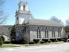
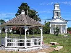
South Canaan Congregational Church |
|
000000001983-03-16-0000March 16, 1983
(#83001272) |
CT 63 and Barnes Rd.
41°57′42″N 73°20′07″W / 41.961667°N 73.335278°W / 41.961667; -73.335278 (South Canaan Congregational Church) |
Canaan |
|
| 130 |
South School |
|
000000001986-03-27-0000March 27, 1986
(#86000522) |
362 S. Main St.
41°47′36″N 73°07′17″W / 41.793333°N 73.121389°W / 41.793333; -73.121389 (South School) |
Torrington |
1915 school designed by Wilson Potter, a New York City-based architect of schools throughout the northeast[11]
|
| 131 |
Southbury Training School |
|
000000001992-05-01-0000May 1, 1992
(#92000368) |
1484 S. Britain Rd.
41°27′49″N 73°16′23″W / 41.463611°N 73.273056°W / 41.463611; -73.273056 (Southbury Training School) |
Roxbury |
Extends into Southbury in New Haven County.
|
| 132 |
Sports Building |
|
000000001984-02-22-0000February 22, 1984
(#84001088) |
Windrow Rd.
41°58′22″N 73°13′13″W / 41.972778°N 73.220278°W / 41.972778; -73.220278 (Sports Building) |
Norfolk |
|
| 133 |
Steward's House-Foreign Mission School |
|
000000002016-10-31-0000October 31, 2016
(#16000858) |
14 Bolton Hill Rd.
41°50′40″N 73°19′57″W / 41.844514°N 73.332634°W / 41.844514; -73.332634 (Steward's House-Foreign Mission School) |
Cornwall |
|
| 134 |
Robbins Stoeckel House |
|
000000001982-08-02-0000August 2, 1982
(#82004465) |
Litchfield Rd.
41°59′10″N 73°12′04″W / 41.986111°N 73.201111°W / 41.986111; -73.201111 (Robbins Stoeckel House) |
Norfolk |
|
| 135 |
Sun Terrace |
|
000000001978-12-20-0000December 20, 1978
(#78002849) |
Stub Hollow Rd.
41°51′15″N 73°00′47″W / 41.854167°N 73.013056°W / 41.854167; -73.013056 (Sun Terrace) |
New Hartford |
|
| 136 |
Sunny Ridge Historic District |
Upload image |
000000001995-11-22-0000November 22, 1995
(#95001346) |
2 and 20 Nettleton Hollow Rd., 145 Old Litchfield Rd., 6 Romford Rd., and 10-32 Sunny Ridge Rd.
41°39′27″N 73°16′36″W / 41.6575°N 73.276667°W / 41.6575; -73.276667 (Sunny Ridge Historic District) |
Washington |
|
| 137 |
Tamarack Lodge Bungalow |
|
000000001977-09-16-0000September 16, 1977
(#77001499) |
South of Norfolk off CT 272 at Dennis Hill Park
41°56′55″N 73°11′58″W / 41.948611°N 73.199444°W / 41.948611; -73.199444 (Tamarack Lodge Bungalow) |
Norfolk |
|
| 138 |
Terryville Waterwheel |
|
000000002002-01-04-0000January 4, 2002
(#01001412) |
262 Main St.
41°40′48″N 73°00′55″W / 41.68°N 73.015278°W / 41.68; -73.015278 (Terryville Waterwheel) |
Plymouth |
|
| 139 |
Thomaston Opera House |
|
000000001972-04-26-0000April 26, 1972
(#72001319) |
Main St.
41°40′23″N 73°04′32″W / 41.673056°N 73.075556°W / 41.673056; -73.075556 (Thomaston Opera House) |
Thomaston |
Building from 1883
|
| 140 |
Tom Thumb House |
Upload image |
000000001984-02-22-0000February 22, 1984
(#84001094) |
Windrow Rd.
41°58′14″N 73°13′10″W / 41.970556°N 73.219444°W / 41.970556; -73.219444 (Tom Thumb House) |
Norfolk |
|
| 141 |
Topsmead |
|
000000001993-11-19-0000November 19, 1993
(#93001243) |
25 and 46 Chase Rd.
41°44′49″N 73°09′30″W / 41.746944°N 73.158333°W / 41.746944; -73.158333 (Topsmead) |
Litchfield |
|
| 142 |
Torringford Street Historic District |
|
000000001991-07-31-0000July 31, 1991
(#91000991) |
Torringford St. from Main St. north to W. Hill Rd.
41°50′45″N 73°04′27″W / 41.845833°N 73.074167°W / 41.845833; -73.074167 (Torringford Street Historic District) |
Torrington |
|
| 143 |
Torrington Fire Department Headquarters |
|
000000001987-12-31-0000December 31, 1987
(#87002185) |
117 Water St.
41°48′07″N 73°08′35″W / 41.801944°N 73.143056°W / 41.801944; -73.143056 (Torrington Fire Department Headquarters) |
Torrington |
|
| 144 |
Town Hall and District School No. 6 |
|
000000001987-11-30-0000November 30, 1987
(#87002109) |
12 South St.
41°40′57″N 73°11′59″W / 41.6825°N 73.199722°W / 41.6825; -73.199722 (Town Hall and District School No. 6) |
Morris |
|
| 145 |
Trinity Church (Milton) |
|
000000001976-04-23-0000April 23, 1976
(#76001981) |
Milton Rd.
41°46′13″N 73°16′03″W / 41.770278°N 73.2675°W / 41.770278; -73.2675 (Trinity Church (Milton)) |
Litchfield |
|
| 146 |
Trinity Church (Thomaston) |
|
000000001984-08-01-0000August 1, 1984
(#84001097) |
Main St.
41°40′21″N 73°04′32″W / 41.6725°N 73.075556°W / 41.6725; -73.075556 (Trinity Church (Thomaston)) |
Thomaston |
|
| 147 |
Union Church/St. Paul's Church |
|
000000001985-02-21-0000February 21, 1985
(#85000307) |
Riverton Rd.
41°57′44″N 73°01′13″W / 41.962222°N 73.020278°W / 41.962222; -73.020278 (Union Church/St. Paul's Church) |
Barkhamsted |
|
| 148 |
Union Depot |
|
000000001972-04-26-0000April 26, 1972
(#72001317) |
U.S. Route 44
42°01′34″N 73°19′48″W / 42.026111°N 73.33°W / 42.026111; -73.33 (Union Depot) |
North Canaan |
|
| 149 |
United Bank Building |
|
000000001982-04-12-0000April 12, 1982
(#82004447) |
19-21 Main St.
41°34′38″N 73°24′42″W / 41.577222°N 73.411667°W / 41.577222; -73.411667 (United Bank Building) |
New Milford |
|
| 150 |
Villa Friuli |
|
000000001991-04-11-0000April 11, 1991
(#91000349) |
58 High St.
41°48′11″N 73°07′54″W / 41.803056°N 73.131667°W / 41.803056; -73.131667 (Villa Friuli) |
Torrington |
|
| 151 |
Warner Theatre |
|
000000001984-02-16-0000February 16, 1984
(#84001098) |
68-82 Main St.
41°48′06″N 73°07′17″W / 41.801667°N 73.121389°W / 41.801667; -73.121389 (Warner Theatre) |
Torrington |
|
| 152 |
Warren Congregational Church |
|
000000001991-11-29-0000November 29, 1991
(#91001743) |
4 Sackett Hill Rd.
41°44′37″N 73°20′58″W / 41.743611°N 73.349444°W / 41.743611; -73.349444 (Warren Congregational Church) |
Warren |
|
| 153 |
Warrenton Woolen Mill |
|
000000001987-02-12-0000February 12, 1987
(#87000115) |
839 Main St.
41°49′06″N 73°07′25″W / 41.818333°N 73.123611°W / 41.818333; -73.123611 (Warrenton Woolen Mill) |
Torrington |
|
| 154 |
Washington Green Historic District |
|
000000001995-11-27-0000November 27, 1995
(#95001345) |
Roughly along Ferry Bridge, Green Hill, Kirby, Roxbury, Wykeham and Woodbury Rds., Parsonage Ln., and The Green
41°37′37″N 73°18′29″W / 41.626936°N 73.307937°W / 41.626936; -73.307937 (Washington Green Historic District) |
Washington |
|
| 155 |
Water Street Historic District |
|
000000002003-01-15-0000January 15, 2003
(#02001698) |
Roughly along Water St., from Church St. to Prospect St.
41°48′09″N 73°07′35″W / 41.8025°N 73.126389°W / 41.8025; -73.126389 (Water Street Historic District) |
Torrington |
|
| 156 |
Watertown Center Historic District |
|
000000002001-04-12-0000April 12, 2001
(#01000352) |
Roughly along Deforest, Main, Woodruff, Woodbury, North, and Warren Sts.
41°36′14″N 73°07′11″W / 41.603889°N 73.119722°W / 41.603889; -73.119722 (Watertown Center Historic District) |
Watertown |
|
| 157 |
David Welch House |
|
000000001984-02-16-0000February 16, 1984
(#84001103) |
Potash and Milton Rds.
41°46′13″N 73°15′59″W / 41.770278°N 73.266389°W / 41.770278; -73.266389 (David Welch House) |
Litchfield |
|
| 158 |
West Cornwall Covered Bridge |
|
000000001975-12-30-0000December 30, 1975
(#75001923) |
CT 128 at the Housatonic River
41°52′18″N 73°21′52″W / 41.871667°N 73.364444°W / 41.871667; -73.364444 (West Cornwall Covered Bridge) |
Cornwall |
|
| 159 |
West End Historic District |
|
000000001990-08-03-0000August 3, 1990
(#90001148) |
Northern side of Main St. between Union and Elm Sts.
41°55′15″N 73°04′18″W / 41.920833°N 73.071667°W / 41.920833; -73.071667 (West End Historic District) |
Winchester* |
|
| 160 |
West Goshen Historic District |
|
000000001987-10-23-0000October 23, 1987
(#87000982) |
Roughly bounded by CT 4, Beach, Mill and Milton Sts., and Thompson Rd.
41°49′32″N 73°15′16″W / 41.825556°N 73.254444°W / 41.825556; -73.254444 (West Goshen Historic District) |
Goshen |
|
| 161 |
E. A. Wildman & Co. Tobacco Warehouse |
|
000000001988-10-20-0000October 20, 1988
(#88000731) |
34 Bridge St.
41°34′35″N 73°24′43″W / 41.576389°N 73.411944°W / 41.576389; -73.411944 (E. A. Wildman & Co. Tobacco Warehouse) |
New Milford |
|
| 162 |
Winchester Soldiers' Monument |
|
000000001984-01-26-0000January 26, 1984
(#84001105) |
Crown St.
41°55′29″N 73°04′22″W / 41.924722°N 73.072778°W / 41.924722; -73.072778 (Winchester Soldiers' Monument) |
Winchester* |
|
| 163 |
Winsted Green Historic District |
|
000000001977-08-16-0000August 16, 1977
(#77001501) |
U.S. Route 44 and CT 8; also 86 Main St.
41°55′19″N 73°03′39″W / 41.921944°N 73.060833°W / 41.921944; -73.060833 (Winsted Green Historic District) |
Winchester* |
Second address represents boundary increase added on April 29, 1982
|
| 164 |
Winsted Hosiery Mill |
|
000000001985-02-21-0000February 21, 1985
(#85000308) |
Whiting at Holabird St., in Winsted neighborhood
41°55′24″N 73°03′32″W / 41.923333°N 73.058889°W / 41.923333; -73.058889 (Winsted Hosiery Mill) |
Winchester* |
|
| 165 |
Oliver Wolcott House |
|
000000001971-11-11-0000November 11, 1971
(#71001011) |
South St.
41°44′38″N 73°11′09″W / 41.743889°N 73.185833°W / 41.743889; -73.185833 (Oliver Wolcott House) |
Litchfield |
1753-built home of Oliver Wolcott, Sr., the soldier and politician, a signer of the U.S. Declaration of Independence and the Articles of Confederation
|
| 166 |
Woodbury Historic District No. 1 |
|
000000001971-03-11-0000March 11, 1971
(#71000908) |
Both sides of Main St. (U.S. Route 6) for 2 miles (3.2 km), and radiating roads
41°32′43″N 73°12′23″W / 41.545278°N 73.206389°W / 41.545278; -73.206389 (Woodbury Historic District No. 1) |
Woodbury |
|
| 167 |
Woodbury Historic District No. 2 |
Upload image |
000000001972-02-23-0000February 23, 1972
(#72001326) |
Both sides of Main St. from Woodbury-Southbury town line to Middle Quarter
41°30′56″N 73°12′17″W / 41.515556°N 73.204722°W / 41.515556; -73.204722 (Woodbury Historic District No. 2) |
Woodbury |
|
| 168 |
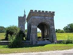
World War I Memorial |
|
000000001984-02-17-0000February 17, 1984
(#84001106) |
Greenwoods Rd. West and North Sts.
41°59′40″N 73°12′10″W / 41.994444°N 73.202778°W / 41.994444; -73.202778 (World War I Memorial) |
Norfolk |
|


.jpg)


.jpg)


.JPG)


.jpg)


.JPG)


.jpg)


.JPG)