| [3] |
Name on the Register[4] |
Image |
Date listed[5] |
Location |
City or town |
Description |
|---|
| 1 |
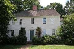
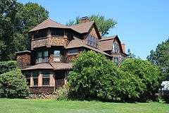
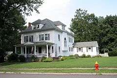
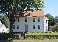
Charles E. Beach House |
|
000000001990-08-23-0000August 23, 1990
(#90001287) |
18 Brightwood Ln.
41°43′57″N 72°44′35″W / 41.7325°N 72.743056°W / 41.7325; -72.743056 (Charles E. Beach House) |
|
|
| 2 |
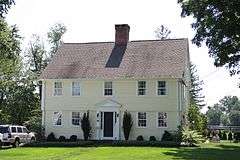
Beardsley-Mix House |
|
000000001986-09-10-0000September 10, 1986
(#86001980) |
81 Rockledge Dr.
41°49′31″N 72°44′30″W / 41.825278°N 72.741667°W / 41.825278; -72.741667 (Beardsley-Mix House) |
|
|
| 3 |
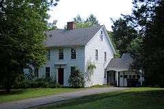
Moses Brace-Uriah Cadwell House |
|
000000001986-09-10-0000September 10, 1986
(#86001982) |
11 Flagg Rd.
41°47′06″N 72°45′00″W / 41.785°N 72.75°W / 41.785; -72.75 (Moses Brace-Uriah Cadwell House) |
|
|
| 4 |
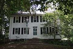
James Butler House |
|
000000001986-09-10-0000September 10, 1986
(#86001987) |
239 N. Main St.
41°46′40″N 72°44′48″W / 41.777778°N 72.746667°W / 41.777778; -72.746667 (James Butler House) |
|
|
| 5 |
Benjamin Colton House |
|
000000001986-09-10-0000September 10, 1986
(#86001988) |
25 Sedgewick Rd.
41°45′04″N 72°44′46″W / 41.751111°N 72.746111°W / 41.751111; -72.746111 (Benjamin Colton House) |
|
|
| 6 |
Elizabeth Park |
|
000000001983-03-10-0000March 10, 1983
(#83001259) |
Asylum Ave.
41°46′20″N 72°43′04″W / 41.772222°N 72.717778°W / 41.772222; -72.717778 (Elizabeth Park) |
|
Extends into Hartford
|
| 7 |
Samuel Farnsworth House |
|
000000001986-09-10-0000September 10, 1986
(#86001990) |
537 Mountain Rd.
41°46′50″N 72°45′59″W / 41.780556°N 72.766389°W / 41.780556; -72.766389 (Samuel Farnsworth House) |
|
|
| 8 |
Asa Gillett House |
|
000000001986-09-10-0000September 10, 1986
(#86001992) |
202 S. Main St.
41°44′55″N 72°44′48″W / 41.748611°N 72.746667°W / 41.748611; -72.746667 (Asa Gillett House) |
|
|
| 9 |
Timothy Goodman House |
|
000000001986-09-10-0000September 10, 1986
(#86001993) |
567 Quaker Ln., S.
41°44′42″N 72°43′50″W / 41.745°N 72.730556°W / 41.745; -72.730556 (Timothy Goodman House) |
|
|
| 10 |
Hartford Golf Club Historic District |
|
000000001986-06-26-0000June 26, 1986
(#86001370) |
Roughly bounded by Simsbury Rd. and Bloomfield Ave., Northmoor Rd., Albany Ave., and Mohegan Dr.
41°47′33″N 72°43′31″W / 41.7925°N 72.725278°W / 41.7925; -72.725278 (Hartford Golf Club Historic District) |
|
Extends into Hartford
|
| 11 |
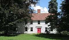
Sarah Whitman Hooker House |
|
000000001979-11-01-0000November 1, 1979
(#79002627) |
1237 New Britain Ave.
41°43′53″N 72°44′35″W / 41.731389°N 72.743056°W / 41.731389; -72.743056 (Sarah Whitman Hooker House) |
|
|
| 12 |
Daniel Hosmer House |
|
000000001986-09-10-0000September 10, 1986
(#86001985) |
253 N. Main St.
41°46′44″N 72°44′50″W / 41.778889°N 72.747222°W / 41.778889; -72.747222 (Daniel Hosmer House) |
|
|
| 13 |
House at 847 Main Street, North |
|
000000001986-09-10-0000September 10, 1986
(#86001996) |
847 Main St., N.
41°47′26″N 72°44′52″W / 41.790556°N 72.747778°W / 41.790556; -72.747778 (House at 847 Main Street, North) |
|
|
| 14 |
Edward W. Morley House |
|
000000001975-05-15-0000May 15, 1975
(#75002057) |
26 Westland Ave.
41°45′21″N 72°45′36″W / 41.755833°N 72.76°W / 41.755833; -72.76 (Edward W. Morley House) |
|
Home of the scientist known for the Michelson-Morley experiment and for his work on the atomic weights of hydrogen and oxygen.
|
| 15 |
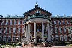
Mount St. Joseph Academy |
|
000000001983-12-22-0000December 22, 1983
(#83003561) |
235 Fern St.
41°46′05″N 72°43′26″W / 41.768056°N 72.723889°W / 41.768056; -72.723889 (Mount St. Joseph Academy) |
|
|
| 16 |
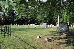
Old Center Burying Yard |
|
000000002002-05-03-0000May 3, 2002
(#02000421) |
30 N. Main St.
41°45′58″N 72°44′30″W / 41.766111°N 72.741667°W / 41.766111; -72.741667 (Old Center Burying Yard) |
|
|
| 17 |
Prospect Avenue Historic District |
|
000000001985-08-29-0000August 29, 1985
(#85001918) |
Roughly bounded by Albany Ave., N. Branch Park River, Elizabeth and Fern Sts., Prospect and Asylum Aves., and Sycamore Rd.
41°46′43″N 72°42′38″W / 41.778611°N 72.710556°W / 41.778611; -72.710556 (Prospect Avenue Historic District) |
|
Extends into Hartford
|
| 18 |
Revolutionary War Campsite |
|
000000001986-04-24-0000April 24, 1986
(#86000853) |
Address Restricted
|
|
A campsite and hospital of the French general Jean-Baptiste Donatien de Vimeur, comte de Rochambeau
|
| 19 |
Elisha Seymour, Jr. House |
|
000000001986-09-10-0000September 10, 1986
(#86001997) |
410 and 412 Park Rd.
41°45′19″N 72°44′00″W / 41.755278°N 72.733333°W / 41.755278; -72.733333 (Elisha Seymour, Jr. House) |
|
|
| 20 |
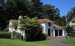
The Spanish House |
|
000000001979-06-14-0000June 14, 1979
(#79002632) |
46 Fernwood Rd.
41°46′16″N 72°43′28″W / 41.771111°N 72.724444°W / 41.771111; -72.724444 (The Spanish House) |
|
|
| 21 |
Stanley-Woodruff-Allen House |
|
000000001986-09-10-0000September 10, 1986
(#86002000) |
37 Buena Vista Rd.
41°44′58″N 72°46′00″W / 41.749444°N 72.766667°W / 41.749444; -72.766667 (Stanley-Woodruff-Allen House) |
|
|
| 22 |
Allyn Steele House |
|
000000001986-09-10-0000September 10, 1986
(#86002022) |
114 N. Main St.
41°46′11″N 72°44′37″W / 41.769722°N 72.743611°W / 41.769722; -72.743611 (Allyn Steele House) |
|
|
| 23 |
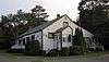
Temple Beth Israel |
|
000000001995-11-27-0000November 27, 1995
(#95001343) |
701 Farmington Ave.
41°45′53″N 72°43′12″W / 41.764722°N 72.72°W / 41.764722; -72.72 (Temple Beth Israel) |
|
|
| 24 |
Watkinson Juvenile Asylum and Farm School |
|
000000001995-03-23-0000March 23, 1995
(#95000273) |
140, 180 and 190 Bloomfield Ave.
41°47′24″N 72°42′45″W / 41.79°N 72.7125°W / 41.79; -72.7125 (Watkinson Juvenile Asylum and Farm School) |
|
Extends into Hartford
|
| 25 |
Noah Webster Birthplace |
|
000000001966-10-15-0000October 15, 1966
(#66000886) |
227 S. Main St.
41°44′46″N 72°44′47″W / 41.746111°N 72.746389°W / 41.746111; -72.746389 (Noah Webster Birthplace) |
|
Home of the American lexicographer.
|
| 26 |
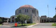
Noah Webster Memorial Library |
|
000000001981-07-30-0000July 30, 1981
(#81000534) |
7 N. Main St.
41°45′41″N 72°43′07″W / 41.761389°N 72.718611°W / 41.761389; -72.718611 (Noah Webster Memorial Library) |
|
|
| 27 |
John Wells, Jr. House |
|
000000001986-09-10-0000September 10, 1986
(#86002025) |
505 Mountain Rd.
41°46′42″N 72°45′59″W / 41.778333°N 72.766389°W / 41.778333; -72.766389 (John Wells, Jr. House) |
|
|
| 28 |
West End North Historic District |
|
000000001985-07-25-0000July 25, 1985
(#85001618) |
Roughly bounded by Farmington Ave., Lorraine, Elizabeth, and Highland Sts.
41°46′09″N 72°42′44″W / 41.769167°N 72.712222°W / 41.769167; -72.712222 (West End North Historic District) |
|
Extends into Hartford
|
| 29 |
West End South Historic District |
|
000000001985-04-11-0000April 11, 1985
(#85000763) |
Roughly bounded by Farmington Ave., Whitney and S. Whitney Sts., West Boulevard, and Prospect Ave.
41°45′47″N 72°42′52″W / 41.763056°N 72.714444°W / 41.763056; -72.714444 (West End South Historic District) |
|
Extends into Hartford
|
| 30 |
West Hill Historic District |
|
000000001996-11-29-0000November 29, 1996
(#96001366) |
West Hill Dr. bounded by Farmington Ave.
41°45′59″N 72°43′28″W / 41.766389°N 72.724444°W / 41.766389; -72.724444 (West Hill Historic District) |
|
|
| 31 |
Whiting Homestead |
|
000000001987-08-03-0000August 3, 1987
(#87001291) |
291 N. Main St.
41°46′50″N 72°44′50″W / 41.780556°N 72.747222°W / 41.780556; -72.747222 (Whiting Homestead) |
|
|
| 32 |
Whitman House |
|
000000001986-09-10-0000September 10, 1986
(#86002028) |
208 N. Main St.
41°46′33″N 72°44′43″W / 41.775833°N 72.745278°W / 41.775833; -72.745278 (Whitman House) |
|
|


_-_front_facade.jpg)