Nekoma, North Dakota
| Nekoma, North Dakota | |
|---|---|
| City | |
|
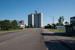
Grain Elevator in Nekoma | |
 Location of Nekoma, North Dakota | |
| Coordinates: 48°34′36″N 98°22′16″W / 48.57667°N 98.37111°WCoordinates: 48°34′36″N 98°22′16″W / 48.57667°N 98.37111°W | |
| Country | United States |
| State | North Dakota |
| County | Cavalier |
| Area[1] | |
| • Total | 0.36 sq mi (0.93 km2) |
| • Land | 0.36 sq mi (0.93 km2) |
| • Water | 0 sq mi (0 km2) |
| Elevation | 1,631 ft (497 m) |
| Population (2010)[2] | |
| • Total | 50 |
| • Estimate (2014)[3] | 48 |
| • Density | 138.9/sq mi (53.6/km2) |
| Time zone | Central (CST) (UTC-6) |
| • Summer (DST) | CDT (UTC-5) |
| ZIP code | 58355 |
| Area code(s) | 701 |
| FIPS code | 38-55740 |
| GNIS feature ID | 1030368[4] |
Nekoma is a city in Cavalier County, North Dakota, United States. The population was 50 at the 2010 census.[5] Nekoma was founded in 1905. Nekoma is 15 miles south of Langdon, North Dakota.
Of particular interest in Nekoma is the Safeguard Program anti-ballistic missile complex, with a large pyramid phased array radar structure visible for miles in every direction.
Geography
Nekoma is located at 48°34′36″N 98°22′16″W / 48.57667°N 98.37111°W (48.576546, -98.371083).[6]
According to the United States Census Bureau, the city has a total area of 0.36 square miles (0.93 km2), all of it land.[1]
Demographics
| Historical population | |||
|---|---|---|---|
| Census | Pop. | %± | |
| 1910 | 120 | — | |
| 1920 | 189 | 57.5% | |
| 1930 | 191 | 1.1% | |
| 1940 | 184 | −3.7% | |
| 1950 | 140 | −23.9% | |
| 1960 | 143 | 2.1% | |
| 1970 | 84 | −41.3% | |
| 1980 | 102 | 21.4% | |
| 1990 | 63 | −38.2% | |
| 2000 | 51 | −19.0% | |
| 2010 | 50 | −2.0% | |
| Est. 2015 | 47 | [7] | −6.0% |
| U.S. Decennial Census[8] 2014 Estimate[3] | |||
2010 census
As of the census[2] of 2010, there were 50 people, 21 households, and 15 families residing in the city. The population density was 138.9 inhabitants per square mile (53.6/km2). There were 36 housing units at an average density of 100.0 per square mile (38.6/km2). The racial makeup of the city was 100.0% White.
There were 21 households of which 19.0% had children under the age of 18 living with them, 57.1% were married couples living together, 4.8% had a female householder with no husband present, 9.5% had a male householder with no wife present, and 28.6% were non-families. 28.6% of all households were made up of individuals and 9.6% had someone living alone who was 65 years of age or older. The average household size was 2.38 and the average family size was 2.93.
The median age in the city was 54 years. 22% of residents were under the age of 18; 2% were between the ages of 18 and 24; 12% were from 25 to 44; 50% were from 45 to 64; and 14% were 65 years of age or older. The gender makeup of the city was 58.0% male and 42.0% female.
2000 census
As of the census of 2000, there were 51 people, 21 households, and 12 families residing in the city. The population density was 136.7 people per square mile (53.2/km²). There were 41 housing units at an average density of 109.9 per square mile (42.8/km²). The racial makeup of the city was 98.04% White, and 1.96% from two or more races.
There were 21 households out of which 38.1% had children under the age of 18 living with them, 52.4% were married couples living together, and 38.1% were non-families. 38.1% of all households were made up of individuals and 23.8% had someone living alone who was 65 years of age or older. The average household size was 2.43 and the average family size was 3.31.
In the city the population was spread out with 29.4% under the age of 18, 3.9% from 18 to 24, 23.5% from 25 to 44, 29.4% from 45 to 64, and 13.7% who were 65 years of age or older. The median age was 44 years. For every 100 females there were 112.5 males. For every 100 females age 18 and over, there were 125.0 males.
The median income for a household in the city was $27,188, and the median income for a family was $34,375. Males had a median income of $28,750 versus $11,250 for females. The per capita income for the city was $13,330. There were no families and 5.4% of the population living below the poverty line, including no under eighteens and 22.2% of those over 64.
References
- 1 2 "US Gazetteer files 2010". United States Census Bureau. Retrieved 2012-06-14.
- 1 2 "American FactFinder". United States Census Bureau. Retrieved 2012-06-14.
- 1 2 "Population Estimates". United States Census Bureau. Retrieved June 6, 2015.
- ↑ "US Board on Geographic Names". United States Geological Survey. 2007-10-25. Retrieved 2008-01-31.
- ↑ "2010 Census Redistricting Data (Public Law 94-171) Summary File". American FactFinder. United States Census Bureau. Retrieved 2 May 2011.
- ↑ "US Gazetteer files: 2010, 2000, and 1990". United States Census Bureau. 2011-02-12. Retrieved 2011-04-23.
- ↑ "Annual Estimates of the Resident Population for Incorporated Places: April 1, 2010 to July 1, 2015". Retrieved July 2, 2016.
- ↑ United States Census Bureau. "Census of Population and Housing". Retrieved August 30, 2013.
Municipalities and communities of Cavalier County, North Dakota, United States | ||
|---|---|---|
| Cities | 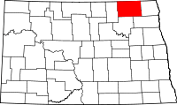 | |
| Townships |
| |
| Unincorporated communities |
| |
| Footnotes | ‡This populated place also has portions in an adjacent county or counties | |