Cavalier County, North Dakota
| Cavalier County, North Dakota | |
|---|---|
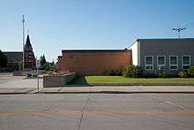
 Cavalier County Courthouse | |
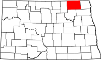
 Location in the U.S. state of North Dakota | |
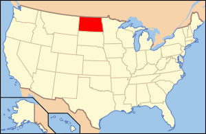
 North Dakota's location in the U.S. | |
| Founded | July 8, 1884 |
| Seat | Langdon |
| Largest city | Langdon |
| Area | |
| • Total | 1,510 sq mi (3,911 km2) |
| • Land | 1,489 sq mi (3,856 km2) |
| • Water | 21 sq mi (54 km2), 1.4% |
| Population (est.) | |
| • (2015) | 3,828 |
| • Density | 2.7/sq mi (1/km²) |
| Congressional district | At-large |
| Time zone | Central: UTC-6/-5 |
| Website |
www |
Cavalier County is a county located in the U.S. state of North Dakota. As of the 2010 Census, the population was 3,993.[1] Its county seat is Langdon.[2] The county was created by the 1873 territorial legislature and named for Charles Cavileer of Pembina (1818–1902), one of the earliest white settlers. The county was organized on July 8, 1884.[3][4] It is south of the Canada–US border with Manitoba.
The city of Cavalier is actually in nearby Pembina County.
History
Cavalier County was created from the western part of Pembina County, North Dakota in 1873 and named by the Territorial Legislature for Charles Turner Cavileer (1818–1902), a well known fur trader, customs agent and postmaster.[5] There is no explanation for the difference in the spelling of "Cavalier," though one placename historian suspects it was an attempt to Gallicize, or make the name appear French.[6]
After petitioning the Territorial Governor for permission to organize the county, Patrick McHugh, W. Hudson Matthews, and L.C. Noracong met for the purpose on July 8, 1884. On July 26 the new county officials met for the second time and chose Noracong as Chairman of the Board with William H. Doyle and Matthews as Commissioners. The first Register of Deeds and County Clerk was McHugh. W.J. Mooney became the first Judge of Probate, Charles B. Nelson was the first Cavalier County Supt. of Schools, and Clarence Hawkes the first Sheriff. Cavalier took its current form in 1887 after the Territorial Legislature authorized an increase in size by taking a portion from Pembina County. The expansion added 15 new townships to the county.[3]
The site of the new county seat was chosen at this meeting and named Langdon after Robert Bruce Langdon of Minnesota and official with the Great Northern Railroad. Langdon never visited the town, but reportedly donated a bell for the local school.[7]
The first court house was built in the fall of 1884 at a cost of $360.00. It was used briefly and then abandoned for warmer and more centrally located quarters in a downtown bank. A large brick court house was built in 1895 on the present site at a contract cost of $9,099.00. This building served county officials until the current court house was constructed in 1957-58.
Cavalier County Historical Society
Established after 1969 - The Holy Trinity Church at Dresden, ND became the cornerstone of the County museum. It now houses local historic artifacts and landmarks.
The Holy Trinity Church at Dresden replaced two previous wooden structures that both burned. The present structure was erected in 1936, built out of fieldstone collected by the local parishioners. An architect from Minneapolis, Fabian Redmond, designed the building. A stonemason from Rugby ND, Edroy Patterson, directed volunteer workers.
Assisting in the building of the church were Andrew Bachman-head carpenter, Alphonse Hiltner, Stanley Koehmstedt and William Geisen.
Geography
According to the U.S. Census Bureau, the county has a total area of 1,510 square miles (3,900 km2), of which 1,489 square miles (3,860 km2) is land and 21 square miles (54 km2) (1.4%) is water.[8]
Adjacent counties and rural municipalities
- Rural Municipality of Louise, Manitoba (north)
- Rural Municipality of Pembina, Manitoba (north)
- Rural Municipality of Stanley, Manitoba (north)
- Pembina County (east)
- Walsh County (southeast)
- Ramsey County (south)
- Towner County (west)
Major highways
 North Dakota Highway 1
 North Dakota Highway 5
 North Dakota Highway 20
 North Dakota Highway 66
Demographics
| Historical population | |||
|---|---|---|---|
| Census | Pop. | %± | |
| 1890 | 6,471 | — | |
| 1900 | 12,580 | 94.4% | |
| 1910 | 15,659 | 24.5% | |
| 1920 | 15,555 | −0.7% | |
| 1930 | 14,554 | −6.4% | |
| 1940 | 13,923 | −4.3% | |
| 1950 | 11,840 | −15.0% | |
| 1960 | 10,064 | −15.0% | |
| 1970 | 8,213 | −18.4% | |
| 1980 | 7,636 | −7.0% | |
| 1990 | 6,064 | −20.6% | |
| 2000 | 4,831 | −20.3% | |
| 2010 | 3,993 | −17.3% | |
| Est. 2015 | 3,828 | [9] | −4.1% |
| U.S. Decennial Census[10] 1790-1960[11] 1900-1990[12] 1990-2000[13] 2010-2015[1] | |||
2000 census
As of the census of 2000, there were 4,831 people, 2,017 households, and 1,361 families residing in the county. The population density was 3 people per square mile (1/km²). There were 2,725 housing units at an average density of 2 per square mile (1/km²). The racial makeup of the county was 98.10% White, 0.14% Black or African American, 0.52% Native American, 0.10% Asian, 0.10% from other races, and 1.03% from two or more races. 0.64% of the population were Hispanic or Latino of any race. 44.5% were of German, 23.1% Norwegian and 6.4% French ancestry.
There were 2,017 households out of which 27.50% had children under the age of 18 living with them, 60.80% were married couples living together, 3.80% had a female householder with no husband present, and 32.50% were non-families. 30.80% of all households were made up of individuals and 17.00% had someone living alone who was 65 years of age or older. The average household size was 2.34 and the average family size was 2.93.
In the county the population was spread out with 24.60% under the age of 18, 3.70% from 18 to 24, 21.30% from 25 to 44, 27.50% from 45 to 64, and 22.90% who were 65 years of age or older. The median age was 45 years. For every 100 females there were 98.90 males. For every 100 females age 18 and over, there were 97.60 males.
The median income for a household in the county was $31,868, and the median income for a family was $39,601. Males had a median income of $28,886 versus $19,647 for females. The per capita income for the county was $15,817. About 7.80% of families and 11.50% of the population were below the poverty line, including 16.60% of those under age 18 and 11.90% of those age 65 or over.
2010 census
As of the 2010 United States Census, there were 3,993 people, 1,818 households, and 1,142 families residing in the county.[14] The population density was 2.7 inhabitants per square mile (1.0/km2). There were 2,309 housing units at an average density of 1.6 per square mile (0.62/km2).[15] The racial makeup of the county was 97.7% white, 0.9% American Indian, 0.2% Asian, 0.1% black or African American, 0.2% from other races, and 0.8% from two or more races. Those of Hispanic or Latino origin made up 0.6% of the population.[14] In terms of ancestry, 44.5% were German, 28.8% were Norwegian, 10.8% were American, 5.8% were Irish, 5.7% were Swedish, and 5.4% were English.[16]
Of the 1,818 households, 21.8% had children under the age of 18 living with them, 55.7% were married couples living together, 4.0% had a female householder with no husband present, 37.2% were non-families, and 34.2% of all households were made up of individuals. The average household size was 2.15 and the average family size was 2.74. The median age was 50.3 years.[14]
The median income for a household in the county was $48,786 and the median income for a family was $57,066. Males had a median income of $41,885 versus $26,914 for females. The per capita income for the county was $26,468. About 6.1% of families and 8.2% of the population were below the poverty line, including 12.8% of those under age 18 and 10.8% of those age 65 or over.[17]
Communities
Cities
Townships
- Alma
- Banner
- Billings
- Bruce
- Byron
- Cypress
- Dresden
- Easby
- East Alma
- Elgin
- Fremont
- Glenila
- Gordon
- Grey
- Harvey
- Hay
- Henderson
- Hope
- Huron
- Langdon
- Linden
- Loam
- Manilla
- Minto
- Montrose
- Moscow
- Mount Carmel
- Nekoma
- North Loma
- North Olga
- Osford
- Osnabrock
- Perry
- Seivert
- South Dresden
- South Olga
- Storlie
- Trier
- Waterloo
- West Hope
Unincorporated communities
See also
External links
- Cavalier County
- Cavalier County Museum
- History of Olga, North Dakota and Our Lady of the Sacred Heart Church : 1882-1982 from the Digital Horizons website
References
- 1 2 "State & County QuickFacts". United States Census Bureau. Retrieved October 31, 2013.
- ↑ "Find a County". National Association of Counties. Archived from the original on 2011-05-31. Retrieved 2011-06-07.
- 1 2 Long, John H. (2006). "Dakota Territory, South Dakota, and North Dakota: Individual County Chronologies". Dakota Territory Atlas of Historical County Boundaries. The Newberry Library. Retrieved 2008-01-31.
- ↑ "County History". North Dakota.gov. The State of North Dakota. Retrieved February 2, 2015.
- ↑ North Dakota Secretary of State (1989). North Dakota Centennial Blue Book. Bismarck, ND: North Dakota Legislative Assembly. p. 484.
- ↑ Williams, Mary Ann (Barnes) (1966). Origins of North Dakota Place Names. Bismarck, North Dakota: Bismarck Tribune, 1966. p. 221. OCLC 431626.
- ↑ Wick, Douglas A. (1988). North Dakota Place Names. Bismarck, North Dakota: Hedemarken Collectibles. p. 109. ISBN 0-9620968-0-6. OCLC 191277027.
- ↑ "2010 Census Gazetteer Files". United States Census Bureau. August 22, 2012. Retrieved January 28, 2015.
- ↑ "County Totals Dataset: Population, Population Change and Estimated Components of Population Change: April 1, 2010 to July 1, 2015". Retrieved July 2, 2016.
- ↑ "U.S. Decennial Census". United States Census Bureau. Archived from the original on May 11, 2015. Retrieved January 28, 2015.
- ↑ "Historical Census Browser". University of Virginia Library. Retrieved January 28, 2015.
- ↑ Forstall, Richard L., ed. (March 27, 1995). "Population of Counties by Decennial Census: 1900 to 1990". United States Census Bureau. Retrieved January 28, 2015.
- ↑ "Census 2000 PHC-T-4. Ranking Tables for Counties: 1990 and 2000" (PDF). United States Census Bureau. April 2, 2001. Retrieved January 28, 2015.
- 1 2 3 "DP-1 Profile of General Population and Housing Characteristics: 2010 Demographic Profile Data". United States Census Bureau. Retrieved 2016-03-14.
- ↑ "Population, Housing Units, Area, and Density: 2010 - County". United States Census Bureau. Retrieved 2016-03-14.
- ↑ "DP02 SELECTED SOCIAL CHARACTERISTICS IN THE UNITED STATES – 2006-2010 American Community Survey 5-Year Estimates". United States Census Bureau. Retrieved 2016-03-14.
- ↑ "DP03 SELECTED ECONOMIC CHARACTERISTICS – 2006-2010 American Community Survey 5-Year Estimates". United States Census Bureau. Retrieved 2016-03-14.
 |
Rural Municipality of Louise, Canada; Rural Municipality of Pembina, Canada; and Rural Municipality of Stanley, Canada |  | ||
| Towner County | |
Pembina County | ||
| ||||
| | ||||
| Ramsey County | Walsh County |
Coordinates: 48°46′N 98°28′W / 48.77°N 98.46°W