Swampscott, Massachusetts
| Swampscott, Massachusetts | ||
|---|---|---|
| Town | ||
|
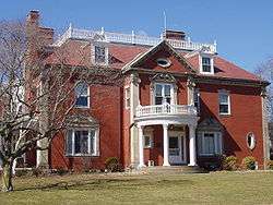
Swampscott Town Hall, 22 Monument Ave | ||
| ||
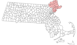 Location in Essex County in Massachusetts | ||
| Coordinates: 42°28′15″N 70°55′05″W / 42.47083°N 70.91806°WCoordinates: 42°28′15″N 70°55′05″W / 42.47083°N 70.91806°W | ||
| Country | United States | |
| State | Massachusetts | |
| County | Essex | |
| Settled | 1629 | |
| Incorporated | 1852 | |
| Government | ||
| • Type | Town Manager/Representative town meeting | |
| • Town Administrator | Gino Cresta | |
| Area | ||
| • Total | 6.7 sq mi (17.4 km2) | |
| • Land | 3.1 sq mi (7.9 km2) | |
| • Water | 3.7 sq mi (9.6 km2) | |
| Elevation | 45 ft (14 m) | |
| Population (2016) | ||
| • Total | 14,722 | |
| • Density | 4,447.4/sq mi (1,745.2/km2) | |
| Time zone | Eastern (UTC-5) | |
| • Summer (DST) | Eastern (UTC-4) | |
| ZIP code | 01907 | |
| Area code(s) | 339 / 781 | |
| FIPS code | 25-68645 | |
| GNIS feature ID | 0618311 | |
| Website | Town of Swampscott, Massachusetts, Official Web Site | |

Swampscott is a town in Essex County, Massachusetts, United States located 15 miles (24 km) up the coast from Boston in an area known as the North Shore. The population was 13,787 as of 2010.[1] A former summer resort on Massachusetts Bay, Swampscott is today a fairly affluent residential community and includes the village of Beach Bluff, as well as part of the neighborhood of Clifton. It is known for its quiet suburban character and lovely beaches. The town was home to the scenic ocean front college, Marian Court College until 2015.[2]
History
Swampscott was first settled in 1629 as the eastern part (Ward One) of Lynn, and was set off and officially incorporated in 1852. A beach town north of Boston, measuring 3 square miles (7.8 km2), and abutting Salem, Marblehead and Lynn, Swampscott was an important destination for the wealthy at the beginning of the 20th century. While Revere Beach, which lies just several miles down the road, has the honor of technically being America's first public beach, Swampscott was the de facto first resort town. Lynn was the divider between the poor beach and the rich resort town. The name "Swampscott" comes from the language of a local Native American tribe, and means "red rock".
The following is verbatim from the official Swampscott web page: "History of Swampscott."[3]
Swampscott's public school system includes three elementary schools, Hadley School, Clarke School, and Stanley School, one middle school, Swampscott Middle School, and one high school, Swampscott High School. The Machon elementary school was shuttered in 2008/9, but the property remains on the district's rolls. A new building was completed in 2007 for Swampscott High School.[4] In 2011, The Town of Swampscott is working out the details of installing a massive wind turbine, with the approximate height of a 30-story building on the property of the Swampscott Middle School. When installed it is expected to generate a little more than half of the power for the middle school.[5]
 Whale Beach in 1909 |
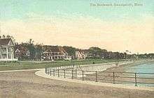 The Boulevard in 1910 |
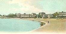
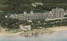 The New Ocean House Hotel circa 1920 |
Geography and transportation
Swampscott is located at 42°28′27″N 70°54′21″W / 42.47417°N 70.90583°W (42.474409, -70.905883).[6] According to the United States Census Bureau, the town has a total area of 6.7 square miles (17.4 km²), of which 3.0 square miles (7.9 km²) is land and 3.7 square miles (9.6 km²), or 54.83%, is water. Located beside Massachusetts Bay and the Atlantic Ocean, Swampscott lies along a mostly rocky shoreline, though there is enough clear shore for five beaches; Phillips which stretches into Preston and is by far the largest beach in town, Eisman's and Whales, Fisherman's, and a part of King's Beach, which extends into Lynn. There are several small parks, along with the small Harold King Forest in the northwest corner of town and the Tedesco Country Club which bisects part of the town. The town also has two small ponds, Foster Pond and Palmer Pond.
Swampscott is mostly suburban, with most of the clear land in the northwest corner of town. There are three villages within town, Beach Bluff to the east, Phillips Point to the south, and Phillips Beach inland between the two. The town is centered around Monument Square, designed by Frederick Law Olmsted;[7] which is 4 miles (6 km) south of Salem, 12 miles (19 km) northeast of Boston, and 20 miles (32 km) southwest of Cape Ann. The town is 23 miles (37 km) to the nearest point in New Hampshire, in the town of Salem. Swampscott is bordered by Marblehead to the northeast, Salem to the northwest, and Lynn to the southwest. The water rights of the town extend into Massachusetts Bay, bordered by those of Marblehead and Lynn.
Swampscott is located along Massachusetts Route 1A and Route 129. Both routes enter from Lynn, with Route 1A passing north of the town center towards Salem, and Route 129 following the coast for a half mile before going inland north of Phillips Point and returning to the coast before heading into Marblehead. There is no highway within town, which lies well south of Massachusetts Route 128 and Interstate 95. The town is served by numerous MBTA bus routes which lead into the surrounding towns. Swampscott has a historic train station along the Newburyport/Rockport Line of the MBTA Commuter Rail, with service from the North Shore to Boston's North Station. Another abandoned spur rail line crosses through the town towards Marblehead, where it has been converted into a bicycle path. The nearest air service can be reached at Beverly Municipal Airport, and the nearest national and international air service can be found at Boston's Logan International Airport.
Demographics
| Historical population | ||
|---|---|---|
| Year | Pop. | ±% |
| 1860 | 1,530 | — |
| 1870 | 1,846 | +20.7% |
| 1880 | 2,500 | +35.4% |
| 1890 | 3,198 | +27.9% |
| 1900 | 4,548 | +42.2% |
| 1910 | 6,204 | +36.4% |
| 1920 | 8,101 | +30.6% |
| 1930 | 10,346 | +27.7% |
| 1940 | 10,761 | +4.0% |
| 1950 | 11,580 | +7.6% |
| 1960 | 13,294 | +14.8% |
| 1970 | 13,578 | +2.1% |
| 1980 | 13,837 | +1.9% |
| 1990 | 13,650 | −1.4% |
| 2000 | 14,412 | +5.6% |
| 2010 | 13,787 | −4.3% |
| * = population estimate. Source: United States Census records and Population Estimates Program data.[8][9][10][11][12][13][14][15][16] | ||
As of the census[17] of 2010, there were 13,787 people, 5,579 households, and 3,986 families residing in the town. The population density was 4,725.9 people per square mile (1,824.4/km²). There were 5,930 housing units at an average density of 1,944.5 per square mile (750.7/km²). The racial makeup of the town was 97.47% White, 0.74% Black or African American, 0.06% Native American, 0.68% Asian, 0.02% Pacific Islander, 0.28% from other races, and 0.75% from two or more races. Hispanic or Latino of any race were 1.27% of the population. .
There were 5,719 households out of which 33.3% had children under the age of 18 living with them, 58.2% were married couples living together, 9.0% had a female householder with no husband present, and 30.3% were non-families. 25.9% of all households were made up of individuals and 13.6% had someone living alone who was 65 years of age or older. The average household size was 2.48 and the average family size was 3.00.
In the town the population was spread out with 24.0% under the age of 18, 4.5% from 18 to 24, 27.8% from 25 to 44, 26.0% from 45 to 64, and 17.7% who were 65 years of age or older. The median age was 42 years. For every 100 females there were 86.5 males. For every 100 females age 18 and over, there were 82.3 males.
The median income for a household in the town was $84,174, and the median income for a family was $92,795. Males had a median income of $56,541 versus $38,690 for females. The per capita income for the town was $45,487. The town is among some of the richest towns in the state (see List of Massachusetts locations by per capita income) and is currently ranked at 16th. About 2.5% of families and 3.7% of the population were below the poverty line, including 4.1% of those under age 18 and 5.4% of those age 65 or over. The median home sale price for the town in 2007 was $565,894. Home values typically range from around $400,000 to upwards of $5 million for ocean front homes. These prices are comparable to other wealthy North Shore towns such as Marblehead and Manchester-by-the-Sea which are located nearby. In upper class oceanfront neighborhoods and neighborhoods with ocean views or views of the Boston skyline, average home prices increase to as much as $1,038,569 and average household incomes can range upwards of $150,000.[18] Larger oceanfront properties have recently been assessed at values greater than $5 million and in some cases upwards of $10 million.[19]
Points of interest
- Eisman's Beach
- Elihu Thomson House, aka Swampscott Town Hall
- Fisherman's Beach
- John Humphreys House
- King's Beach
- Mary Baker Eddy Historic House
- Olmsted Subdivision Historic District, located on Monument Avenue
- Phillip's Beach
- Swampscott Fish House
- Tedesco Country Club
Transportation
The MBTA provides its Commuter Rail service from Boston's North Station with the Swampscott station on its Newburyport/Rockport Line, as well as several bus lines. The closest access to the subway is the Blue Line at Wonderland station in Revere, Massachusetts.
Notable people
- Bill Adams, retired player for the NFL's Buffalo Bills
- Harold Alfond, founder of Dexter Shoe
- Osborne Anderson, ice hockey player who competed in the 1932 Winter Olympics
- Anthony Athanas, restaurateur and philanthropist
- Charlie Baker, C.E.O. of Harvard Pilgrim Health Care, Inc., Republican Governor of Massachusetts
- Charles Henry Bond, president and general manager of Waitt & Bond, one of Boston's largest real estate holders, and a patron of the arts
- Walter Brennan, multiple Academy Award-winning actor
- Freddy Cannon, rock singer who had hits with "Way Down Yonder in New Orleans" and "Palisades Park"
- Peggy Stuart Coolidge, composer and conductor
- Kyle Cooper: Film Director, Title Designer[20]
- Mabel Wheeler Daniels, composer, conductor, and teacher
- Jamie Denbo, actress and comedian
- Mary Baker Eddy, founder of the Christian Science religion
- Larry Eigner, poet
- Jefferson Friedman, composer
- Mel Goldstein, chief meteorologist for WTNH television in New Haven, Connecticut
- Barry Goralnick, founder of Barry Goralnick Architects; theatrical producer of Eve-olution, Scituate, The Irish Curse, Saint Heaven
- Barry Goudreau, original guitarist of the rock group Boston and the Lisa Guyer Band
- Ziad Hamzeh, film director and owner of Hamzeh Mystique Films
- Sarah P. Harkness, architect
- Jim Hegan, professional baseball catcher and coach
- Mary-Louise Hooper, civil rights activist
- Dick Jauron, professional football player and head coach of the NFL's Chicago Bears, Detroit Lions, and Buffalo Bills
- Harvey Jewell, Speaker of the Massachusetts House of Representatives from 1868 to 1871
- Theodora J. Kalikow, American academic and university president
- Jackson Katz, anti-domestic violence advocate
- Piper Kerman, author of Orange Is the New Black: My Year in a Women's Prison
- Ken Linseman, former professional hockey player (Boston Bruins and Philadelphia Flyers)
- Mike Lynch, sports anchor at WCVB-TV Channel 5
- Todd McShay, ESPN NFL draft prospect analyst
- Gerhard Neumann, German-born aviation engineer and innovator; former Vice President of General Electric
- Chris Paine, documentary director
- Michael Palmer, author of The First Patient
- Barry Pederson, former NHL and Bruins all star; current NESN hockey analyst
- Johnny Pesky, pro baseball coach, former Red Sox shortstop
- Antonio Pierro, recognized as the oldest living man in the U.S. (January 9 to February 8, 2007) and the world's oldest living World War I veteran (January 24 to February 8, 2007)
- David Portnoy, founder of Barstoolsports.com
- David Lee Roth, lead singer of the rock group Van Halen
- Blondy Ryan, Major League Baseball shortstop
- George P. Sanger, lawyer, editor, judge, and businessman
- Mark Shasha, artist, author of Night of the Moonjellies
- Fran Sheehan, original bass player of the rock group Boston
- Lesley Stahl, 60 Minutes correspondent
- Thomas Stephens, Retired player for the NFL's Patriots
- G. Joseph Tauro, Chief Justice of the Massachusetts Supreme Judicial Court from 1970 to 1976
- Elihu Thomson, founder of General Electric
- Ilario Zannino, member of the Patriarca crime family
- Spencer Charnas, member of Ice Nine Kills
References
- ↑ "Profile of General Population and Housing Characteristics: 2010 Demographic Profile Data (DP-1): Swampscott town, Essex County, Massachusetts". U.S. Census Bureau, American Factfinder. Retrieved September 5, 2012.
- ↑ Swampscott, MA. "Swampscott, MA". Town.swampscott.ma.us. Retrieved 2016-06-05.
- ↑ "Swampscott, MA - About Swampscott". Town.swampscott.ma.us. 2016-01-21. Retrieved 2016-06-05.
- ↑ "Swampscott could build $3M turbine | Local News". Salemnews.com. 2011-08-17. Retrieved 2016-06-05.
- ↑ "Turbine more powerful than thought | Local News". Salemnews.com. 2011-08-19. Retrieved 2016-06-05.
- ↑ "US Gazetteer files: 2010, 2000, and 1990". United States Census Bureau. 2011-02-12. Retrieved 2011-04-23.
- ↑ "Archived copy" (PDF). Archived from the original (PDF) on July 16, 2011. Retrieved February 28, 2010.
- ↑ "TOTAL POPULATION (P1), 2010 Census Summary File 1, All County Subdivisions within Massachusetts". United States Census Bureau. Retrieved September 13, 2011.
- ↑ "Massachusetts by Place and County Subdivision - GCT-T1. Population Estimates". United States Census Bureau. Retrieved July 12, 2011.
- ↑ "1990 Census of Population, General Population Characteristics: Massachusetts" (PDF). US Census Bureau. December 1990. Table 76: General Characteristics of Persons, Households, and Families: 1990. 1990 CP-1-23. Retrieved July 12, 2011.
- ↑ "1980 Census of the Population, Number of Inhabitants: Massachusetts" (PDF). US Census Bureau. December 1981. Table 4. Populations of County Subdivisions: 1960 to 1980. PC80-1-A23. Retrieved July 12, 2011.
- ↑ "1950 Census of Population" (PDF). 1: Number of Inhabitants. Bureau of the Census. 1952. Section 6, Pages 21-10 and 21-11, Massachusetts Table 6. Population of Counties by Minor Civil Divisions: 1930 to 1950. Retrieved July 12, 2011.
- ↑ "1920 Census of Population" (PDF). Bureau of the Census. Number of Inhabitants, by Counties and Minor Civil Divisions. Pages 21-5 through 21-7. Massachusetts Table 2. Population of Counties by Minor Civil Divisions: 1900, 1910, and 1920. Retrieved July 12, 2011.
- ↑ "1890 Census of the Population" (PDF). Department of the Interior, Census Office. Pages 179 through 182. Massachusetts Table 5. Population of States and Territories by Minor Civil Divisions: 1880 and 1890. Retrieved July 12, 2011.
- ↑ "1870 Census of the Population" (PDF). Department of the Interior, Census Office. 1872. Pages 217 through 220. Table IX. Population of Minor Civil Divisions, &c. Massachusetts. Retrieved July 12, 2011.
- ↑ "1860 Census" (PDF). Department of the Interior, Census Office. 1864. Pages 220 through 226. State of Massachusetts Table No. 3. Populations of Cities, Towns, &c. Retrieved July 12, 2011.
- ↑ "American FactFinder". United States Census Bureau. Retrieved 2008-01-31.
- ↑ "Phillips Point (Phillip's Point) neighborhood in Swampscott, Massachusetts (MA), 01907 subdivision profile". City-data.com. Retrieved 2016-06-05.
- ↑ "Swampscott Real Estate". Zillow.com. Retrieved 2016-06-05.
- ↑
External links
| Wikimedia Commons has media related to Swampscott, Massachusetts. |
| Wikisource has the text of the 1905 New International Encyclopedia article Swampscott. |
- Town of Swampscott official website
- Swampscott Historical Commission
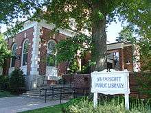
- Swampscott Public Library
- Clifton Improvement Association
- Marian Court College
- Landscape Photos of Swampscott's shore
Municipalities and communities of Essex County, Massachusetts, United States | ||
|---|---|---|
| Cities |  | |
| Towns | ||
| CDPs | ||
| Other villages | ||