Newport, Minnesota
| Newport, Minnesota | |
|---|---|
| City | |
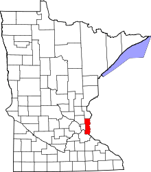
 Location of the city of Newport within Washington County, Minnesota | |
| Coordinates: 44°52′16″N 93°0′7″W / 44.87111°N 93.00194°W | |
| Country | United States |
| State | Minnesota |
| County | Washington |
| Area[1] | |
| • Total | 3.88 sq mi (10.05 km2) |
| • Land | 3.63 sq mi (9.40 km2) |
| • Water | 0.25 sq mi (0.65 km2) |
| Elevation | 745 ft (227 m) |
| Population (2010)[2] | |
| • Total | 3,435 |
| • Estimate (2012[3]) | 3,453 |
| • Density | 946.3/sq mi (365.4/km2) |
| Time zone | Central (CST) (UTC-6) |
| • Summer (DST) | CDT (UTC-5) |
| ZIP code | 55055 |
| Area code(s) | 651 |
| FIPS code | 27-45790[4] |
| GNIS feature ID | 0648530[5] |
| Website | www.ci.newport.mn.us |
Newport is a city in Washington County, Minnesota, United States. The population was 3,435 at the 2010 census.[6]
History
Newport was platted in 1857.[7] A post office has been in operation at Newport since 1857.[8]
Geography
According to the United States Census Bureau, the city has a total area of 3.88 square miles (10.05 km2); 3.63 square miles (9.40 km2) is land and 0.25 square miles (0.65 km2) is water.[1]
Interstate 494, U.S. Highway 10 and U.S. Highway 61 serve as the main routes in the community.
Newport is located along the Mississippi River, southeast of the city of Saint Paul.
Demographics
| Historical population | |||
|---|---|---|---|
| Census | Pop. | %± | |
| 1900 | 307 | — | |
| 1910 | 370 | 20.5% | |
| 1920 | 453 | 22.4% | |
| 1930 | 541 | 19.4% | |
| 1940 | 872 | 61.2% | |
| 1950 | 1,672 | 91.7% | |
| 1960 | 2,349 | 40.5% | |
| 1970 | 2,922 | 24.4% | |
| 1980 | 3,323 | 13.7% | |
| 1990 | 3,720 | 11.9% | |
| 2000 | 3,715 | −0.1% | |
| 2010 | 3,435 | −7.5% | |
| Est. 2015 | 3,480 | [9] | 1.3% |
2010 census
As of the census[2] of 2010, there were 3,435 people, 1,354 households, and 875 families residing in the city. The population density was 946.3 inhabitants per square mile (365.4/km2). There were 1,466 housing units at an average density of 403.9 per square mile (155.9/km2). The racial makeup of the city was 85.0% White, 5.0% African American, 0.7% Native American, 3.8% Asian, 0.1% Pacific Islander, 2.6% from other races, and 2.6% from two or more races. Hispanic or Latino of any race were 6.4% of the population.
There were 1,354 households of which 31.4% had children under the age of 18 living with them, 46.8% were married couples living together, 10.9% had a female householder with no husband present, 7.0% had a male householder with no wife present, and 35.4% were non-families. 28.2% of all households were made up of individuals and 8.6% had someone living alone who was 65 years of age or older. The average household size was 2.53 and the average family size was 3.09.
The median age in the city was 37.3 years. 24.4% of residents were under the age of 18; 8.4% were between the ages of 18 and 24; 27.5% were from 25 to 44; 28.7% were from 45 to 64; and 11.1% were 65 years of age or older. The gender makeup of the city was 51.4% male and 48.6% female.
2000 census
As of the census[4] of 2000, there were 3,715 people, 1,418 households, and 968 families residing in the city. The population density was 1,014.4 people per square mile (391.9/km²). There were 1,442 housing units at an average density of 393.8 per square mile (152.1/km²). The racial makeup of the city was 91.76% White, 1.70% African American, 0.92% Native American, 1.48% Asian, 0.11% Pacific Islander, 1.94% from other races, and 2.10% from two or more races. Hispanic or Latino of any race were 4.25% of the population.
There were 1,418 households out of which 36.1% had children under the age of 18 living with them, 49.7% were married couples living together, 13.1% had a female householder with no husband present, and 31.7% were non-families. 24.9% of all households were made up of individuals and 8.9% had someone living alone who was 65 years of age or older. The average household size was 2.61 and the average family size was 3.11.
In the city the population was spread out with 27.4% under the age of 18, 9.5% from 18 to 24, 31.3% from 25 to 44, 22.0% from 45 to 64, and 9.9% who were 65 years of age or older. The median age was 34 years. For every 100 females there were 93.3 males. For every 100 females age 18 and over, there were 94.4 males.
The median income for a household in the city was $45,373, and the median income for a family was $51,223. Males had a median income of $38,140 versus $28,527 for females. The per capita income for the city was $22,310. About 2.4% of families and 3.7% of the population were below the poverty line, including 4.2% of those under age 18 and 8.2% of those age 65 or over.
References
- 1 2 "US Gazetteer files 2010". United States Census Bureau. Retrieved 2012-11-13.
- 1 2 "American FactFinder". United States Census Bureau. Retrieved 2012-11-13.
- ↑ "Population Estimates". United States Census Bureau. Retrieved 2013-05-28.
- 1 2 "American FactFinder". United States Census Bureau. Retrieved 2008-01-31.
- ↑ "US Board on Geographic Names". United States Geological Survey. 2007-10-25. Retrieved 2008-01-31.
- ↑ "2010 Census Redistricting Data (Public Law 94-171) Summary File". American FactFinder. U.S. Census Bureau, 2010 Census. Retrieved 23 April 2011.
- ↑ Upham, Warren (1920). Minnesota Geographic Names: Their Origin and Historic Significance. Minnesota Historical Society. p. 570.
- ↑ "Washington County". Jim Forte Postal History. Retrieved 13 August 2015.
- ↑ "Annual Estimates of the Resident Population for Incorporated Places: April 1, 2010 to July 1, 2015". Retrieved July 2, 2016.
- ↑ "Census of Population and Housing". Census.gov. Retrieved June 4, 2015.
Municipalities and communities of Washington County, Minnesota, United States | ||
|---|---|---|
| Cities |
|  |
| Townships | ||
| Unincorporated communities | ||
| Ghost towns | ||
| Footnotes | ‡This populated place also has portions in an adjacent county or counties | |
Coordinates: 44°51′59″N 93°00′02″W / 44.86639°N 93.00056°W