Grade I listed buildings in Hertfordshire

Hertfordshire shown in England
There are over 6000 Grade I listed buildings in England. This page is a list of these buildings in the county of Hertfordshire, organised by district.
Broxbourne
| Name | Location | Type | Completed [note 1] | Date designated | Grid ref.[note 2] Geo-coordinates |
Entry number [note 3] | Image |
|---|---|---|---|---|---|---|---|
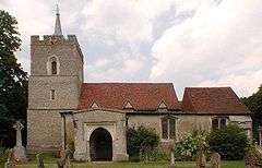
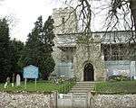
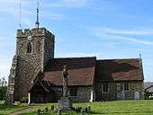
| Church of St Mary | Cheshunt | Church | 1418-1448 | 11 June 1954 | TL3491502415 51°42′15″N 0°02′56″W / 51.704264°N 0.048966°W |
1172977 | 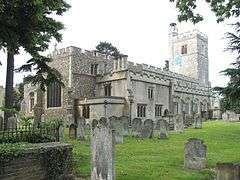 |
| Eleanor Cross | Waltham Cross | Eleanor Cross | 1291 | 11 June 1954 | TL3607300394 51°41′09″N 0°01′59″W / 51.685824°N 0.033006°W |
1173222 |  |
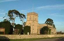
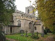
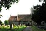
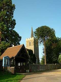
| Parish Church of St Augustine | Broxbourne | Parish Church | C15-C16 | 13 April 1961 | TL3715906947 51°44′40″N 0°00′53″W / 51.744443°N 0.01473°W |
1100545 | 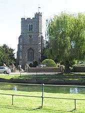 |
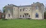
| Wormleybury | Wormley | House | 1734 | 13 April 1961 | TL3557505783 51°44′04″N 0°02′17″W / 51.734369°N 0.038111°W |
1100541 |  |
Dacorum


.jpg)


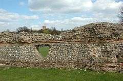
East Hertfordshire


.jpg)


.jpg)
.jpg)
.jpg)
Hertsmere
| Name | Location | Type | Completed [note 1] | Date designated | Grid ref.[note 2] Geo-coordinates |
Entry number [note 3] | Image |
|---|---|---|---|---|---|---|---|
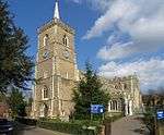
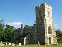
| Church of St John the Baptist | Aldenham | Parish Church | 12th century | 1 September 1953 | TQ1398898463 51°40′24″N 0°21′11″W / 51.673382°N 0.352955°W |
1103642 | 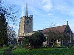 |
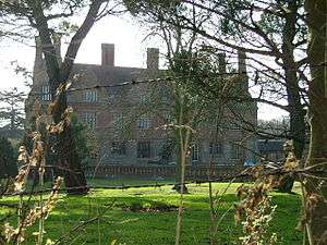
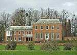
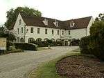
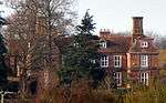
| Tyttenhanger House | Ridge | Country House | c. 1655 | 25 February 1952 | TL1914604655 51°43′41″N 0°16′35″W / 51.727961°N 0.276285°W |
1174935 | 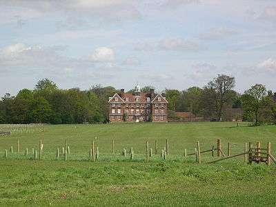 |
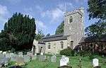
| Church of St Giles | South Mimms | Parish Church | 13th century | 20 May 1949 | TL2223101196 51°41′46″N 0°13′58″W / 51.696212°N 0.232852°W |
1174342 | 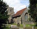 |
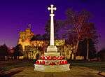
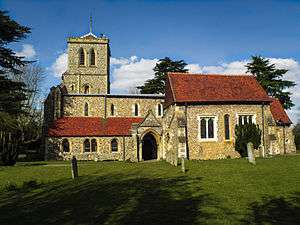
North Hertfordshire


.jpg)


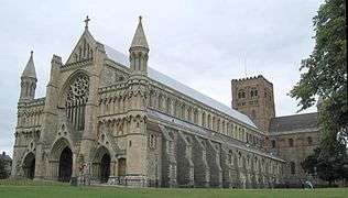
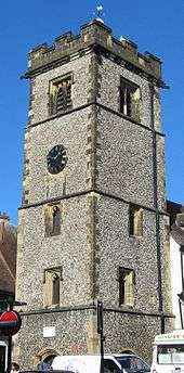
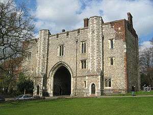
St Albans


Stevenage
| Name | Location | Type | Completed [note 1] | Date designated | Grid ref.[note 2] Geo-coordinates |
Entry number [note 3] | Image |
|---|---|---|---|---|---|---|---|
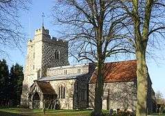
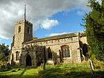
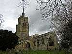
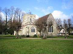
| Church of Saint Nicholas | Stevenage | Church | c. 1125 | 18 February 1948 | TL2407426207 51°55′14″N 0°11′50″W / 51.920571°N 0.197254°W |
1176923 | 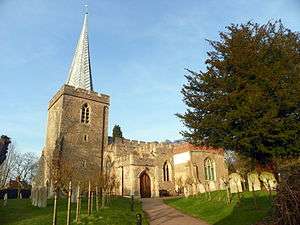 |
| Rooks Nest House (Howards) | Stevenage | House | 18th century | 30 September 1976 | TL2443826721 51°55′30″N 0°11′30″W / 51.925109°N 0.191778°W |
1176972 |  |
Three Rivers
| Name | Location | Type | Completed [note 1] | Date designated | Grid ref.[note 2] Geo-coordinates |
Entry number [note 3] | Image |
|---|---|---|---|---|---|---|---|
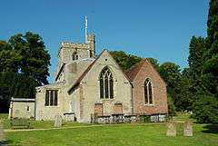
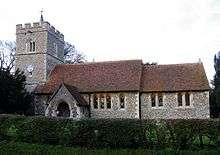
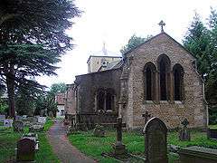
| Church of St Lawrence the Martyr | Abbots Langley | Parish Church | Late 12th century | 1 September 1953 | TL0948202189 51°42′28″N 0°25′01″W / 51.707766°N 0.416924°W |
1296433 | 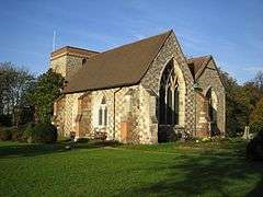 |
| The Orchard | Chorleywood | House | 1899-1900 | 16 July 1975 | TQ0193295698 51°39′03″N 0°31′41″W / 51.650844°N 0.528044°W |
1348234 | 
|
| Moor Park and Orangery/Stable Block | Rickmansworth | Country House | Late 17th century | 26 July 1951 | TQ0745893316 51°37′42″N 0°26′56″W / 51.628407°N 0.448931°W |
1173698 |  |
Watford
| Name | Location | Type | Completed [note 1] | Date designated | Grid ref.[note 2] Geo-coordinates |
Entry number [note 3] | Image |
|---|---|---|---|---|---|---|---|
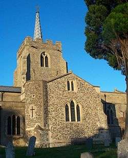
| Church of St Mary | Watford | Church | 13th century | 26 August 1952 | TQ1107696316 51°39′17″N 0°23′45″W / 51.654668°N 0.395731°W |
1101120 | 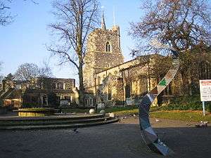 |
| Holy Rood Church | Watford | Roman Catholic Church | 1879-1900 | 12 September 1980 | TQ1087796327 51°39′17″N 0°23′55″W / 51.654807°N 0.398603°W |
1101104 | 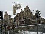 |
Welwyn Hatfield
| Name | Location | Type | Completed [note 1] | Date designated | Grid ref.[note 2] Geo-coordinates |
Entry number [note 3] | Image |
|---|---|---|---|---|---|---|---|
| New Saint Lawrence Church | Ayot St. Lawrence | Church | 1778 | 24 January 1967 | TL1917116895 51°50′17″N 0°16′18″W / 51.837956°N 0.271724°W |
1348106 |  |
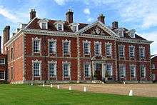
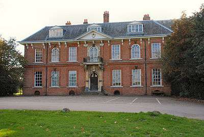
| Brocket Hall | Lemsford | Country House | c. 1760 | 6 February 1952 | TL2140813036 51°48′10″N 0°14′26″W / 51.802795°N 0.240624°W |
1100987 |  |
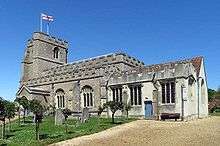
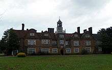
| Hatfield House | Old Hatfield, Hatfield | Country House | 1607-1612 | 6 February 1952 | TL2371508394 51°45′38″N 0°12′32″W / 51.760574°N 0.208836°W |
1173363 | 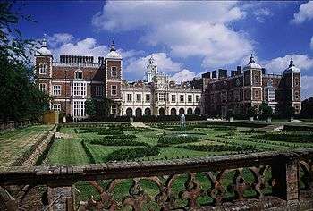 |
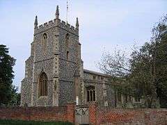
| Parish Church of St Etheldreda | Hatfield | Church | 13th century | 30 March 1966 | TL2350508488 51°45′41″N 0°12′43″W / 51.761465°N 0.211844°W |
1348124 | 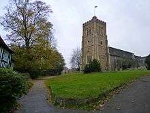 |
| The Palace | Old Hatfield, Hatfield | Bishops Palace | c. 1480 | 6 February 1952 | TL2357808460 51°45′40″N 0°12′39″W / 51.761197°N 0.210796°W |
1348152 | 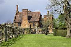 |
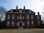
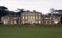
| North Mymms Park with Adjoining Garden Walls and Ha Ha | North Mymms | Country House | c. 1600 | 6 February 1952 | TL2177604267 51°43′26″N 0°14′18″W / 51.72391°N 0.23836°W |
1100946 |  |
Notes
- 1 2 3 4 5 6 7 8 9 10 The date given is the date used by Historic England as significant for the initial building or that of an important part in the structure's description.
- 1 2 3 4 5 6 7 8 9 10 Sometimes known as OSGB36, the grid reference is based on the British national grid reference system used by the Ordnance Survey.
- 1 2 3 4 5 6 7 8 9 10 The "List Entry Number" is a unique number assigned to each listed building and scheduled monument by Historic England.
References
English Heritage Images of England
External links
![]() Media related to Grade I listed buildings in Hertfordshire at Wikimedia Commons
Media related to Grade I listed buildings in Hertfordshire at Wikimedia Commons
This article is issued from Wikipedia - version of the 12/2/2016. The text is available under the Creative Commons Attribution/Share Alike but additional terms may apply for the media files.