North Quincy (MBTA station)
NORTH QUINCY | |||||||||||
|---|---|---|---|---|---|---|---|---|---|---|---|
 The south end of the station viewed from the parking garage in 2016 | |||||||||||
| Location |
Hancock Street at West Squantum Street North Quincy, Massachusetts | ||||||||||
| Coordinates | 42°16′33″N 71°01′49″W / 42.2758°N 71.0302°WCoordinates: 42°16′33″N 71°01′49″W / 42.2758°N 71.0302°W | ||||||||||
| Owned by | Massachusetts Bay Transportation Authority | ||||||||||
| Line(s) | |||||||||||
| Platforms | 1 island platform | ||||||||||
| Tracks | 2 | ||||||||||
| Construction | |||||||||||
| Parking |
1206 spaces ($5.00 daily) 18 accessible spaces | ||||||||||
| Bicycle facilities | 43 spaces | ||||||||||
| Disabled access | Yes | ||||||||||
| History | |||||||||||
| Opened | September 1, 1971[1] | ||||||||||
| Traffic | |||||||||||
| Passengers (2013) | 6,975 (weekday average boardings)[2] | ||||||||||
| Services | |||||||||||
| |||||||||||
North Quincy is a rapid transit station on the MBTA Red Line, located off Hancock Street (Route 3A) in the North Quincy neighborhood of Quincy, Massachusetts. A major park-and-ride stop, it has over 1200 parking spaces for commuters. It also serves as a minor bus terminal, with five MBTA Bus routes stopping at the south end of the station. The station is fully handicapped accessible.
It opened in 1971 along with Wollaston and Quincy Center as the first section of the South Shore Line section of the Red Line.[1] It is the only of the four Red Line stations in Quincy not located at a former Old Colony Railroad station site; the Old Colony served Atlantic and Norfolk Downs stations short distances away.
History
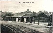

The Old Colony Railroad opened through Quincy in November 1845. Several local stations were added in Quincy, including Atlantic at Atlantic Avenue (now Sagamore Street).[3] In 1848, the Old Colony built its Gravel Branch from Atlantic to Montclair, but abandoned in the next year. In 1871 it was rebuilt, extended, and connected to the Granite Railway as the Granite Branch.[3] Norfolk Downs station at Billings Road was added in the 1890s when the surrounding marshland was filled and developed.[4][5]
The Old Colony switched from English-style left-hand running to American-style right-hand running in 1893 when it was acquired by the New York, New Haven and Hartford Railroad. Unlike nearby Wollaston, Atlantic station was already on the east side of the tracks and was not moved.[3][6][7]
Passenger service on the Granite Branch ended in 1940.[3] Ridership on the Old Colony system declined further after World War II, and the New Haven decided to abandon the line in the late 1950's. Emergency subsidies kept the lines open during construction of the Southeast Expressway, but all passenger service to Wollaston and the rest of the former Old Colony system was ended on June 30, 1959.[3]
Even before 1959, discussion was underway to bring rapid transit to the Old Colony mainline. The 1926 Report on Improved Transportation Facilities and 1945–47 Coolidge Commission Report recommended a branch of the Cambridge-Dorchester Line (later renamed as the Red Line) to parallel the Old Colony mainline to Braintree, taking over service on local stops.[8][9] The newly formed MBTA bought the Old Colony right-of-way from South Boston to South Braintree in 1965.[3] In 1966, the Program for Mass Transportation recommended the extension, and construction of the station began that year. North Quincy opened along with Wollaston and Quincy Center on September 1, 1971.[1]
In February 2016, three bidders submitted proposals for mixed-use transit-oriented development to be built on the Hancock Street lot, with a new garage to replace lost parking spaces.[10]
Bus connections
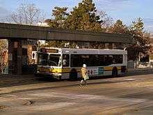
Three MBTA Bus routes stop at a busway at the southern (West Squantum Street) end of the station:[11]
- 210 Quincy Center station - North Quincy station or Fields Corner station via Hancock Street and Neponset Avenue
- 211 Quincy Center Station - Squantum via Montclair and North Quincy station
- 212 Quincy Center Station - North Quincy Station via Billings Road
Two additional routes only serve the station on weekends:
- 201 Fields Corner or North Quincy Station - Fields Corner via Neponset Avenue to Adams Street
- 202 Fields Corner or North Quincy Station - Fields Corner via Adams Street to Neponset Avenue
Station layout

| G | Street Level | Exit/Entrance |
| M | Mezzanine | Fare control, to entrances/exits |
| P Platform level |
Inbound | ← Red Line toward Alewife (JFK/UMass) |
| Island platform, doors will open on the left | ||
| Outbound | → Red Line toward Braintree (Wollaston) → | |
| Commuter rail track | ← Commuter rail lines/CapeFLYER do not stop here → | |
| Commuter rail track | ← Commuter rail lines/CapeFLYER do not stop here → | |
References
- 1 2 3 Belcher, Jonathan (26 December 2015). "Changes to Transit Service in the MBTA district 1964-2015" (PDF). NETransit. Retrieved 28 February 2016.
- ↑ "Ridership and Service Statistics" (PDF) (14 ed.). Massachusetts Bay Transportation Authority. 2014. Retrieved 28 February 2016.
- 1 2 3 4 5 6 Karr, Ronald Dale (1995). The Rail Lines of Southern New England. Branch Line Press. pp. 310–315. ISBN 0942147022.
- ↑ "City of Quincy". Atlas of Massachusetts. Walker Lithograph & Publishing Co. 1891 – via WardMaps.
- ↑ "Index Map of the City of Quincy Mass.". Atlas of The City of Quincy, Norfolk County, Mass. George W. Stadley & Co. 1897 – via WardMaps.
- ↑ Cheney, Frank (2002). Boston's Red Line: Bridging the Charles from Alewife to Braintree. Arcadia Publishing. p. 111. ISBN 9780738510477.
- ↑ "Index Plate". Atlas of the City of Quincy. Ernest Branch. 1907. Retrieved 24 January 2013.
- ↑ Central Transportation Planning Staff (15 November 1993). "The Transportation Plan for the Boston Region - Volume 2". National Transportation Library. Retrieved 24 January 2013.
- ↑ Boston Elevated Railway and Boston Department of Public Utilities (1945). "Boston Rapid Transit System & Proposed Extentions [sic] 1945 - Metropolitan Transit Recess Commission Air View". Retrieved 24 January 2013 – via Wardmaps LLC.
- ↑ Ronan, Patrick (22 February 2016). "Familiar developers in mix for North Quincy MBTA parking lot project". Patriot Ledger. Retrieved 4 March 2016.
- ↑ "North Quincy Station Neighborhood Map" (PDF). Massachusetts Bay Transportation Authority. July 2012. Retrieved 28 February 2016.
External links
| Wikimedia Commons has media related to North Quincy (MBTA station). |
- MBTA – North Quincy
- Google Maps Street View: Hunt Street entrance, West Squantum Street entrance
| Neighborhoods |  | |
|---|---|---|
| Schools | ||
| Colleges and universities | ||
| Landmarks | ||
| Media | ||
| MBTA stations | ||
| Islands | ||
| History | ||
| Subway lines (List of stations) |
| |||||||||||
|---|---|---|---|---|---|---|---|---|---|---|---|---|
| Commuter Rail lines (List of stations) |
| |||||||||||
| Bus routes (List of routes) | ||||||||||||
| Other services | ||||||||||||
| Component parts of system lines | ||||||||||||
| Capital projects |
| |||||||||||
| History |
| |||||||||||
| Other | ||||||||||||