North Station
NORTH STATION
NORTH STATION
NORTH STATION | ||||||||||||||||||||||||||||||||||||||||||||||||||||||||||||||||||||||||||||||||||||||||||||
|---|---|---|---|---|---|---|---|---|---|---|---|---|---|---|---|---|---|---|---|---|---|---|---|---|---|---|---|---|---|---|---|---|---|---|---|---|---|---|---|---|---|---|---|---|---|---|---|---|---|---|---|---|---|---|---|---|---|---|---|---|---|---|---|---|---|---|---|---|---|---|---|---|---|---|---|---|---|---|---|---|---|---|---|---|---|---|---|---|---|---|---|---|
|
| ||||||||||||||||||||||||||||||||||||||||||||||||||||||||||||||||||||||||||||||||||||||||||||
| Location |
126 Causeway Street Boston, MA 02114 | |||||||||||||||||||||||||||||||||||||||||||||||||||||||||||||||||||||||||||||||||||||||||||
| Coordinates | 42°21′57″N 71°03′40″W / 42.3657°N 71.061°WCoordinates: 42°21′57″N 71°03′40″W / 42.3657°N 71.061°W | |||||||||||||||||||||||||||||||||||||||||||||||||||||||||||||||||||||||||||||||||||||||||||
| Owned by | Massachusetts Bay Transportation Authority | |||||||||||||||||||||||||||||||||||||||||||||||||||||||||||||||||||||||||||||||||||||||||||
| Platforms |
6 island platforms (Commuter Rail and Amtrak; only 5 active) 2 side platforms and 1 island platform (Orange Line and Green Line) | |||||||||||||||||||||||||||||||||||||||||||||||||||||||||||||||||||||||||||||||||||||||||||
| Tracks |
12 (Commuter Rail and Amtrak; only 10 active) 2 (Orange Line) 2 (Green Line) | |||||||||||||||||||||||||||||||||||||||||||||||||||||||||||||||||||||||||||||||||||||||||||
| Connections |
| |||||||||||||||||||||||||||||||||||||||||||||||||||||||||||||||||||||||||||||||||||||||||||
| Construction | ||||||||||||||||||||||||||||||||||||||||||||||||||||||||||||||||||||||||||||||||||||||||||||
| Parking |
1275 spaces (privately owned garage) 38 accessible spaces | |||||||||||||||||||||||||||||||||||||||||||||||||||||||||||||||||||||||||||||||||||||||||||
| Bicycle facilities |
20 spaces Hubway dock | |||||||||||||||||||||||||||||||||||||||||||||||||||||||||||||||||||||||||||||||||||||||||||
| Disabled access | Yes | |||||||||||||||||||||||||||||||||||||||||||||||||||||||||||||||||||||||||||||||||||||||||||
| Other information | ||||||||||||||||||||||||||||||||||||||||||||||||||||||||||||||||||||||||||||||||||||||||||||
| Station code | BON (Amtrak) | |||||||||||||||||||||||||||||||||||||||||||||||||||||||||||||||||||||||||||||||||||||||||||
| Fare zone | 1A (MBTA Commuter Rail) | |||||||||||||||||||||||||||||||||||||||||||||||||||||||||||||||||||||||||||||||||||||||||||
| History | ||||||||||||||||||||||||||||||||||||||||||||||||||||||||||||||||||||||||||||||||||||||||||||
| Opened |
September 3, 1898 (Green Line surface) June 19, 1901 (Orange Line elevated) June 1, 1912 (Green Line elevated) 1928 (commuter and intercity rail) April 7, 1975 (Orange Line subway) June 28, 2004 (Green Line subway)[1] | |||||||||||||||||||||||||||||||||||||||||||||||||||||||||||||||||||||||||||||||||||||||||||
| Closed |
April 4, 1975 (Orange Line elevated) March 28, 1997 (Green Line surface) June 25, 2004 (Green Line elevated)[1] | |||||||||||||||||||||||||||||||||||||||||||||||||||||||||||||||||||||||||||||||||||||||||||
| Rebuilt | 1995, January 2007 (commuter rail) | |||||||||||||||||||||||||||||||||||||||||||||||||||||||||||||||||||||||||||||||||||||||||||
| Traffic | ||||||||||||||||||||||||||||||||||||||||||||||||||||||||||||||||||||||||||||||||||||||||||||
| Passengers (2013) | 17,079 daily boardings[2] (MBTA subway) | |||||||||||||||||||||||||||||||||||||||||||||||||||||||||||||||||||||||||||||||||||||||||||
| Passengers (2012) | 16,436 daily boardings[3] (MBTA Commuter Rail) | |||||||||||||||||||||||||||||||||||||||||||||||||||||||||||||||||||||||||||||||||||||||||||
| Passengers (2015) |
358,286 annual boardings and alightings[4] | |||||||||||||||||||||||||||||||||||||||||||||||||||||||||||||||||||||||||||||||||||||||||||
| Services | ||||||||||||||||||||||||||||||||||||||||||||||||||||||||||||||||||||||||||||||||||||||||||||
| ||||||||||||||||||||||||||||||||||||||||||||||||||||||||||||||||||||||||||||||||||||||||||||
| Location | ||||||||||||||||||||||||||||||||||||||||||||||||||||||||||||||||||||||||||||||||||||||||||||
 | ||||||||||||||||||||||||||||||||||||||||||||||||||||||||||||||||||||||||||||||||||||||||||||
North Station is a major transportation hub located at Causeway and Nashua Streets in Boston, Massachusetts, United States. It is one of the city's two inbound terminals for Amtrak and MBTA Commuter Rail trains, the other being South Station. The main concourse of North Station is located at the street level, immediately below TD Garden, a major sports venue in Boston, home of the Boston Bruins hockey team and the Boston Celtics basketball team. The arena is also used for rock concerts and other events, taking advantage of the extensive transportation connections at the site.
Description
Rail station

North Station facilities include:
- Terminus for MBTA Commuter Rail northern routes and Amtrak's Downeaster service
- Staffed ticket windows
- Small food court and waiting area
- Direct access to adjacent TD Garden for sporting and other events
- Parking garage (privately operated)
Several MBTA commuter rail lines, plus Amtrak's Northeast Corridor service to New York City, Philadelphia, Washington, D.C. and beyond, originate from South Station, about 1-1/4 miles around the Boston peninsula from North Station. No direct link exists between the two stations, although MBTA subway connections are available. Transfers to Amtrak and the MBTA Commuter Rail's Providence/Stoughton, Needham, Franklin, and Framingham/Worcester Lines may also be made at Back Bay, a one-seat ride on the Orange Line from North Station. Additionally, transfers from the Fitchburg Line to the South Station lines can be made at Porter, a one-seat ride on the Red Line. A North–South Rail Link is proposed to link North and South Stations, but as of May 2006 the Commonwealth of Massachusetts has withdrawn its sponsorship of the proposal due to its high cost.
Subway station

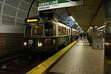
- Station on the Boston subway's Orange Line and Green Line
Station layout
| G | Street Level | Exit/Entrance |
| B1 | Outbound | Green Line toward Lechmere (Science Park) → Green Line short turn → |
| Side platform, doors will open on the right | ||
| Mezzanine | One-way faregates, ticket machines, station agent Connection to MBTA Commuter Rail/Amtrak platforms | |
| B2 | Inbound | ← Green Line toward Cleveland Circle or Heath Street (Haymarket) |
| Island platform, doors will open on the left for Green Line trains and right for Orange Line trains | ||
| Inbound | ← Orange Line toward Forest Hills (Haymarket) | |
| Outbound | Orange Line toward Oak Grove (Community College) → | |
| Side platform, doors will open on the right | ||
Accessibility
North Station is wheelchair accessible on all modes. There is a cross-platform connection between the inbound Orange Line and the inbound Green Line; transferring in other directions is accessible but requires the use of elevators. All other Orange Line stations are accessible as well, but not all Green Line stations are wheelchair accessible.
Most major stations on the MBTA Commuter Rail routes are accessible with full-length high or mini-high platforms, but some stations are not accessible. All Downeaster stations are accessible with high platforms or low platforms with wheelchair lifts.
Bus connections
One MBTA Bus route and one privately run (but open to the public) route serve North Station:
- 4 North Station - World Trade Center via Federal Courthouse & South Station
- EZRide Shuttle
The 4 runs on Causeway Street, with stops near Canal Street. The EZRide Shuttle loops on Red Auerbach Way with a stop near the secondary entrance to North Station.[5]
Lovejoy Wharf
Lovejoy Wharf, located off Beverly Street northeast of North Station, is the furthest upstream that regular water transport is available on the Charles River due to the adjacent Charles River Dam.[5] It is served by water taxi services to Logan Airport and the Boston waterfront by two private companies.[6]
Scheduled ferry service was formerly operated to Lovejoy Wharf as well. Two MBTA Boat routes - the F3 Lovejoy Wharf - Boston Navy Yard and F5 Lovejoy Wharf - World Trade Center via Moakley Courthouse - began operation in 1997 during Big Dig construction.[7] They were discontinued on January 21, 2005 due to low ridership.[7][8] The F5X Lovejoy Wharf - World Trade Center Express route, which did not rely on MBTA funding, was run until February 24, 2006.[8]
History
Early history
North Union Station

Before North Union Station opened on the spot in 1893, there were four separate stations in the area:
- The Boston and Maine Railroad terminal was just north of Haymarket Square, between Canal Street and Haverhill Street, stretching most of the way to Traverse Street. This approach was later used by the Green Line and Orange Line. The other three were all on the north side of Causeway Street, with the first two in the area where North Station is now.
- The Boston and Lowell Railroad terminal was on the east side of Nashua Street, stretching east for about a block.
- Next was the Eastern Railroad terminal, across Causeway Street from Friend Street.
- The Fitchburg Railroad station was on the other side of the Boston and Maine Railroad approach, right next to Beverly Street, the approach to the Warren Bridge.
Just south of North Station was the Canal Street Incline through which the Green Line and Orange Line originally went from elevated to subway.
Construction of the subways
The Tremont Street Subway was extended north from Park Street in 1898. It rose to the surface at the Canal Street Incline, with a surface terminal at Causeway Street. The Main Line Elevated opened in 1901 with an elevated station at North Union Station. Elevated trains ran south through the Tremont Street Subway, north on the Charlestown Elevated, and east along the waterfront on the Atlantic Avenue Elevated. The elevated moved into its own tunnel in 1908.[1]
The Causeway Street Elevated opened in 1912, with an elevated tram station over Causeway Street. The project included a single-track platform for Atlantic Avenue Elevated shuttle trains.
North Station

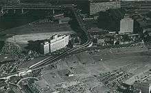
The original North Union Station was demolished in 1928 to make way for the Boston Garden, which included a new North Station as part of the design.
The Atlantic Avenue elevated was reduced to a North Station-South Station shuttle by 1928 after an accident at Beach Street, and closed entirely in 1938. It was demolished in 1942, but the shuttle platform remained intact.
1959 bombing
.jpg)
In 1959, a bomb exploded in a locker in the Main Line Elevated station, killing one M.T.A. worker. Operations were suspended the rest of the day, and the track was up and running the next day, contrary to public expectations. Further bomb threats were phoned in, but no other bombs were found.[9]
End of interstate service

Until the 1960s, the station was the hub for long-distance B&M service to multiple locales north and west of Boston, usually in conjunction with other railroads. Service cutbacks began in the 1950s, and service soon dwindled down to commuter rail operations. The sole interstate routes remaining after 1965 were single daily round trips to Concord and Dover, New Hampshire, which lasted until June 30, 1967.[1] By this point, the interstate train itineraries consisted of self-propelled Budd Rail Diesel Cars, often just one or two cars for the trip.
Limited MBTA Commuter Rail service to Concord was run from January 28, 1980 to March 1, 1981 as part of a federally funded experiment.[1]
| Name | Final B & M station at peak level | Partner railroad in continuing joint train service | Final destination | Year discontinued |
|---|---|---|---|---|
| The Minute Man | Troy, New York via Fitchburg and Greenfield | New York Central | Chicago, Illinois | 1960 |
| The Cheshire | Bellows Falls, Vermont via Fitchburg and Keene | - | - | 1958 |
| Green Mountain Flyer | Bellows Falls | Rutland Railway | Burlington, Vermont, Montreal, Quebec | 1953 |
| The Ambassador[10] | White River Junction, Vermont via Lowell, Massachusetts and Concord, New Hampshire | Central Vermont Railway | Essex Junction, Vermont, Montreal | 1965 |
| Alouette[11] | Wells River, Vermont via Lowell, Massachusetts and Concord, New Hampshire | Canadian Pacific Railway | Montreal | 1965 |
| Flying Yankee | Portland, Maine via Dover | Maine Central Railroad | Bangor Union Station | 1957 |
| Aroostook Flyer | Portland, Maine | Maine Central Railroad Bangor and Aroostook Railroad | Bangor, Maine, Presque Isle, Maine | 1961 |
| The Gull[11] | Portland | Maine Central Railroad Canadian Pacific Railway Canadian National Railway | Halifax, Nova Scotia via St. John, New Brunswick | 1960 |
MBTA era
Subway station
In 1975, the Orange Line was moved underground as part of the Haymarket North Extension project.
New station
The FleetCenter (now the TD Garden) replaced Boston Garden in 1995, including a redesigned North Station.
"Superstation"

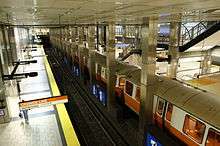
In November 2005, the MBTA completed construction of its "North Station Superstation" project, which placed the Green Line underground, offering inbound cross-platform transfers between the Green and Orange Lines. Outbound Green Line trains arrive on the mezzanine level, still within fare control. The project was done primarily to improve transfer between the two lines but also to tear down the old elevated North Station Green Line stop and the old Causeway Street Elevated structure.[1]
Renovation
In April 2006, the MBTA announced plans to enlarge the cramped waiting area in the aboveground portion of the station, by building over the south end of the tracks and platforms. The expansion was substantially completed by the end of January 2007 and was paid for by Delaware North Companies, owners of the TD Garden, who signed a deal for sharing revenue from concessions and advertising with the MBTA. The redesigned station was built for 12 tracks, but only 10 were placed in service.
Boston Garden Towers changes
Beginning in early 2016, Boston Properties will be building 'The Boston Garden', a mixed-use development including two towers, on the former Boston Garden site. The development will include a new entrance to the rail station from Causeway Street opposite Canal Street, plus an underground passageway from the rail station to the subway station.[12][13] The MBTA subway headhouse on the north side of Causeway Street was permanently closed on January 2, 2016; the underground connection which replaces it is scheduled to open three years later.[14]
Drawbridge replacement
The two aging two-track drawbridges at North Station are planned to be replaced by two new three-track spans, which will be more reliable and have higher capacity. A sixth platform will be added to serve new tracks 11 and 12, the Fitchburg mainline will be slightly relocated to provide more layover space near the maintenance facility, and FX interlocking will be reconfigured.[15] As of October 2016, bidding for a $75 million contract on the drawbridge work is expected to begin in December 2016.[16]
References
- 1 2 3 4 5 6 Belcher, Jonathan (12 November 2012). "Changes to Transit Service in the MBTA district" (PDF). NETransit. Retrieved 20 February 2013.
- ↑ "Ridership and Service Statistics" (PDF) (14 ed.). Massachusetts Bay Transportation Authority. 2014. Retrieved 18 August 2014.
- ↑ Humphrey, Thomas J. (21 December 2012). "MBTA Commuter Rail Passenger Count Results" (PDF). Boston Region Metropolitan Planning Organization. Retrieved 10 August 2015.
- ↑ "Amtrak Fact Sheet, FY2015, Commonwealth of Massachusetts" (PDF). Amtrak. November 2015. Retrieved May 1, 2016.
- 1 2 "North Station Neighborhood Map" (PDF). Massachusetts Bay Transportation Authority. April 2012. Retrieved 25 November 2015.
- ↑ "Water Transport: Water Shuttles and Water Taxis". Massachusetts Port Authority. Retrieved 8 December 2015.
- 1 2 "Lovejoy Ferry Service Ends" (PDF). TRANSreport. Boston Region Metropolitan Planning Organization: 3. January 2005. Retrieved 25 November 2015.
- 1 2 "Ridership and Service Statistics" (PDF). Massachusetts Bay Transportation Authority. 2010. Retrieved 1 August 2014.
- ↑ "North Station Explosion, 1959". Celebrate Boston. Retrieved 25 January 2015.
- ↑ "White River Junction, Vt. and Area, 1964-65 and 2000" http://www.trainweb.org/theattic/UpperNE.html
- 1 2 "Run-Through Passenger Trains in New England" http://www.faracresfarm.com/jbvb/rr/run_thru.html
- ↑ Carlock, Caroline (5 November 2015). "Boston Properties clears major hurdle for ambitious Boston Garden project". Boston Business Journal. Retrieved 25 November 2015.
- ↑ Epsilon Associates, Inc. (6 September 2013). "Expanded Project Notification Form: The Boston Garden". Boston Redevelopment Authority. Retrieved 25 November 2015.
- ↑ "Subway Service Alerts: Green Line". Massachusetts Bay Transportation Authority. 25 November 2015. Archived from the original on 26 November 2015.
- ↑ "Commuter Rail Schedules Initiative: North Side" (PDF). Massachusetts Bay Transportation Authority. October 6, 2015. p. 13.
- ↑ "Future Construction Contract Bid Solicitations". Massachusetts Bay Transportation Authority. October 2016. Archived from the original on October 14, 2016.
External links
| Wikimedia Commons has media related to |
- Amtrak – Stations – Boston North Station
- MBTA: Boston North Station
- Boston North Amtrak Station (USA RailGuide -- TrainWeb)
- Causeway Street and Accolyn Way entrance from Google Maps Street View
- Commuter Rail and Amtrak platforms from Google Maps Street View
- Boston-North Station, MA (BON) (Amtrak's Great American Stations)
- Boston Redevelopment Authority - The Boston Garden