Oelrichs, South Dakota
| Oelrichs, South Dakota šuŋkpȟáwaksa | |
|---|---|
| Town | |
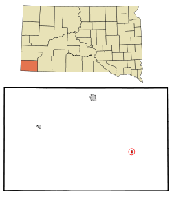 Location in Fall River County and the state of South Dakota | |
| Coordinates: 43°10′53″N 103°14′1″W / 43.18139°N 103.23361°WCoordinates: 43°10′53″N 103°14′1″W / 43.18139°N 103.23361°W | |
| Country | United States |
| State | South Dakota |
| County | Fall River |
| Incorporated | 1910[1] |
| Area[2] | |
| • Total | 0.38 sq mi (0.98 km2) |
| • Land | 0.38 sq mi (0.98 km2) |
| • Water | 0 sq mi (0 km2) |
| Elevation | 3,356 ft (1,023 m) |
| Population (2010)[3] | |
| • Total | 126 |
| • Estimate (2012[4]) | 125 |
| • Density | 331.6/sq mi (128.0/km2) |
| Time zone | Mountain (MST) (UTC-7) |
| • Summer (DST) | MDT (UTC-6) |
| ZIP codes | 57763, 57782 |
| Area code(s) | 605 |
| FIPS code | 46-46500[5] |
| GNIS feature ID | 1262163[6] |
Oelrichs (Lakota: šuŋkpȟáwaksa;[7] "Severed Horse Head") is a town in Fall River County, South Dakota, United States. The population was 126 at the 2010 census.
History
Oelrichs was laid out in 1885.[8] The town was named for Henry Oelrichs, a local cattleman.[9] A post office called Oelrichs has been in operation since 1885.[10]
Geography
Oelrichs is located at 43°10′53″N 103°14′1″W / 43.18139°N 103.23361°W (43.181458, -103.233601).[11]
According to the United States Census Bureau, the town has a total area of 0.38 square miles (0.98 km2), all of it land.[2]
Oelrichs has been assigned the ZIP code 57763 and the FIPS place code 46500.
Demographics
| Historical population | |||
|---|---|---|---|
| Census | Pop. | %± | |
| 1890 | 303 | — | |
| 1910 | 150 | — | |
| 1920 | 176 | 17.3% | |
| 1930 | 206 | 17.0% | |
| 1940 | 212 | 2.9% | |
| 1950 | 168 | −20.8% | |
| 1960 | 132 | −21.4% | |
| 1970 | 94 | −28.8% | |
| 1980 | 124 | 31.9% | |
| 1990 | 138 | 11.3% | |
| 2000 | 145 | 5.1% | |
| 2010 | 126 | −13.1% | |
| Est. 2015 | 122 | [12] | −3.2% |
2010 census
As of the census[3] of 2010, there were 126 people, 61 households, and 38 families residing in the town. The population density was 331.6 inhabitants per square mile (128.0/km2). There were 74 housing units at an average density of 194.7 per square mile (75.2/km2). The racial makeup of the town was 79.4% White, 18.3% Native American, and 2.4% from two or more races.
There were 61 households of which 19.7% had children under the age of 18 living with them, 41.0% were married couples living together, 19.7% had a female householder with no husband present, 1.6% had a male householder with no wife present, and 37.7% were non-families. 34.4% of all households were made up of individuals and 19.7% had someone living alone who was 65 years of age or older. The average household size was 2.07 and the average family size was 2.61.
The median age in the town was 53 years. 18.3% of residents were under the age of 18; 2.4% were between the ages of 18 and 24; 22.2% were from 25 to 44; 34.1% were from 45 to 64; and 23% were 65 years of age or older. The gender makeup of the town was 47.6% male and 52.4% female.
2000 census
As of the census[5] of 2000, there were 145 people, 67 households, and 45 families residing in the town. The population density was 384.0 people per square mile (147.3/km²). There were 76 housing units at an average density of 201.3 per square mile (77.2/km²). The racial makeup of the town was 83.45% White, 15.86% Native American, and 0.69% from two or more races.
There were 67 households out of which 16.4% had children under the age of 18 living with them, 50.7% were married couples living together, 11.9% had a female householder with no husband present, and 32.8% were non-families. 25.4% of all households were made up of individuals and 17.9% had someone living alone who was 65 years of age or older. The average household size was 2.16 and the average family size was 2.47.
In the town the population was spread out with 16.6% under the age of 18, 4.1% from 18 to 24, 15.9% from 25 to 44, 29.7% from 45 to 64, and 33.8% who were 65 years of age or older. The median age was 51 years. For every 100 females there were 90.8 males. For every 100 females age 18 and over, there were 92.1 males.
The median income for a household in the town was $27,222, and the median income for a family was $28,906. Males had a median income of $19,583 versus $19,167 for females. The per capita income for the town was $13,454. There were 5.1% of families and 12.7% of the population living below the poverty line, including 36.0% of under eighteens and 2.0% of those over 64.
References
- ↑ "SD Towns" (PDF). South Dakota State Historical Society. Retrieved 2010-02-14.
- 1 2 "US Gazetteer files 2010". United States Census Bureau. Retrieved 2012-06-21.
- 1 2 "American FactFinder". United States Census Bureau. Retrieved 2012-06-21.
- ↑ "Population Estimates". United States Census Bureau. Retrieved 2013-05-29.
- 1 2 "American FactFinder". United States Census Bureau. Retrieved 2008-01-31.
- ↑ "US Board on Geographic Names". United States Geological Survey. 2007-10-25. Retrieved 2008-01-31.
- ↑ Ullrich, Jan F. (2014). New Lakota Dictionary (2nd ed.). Bloomington, IN: Lakota Language Consortium. ISBN 978-0-9761082-9-0.
- ↑ Federal Writers' Project (1940). South Dakota place-names, v.1-3. University of South Dakota. p. 52.
- ↑ Chicago and North Western Railway Company (1908). A History of the Origin of the Place Names Connected with the Chicago & North Western and Chicago, St. Paul, Minneapolis & Omaha Railways. p. 109.
- ↑ "Fall River County". Jim Forte Postal History. Retrieved 24 March 2015.
- ↑ "US Gazetteer files: 2010, 2000, and 1990". United States Census Bureau. 2011-02-12. Retrieved 2011-04-23.
- ↑ "Annual Estimates of the Resident Population for Incorporated Places: April 1, 2010 to July 1, 2015". Retrieved July 2, 2016.
- ↑ "Census of Population and Housing". Census.gov. Retrieved June 4, 2015.
Municipalities and communities of Fall River County, South Dakota, United States | ||
|---|---|---|
| Cities | 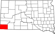 | |
| Town | ||
| Townships | ||
| Unincorporated communities | ||
| Ghost towns | ||