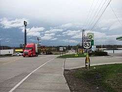
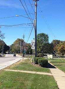
Ohio State Route 83
| ||||
|---|---|---|---|---|
 | ||||
| Route information | ||||
| Maintained by ODOT | ||||
| Length: | 157.59 mi[1] (253.62 km) | |||
| Existed: | 1972 – present | |||
| Major junctions | ||||
| South end: |
| |||
|
| ||||
| North end: |
| |||
| Location | ||||
| Counties: | Washington, Morgan, Noble, Guernsey, Muskingum, Coshocton, Holmes, Wayne, Medina, Lorain | |||
| Highway system | ||||
| ||||

State Route 83 is a north–south state highway in the U.S. state of Ohio. Its southern terminus is near the town of Beverly at State Route 60, and its northern terminus is overlooking Lake Erie at U.S. Route 6 in Avon Lake.
A portion of SR 83 is part of the Morgan County Scenic Byway.
History
- 1972 – Certified as State Route 83[2] when this designation replaced that of State Route 76 (which was removed to prevent confusion with Interstate 76 after its completion). At this time, the designation was also routed along a new divided highway south and west of Coshocton.[2]
SR 83 was planned to be relocated in Lorain County, but only two short segments of this relocation were built, at Interstate 90/State Route 2 and at State Route 10, with the rest of the plans abandoned after 1991.[3] The latter segment carries part of SR 83C.
Before 1960
- 1923 – Original route established[4] from Ashtabula to the Pennsylvania state line south of Conneaut.[2]
- 1926 – Rerouted through Kingsville (village east of Ashtabula) along the current State Route 84 alignment.[2]
- 1938 – Rerouted from Ashtabula to Kelloggsville (village south of Conneaut) along previously unnumbered roads; alignment through Kingsville certified as State Route 84.[2]
- 1960 – Route decertified.[2]
Major Junctions
| County | Location | mi | km | Destinations | Notes |
|---|---|---|---|---|---|
| Washington | Waterford Township | 0.00 | 0.00 | Southern terminus of SR 83. | |
| Morgan | Manchester Township | 9.50 | 15.29 | Eastern terminus of SR 78 concurrence. | |
| Bristol Township | 12.35 | 19.88 | Western terminus of SR 78 concurrence. | ||
| 12.54 | 20.18 | ||||
| Guernsey | Cumberland | 25.12 | 40.43 | Main Street | |
| Westland Township | 31.42 | 50.57 | Clay Pike Road | ||
| Muskingum | New Concord | 36.25 | 58.34 | Junction with I-70 eastbound. | |
| 36.43 | 58.63 | Junction with I-70 westbound. | |||
| 37.28 | 60.00 | Main Street | |||
| Highland Township | 41.94 | 67.50 | Cambridge Road, Western Terminus of SR 209. | ||
| Monroe Township | 47.34 | 76.19 | Western terminus of SR 93 concurrence (Adamsville-Otsego Road). | ||
| 47.65 | 76.69 | Eastern terminus of SR 93 concurrence (Plainfield Road). | |||
| Coshocton | Jackson Township | 59.81 | 96.25 | Western terminus of SR 16 concurrence. | |
| Coshocton | 62.57 | 100.70 | Chestnut Street via interchange. | ||
| 63.11 | 101.57 | Western terminus of SR 36 concurrence. | |||
| Tuscarawas Township | 63.46 | 102.13 | Eastern terminus of US 36 and SR 16 concurrence. | ||
| Keene Township | 67.26 | 108.24 | |||
| Holmes | Mechanic Township | 83.63 | 134.59 | Western terminus of US 62 concurrency. | |
| Millersburg | 86.55 | 139.29 | Eastern terminus of US 62 concurrency (Jackson Street). | ||
| Wayne | Wooster | 103.38 | 166.37 | Western terminus of US 250 concurrency (Dover Road). | |
| 105.98 | 170.56 | Eastern terminus of US 250 concurrency (Dover Road). | |||
| 106.20 | 170.91 | Interchange at Lincoln Way | |||
| 106.28 | 171.04 | Southern eastern terminus of SR 3 concurrency. SR 3 intersects SR 83 at the SR 83/SR 3/US 30 junction following an on-ramp that hits SR 83 from the east side. | |||
| 109.07 | 175.53 | Northern eastern terminus of SR 3 concurrency. SR 83 and SR 3 split with SR 3 heading east and intersecting Cleveland Road, while SR 83 continues northbound and passes over SR 3. This is why there are two eastern termini of SR 3 while it is concurrent with SR 83. | |||
| Congress Township | 117.57 | 189.21 | Easton Road | ||
| Medina | Harrisville Township | 121.19 | 195.04 | I-71 Exit 204 | |
| Lodi | 124.14 | 199.78 | Bank Street to west, Medina Street to east | ||
| Harrisville Township | 124.94 | 201.07 | Junction with US 42 northbound and US 224 eastbound (Lafayette Road). | ||
| 124.99 | 201.15 | Junction with US 42 southbound and US 224 westbound (Lafayette Road). | |||
| Chatham Township | 128.77 | 207.24 | Chatham Road | ||
| Litchfield | 133.45 | 214.77 | Southern eastern terminus with SR 18. Southern end of Litchfield traffic circle heading westbound (counterclockwise). Southern terminus with SR 83D (Norwalk Road). | ||
| 133.53 | 214.90 | Southern eastern terminus with SR 18. Northern end of Litchfield traffic circle heading westbound (counterclockwise). Northern terminus with SR 83D (Norwalk Road). | |||
| Lorain | Grafton Township | 138.28 | 222.54 | Western terminus of SR 303 (Lagrange-Richfield Road). | |
| 138.34 | 222.64 | Eastern terminus of SR 303 and SR 57 (Medina-Elyria Road). | |||
| 139.90 | 225.15 | Western terminus of SR 57 (Grafton Road). | |||
| Eaton Township | 143.65 | 231.18 | Royalton Road | ||
| North Ridgeville | 146.34 | 235.51 | Lorain Road; eastern terminus of SR 83C | ||
| 148.97 | 239.74 | Center Ridge Road | |||
| Avon | 153.77 | 247.47 | Detroit Road | ||
| 154.09 | 247.98 | I-90/OH-2 Exit 153 | |||
| Avon Lake | 157.59 | 253.62 | Northern terminus of SR 83 at Lake Road. | ||
1.000 mi = 1.609 km; 1.000 km = 0.621 mi
| |||||
Route 83C
Route 83C is an unsigned, ¾-mile route connecting SR 83 with SR 10 in North Ridgeville and Eaton Township. SR 83C runs southwest from SR 83 along Lorain Road and Butternut Ridge Road, then turns northwest, intersecting SR 10 then ending just beyond at Chestnut Ridge Road.[5] The latter road is one of the two constructed segments of the once-proposed relocation of SR 83.[3] The route is marked "To SR 10/I-480/I-80" westbound and "To SR 83" eastbound.[6] (SR 83 as it has remained has not received direct access to SR 10.)
References
- ↑ Ohio Department of Transportation. "Technical Services Straight Line Diagrams". Retrieved 2010-04-30.
- 1 2 3 4 5 6 Route 83 (The Unofficial Ohio State Highways Web Site) by John Simpson
- 1 2 Smith, Taylor J. (2005-03-20). "1955 - 2005, Fifty Years of Progress in Avon". The Morning Journal. Retrieved 2015-04-19.
- ↑ Explanation of the Ohio State Highway System Archived May 23, 2006, at the Wayback Machine. (The Unofficial Ohio State Highways Web Site) by John Simpson
- ↑ Ohio Department of Transportation DESTAPE for Lorain County, 2014-07-03.
- ↑ Google. "Google Street View: 11716 Butternut Ridge Road (October 2013)" (Map). Google Maps. Google.