Panchià
| Panchià | |
|---|---|
| Comune | |
| Comune di Panchià | |
 Panchià Location of Panchià in Italy | |
| Coordinates: 46°17′N 11°33′E / 46.283°N 11.550°ECoordinates: 46°17′N 11°33′E / 46.283°N 11.550°E | |
| Country | Italy |
| Region | Trentino-Alto Adige/Südtirol |
| Province / Metropolitan city | Trentino (TN) |
| Area | |
| • Total | 20.2 km2 (7.8 sq mi) |
| Elevation | 981 m (3,219 ft) |
| Population (Dec. 2004) | |
| • Total | 718 |
| • Density | 36/km2 (92/sq mi) |
| Demonym(s) | Panciai |
| Time zone | CET (UTC+1) |
| • Summer (DST) | CEST (UTC+2) |
| Postal code | 38030 |
| Dialing code | 0462 |
Panchià (German: Weissbach) is a comune (municipality) in Trentino in the northern Italian region Trentino-Alto Adige/Südtirol, located about 40 kilometres (25 mi) northeast of Trento. As of 31 December 2004, it had a population of 718 and an area of 20.2 square kilometres (7.8 sq mi).[1]
Panchià borders the following municipalities: Predazzo, Tesero, Ziano di Fiemme and Pieve Tesino.
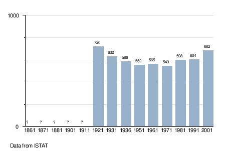
Demographic evolution
References

This article is issued from Wikipedia - version of the 1/31/2015. The text is available under the Creative Commons Attribution/Share Alike but additional terms may apply for the media files.