Panshet Dam
| Panshet Dam | |
|---|---|
|
Panshet Dam | |
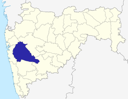
 Location of Panshet Dam in India Maharashtra | |
| Official name |
Panshet Dam Tanajisagar Dam |
| Location | Velhe Pune District, Maharashtra, India |
| Coordinates | 18°23′15″N 73°36′46″E / 18.38750°N 73.61278°ECoordinates: 18°23′15″N 73°36′46″E / 18.38750°N 73.61278°E |
| Opening date | 1972 |
| Owner(s) | Government of Maharashtra, India |
| Dam and spillways | |
| Type of dam |
Earthfill Gravity |
| Impounds | Ambi river |
| Height | 63.56 m (208.5 ft) |
| Length | 1,039 m (3,409 ft) |
| Dam volume | 4,190 km3 (1,010 cu mi) |
Panshet Dam, also called Tanajisagar Dam, is a dam on the Ambi river about 50 km (31 mi) southwest of the city of Pune in western India. The dam was constructed in late 1950s for irrigation and, along with three other dams nearby, Varasgaon, Temghar and Khadakwasla, it supplies drinking water to Pune. Panshet Dam burst in its first year of storing water on 12 July 1961, when the dam wall burst, because of the total absence of mandatory reinforced cement concrete (RCC) strengthening,[1] causing massive flooding in Pune. An estimated 1,000 people died from the resulting flood.[2]
Location
It is about 50 km (31 mi) from Pune and about 180 km (110 mi) from Mumbai.
Specifications
The height of the dam above its lowest foundation is 63.56 m (208.5 ft) while the length is 1,039 m (3,409 ft). The volume content is 4,190 km3 (1,010 cu mi) and gross storage capacity is 303,000 m3 (10,700,000 cu ft).[3]
Purpose
- Irrigation
- Water supply
Attraction
- Panshet Lake
Panshet is one of the famous picnic spots of Pune and attracts many visitors from Mumbai. The lake is made because of the backwater from the Panshet Dam; from the dam, tourists can see the Sahyadri mountains.
- Panshet Water Park
Panshet Water Park is a water sports center.
See also
References
| Wikimedia Commons has media related to Panshet Dam. |
- ↑ "What went wrong at Panshet dam?". dna. Retrieved 10 April 2015.
- ↑ "July 12, 1961... - Sakal Times". sakaaltimes.com. Retrieved 10 April 2015.
- ↑ Specifications of large dams in India
