Petrich
| Petrich Петрич | |
|---|---|
 | |
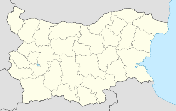 Petrich Location of Petrich | |
| Coordinates: 41°24′N 23°13′E / 41.400°N 23.217°ECoordinates: 41°24′N 23°13′E / 41.400°N 23.217°E | |
| Country | Bulgaria |
| Province (Oblast) | Blagoevgrad |
| Government | |
| • Mayor | Dimitar Bruchkov |
| Area | |
| • City | 80.421 km2 (31.051 sq mi) |
| Elevation | 168 m (551 ft) |
| Population (2015)[1] | |
| • City | 30,722 |
| • Density | 380/km2 (990/sq mi) |
| • Urban | 54,006 |
| Time zone | EET (UTC+2) |
| • Summer (DST) | EEST (UTC+3) |
| Postal Code | 2850 |
| Area code(s) | (+359) 0745 |
| Website | Official website |
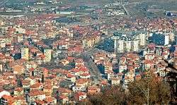
Petrich (Bulgarian: Петрич) is a town in Blagoevgrad Province in southwestern Bulgaria, located at the foot of the Belasica Mountains in the Strumeshnitsa Valley. As of 31 December 2013, the town has 31,140 inhabitants.[2]
It is the seat of Petrich Municipality.
Petrich is located close to the borders with Greece and the Republic of Macedonia. The crossing into Republic of Macedonia is known as Novo Selo-Petrich, as the first settlement across the border is Novo Selo.
Petrich Peak on Livingston Island in the South Shetland Islands, Antarctica is named for Petrich.
History
Petrich was included in the territory of the Bulgarian State during the reign of Knyaz Boris I (852-889). During the Middle Ages it was a Bulgarian fortress of importance during Tsar Samuil's wars (997-1014) with Byzantium. During Ottoman rule, it formed part of the Rumeli Eyalet, and in the 19th century became a kaza of the Sanjak of Serres in the Salonica Vilayet. From 19 January 1892, Petrich and its district were included in the Bulgarian Exarchate, before being included in Bulgaria following the Balkan Wars in 1912-13.
In October 1925 it was the site of a brief conflict between Greece and Bulgaria sometimes called the War of the Stray Dog.
Climate
The climate of Petrich is mediterranean climate (Köppen climate classification Csa) with an average annual temperature of 15.5 °C (60 °F). The town experiences considerable continental influence, especially in winter.
Petrich is the sunniest city in Bulgaria slightly ahead of Sandanski with yearly sunshine hours exceeding 2,700 on average.
Summer is hot and sunny and it is the longest season in Petrich, lasting from May through September, even as late as October. The average summer temperature is around 25 °C. In July, the sunniest month, Petrich receives 373 hours of sunshine, making it one of the sunniest places in Continental Europe. Winter season, around two months, starts in late December and lasts until early February. Average winter temperature is one of the highest in the country with average around 5 °C. In December, the darkest month, there are 103 hours of sunshine, on average.
Climate table:
| Climate data for Petrich | |||||||||||||
|---|---|---|---|---|---|---|---|---|---|---|---|---|---|
| Month | Jan | Feb | Mar | Apr | May | Jun | Jul | Aug | Sep | Oct | Nov | Dec | Year |
| Average high °C (°F) | 9.2 (48.6) |
11.1 (52) |
15.6 (60.1) |
20.5 (68.9) |
26.0 (78.8) |
30.2 (86.4) |
33.3 (91.9) |
33.3 (91.9) |
28.1 (82.6) |
21.7 (71.1) |
15.5 (59.9) |
9.5 (49.1) |
21.0 (69.8) |
| Daily mean °C (°F) | 4.0 (39.2) |
5.5 (41.9) |
10.2 (50.4) |
14.8 (58.6) |
20.1 (68.2) |
24.0 (75.2) |
27.0 (80.6) |
27.0 (80.6) |
22.0 (71.6) |
16.1 (61) |
10.3 (50.5) |
5.1 (41.2) |
15.5 (59.9) |
| Average low °C (°F) | 0.7 (33.3) |
1.4 (34.5) |
4.5 (40.1) |
8.8 (47.8) |
13.4 (56.1) |
17.0 (62.6) |
19.3 (66.7) |
19.3 (66.7) |
15.5 (59.9) |
10.9 (51.6) |
5.8 (42.4) |
2.3 (36.1) |
10.0 (50) |
| Average precipitation mm (inches) | 38 (1.5) |
38 (1.5) |
38 (1.5) |
38 (1.5) |
48 (1.89) |
39 (1.54) |
32 (1.26) |
28 (1.1) |
25 (0.98) |
38 (1.5) |
59 (2.32) |
50 (1.97) |
471 (18.54) |
| Mean monthly sunshine hours | 113 | 139 | 211 | 215 | 286 | 331 | 373 | 344 | 273 | 206 | 147 | 103 | 2,733 |
| Source: [3] | |||||||||||||
Economy
The town is an agricultural centre for fruit, vegetables and tobacco. It has three factories, making water level detectors, details for cranes and a furniture factory.
Broadcasting station
There is a 500 kW mediumwave broadcasting station working on 747 kHz. It uses as antenna a 205 metre tall guyed mast insulated with an additional cage antenna. This mast was built in 1977.
Gallery
 "St Bogoroditsa" Church
- Central Petrich
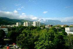 Petrich and Belasica
 Petrich at night
 Petrich and Pirin Mountains
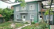 The house of Vanga in Petrich
References
- ↑ "Untitled". Grao.bg. Retrieved 2015-03-15.
- ↑ National Statistical Institute of Bulgaria.
- ↑ http://www.stringmeteo.com/synop/bg_tuti.php?mode=c&year=2010&month=12&day=01&station=157120&submit1=%CF%CE%CA%C0%C6%C8#sel
External links
| Wikimedia Commons has media related to Petrich. |
- Petrich.bg
- Petrich, information and photos
- Petrich municipality at Domino.bg
- Guide to Petrich municipality – cities, villages, regions
