Zlatitsa
| Zlatitsa Златица | ||
|---|---|---|
|
Chitalishte Hristo Smirnenski | ||
| ||
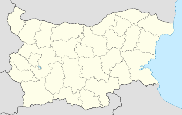 Zlatitsa Location of Zlatitsa | ||
| Coordinates: 42°43′N 24°08′E / 42.717°N 24.133°E | ||
| Country | Bulgaria | |
| Provinces (Oblast) | Sofia | |
| Government | ||
| • Mayor | Geogri Gerginekov | |
| Elevation | 680 m (2,230 ft) | |
| Population (01/01/2007) | ||
| • Total | 5 286 | |
| Time zone | EET (UTC+2) | |
| • Summer (DST) | EEST (UTC+3) | |
| Postal Code | 2080 | |
| Area code(s) | 0728 | |


Zlatitsa (Bulgarian: Златица) is a town and seat of Zlatitsa Municipality in southern Bulgaria located in the Zlatitsa-Pirdop valley, between Stara Planina to the north and Sredna Gora to the south at 680 meters above the sea level. It is situated immediately south in the lap of the Zlatitsa -Teteven Mountain. Zlatitsa is situated 75 km east of Sofia, 27 km south of Etropole, 32 km north of Panagiurishte, 2 km west of Pirdop and 32 km northwest of Koprivshtitsa. The population is 5,286.
The main highway Sofia - Karlovo - Bourgas as well as the main railway line Sofia - Karlovo - Bourgas pass through it.
Nine kilometers south of Zlatitsa is the Old Kemer – a bridge spanning the river Topolnitsa from Roman times. The church complex called Spasovo Kladenche is 500 meters away from the town. The park monument Kambana can be found in the nearby village of Petrich.
Until the early 1990s, Zlatitsa together with Pirdop formed a single town called Srednogorie.
Capital: Zlatitsa | ||
| Villages | 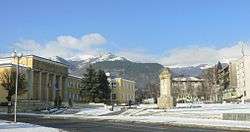 | |
| Landmarks | ||
| Culture | ||
| Notable people |
| |
Coordinates: 42°43′N 24°08′E / 42.717°N 24.133°E