Phú Quốc
| Phú Quốc District Huyện đảo Phú Quốc | |
|---|---|
|
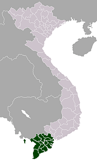
Coordinates: 10°13′44″N 103°57′26″E / 10.22889°N 103.95722°E 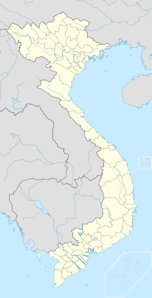 Phú Quốc Phú Quốc on a map of Vietnam | |
| Country |
|
| Region | Mekong Delta |
| Area | |
| • Total | 593.05 km2 (228.98 sq mi) |
| Population (2012) | |
| • Total | 103,000 |
| • Density | 170/km2 (450/sq mi) |
| Demographics | |
| • Ethnicities | Vietnamese (100%) |
| Time zone | ICT (UTC+7) |
| Calling code | 773 |
| ISO 3166 code | VN-47 |
| Website | www.kiengiang.gov.vn |
Phú Quốc is the largest island in Vietnam. Phú Quốc and nearby islands, along with distant Thổ Chu Islands, is part of Kiên Giang Province as Phú Quốc District, the district has a total area of 574 square kilometres (222 sq mi) and a permanent population of approximately 103,000.[1] Located in the Gulf of Thailand, the district of Phú Quốc includes the island proper and 21 smaller islets. The district seat, Dương Đông, is located on the west coast, and is also the largest town on the island. The economy is centered on fishing, agriculture and a fast-growing tourism sector.
From March 2014, Vietnam allows all foreign tourists to visit Phú Quốc visa-free for a period of up to 30 days.[2][3]
Geography
Phú Quốc lies south of the Cambodian coast, west of Kampot, and 40 km west of Ha Tien, the nearest coastal town in Vietnam. Roughly triangular in shape the island is 50 kilometres (31 mi) long from north to south and 25 kilometres (16 mi) from east to west in the north at its widest. It is also located 62 nautical miles (115 km; 71 mi) from Rạch Giá and nearly 290 nautical miles (540 km; 330 mi) from Laem Chabang, Thailand.
A mountainous ridge known as "99 Peaks" runs the length of Phú Quốc, with Chúa Mountain being the tallest at 603 metres (1,978 ft).
Phu Quoc Island is mainly composed of sedimentary rocks from the Mesozoic and Cenozoic age, including heterogeneous conglomerate composition, layering thick, quartz pebbles, silica, limestone, riolit and felsit. The Mesozoic rocks are classified in Phu Quoc Formation (K pq). The Cenozoic sediments are classified in formations of Long Toan (middle - upper Pleistocene), Long My, (upper Pleistocene), Hau Giang (lower - middle Holocene), upper Holocene sediments, and undivided Quaternary (Q).
Economy
Phu Quoc is famous for its two traditional products: fish sauce and black pepper. The rich fishing grounds offshore provides the anchovy catch from which the prized sauce is made. Pepper cultivation is located inland in the center of the island. More recently a pearl farm was established.
Tourism plays an important role in the economy with the beaches being the main attraction. Phu Quoc was served by Phu Quoc Airport with air links to Ho Chi Minh City (Saigon) Tan Son Nhat International Airport, Ha noi (Noi Bai International Airport), Rach Gia (Rach Gia Airport), Can Tho (Can Tho International Airport). Phu Quoc Airport was closed and replaced by the new Phu Quoc International Airport from December 2, 2012.[4] Phu Quoc is also linked with Rach Gia and Hà Tiên by fast ferry hydrofoils.
Air Mekong has its headquarters in An Thoi, Phú Quốc.[5][6]
With the opening of the new Vinmec Phu Quoc International Hospital in June 2015, Phu Quoc will add an additional source of revenue to the local economy in terms of medical services, medical tourism, and medical education.[7]
History
Phu Quoc has been a sleepy historical backwater for most of its history. However, in the 20th century, it was involved in a series of high-profile events:
The French missionary Pigneau de Behaine used the island as a base during the 1760s and 1780s to shelter Nguyễn Ánh who was hunted by the Tây Sơn army.[8]
An 1856 record mentions the island: "... King Ang Duong (of Cambodia) apprise Mr. de Montigny, French envoy in visit to Bangkok, through the intermediary of Bishop Miche, his intention to yield Phu Quoc to France.[9] Such a proposition aimed to create a military alliance with France to avoid the threat of Vietnam on Cambodia. The proposal did not receive an answer from the French.[10]
While the war between Vietnam, France, and Spain was about to begin, Ang Duong sent another letter, dated November 25, 1856, to Napoleon III to warn him on Cambodian claims on the lower Cochinchina region: the Cambodian king listed provinces and islands, including Koh Trol កោះត្រល់ (Phú Quốc), being parts of Vietnam for several years or decades (in the case of Saigon, some 200 years according to this letter). Ang Duong asked the French emperor to not annex any part of these territories because, as he wrote, despite this relatively long Vietnamese rule, they remained Cambodian lands. In 1867, Phu Quoc's Vietnamese authorities pledged allegiance to French troops just conquering Hà Tiên.
In 1939, the Governor-general of French Indochina, Jules Brévié drew a line to delimit the administrative boundaries for islands in the Gulf of Thailand: those north of the line were placed under Cambodia protectorate; those south of the line were managed by the colony of Cochinchina. Brévié made the point that the decision merely addressed administrative task, and that no sovereignty decision had been made.[11] As a result, Phu Quoc remains under Cochinchina administration. Later, Cochinchina's sovereignty was handed over to the State of Vietnam and remained so after France left.
After Mainland China fell under the control of the Chinese Communist Party in 1949, General Huang Chieh moved 33,000+ Republic of China Army soldiers mostly from Hunan Province to Vietnam and they were stationed at Phu Quoc. Later, the army moved to Taiwan in June 1953.[12]
During the Vietnam War the island housed South Vietnam's largest prisoner camp (40,000 in 1973), known as Phú Quốc Prison.[13]
On May 1, 1975, a squad of Khmer Rouge soldiers raided and took Phu Quoc, but Vietnam soon recaptured it. This was to be the first of a series of incursions and counter-incursions that would escalate to the Cambodian–Vietnamese War in 1979. Cambodia dropped its claims to Phu Quoc in 1976.[14] But the bone of contention involving the island between the governments of the two countries continued, as both have an historical claim to it and the surrounding waters. A July 1982 agreement between Vietnam and The People's Republic of Kampuchea ostensibly settled the dispute, but since Vietnam's withdrawal from Cambodia, the agreement has not been recognized and the island is still the object of irredentist sentiments.[15] The opposition Cambodian National Rescue Party still claims the island as Cambodian territory..
Climate
The island's monsoonal sub-equatorial climate is characterized by distinct rainy (June to November) and dry seasons (December to May). The annual rainfall is high, averaging 2,879 millimetres (9.446 ft). In the northern mountains up to 4,000 millimetres (13 ft) has been recorded. April and May are the hottest months, with temperature reaching 35 °C (95 °F).
| Climate data for Duong Dong, Phu Quoc | |||||||||||||
|---|---|---|---|---|---|---|---|---|---|---|---|---|---|
| Month | Jan | Feb | Mar | Apr | May | Jun | Jul | Aug | Sep | Oct | Nov | Dec | Year |
| Average high °C (°F) | 31 (88) |
31 (88) |
32 (90) |
34 (93) |
33 (91) |
32 (90) |
31 (88) |
31 (88) |
31 (88) |
31 (88) |
30 (86) |
30 (86) |
31.4 (88.7) |
| Average low °C (°F) | 22 (72) |
22 (72) |
23 (73) |
24 (75) |
24 (75) |
24 (75) |
24 (75) |
24 (75) |
24 (75) |
24 (75) |
23 (73) |
22 (72) |
23.3 (73.9) |
| Average precipitation mm (inches) | 40 (1.57) |
36 (1.42) |
80 (3.15) |
130 (5.12) |
193 (7.6) |
266 (10.47) |
290 (11.42) |
398 (15.67) |
296 (11.65) |
276 (10.87) |
212 (8.35) |
104 (4.09) |
2,321 (91.38) |
| Average precipitation days | 4 | 3 | 5 | 9 | 17 | 18 | 19 | 20 | 21 | 19 | 13 | 8 | 156 |
| Mean monthly sunshine hours | 217 | 226 | 248 | 240 | 186 | 180 | 155 | 155 | 150 | 186 | 180 | 217 | 2,340 |
| Source: World Climate Guide | |||||||||||||
.jpg)
Pictures
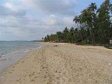
- Bai Sao or Sao Beach
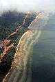 Phú Quốc coastline
 Phú Quốc coastline
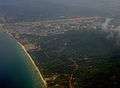 Phú Quốc coastline
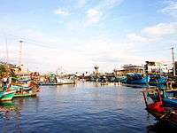
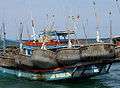 Fishing boat
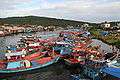 Fishing boat
 Manufacturing of fish sauce
 A bridge on Dương Đông river
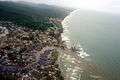 Dương Đông river's mouth
 Hotel in Phú Quốc
 Hotel in Phú Quốc
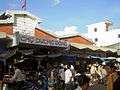 Dương Đông market
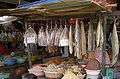 Dương Đông market
 Sùng Hưng pagoda
 A beach in Phú Quốc
 A beach in Phú Quốc (Bãi Sao)
 Dương Đông river
 Suối Tranh
 Nguyễn Trung Trực's temple
 Woman selling shellfish by the roadside
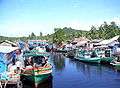 Fishermen's village
References
- ↑ Kien Giang Government
- ↑ Visa no longer needed to enter Phu Quoc by sea
- ↑ Phu Quoc giving free 30-day visas
- ↑ "Vietnam Airlines capitalises on new Phu Quoc airport". Voice of Vietnam. 2012-12-03. Retrieved 2012-12-03.
- ↑ "About Us." Air Mekong. Retrieved on December 21, 2010. "Headquarters: Hamlet 3, Village 7, An Thoi Town, Phu Quoc Island, Kiên Giang Province, Vietnam..."
- ↑ "Website usage terms and conditions." Air Mekong. Retrieved on December 21, 2010
- ↑ .
- ↑ Nick Ray, Wendy Yanagihara. Vietnam. Retrieved 2015-10-09. p.445
- ↑ "Le Second Empire en Indo-Chine (Siam-Cambodge-Annam): l'ouverture de Siam au commerce et la convention du Cambodge”, Charles Meyniard, 1891, Bibliothèque générale de géographie
- ↑ "La Politique coloniale de la France au début du second Empire (Indo-Chine, 1852-1858)", Henri Cordier, 1911, Ed. E.J. Brill
- ↑ Polomka, Peter. Ocean Politics in Southeast Asia. Retrieved 2015-10-09. p.20
- ↑ 2009年03月31日, 抗日名将黄杰与最后一支离开大陆的国民党部队, 凤凰资讯. There is currently a small island in Kaohsiung, Taiwan's Chengcing Lake that was constructed in November 1955 and named Phu Quoc Island in memory of the Nationalist Chinese loyal soldiers who was detained from 1949-1953.
- ↑ Ngo Cong Duc, deputy of the Vinh Binh province, quoted in "Le régime de Nguyen Van Thieu à travers l'épreuve", Etude Vietnamienne, 1974, pp. 99–131
- ↑ Hanns Jürgen Buchholz. Law of the Sea Zones in the Pacific Ocean. Retrieved 2015-10-09. p.41
- ↑ Amer, Ramses. 2002. Claims and Conflict Situations in "War or Peace in the South China Sea?" edited by Timo Kivimaki. Nordic Institute of Asian Studies (NIAS), Copenhagen, Denmark
External links
- Travel Guide Phu Quoc Island
- Island Information + Video of Phu Quoc in Vietnam