An Phú District
| An Phú District Huyện An Phú | |
|---|---|
| Rural district | |
|
The district is connected to the Mekong via the Hau River. The district along the river served as a stop off point by traders on the way to Phnom Penh. | |
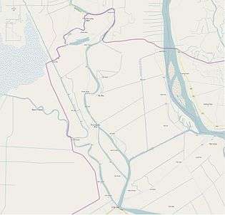
 Location in An Giang Province | |
| Coordinates: VN 10°55′N 105°4′E / 10.917°N 105.067°E | |
| Country |
|
| Province | An Giang |
| Capital | An Phú |
| Area | |
| • Total | 87 sq mi (226 km2) |
| Population (2011) | |
| • Total | 179,941 |
| Time zone | Indochina Time (UTC+07:00) |
| Website | |
.jpg)
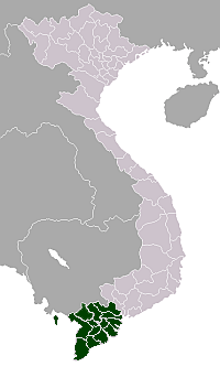
An Phú is a district of An Giang Province in the Mekong Delta region of Vietnam on the border with Cambodia. An Phú juts out at the western edge of Vietnam into Cambodia. As of 2003 the district had a population of 178,613.[1] The district covers an area of 226 km². The district capital lies at An Phú town.[1]
History
The district is one of the most remote places in Vietnam. An Phu was a part of the Tam Phong Long region that had links with former Funan kingdom and was given to the Nguyễn lords in 1757 by Chenla king Outey II.
Thanks to favorable conditions for agricultural cultivation and transport by water the Vietnamese settled in the district area. Chinese traders came along the Mekong and Hau River from Chaozhou and Guangdong and elsewhere along the route to Phnom Penh. The region was an important route in the trade, business strategy, and also strategically.
In May 1833 during the Siam Viet war, the Siemese soldiers across the district on the river to attack Dai Nam.
In 1841, many Chams people in Cambodia went to the district to avoid the war in Cambodia.
In the Daniel Marvin's book Expendable Elite – One Soldier's Journey Into Covert Warfare, he talked about the time he worked there in the Special Forces in 1965-1966. Their camp Dan Nam camped in An Phu town and they organized a group of militant Hao Hao forces to support them. He said: "An Phu is the safest place all Vietnam".[2]
There was military invasion from 1977–78 by Pol Pot and the Khmer Rouge army. Almost all of the people in An Phu had to be evacuated (mainly to the Cho Moi, Phu Tan district). The resultant damage was non-significant.
Geography
The district borders with Cambodia to the north and west. The eastern border of the district borders with Tân Châu. The southern border is the Hau Chau Doc River.
Most of An Phu district is plain. Every year, An Phu is affected by the flooding season in summer. Between 6 months each year, rising levels in the Mekong River from high rainfall means an average rise from 2–3 metres. The time of flooding is typically very prolonged, usually about 6 months, having a major impact on practices and production of people.
However, the location of An Phu District is quite favorable, it is an important location from Cambodia into Vietnam, connected by river and on the road and connecting the provinces of western coastal Hau River region in Vietnam with the capital Phnom Penh of Cambodia via the National Road 21.
There's a large lake named Bung Binh Thien in the north of An Phu district. It's one of the largest fresh lake in Mekong Delta in Vietnam.
Administrative divisions
The district is divided into two urban municipalities, An Phú and Long Bình and 12 rural communes. These are:
- Khánh An
- Phú Hữu
- Vĩnh Lộc
- Vĩnh Hậu
- Nhơn Hội
- Phú Hội
- Vĩnh Hội Đông
- Khánh Bình
- Quốc Thái
- Phước Hưng
- Đa Phước
- Vĩnh Trường
Before 1975 An Phú was a part of Long Chau Tien, but An Phu district then separated, following the 1975 merger with Tân Châu District of Phu Chau. By the year 1992 it was fully separated into the An Phú district today.
People
Most of the people in An Phu district are Viet. Some of them are Chinese descendants.
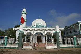
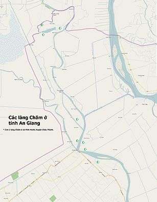
There're about 12,000 Chams people in An Phu. Most of them are Muslim. The Chams live in 5 villages in Da Phuoc, Vinh Truong, Nhon Hoi, Khanh Binh, Quoc Thai.
Monsoonal flooding
Located near Châu Đốc, An Phú District is famous for its rice and fish during the monsoonal flood season. The food comes in the seventh lunar month, roughly in August. The local government organises the Flood Season Festival annually. When the monsoonal season comes, many villages are inundated by water. Many houses were built on stilts to protect themselves against flooding. Many ricefields are inundated. Although produce cannot be grown in this season, the fishing catch is plentiful, and boats are the dominant mode of transport during this season.
Economy
Residents of An Phú District are mainly farmers, most of the area is under rice cultivation with alluvium soil and freshwater which also allows much fishing. Every year, when all the communes are affected by water the fields become indundated. On the Cambodian border on the other side, opposite the town of Long Binh is a market area of Cambodia known as Chrey Thum (Koh Thum).
As the road from An Phú to the capital Phnom Penh is Cambodia's most recent road from Vietnam it has created good conditions for trade in the region.
Education
All communes and towns have schools from kindergarten to middle school.
Gallery
-

Một góc Đa Phước, ở khu vực chùa Đa Phước, bên sông Châu Đốc (An Giang, Việt Nam).
-
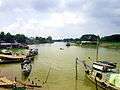
Bến phà tại chợ thị trấn Long Bình (An Phú, An Giang, Việt Nam), bên sông Bình Di. Đến đây, khúc sông này trở thành biên giới tự nhiên giữa Việt Nam và Campuchia (bờ bên phải ảnh).
-
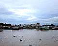
Chiều trên sông Châu Đốc, chỗ bến đò Châu Giang ở Đa Phước, thuộc huyện An Phú, tỉnh An Giang, Việt Nam.
-
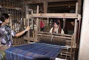
Người Chăm dệt vải ở Đa Phước
-
_(6620595609).jpg)
Chèo xuồng ở làng nổi Cồn Tiên
-
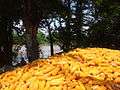
Ngô vàng tại An Phú
-

Thánh đường Hồi giáo Mas Jid Khoy Ri Yah ở Búng Bình Thiên (Huyện An Phú, An Giang, Việt Nam) do Đại sứ quán Các tiểu vương quốc Ả Rập Thống nhất tài trợ xây dựng
-

Công viên trung tâm ở thị trấn An Phú, thuộc huyện An Phú, An Giang, Việt Nam.
-

Thánh đường Ehsan ở Đa Phước.
References
- 1 2 "Districts of Vietnam". Statoids. Archived from the original on 1 March 2009. Retrieved March 13, 2009.
- ↑ There's also another book about An Phu by Ronald C. Wood, a US enlist soldier, Vietnam: Remembrances of a Native American Soldier.
Coordinates: 10°55′01″N 105°04′59″E / 10.917°N 105.083°E