Thới Lai District
| Thới Lai District Huyện Thới Lai | |
|---|---|
| Rural district | |
| Country |
|
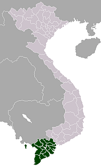
| City | Cần Thơ |
| Capital | Thới Lai |
| Area | |
| • Total | 98.71 sq mi (255.66 km2) |
| Population (2003) | |
| • Total | 120,964 |
| Time zone | UTC + 7 (UTC+7) |
Thới Lai is a new rural district (huyện) of Cần Thơ City in the Mekong Delta region of Vietnam. As of 2009 the district had a population of 120,964.[1] The district covers an area of 255.66 km². The district capital lies at Thới Lai town.[1] This district established in 2009 with split Cờ Đỏ District into Thới Lai District and new Cờ Đỏ District.
Đông giáp huyện Phong Điền, quận Ô Môn; Tây giáp huyện Cờ Đỏ, thành phố Cần Thơ và tỉnh Kiên Giang; Nam giáp huyện Phong Điền, thành phố Cần Thơ và tỉnh Hậu Giang, tỉnh Kiên Giang; Bắc giáp huyện Cờ Đỏ, quận Ô Môn. The district borders Phong Điền District and Ô Môn District to the east, Cờ Đỏ District and Kiên Giang Province to the west, Phong Điền District and Hậu Giang Province to the south and Cờ Đỏ District and Ô Môn District to the north.
Administrative divisions
The district is divided into one commune-level town Thới Lai and 13 communes: Thới Thạnh, Tân Thạnh, Định Môn, Trường Thành, Trường Xuân, Trường Xuân A, Trường Xuân B, Trường Thắng, Xuân Thắng, Thới Tân, Đông Bình, Đông Thuận.
References
External links
Coordinates: 9°59′57″N 105°39′40″E / 9.99917°N 105.66111°E