Pinhook, Missouri
| Pinhook, Missouri | |
|---|---|
| Village | |
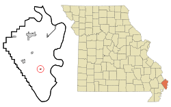 Location of Pinhook, Missouri | |
| Coordinates: 36°44′21″N 89°16′4″W / 36.73917°N 89.26778°WCoordinates: 36°44′21″N 89°16′4″W / 36.73917°N 89.26778°W | |
| Country | United States |
| State | Missouri |
| County | Mississippi |
| Area[1] | |
| • Total | 0.14 sq mi (0.36 km2) |
| • Land | 0.14 sq mi (0.36 km2) |
| • Water | 0 sq mi (0 km2) |
| Elevation | 302 ft (92 m) |
| Population (2010)[2] | |
| • Total | 30 |
| • Estimate (2012[3]) | 30 |
| • Density | 214.3/sq mi (82.7/km2) |
| Time zone | Central (CST) (UTC-6) |
| • Summer (DST) | CDT (UTC-5) |
| FIPS code | 29-57926[4] |
| GNIS feature ID | 0741154[5] |
Pinhook is a village in Mississippi County, Missouri, United States. The population was 30 at the 2010 census.
It was settled in the 1920s by sharecroppers. The community takes its name from a nearby ridge of the same name which in turn was so named on account it having the form of a pinhook.[6] The community was hit by water after the U.S. Army Corps of Engineers caused a breach in the Bird’s Point Levee to save the town of Cairo, Illinois. Because of that, the former residents resettled in East Prairie and Sikeston.[7]
Geography
Pinhook is located at 36°44′21″N 89°16′4″W / 36.73917°N 89.26778°W (36.739225, -89.267693).[8]
According to the United States Census Bureau, the village has a total area of 0.14 square miles (0.36 km2), all of it land.[1]
Demographics
2010 census
As of the census[2] of 2010, there were 30 people, 17 households, and 8 families residing in the village. The population density was 214.3 inhabitants per square mile (82.7/km2). There were 19 housing units at an average density of 135.7 per square mile (52.4/km2). The racial makeup of the village was 3.33% White and 96.67% Black or African American.
There were 17 households of which 11.8% had children under the age of 18 living with them, 29.4% were married couples living together, 11.8% had a female householder with no husband present, 5.9% had a male householder with no wife present, and 52.9% were non-families. 52.9% of all households were made up of individuals and 17.6% had someone living alone who was 65 years of age or older. The average household size was 1.76 and the average family size was 2.63.
The median age in the village was 54 years. 10% of residents were under the age of 18; 6.7% were between the ages of 18 and 24; 10% were from 25 to 44; 39.9% were from 45 to 64; and 33.3% were 65 years of age or older. The gender makeup of the village was 50.0% male and 50.0% female.
2000 census
As of the census[4] of 2000, there were 48 people, 20 households, and 15 families residing in the village. The population density was 336.1 people per square mile (132.4/km²). There were 21 housing units at an average density of 147.0 per square mile (57.9/km²). The racial makeup of the village was 10.42% White, 87.50% African American, and 2.08% from two or more races.
There were 20 households out of which 35.0% had children under the age of 18 living with them, 40.0% were married couples living together, 35.0% had a female householder with no husband present, and 25.0% were non-families. 25.0% of all households were made up of individuals and 10.0% had someone living alone who was 65 years of age or older. The average household size was 2.40 and the average family size was 2.87.
In the village the population was spread out with 29.2% under the age of 18, 6.3% from 18 to 24, 29.2% from 25 to 44, 18.8% from 45 to 64, and 16.7% who were 65 years of age or older. The median age was 38 years. For every 100 females there were 71.4 males. For every 100 females age 18 and over, there were 70.0 males.
The median income for a household in the village was $15,417, and the median income for a family was $16,250. Males had a median income of $23,750 versus $16,250 for females. The per capita income for the village was $10,114. There were 47.1% of families and 55.4% of the population living below the poverty line, including 50.0% of under eighteens and 83.3% of those over 64.
History
There has been a lot of mystery about the founding of Pinhook. Many people believe that it was founded by sharecroppers in the 1930s. This largely African American colony was expanded to nearly 250 people at one time. During the Summer of 2011 the Mississippi began to flood, Pinhook was destroyed on May 2, 2011. The Birds Point- New Madrid levee was blown to save Cairo, Illinois from flooding. Everyone in Pinhook lost their homes that they had lived in for many years. Many are devastated because they loved living in a small community, knowing everyone. These people fled to family or apartments, until they could find a new home. There has been talk of relocating the community as a whole, but the funding is the only issue. In August 2015 remaining buildings were bulldozed.[9]
References
- 1 2 "US Gazetteer files 2010". United States Census Bureau. Archived from the original on January 24, 2012. Retrieved 2012-07-08.
- 1 2 "American FactFinder". United States Census Bureau. Retrieved 2012-07-08.
- ↑ "Population Estimates". United States Census Bureau. Archived from the original on June 17, 2013. Retrieved 2013-05-30.
- 1 2 "American FactFinder". United States Census Bureau. Retrieved 2008-01-31.
- ↑ "US Board on Geographic Names". United States Geological Survey. 2007-10-25. Retrieved 2008-01-31.
- ↑ "Mississippi County Place Names, 1928–1945". The State Historical Society of Missouri. Archived from the original on June 24, 2016. Retrieved November 6, 2016.
- ↑ Schuessler, Ryan. "One by one, Missouri’s black towns disappear" (Archive). Al Jazeera. April 5, 2014. Retrieved on June 23, 2014.
- ↑ "US Gazetteer files: 2010, 2000, and 1990". United States Census Bureau. 2011-02-12. Retrieved 2011-04-23.
- ↑ Graef, Tyle. "Former Pinhook residents watch as bulldozers level what's left of the town the 2011 flood destroyed". Southeast Missourian. August 7, 2015. Retrieved on August 9, 2015.
Municipalities and communities of Mississippi County, Missouri, United States | ||
|---|---|---|
| Cities |  | |
| Villages | ||
| Townships |
| |
| Unincorporated communities | ||
| Ghost towns | ||
| Footnotes | ‡This populated place also has portions in an adjacent county or counties | |