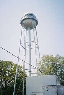
Bertrand, Missouri
| Bertrand, Missouri | |
|---|---|
| City | |
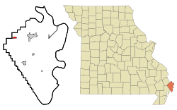 Location of Bertrand, Missouri | |
 Location of Missouri in the United States | |
| Coordinates: 36°54′37″N 89°26′54″W / 36.91028°N 89.44833°WCoordinates: 36°54′37″N 89°26′54″W / 36.91028°N 89.44833°W | |
| Country | United States |
| State | Missouri |
| County | Mississippi |
| Area[1] | |
| • Total | 0.78 sq mi (2.02 km2) |
| • Land | 0.78 sq mi (2.02 km2) |
| • Water | 0 sq mi (0 km2) |
| Elevation | 322 ft (98 m) |
| Population (2010)[2] | |
| • Total | 821 |
| • Estimate (2012[3]) | 817 |
| • Density | 1,052.6/sq mi (406.4/km2) |
| Time zone | Central (CST) (UTC-6) |
| • Summer (DST) | CDT (UTC-5) |
| ZIP code | 63823 |
| Area code(s) | 573 |
| FIPS code | 29-04996[4] |
| GNIS feature ID | 0714002[5] |
Bertrand is a city in Mississippi County, Missouri, United States. The population was 821 at the 2010 census.
History
Bertrand was platted in 1859.[6] The community has the name of one Mr. Bertrand, a railroad promoter.[7] A post office called Bertrand has been in operation since 1874.[8]
Geography
Bertrand is located at 36°54′37″N 89°26′54″W / 36.91028°N 89.44833°W (36.910323, -89.448213).[9] According to the United States Census Bureau, the city has a total area of 0.78 square miles (2.02 km2), all of it land.[1]
Demographics
| Historical population | |||
|---|---|---|---|
| Census | Pop. | %± | |
| 1880 | 126 | — | |
| 1890 | 221 | 75.4% | |
| 1900 | 266 | 20.4% | |
| 1910 | 346 | 30.1% | |
| 1920 | 355 | 2.6% | |
| 1930 | 322 | −9.3% | |
| 1940 | 377 | 17.1% | |
| 1950 | 390 | 3.4% | |
| 1960 | 465 | 19.2% | |
| 1970 | 604 | 29.9% | |
| 1980 | 688 | 13.9% | |
| 1990 | 692 | 0.6% | |
| 2000 | 740 | 6.9% | |
| 2010 | 821 | 10.9% | |
| Est. 2015 | 792 | [10] | −3.5% |
| source:[11] | |||
2010 census
As of the census[2] of 2010, there were 821 people, 341 households, and 232 families residing in the city. The population density was 1,052.6 inhabitants per square mile (406.4/km2). There were 355 housing units at an average density of 455.1 per square mile (175.7/km2). The racial makeup of the city was 97.32% White, 1.83% Black or African American, 0.12% Native American, 0.12% Asian, 0.12% from other races, and 0.49% from two or more races. Hispanic or Latino of any race were 1.95% of the population.
There were 341 households of which 33.4% had children under the age of 18 living with them, 45.2% were married couples living together, 18.8% had a female householder with no husband present, 4.1% had a male householder with no wife present, and 32.0% were non-families. 27.3% of all households were made up of individuals and 12.6% had someone living alone who was 65 years of age or older. The average household size was 2.30 and the average family size was 2.74.
The median age in the city was 46.1 years. 23% of residents were under the age of 18; 5.9% were between the ages of 18 and 24; 19.8% were from 25 to 44; 28.4% were from 45 to 64; and 22.9% were 65 years of age or older. The gender makeup of the city was 45.2% male and 54.8% female.
2000 census
As of the census[4] of 2000, there were 740 people, 316 households, and 207 families residing in the city. The population density was 1,115.2 people per square mile (432.9/km²). There were 351 housing units at an average density of 528.9 per square mile (205.3/km²). The racial makeup of the city was 95.81% White, 2.84% African American, 0.41% Native American, and 0.95% from two or more races. Hispanic or Latino of any race were 0.41% of the population.
There were 316 households out of which 21.5% had children under the age of 18 residing with them, 52.2% were married couples living together, 13.0% had a female householder with no husband present, and 34.2% were non-families. 29.7% of all households were made up of individuals and 13.0% had someone living alone who was 65 years of age or older. The average household size was 2.17 and the average family size was 2.66.
In the city the population was spread out with 17.0% under the age of 18, 7.6% from 18 to 24, 24.6% from 25 to 44, 27.6% from 45 to 64, and 23.2% who were 65 years of age or older. The median age was 46 years. For every 100 females there were 84.5 males. For every 100 females age 18 and over, there were 80.6 males.
The median income for a household in the city was $26,023, and the median income for a family was $32,833. Males had a median income of $24,643 versus $21,042 for females. The per capita income for the city was $15,346. About 14.6% of families and 15.4% of the population were below the poverty line, including 17.4% of those under age 18 and 11.7% of those age 65 or over.
References
- 1 2 "US Gazetteer files 2010". United States Census Bureau. Archived from the original on 2012-07-14. Retrieved 2012-07-08.
- 1 2 "American FactFinder". United States Census Bureau. Retrieved 2012-07-08.
- ↑ "Population Estimates". United States Census Bureau. Archived from the original on 2013-06-17. Retrieved 2013-05-30.
- 1 2 "American FactFinder". United States Census Bureau. Archived from the original on 2013-09-11. Retrieved 2008-01-31.
- ↑ "US Board on Geographic Names". United States Geological Survey. 2007-10-25. Retrieved 2008-01-31.
- ↑ Eaton, David Wolfe (1917). How Missouri Counties, Towns and Streams Were Named. The State Historical Society of Missouri. p. 208.
- ↑ "Mississippi County Place Names, 1928–1945". The State Historical Society of Missouri. Archived from the original on June 24, 2016. Retrieved November 6, 2016.
- ↑ "Post Offices". Jim Forte Postal History. Retrieved 6 November 2016.
- ↑ "US Gazetteer files: 2010, 2000, and 1990". United States Census Bureau. 2011-02-12. Retrieved 2011-04-23.
- ↑ "Annual Estimates of the Resident Population for Incorporated Places: April 1, 2010 to July 1, 2015". Retrieved July 2, 2016.
- ↑ "Missouri Population 1900 - 1990" (CSV). Missouri Census Data Center. Retrieved 6 October 2014.
External links
- Historic maps of Bertrand in the Sanborn Maps of Missouri Collection at the University of Missouri
Municipalities and communities of Mississippi County, Missouri, United States | ||
|---|---|---|
| Cities | 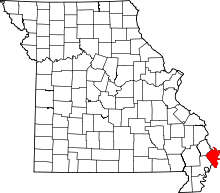 | |
| Villages | ||
| Townships |
| |
| Unincorporated communities | ||
| Ghost towns | ||
| Footnotes | ‡This populated place also has portions in an adjacent county or counties | |