Prairie Township, Edgar County, Illinois
| Prairie Township | |
|---|---|
| Township | |
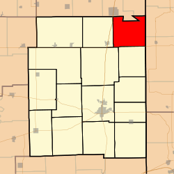 Location in Edgar County | |
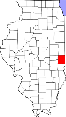 Edgar County's location in Illinois | |
| Coordinates: 39°50′26″N 87°35′27″W / 39.84056°N 87.59083°WCoordinates: 39°50′26″N 87°35′27″W / 39.84056°N 87.59083°W | |
| Country | United States |
| State | Illinois |
| County | Edgar |
| Established | November 4, 1856 |
| Area | |
| • Total | 35.99 sq mi (93.2 km2) |
| • Land | 35.98 sq mi (93.2 km2) |
| • Water | 0.01 sq mi (0.03 km2) 0.03% |
| Elevation | 643 ft (196 m) |
| Population (2010) | |
| • Total | 273 |
| • Density | 7.6/sq mi (2.9/km2) |
| Time zone | CST (UTC-6) |
| • Summer (DST) | CDT (UTC-5) |
| ZIP codes | 61870, 61924 |
| GNIS feature ID | 0429595 |
Prairie Township is one of fifteen townships in Edgar County, Illinois, USA. As of the 2010 census, its population was 273 and it contained 125 housing units.[1]
Geography
According to the 2010 census, the township has a total area of 35.99 square miles (93.2 km2), of which 35.98 square miles (93.2 km2) (or 99.97%) is land and 0.01 square miles (0.026 km2) (or 0.03%) is water.[1]
Unincorporated towns
Extinct towns
- Illiana
- Quaker
- Raven
Cemeteries
The township contains Wesley Chapel Cemetery.
Major highways
Airports and landing strips
- Rowe Airport
School districts
- Edgar County Community Unit District 6
- Georgetown-Ridge Farm Consolidated Unit School District 4
Political districts
- Illinois' 15th congressional district
- State House District 109
- State Senate District 55
References
- "Prairie Township, Edgar County, Illinois". Geographic Names Information System. United States Geological Survey. Retrieved 2010-01-10.
- United States Census Bureau 2007 TIGER/Line Shapefiles
- United States National Atlas
- 1 2 "Population, Housing Units, Area, and Density: 2010 - County -- County Subdivision and Place -- 2010 Census Summary File 1". United States Census. Retrieved 2013-05-28.
External links

Municipalities and communities of Edgar County, Illinois, United States | ||
|---|---|---|
| Cities | ||
| Villages | ||
| Townships | ||
| Unincorporated communities | ||
| Footnotes | ‡This populated place also has portions in an adjacent county or counties | |
This article is issued from Wikipedia - version of the 12/3/2013. The text is available under the Creative Commons Attribution/Share Alike but additional terms may apply for the media files.