Rangeville, Queensland
| Rangeville Toowoomba, Queensland | |||||||||||||
|---|---|---|---|---|---|---|---|---|---|---|---|---|---|
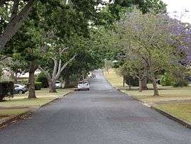 Maker Street, 2014 | |||||||||||||
 Rangeville | |||||||||||||
| Coordinates | 27°35′06″S 151°59′28″E / 27.585°S 151.991°ECoordinates: 27°35′06″S 151°59′28″E / 27.585°S 151.991°E | ||||||||||||
| Population | 8,217 (2011 census)[1] | ||||||||||||
| • Density | 814/km2 (2,107/sq mi) | ||||||||||||
| Postcode(s) | 4350 | ||||||||||||
| Area | 10.1 km2 (3.9 sq mi) | ||||||||||||
| Location | 5 km (3 mi) SE of Toowoomba | ||||||||||||
| LGA(s) | Toowoomba Region | ||||||||||||
| State electorate(s) | Toowoomba South | ||||||||||||
| Federal Division(s) | Groom | ||||||||||||
| |||||||||||||
Rangeville is a suburb of Toowoomba, Queensland, Australia, located 5 kilometres (3 mi) south-east of the city centre. At the 2011 Australian Census the suburb recorded a population of 8,217.[1]
Geography
The suburb's eastern boundary is home to four reserves: Picnic Point Park (with several lookouts, a restaurant and a bar); Mount Tabletop, accessible only by a walking track from Table Top Drive; McKnight Park, and J. E. Duggan Park, named for former Labor Opposition leader Jack Duggan who represented the local area for over 30 years. The western boundary along East Creek is home to the Toowoomba Bicentennial Waterbird Habitat.
At Pincic Point a 150-foot flagpole was erected as part of the Q150 celebrations.[2]
History
As closer settlement moved further along the range from Toowoomba, the suburb appears to have been named Rangeville to distinguish it from The Range, which was the general term for the area along the Range.[3]
Heritage listings

Rangeville has a number of heritage-listed sites, including:
- 1 South Street: Geeumbi[4]
- 2 South Street: Rodway, Toowoomba[5]
- 168 Tourist Road: Picnic Point and adjacent Parkland[6]
Education
Rangeville contains two schools: Rangeville State School (1909) and St. Joseph's College (Catholic, 1956).
References
- 1 2 Australian Bureau of Statistics (31 October 2012). "Rangeville (State Suburb)". 2011 Census QuickStats. Retrieved 9 November 2014.
- ↑ "Aussie flag flies high over Picnic Point". The Chronicle. 14 January 2009. Retrieved 9 November 2014.
- ↑ "Rangeville (entry 48049)". Queensland Place Names. Queensland Government. Retrieved 4 June 2011.
- ↑ "Geeumbi (entry 600867)". Queensland Heritage Register. Queensland Heritage Council. Retrieved 15 July 2013.
- ↑ "Rodway (entry 600868)". Queensland Heritage Register. Queensland Heritage Council. Retrieved 9 November 2014.
- ↑ "Picnic Point and adjacent Parkland (entry 601205)". Queensland Heritage Register. Queensland Heritage Council. Retrieved 15 July 2013.
External links
![]() Media related to Rangeville, Queensland at Wikimedia Commons
Media related to Rangeville, Queensland at Wikimedia Commons