Richmond, New Hampshire
| Richmond, New Hampshire | ||
|---|---|---|
| Town | ||
|
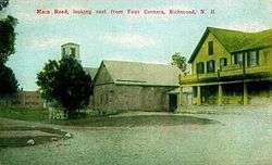
Fitzwilliam Road in 1911 | ||
| ||
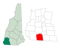 Location in Cheshire County, New Hampshire | ||
| Coordinates: 42°45′17″N 72°16′18″W / 42.75472°N 72.27167°WCoordinates: 42°45′17″N 72°16′18″W / 42.75472°N 72.27167°W | ||
| Country | United States | |
| State | New Hampshire | |
| County | Cheshire | |
| Incorporated | 1752 | |
| Government | ||
| • Board of Selectmen |
Christin Daugherty, Chair Kathryn McWhirk Carol Jameson | |
| Area | ||
| • Total | 37.8 sq mi (97.8 km2) | |
| • Land | 37.6 sq mi (97.3 km2) | |
| • Water | 0.2 sq mi (0.5 km2) 0.53% | |
| Elevation | 1,063 ft (324 m) | |
| Population (2010) | ||
| • Total | 1,155 | |
| • Density | 31/sq mi (12/km2) | |
| Time zone | Eastern (UTC-5) | |
| • Summer (DST) | Eastern (UTC-4) | |
| ZIP code | 03470 | |
| Area code(s) | 603 | |
| FIPS code | 33-64420 | |
| GNIS feature ID | 0873706 | |
| Website |
www | |
Richmond is a town in Cheshire County, New Hampshire, United States. The population was 1,155 at the 2010 census.[1]
History
The town was first chartered in 1735 by Governor Jonathan Belcher of Massachusetts. Granted to soldiers returning from the war in Canada, it was named Sylvester-Canada in honor of Captain Joseph Sylvester of Scituate, Massachusetts, who was killed in 1690 during an attempt to capture Quebec. After the border between Massachusetts and New Hampshire was fixed, the town fell on the New Hampshire side of the line. It was incorporated in 1752 as Richmond by Governor Benning Wentworth. He named it after Charles Lennox, 3rd Duke of Richmond, a staunch advocate of colonial independence. It was settled about 1757 by emigrants from Rhode Island and Massachusetts.[2]
Geography
According to the United States Census Bureau, the town has a total area of 37.8 square miles (98 km2), of which 37.6 sq mi (97 km2) is land and 0.2 sq mi (0.52 km2) is water, comprising 0.53% of the town. Little Monadnock Mountain, elevation 1,883 feet (574 m) above sea level, is within a mile of the eastern boundary, in the town of Fitzwilliam. The highest point in Richmond is one mile northwest of Little Monadnock, on an unnamed hill whose elevation is 1,624 feet (495 m) above sea level. The Franconia Mountain Range (not to be confused with the much higher ridge in the White Mountains to the north) is a 1,300-foot (400 m) high chain of hills in the western part of town.
Richmond is served by state routes 32 and 119.
Demographics
| Historical population | |||
|---|---|---|---|
| Census | Pop. | %± | |
| 1790 | 1,380 | — | |
| 1800 | 1,390 | 0.7% | |
| 1810 | 1,290 | −7.2% | |
| 1820 | 1,391 | 7.8% | |
| 1830 | 1,301 | −6.5% | |
| 1840 | 1,165 | −10.5% | |
| 1850 | 1,128 | −3.2% | |
| 1860 | 1,015 | −10.0% | |
| 1870 | 868 | −14.5% | |
| 1880 | 669 | −22.9% | |
| 1890 | 476 | −28.8% | |
| 1900 | 459 | −3.6% | |
| 1910 | 393 | −14.4% | |
| 1920 | 306 | −22.1% | |
| 1930 | 241 | −21.2% | |
| 1940 | 296 | 22.8% | |
| 1950 | 259 | −12.5% | |
| 1960 | 295 | 13.9% | |
| 1970 | 287 | −2.7% | |
| 1980 | 518 | 80.5% | |
| 1990 | 877 | 69.3% | |
| 2000 | 1,077 | 22.8% | |
| 2010 | 1,155 | 7.2% | |
| Est. 2015 | 1,137 | [3] | −1.6% |
As of the census[5] of 2000, there were 1,077 people, 379 households, and 285 families residing in the town. The population density was 28.7 people per square mile (11.1/km²). There were 432 housing units at an average density of 11.5 per square mile (4.4/km²). The racial makeup of the town was 97.68% White, 0.37% African American, 0.46% Native American, 0.19% Asian, 0.19% from other races, and 1.11% from two or more races. Hispanic or Latino of any race were 0.56% of the population.
There were 379 households out of which 35.1% had children under the age of 18 living with them, 67.5% were married couples living together, 4.5% had a female householder with no husband present, and 24.8% were non-families. 19.3% of all households were made up of individuals and 5.8% had someone living alone who was 65 years of age or older. The average household size was 2.82 and the average family size was 3.22.
In the town the population was spread out with 29.2% under the age of 18, 5.4% from 18 to 24, 28.6% from 25 to 44, 25.5% from 45 to 64, and 11.2% who were 65 years of age or older. The median age was 38 years. For every 100 females there were 105.5 males. For every 100 females age 18 and over, there were 102.7 males.
The median income for a household in the town was $49,141, and the median income for a family was $54,625. Males had a median income of $37,083 versus $27,500 for females. The per capita income for the town was $21,174. About 4.6% of families and 7.6% of the population were below the poverty line, including 8.5% of those under age 18 and 7.6% of those age 65 or over.
Religious institutions
At the center of town, called Richmond Four Corners, is the Richmond Community United Methodist Church, a brick Greek revival-style edifice built in 1837.
Since 1988, Richmond has been the home of Saint Benedict Center, a traditionalist Catholic community with monastery, convent, chapel, and school.
Notable people
- Hosea Ballou, clergyman and theologian
- Horatio Admiral Nelson, merchant and politician in Quebec
- Joseph Weeks, US congressman
Footnotes
- ↑ United States Census Bureau, American FactFinder, 2010 Census figures. Retrieved March 23, 2011.
- ↑ Coolidge, Austin J.; John B. Mansfield (1859). A History and Description of New England. Boston, Massachusetts. pp. 631–632.
- ↑ "Annual Estimates of the Resident Population for Incorporated Places: April 1, 2010 to July 1, 2015". Retrieved July 2, 2016.
- ↑ "Census of Population and Housing". Census.gov. Archived from the original on May 11, 2015. Retrieved June 4, 2016.
- ↑ "American FactFinder". United States Census Bureau. Archived from the original on September 11, 2013. Retrieved 2008-01-31.
Further reading
- William Bassett, History of the Town of Richmond, Cheshire County, New Hampshire: From Its First Settlement, to 1882. Boston: C.W. Calkins and Co., 1884.
- Neith Boyce and Beatrix Faust, The Town in the Forest: Life Story of Richmond, New Hampshire. Richmond, NH: Richmond Archives, 1992.
- Richard A. Martin, The Only Mill in Town: The Story of the Pail-making Industry in Richmond, New Hampshire. Richmond, NH: Friends of Historic Richmond, 1995.
- June Riedrich Zublic, The Land Forever: The Power of the Land in One Family: Abraham Phillips, from 1778, of Richmond, New Hampshire. Turnersville, NJ: J.R. Zublic, 1999.
External links
- Town of Richmond official website
- Richmond Public Library
- The Richmond Rooster
- New Hampshire Economic and Labor Market Information Bureau Profile
Municipalities and communities of Cheshire County, New Hampshire, United States | ||
|---|---|---|
| City | 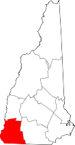 | |
| Towns | ||
| CDPs | ||
| Other villages | ||