Walpole, New Hampshire
| Walpole, New Hampshire | |
|---|---|
| Town | |
|
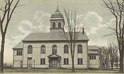
Town Hall in 1906 | |
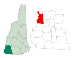 Location in Cheshire County, New Hampshire | |
| Coordinates: 43°04′46″N 72°25′33″W / 43.07944°N 72.42583°WCoordinates: 43°04′46″N 72°25′33″W / 43.07944°N 72.42583°W | |
| Country | United States |
| State | New Hampshire |
| County | Cheshire |
| Incorporated | 1756 |
| Villages | North Walpole, Drewsville |
| Government | |
| • Board of Selectmen |
Steve Dalessio, Chair Peggy Pschirrer Joe Aldrich |
| Area | |
| • Total | 36.7 sq mi (95.1 km2) |
| • Land | 35.2 sq mi (91.1 km2) |
| • Water | 1.5 sq mi (4.0 km2) 4.16% |
| Elevation | 400 ft (122 m) |
| Population (2010) | |
| • Total | 3,734 |
| • Density | 100/sq mi (39/km2) |
| Time zone | Eastern (UTC-5) |
| • Summer (DST) | Eastern (UTC-4) |
| ZIP code | 03608 |
| Area code(s) | 603 |
| FIPS code | 33-78420 |
| GNIS feature ID | 0873744 |
| Website | www.walpolenh.us |
Walpole is a town in Cheshire County, New Hampshire, United States. The population was 3,734 at the 2010 census.[1]
The town's central settlement, where 605 people resided at the 2010 census,[1] is defined as the Walpole census-designated place (CDP), and is east of New Hampshire Route 12. The town also includes the villages of North Walpole and Drewsville.
History
The town was first granted in 1736 by Colonial Governor Jonathan Belcher of Massachusetts as Number 3, third in a line of Connecticut River fort towns. It would be settled as early as 1736, and called Great Falls or Lunenburg. Colonel Benjamin Bellows, for whom Bellows Falls, Vermont, is named, built a large fort here for defense against Indian attack. After the border between Massachusetts and New Hampshire was fixed (with Number 3 on the New Hampshire side of the line), the town was regranted by Governor Benning Wentworth as Bellowstown, after its founder. It would be incorporated in 1756. The grant was renewed in 1761, when the town was renamed Walpole, in honor of Sir Robert Walpole, 1st Earl of Orford, and first Prime Minister of Great Britain.[2]
The first bridge across the Connecticut River, an engineering feat in its day, was built at Walpole in 1785, and is regarded as one of the most famous early spans in the United States. The town contains many architecturally significant old houses, including several associated with Colonel Bellows and members of his family. Walpole Academy, built in 1831 and attributed to master-builder Aaron Prentiss Howland, is listed on the National Register of Historic Places. The abundant lilacs in the town inspired Louisa May Alcott to write the 1878 book Under the Lilacs.
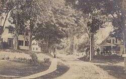
 Westminster St. in 1906
 Town library in 1906
 Old church c. 1905
Geography
According to the United States Census Bureau, the town has a total area of 36.7 square miles (95 km2), of which 35.2 square miles (91 km2) is land and 1.5 square miles (3.9 km2) is water, comprising 4.16% of the town.[3] The town is drained by the Connecticut River, which forms the western border of the town and is also the state border with Vermont. The northern part of Walpole is drained by the Cold River, a tributary of the Connecticut. The highest point in town is the summit of Derry Hill, at 1,663 feet (507 m) above sea level.
Walpole is served by state routes 12 and 123.
Demographics
| Historical population | |||
|---|---|---|---|
| Census | Pop. | %± | |
| 1790 | 1,245 | — | |
| 1800 | 1,743 | 40.0% | |
| 1810 | 1,894 | 8.7% | |
| 1820 | 2,020 | 6.7% | |
| 1830 | 1,974 | −2.3% | |
| 1840 | 2,015 | 2.1% | |
| 1850 | 2,034 | 0.9% | |
| 1860 | 1,868 | −8.2% | |
| 1870 | 1,830 | −2.0% | |
| 1880 | 2,018 | 10.3% | |
| 1890 | 2,163 | 7.2% | |
| 1900 | 2,693 | 24.5% | |
| 1910 | 2,668 | −0.9% | |
| 1920 | 2,553 | −4.3% | |
| 1930 | 2,287 | −10.4% | |
| 1940 | 2,400 | 4.9% | |
| 1950 | 2,536 | 5.7% | |
| 1960 | 2,825 | 11.4% | |
| 1970 | 2,966 | 5.0% | |
| 1980 | 3,188 | 7.5% | |
| 1990 | 3,210 | 0.7% | |
| 2000 | 3,594 | 12.0% | |
| 2010 | 3,734 | 3.9% | |
| Est. 2015 | 3,767 | [4] | 0.9% |
As of the census[6] of 2000, there were 3,594 people, 1,490 households, and 1,016 families residing in the town. The population density was 101.0 people per square mile (39.0/km²). There were 1,592 housing units at an average density of 44.8 per square mile (17.3/km²). The racial makeup of the town was 98.30% White, 0.14% African American, 0.25% Native American, 0.17% Asian, 0.08% from other races, and 1.06% from two or more races. Hispanic or Latino of any race were 0.47% of the population.
There were 1,490 households out of which 30.9% had children under the age of 18 living with them, 54.8% were married couples living together, 9.2% had a female householder with no husband present, and 31.8% were non-families. 26.7% of all households were made up of individuals and 12.3% had someone living alone who was 65 years of age or older. The average household size was 2.41 and the average family size was 2.90.
In the town the population was spread out with 25.1% under the age of 18, 5.8% from 18 to 24, 26.4% from 25 to 44, 25.0% from 45 to 64, and 17.8% who were 65 years of age or older. The median age was 41 years. For every 100 females there were 92.3 males. For every 100 females age 18 and over, there were 91.5 males.
The median income for a household in the town was $44,673, and the median income for a family was $53,561. Males had a median income of $37,193 versus $24,323 for females. The per capita income for the town was $23,295. About 3.9% of families and 6.1% of the population were below the poverty line, including 10.4% of those under age 18 and 3.6% of those age 65 or over.
Site of interest
Notable people
- Amos Bronson Alcott, writer, philosopher, and abolitionist
- Louisa May Alcott, writer (summer resident)
- Glover Morrill Allen, zoologist
- Ken Burns, documentary film-maker
- Davis Carpenter, US congressman
- Herman M. Chapin, mayor of Cleveland
- Dayton Duncan, writer and documentary producer
- Franklin Hooper, professor and president of Antioch College
- Rev. Jonathan Leavitt, first minister, later dismissed by the town
- Charles Holland Mason, politician and lawyer
- Howard Petrie, film and television actor
- Gary Smith, record producer
- Roger Vose, US congressman
- Horace Wells, pioneered anaesthesia in dentistry, specifically nitrous oxide
References
- 1 2 United States Census Bureau, American FactFinder, 2010 Census figures. Retrieved March 23, 2011.
- ↑ Coolidge, Austin J.; John B. Mansfield (1859). A History and Description of New England. Boston, Massachusetts. pp. 668–671.
- ↑ "Geographic Identifiers: 2010 Demographic Profile Data (G001) - Walpole town, New Hampshire". U.S. Census Bureau American Factfinder. Retrieved November 8, 2011.
- ↑ "Annual Estimates of the Resident Population for Incorporated Places: April 1, 2010 to July 1, 2015". Retrieved July 2, 2016.
- ↑ "Census of Population and Housing". Census.gov. Retrieved June 4, 2016.
- ↑ "American FactFinder". United States Census Bureau. Retrieved 2008-01-31.
| Wikimedia Commons has media related to Walpole, New Hampshire. |
External links
- Town of Walpole official website
- Walpole Town Library
- New Hampshire Economic and Labor Market Information Bureau Profile
- Walpole, New Hampshire, at City-Data.com
- The Walpole Clarion, a monthly community publication
Municipalities and communities of Cheshire County, New Hampshire, United States | ||
|---|---|---|
| City | 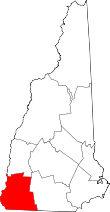 | |
| Towns | ||
| CDPs | ||
| Other villages | ||