Rollersville, Ohio
| Rollersville, Ohio | |
|---|---|
| Unincorporated community | |
|
Rollersville, Ohio is bisected by the Grand Army of the Republic Highway. | |
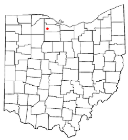 Location of Rollersville, Ohio | |
| Coordinates: 41°20′27″N 83°22′42″W / 41.34083°N 83.37833°W | |
| Country | United States |
| State | Ohio |
| County | Sandusky |
| Elevation[1] | 686 ft (209 m) |
| Time zone | Eastern (EST) (UTC-5) |
| • Summer (DST) | EDT (UTC-4) |
| Area code(s) | 419 |
| GNIS feature ID | 1065244[1] |

Rollersville is an unincorporated community on the border between Madison and Scott townships in Sandusky County, Ohio, United States. It is located on the Grand Army of the Republic Highway (U.S. Route 6), approximately 4.5 miles (7.2 km) west of Helena, Ohio. Rollersville had a post office from 1839 to 1908.[1]
History
A post office called Rollersville was established in 1839, and remained in operation until 1908.[2] The community was named for Henry Roller, a War of 1812 veteran and pioneer settler.[3]
References
- 1 2 3 "US Board on Geographic Names". United States Geological Survey. 2007-10-25. Retrieved 2008-01-31.
- ↑ "Sandusky County". Jim Forte Postal History. Retrieved 28 December 2015.
- ↑ Meek, Basil (1909). Twentieth Century History of Sandusky County, Ohio and Representative Citizens. Whipporwill Publications. p. 341.
Municipalities and communities of Sandusky County, Ohio, United States | ||
|---|---|---|
| Cities | 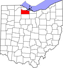 | |
| Villages | ||
| Townships | ||
| CDPs | ||
| Unincorporated communities | ||
| Footnotes | ‡This populated place also has portions in an adjacent county or counties | |
Coordinates: 41°20′27″N 83°22′42″W / 41.34083°N 83.37833°W
This article is issued from Wikipedia - version of the 11/3/2016. The text is available under the Creative Commons Attribution/Share Alike but additional terms may apply for the media files.