Oregon Route 126
| ||||
|---|---|---|---|---|
 | ||||
| Route information | ||||
| Maintained by ODOT | ||||
| Length: | 204.63 mi (329.32 km) | |||
| Existed: | 1926 – present | |||
| Major junctions | ||||
| West end: |
| |||
|
| ||||
| East end: |
| |||
| Highway system | ||||
| ||||

Oregon Route 126 is a 204.63-mile-long (329.32 km) state highway that connects coastal, western, and central parts of the U.S. state of Oregon. A short freeway section of Oregon 126 in Eugene and Springfield is concurrent with Interstate 105.
Route description (East to west)
A business route in the Eugene/Springfield area is also identified.
Prineville to Springfield
Route 126's eastern terminus is in Prineville, with its intersection with U.S. 26. Route 126 travels westward via the Ochoco Highway to Redmond, crossing U.S. Route 97. From Redmond, it continues west along the Sisters-Redmond Highway to the eastern edge of Sisters, where it merges with U.S. Route 20. The highways run co-signed through Sisters to the west end of town and the junction with Oregon Route 242, and then west through the Cascade Mountains to Santiam Junction and the eastern terminus of Oregon Route 22.
Just past Santiam Junction, U.S. Route 20 turns west at Clear Lake (Linn County, Oregon) and crosses the mountains toward the Willamette Valley. Meanwhile, Route 126 continues south along the Clear Lake-Belknap Springs Highway to Belknap Springs and the western terminus of Route 242. From that point, Route 126 veers west as the McKenzie Highway, flanking the McKenzie River for most of its length toward Springfield and Eugene.
Freeway (I-105) section
| |
|---|---|
| Location: | Eugene, Oregon |
In east Springfield lies the eastern terminus of Eugene-Springfield Highway No. 227 (see Oregon highways and routes), an east–west freeway through the Eugene-Springfield metropolitan area. Oregon 126 is routed along this freeway for its entire length. West of the Interstate 5 interchange, the freeway is also designated as Interstate 105, a spur of I-5. At this point, I-105 and Route 126 enter Eugene. After two exits and a Willamette River crossing, I-105 reaches its western terminus at Oregon Route 99 (West Sixth Avenue) between Washington and Jefferson streets. The bridge and viaduct carrying the last 1.5 miles of I-105 are known as the Washington-Jefferson Street Bridge.[1] In December 2011 the section of highway from the Washington-Jefferson Street Bridge to Springfield was renamed Officer Chris Kilcullen Memorial Highway to commemorate the fallen Eugene Police Department officer who was fatally wounded while conducting a traffic stop on the highway in April 2011.[2]
Business route
Within the Eugene-Springfield area, Oregon 126 has a business loop. At the western terminus of I-105, Route 126 heads west on Sixth Avenue (cosigned with Oregon 99). From that same terminus, Business Route 126 heads east, also cosigned with Route 99, along Seventh Avenue. This route then proceeds through Eugene's downtown core and turns south at an interchange near the Ferry Street Bridge.
After two blocks, Business Route 126/Route 99 turns east again on East Broadway, which becomes Franklin Boulevard at Alder Street. Franklin Boulevard separates the south shore of the Willamette River from the northern edge of the University of Oregon campus.
Past the university campus and surrounding business district, Business Route 126 and Route 99 split. Route 99 joins southbound I-5, while Route 126 continues eastbound through the community of Glenwood. It then crosses the Willamette River and enters the city of Springfield. Business Route 126 continues east through downtown Springfield, eventually rejoining the main stem of Route 126 in the Thurston neighborhood of the city's east end.
Eugene to Florence

At the western terminus of I-105, Oregon 126 turns west and is cosigned with Oregon 99 for a mile and a half. At Garfield Street, the highways separate. Route 126 becomes the Florence-Eugene Highway, proceeding south on Garfield five blocks to West 11th Avenue, which carries the highway out of Eugene toward the Oregon Coast. In west Eugene, Route 126 intersects the western terminus of Oregon Route 569 (Beltline Highway).
Between Eugene and the rural-suburban city of Veneta, Route 126 passes through farmland and crosses the southern portion of Fern Ridge Reservoir, a popular recreation magnet for the area. A Coos Bay Rail Link line, originally part of Southern Pacific, built to Coos Bay in 1914, parallels Route 126 for much of its length between Eugene and Veneta.
Two miles west of Veneta, Route 126 begins its ascent into the Coast Range, passing the town of Noti and cresting at Cougar Pass, elevation 769 ft (234 m). Cougar Pass marks the division point between the watersheds of the Willamette and Siuslaw rivers. As it descends toward the Siuslaw Valley and the coast, Route 126 follows first Wildcat Creek and then the Siuslaw River itself. The town of Walton is passed. The Coos-Bay Rail Link is also visible from time to time of this section as well the following section from Mapleton to Florence.
The Petersen Tunnel (completed in 1957) marks the point where the last barrier to a one-hour drive from Eugene to the coast was breached. Originally called the Mapleton Tunnel, in 1988 the tunnel was renamed for Ralph A. Petersen (1902–1986), the Lane County Commissioner who was instrumental in completing it.[3]
At Mapleton and the junction with Oregon Route 36, Route 126 makes a sharp left turn, continuing westward. For 14 miles, it follows the Siuslaw River, the CBRL crossing over the highway and river on a bridge at Cushman, to the western terminus of the road, the coastal community of Florence, ending at its junction with US101.
In January 2016, the Oregon Legislature passed SB 5, designating Oregon Route 126 between Florence and Eugene as "William Tebeau Memorial Highway,"[4] named after a pioneering ODOT engineer.
History
.svg.png)
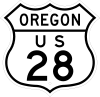
In 1926, the route between Florence and Ontario, Oregon was designated as U.S. 28. The Junction City-Florence section of the highway ran roughly along what are now Oregon routes 36 and 126.
In 1937, the same year a new U.S. 99 alignment between Eugene and Junction City opened, U.S. 28 was truncated and its western terminus moved to Glenwood (between Eugene and Springfield).
In 1951, U.S. 28 was eliminated from the federal highway route system. The highway was redesignated U.S. Route 26 between the Oregon-Idaho border and Prineville (and then continuing north and west through Portland to Astoria. The former U.S. 28 section between Prineville and Eugene was then designated U.S. Route 126.
In 1957 the long-awaited direct route between Eugene and the coast, known as "Route F," was completed. The state of Oregon formally named the new route the Eugene-Mapleton Highway, but did not assign a it a route number until 1965, when it became Oregon 126. Federal highway authorities agreed to the duplication as a temporary one, as U.S. 126 would soon disappear under the ongoing elimination of three-digit U.S. routes lying entirely within one state.
In 1972, the federal government dropped U.S. 126 from its highway system. The state of Oregon promptly redesignated the Prineville-Eugene section of the former U.S. route, and the Mapleton-Florence section of Oregon 36, as Oregon 126.
Prior routes
The routes of Oregon 126 and its predecessors have changed numerous times over the years. The original route of U.S. 28 from Florence to Eugene ran through Junction City, and multiplexed with U.S. Route 99 (now Oregon Route 99) from there south to Eugene. The route between Junction City and Brickerville is now Oregon Route 36; the original route of US 28 west of Brickerville is no longer on the state highway system.
In 1972, U.S. 126 was eliminated and Oregon 126 through the Eugene-Springfield area was routed onto a newly constructed freeway through north and east Springfield, and then the older Interstate 105 at Eugene. The portions of the former U.S. 126 rolling through downtown Springfield and Eugene were designated as the Route 126 business route.[5]
The place where Oregon 126 and its predecessors crosses the Cascade Mountains has changed over the years. Originally, the highway was routed over McKenzie Pass, a high mountainous route that frequently was closed in winter due to poor road conditions. In 1962, the Clear Lake Cutoff was constructed between Clear Lake and Belknap Springs, connecting the McKenzie Highway to the Santiam Highway (U.S. Route 20) to the north. U.S. 126 was re-routed over the cutoff and multiplexed with U.S. 20 east over the Cascades to Sisters, where it resumes its original course. The stretch of the McKenzie Highway between Belknap Springs and Sisters is now designated as Oregon Route 242. Route 242 is primarily a scenic route and is not plowed in wintertime.[6]
Proposed expansions
Currently, the route of Oregon Route 126 through western Eugene runs along several surface streets, most notably including West 11th Avenue. This route is well known in the Eugene area for traffic problems. Several projects have been proposed to deal with this; however, none has met with community approval.
A new proposed alignment of 126, the West Eugene Parkway is being planned by transportation authorities (but is facing fierce opposition from activists opposed to the parkway). The proposed parkway, a limited-access expressway with some at-grade intersections and some interchanges, would run north of the current West 11th alignment. Transportation planners have argued that the new route is necessary to fight congestion in Eugene and its western suburbs, and that the highway would facilitate traffic and growth in the year 2025. Highway opponents note that world petroleum supplies will likely be in decline long before the road would be completed, and therefore modest fixes to existing roads would be sufficient.
The Roosevelt Freeway was a freeway proposed in the 1960s and planned in the 1970s, which would serve as a new alignment of OR 126 through west Eugene. It was cancelled in 1978 due to community opposition.
Construction on the parkway is set to begin in 2006 though land-use appeals and lack of funding may delay groundbreaking on the project. The West Eugene Parkway is a somewhat similar (though scaled-back) project which is being currently planned.
Roosevelt Freeway
The Roosevelt Freeway was a proposed freeway alignment of Route 126 through Eugene, Oregon and its western suburbs. The project was canceled in 1972, largely due to the Oregon freeway revolts.
The freeway was proposed to go north of the current Route 126 alignment along West 11th Avenue, Roosevelt Boulevard and the Willamette River near the Whitaker neighborhood, and connect to the current Interstate 105 just south of the Washington-Jefferson Street Bridge.[7] (A proposed eastward extension of the project, the Skinner Butte Freeway, never made it off the drawing board).
The freeway was designed to solve a longstanding traffic issue in Eugene, the inadequacy of West 11th Avenue (a neighborhood arterial) to handle long-haul and commuter traffic. Many commuters, as well as state transportation officials, strongly desired to build the freeway. Plans for the freeway were completed in the mid-1970s, and the state of Oregon had begun buying up property for the right-of-way. A ramp stub currently exists on I-105, where the interchange with the Roosevelt Freeway would have been.

However, the freeway proved to be unpopular with Eugene residents, due to its impact on existing neighborhoods and riverfront access. In 1978, the so-called "T-2000" transportation plan was adopted, which effectively killed the Roosevelt Freeway by removing it from the plan's list of transportation projects. The plan did call for an east–west corridor through west Eugene, but for a scaled-down version. The mothballed West Eugene Parkway, a non-freeway route on a similar alignment, was seen by supporters and critics alike as an implementation of these plans.
West Eugene Parkway
The West Eugene Parkway, or WEP, was a proposed re-alignment of Oregon 126 through the western parts of Eugene and its suburbs. Route 126 runs through west Eugene along several surface streets, including West 11th Avenue, which is well known for its traffic problems. The proposed route, a limited-access expressway with some at-grade intersections and one interchange, would have run north of the current West 11th alignment, terminating at the western terminus of the Sixth-Seventh Avenue couplet carrying Oregon 99 through west Eugene. The project proved to be highly controversial. In July 2006, ODOT suspended work on it, and recommended a no-build alternative to the Federal Highway Administration.[8]
Transportation planners argued that the new route is necessary to fight traffic congestion in Eugene and its western suburbs, and that the highway would facilitate traffic and growth in the year 2025.
Opponents to the parkway have several reasons for their objection:
- The route is not needed; further road construction is a symptom of urban sprawl and better land use planning is the solution
- The route will encourage further development and urban sprawl in west Eugene
- World petroleum supplies will likely be in decline long before the road would be completed, and therefore modest fixes to existing roads would be sufficient
- The proposed route will disrupt environmentally-sensitive areas, including wetlands near the proposed alignment
- The parkway is just a resurrection of the old Roosevelt Freeway proposal (canceled in 1972), and calling the proposed project a "parkway" is deceptive
- The proposed route will just dump more traffic in Eugene's downtown core. The project fails the federally mandated "independent utility" test, and is thus illegal, because public transportation projects must be self-standing, according to federal law. It is alleged that construction of the parkway will raise traffic on Sixth and Seventh Avenues to unacceptable levels, requiring construction of a new highway through downtown. If such a design element was included in the current plan, such inclusion would likely lead to its cancellation.
- Funds spent on the project (officially $169 million) would be better spent on other improvements to the area transportation network.
- Over the past 20 years Eugene City Planning required businesses build along the West 11th corridor to place their parking lots behind their buildings, resulting in many buildings erected close to the existing street. Construction of the proposed parkway would require widening of the current road, forcing many of these businesses to close or relocate. Consequently, the project was opposed by many business owners along the route.
On June 18 and 19, 2001, the City of Eugene, Lane County, the Oregon Department of Transportation (ODOT), the Federal Highway Administration (FHWA) and the Bureau of Land Management (BLM), among others, held a two-day "West Eugene Charrette" to discuss the future of the project. Most participants were supporters of the highway, but at the end of the conference agreed to select the "no build" option. This consensus was not implemented, although ODOT and FHWA continued to spend millions, for a time, on the Environmental Impact Statement.[9]
Supporters, and the government agencies involved in the planning of the project, pointed to the fact that the parkway proposal has been approved by city voters in two referendum elections, most recently in 2001. Opponents note that the election was 51 to 49, and that proponents claimed "The Money Is There" when selling the project. The official price tag for the WEP was $88 million in 2001, but a 2004 estimate by local and state governments predicts the cost is really $169 million. Few WEP proponents support tax increases to pay for the highway.
On October 26, 2005, the Eugene City Council voted 5-4 to withdraw the City's support for the project, although the City of Eugene has continued its agreement with ODOT to assume responsibility for maintaining part of the road. The city also owns property for the parkway that has not yet been transferred to the BLM nature preserve for conservation and restoration.
In July 2006, ODOT withdrew its support of the project, effectively killing it.
Major intersections
Note: mileposts do not reflect actual mileage due to realignments.
| County | Location | mi[10] | km | Exit | Destinations | Notes |
|---|---|---|---|---|---|---|
| Lane | Florence | 0.02 | 0.032 | |||
| Mapleton | 14.40 | 23.17 | ||||
| Veneta | 46.92 | 75.51 | ||||
| | 52.69 0.00 | 84.80 0.00 | West end of formerly proposed West Eugene Parkway | |||
| Eugene | 3.10 | 4.99 | ||||
| 122.26 | 196.76 | West end of OR 99 overlap | ||||
| 123.10 | 198.11 | Blair Boulevard | Former Junction City-Eugene Highway | |||
| 123.30 | 198.43 | Jefferson Street – Lane County Fairgrounds | ||||
| 123.37 0.00 | 198.54 0.00 | East end of OR 99 overlap; west end of freeway and I-105 overlap | ||||
| 0.89 | 1.43 | 1 | ||||
| 1.96 | 3.15 | 2 | Country Club Road, Coburg Road – Downtown Eugene | |||
| Springfield | 3.50 | 5.63 | 4 | East end of I-105 overlap; signed as exits 4A (south) and 4B (north); I-5 exits 194A-B | ||
| 4.67 | 7.52 | — | ||||
| 6.09 | 9.80 | — | Mohawk Boulevard | |||
| 7.51 | 12.09 | — | 42nd Street – Marcola | Western access to Weyerhaeuser Complex | ||
| 9.05 | 14.56 | 52nd Street | Eastern access to Weyerhaeuser Complex | |||
| 9.05 | 14.56 | East end of freeway | ||||
| | 9.97 6.23 | 16.05 10.03 | ||||
| | 54.97 19.81 | 88.47 31.88 | ||||
| Linn | | 0.00 71.69 | 0.00 115.37 | West end of US 20 overlap | ||
| Santiam Junction | 74.90 | 120.54 | ||||
| Deschutes | Sisters | 100.12 92.03 | 161.13 148.11 | |||
| 93.07 | 149.78 | East end of US 20 overlap | ||||
| | 107.43 | 172.89 | — | Cline Falls Highway | Interchange | |
| Redmond | 111.94 −0.06 | 180.15 −0.097 | ||||
| Crook | Powell Butte | 6.84 | 11.01 | Bozarth Road | Former Powell Butte Highway | |
| Prineville | 17.92 | 28.84 | ||||
| 18.16 | 29.23 | |||||
1.000 mi = 1.609 km; 1.000 km = 0.621 mi
| ||||||
See also
-
 Oregon portal
 -
 U.S. Roads portal
References
- ↑ "Interstate-Guide.com". Interstate-Guide.com. Retrieved August 11, 2012.
- ↑ "Officer Chris Kilcullen Memorial Highway signs unveiled, dedicated". www.kmtr.com.
- ↑ "Mapleton tunnel to be renamed". news.google.com. Eugene Register-Guard - Google News Archive Search. October 22, 1988. Retrieved July 22, 2016.
- ↑ "The Oregonian, Your Government, 2015 Session, Senate Bill 5, Provides that portion of State Highway 126 between Florence and Eugene shall be known as William Tebeau Memorial Highway". Oregon Live. 2016. Retrieved 2016-01-29.
- ↑ "Interstate 105". oroads.com. Retrieved October 2, 2007.
- ↑ East of McKenzie Bridge Archived December 11, 2006, at the Wayback Machine.
- ↑ "Eugene's 1967 Highway Plan". Permatopia.com. Retrieved August 11, 2012.
- ↑ Northwest Region- Region 2 West Eugene Parkway Project Archived May 7, 2007, at the Wayback Machine.
- ↑ "Report on WEP charette". Permatopia.com. Retrieved August 11, 2012.
- ↑ Oregon Department of Transportation, Public Road Inventory (primarily the Digital Video Log), accessed April 2008
External links
 Media related to Oregon Route 126 at Wikimedia Commons
- I-105 at ORoads
- Wetlands: West Eugene Transportation, Land and Neighborhood Design Solutions, an alternative to the $200 million WEP
- West Eugene Parkway controversy
| ||
| Browse numbered routes | ||||
|---|---|---|---|---|
| ← | I-105 | OR 120 | ||