Sanpete County, Utah
| Sanpete County, Utah | |
|---|---|
|
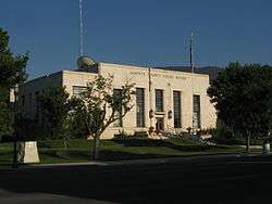
Sanpete County Courthouse | |
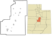
 Location in the U.S. state of Utah | |
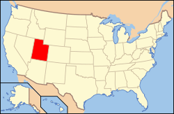 Utah's location in the U.S. | |
| Founded | 1850 |
| Named for | Chief Sanpitch |
| Seat | Manti |
| Largest city | Ephraim |
| Area | |
| • Total | 1,603 sq mi (4,152 km2) |
| • Land | 1,590 sq mi (4,118 km2) |
| • Water | 12 sq mi (31 km2), 0.8% |
| Population | |
| • (2010) | 27,822 |
| • Density | 17/sq mi (7/km²) |
| Congressional districts | 2nd, 4th |
| Time zone | Mountain: UTC-7/-6 |
| Website |
sanpete |
Sanpete County is a county located in the U.S. state of Utah. As of the 2010 census, the population was 27,822.[1] Its county seat is Manti,[2] and its largest city is Ephraim. The county was created in 1850.[3] It was named for the Ute chief Sanpitch, which was changed to Sanpete.[4] According to William Bright, the name comes from the Ute word saimpitsi, meaning "people of the tules".[5]
History
On June 14, 1849, Ute chiefs Walkara and Sowiette went to the Salt Lake Valley to ask Mormon leader Brigham Young to settle a group of his people in the valley of Sanpitch,[6] about 125 miles (201 km) to the south. Wanting to honor their request and needing to found new settlements where the quickly-growing population of Salt Lake could expand, Brigham Young sent a party to explore the area in August of that year. It was deemed favorable to settlement, and Brigham Young called Isaac Morley and George Washington Bradley to organize about fifty families to move south and settle "San Pete."[7]
The settlers arrived in the valley on November 19, 1849. They numbered 224 men, women, and children and were led by Isaac Morley, Charles Shumway, and Seth Taft and George Washington Bradley. After some debate, the first settlement in the valley was established on the present site of Manti, Utah.[7]
Over the course of the 19th Century, many of the settlers came from Scandinavian countries, as documented in the Saga of the Sanpitch.
Geography
According to the U.S. Census Bureau, the county has a total area of 1,603 square miles (4,150 km2), of which 1,590 square miles (4,100 km2) is land and 12 square miles (31 km2) (0.8%) is water.[8] The geographical center of Utah is located in Sanpete County, just west of Ephraim.
Sanpete County is bounded along its eastern side by the Wasatch Plateau (sometimes known as the Manti Mountains). The Wasatch Plateau rises to elevations of approximately 11,000 feet (3,300 m). Most of the Wasatch Plateau is encompassed by the Manti Division of the Manti-La Sal National Forest. Runoff from the western slopes of these mountains provides water to the county's cities and agricultural areas. Central Sanpete is dominated by the Sanpete Valley (sometimes known as the Sanpitch Valley), where most of the county's cities are located. The western side of the valley is bounded by the lower and drier San Pitch Mountains, which also form part of the western boundary of the county. The San Pitch River, runs from north to south through Sanpete and empties into the Sevier River in southwestern Sanpete. This portion of the Sevier River Valley is known as Gunnison Valley.
Adjacent counties
- Utah County (north)
- Carbon County (northeast)
- Emery County (east)
- Sevier County (south)
- Millard County (southwest)
- Juab County (northwest)
National protected areas
- Fishlake National Forest (part)
- Manti-La Sal National Forest (part)
- Uinta-Wasatch-Cache National Forest (part)
Demographics
| Historical population | |||
|---|---|---|---|
| Census | Pop. | %± | |
| 1850 | 365 | — | |
| 1860 | 3,815 | 945.2% | |
| 1870 | 6,786 | 77.9% | |
| 1880 | 11,557 | 70.3% | |
| 1890 | 13,146 | 13.7% | |
| 1900 | 16,313 | 24.1% | |
| 1910 | 16,704 | 2.4% | |
| 1920 | 17,505 | 4.8% | |
| 1930 | 16,022 | −8.5% | |
| 1940 | 16,063 | 0.3% | |
| 1950 | 13,891 | −13.5% | |
| 1960 | 11,053 | −20.4% | |
| 1970 | 10,976 | −0.7% | |
| 1980 | 14,620 | 33.2% | |
| 1990 | 16,259 | 11.2% | |
| 2000 | 22,763 | 40.0% | |
| 2010 | 27,822 | 22.2% | |
| Est. 2015 | 28,778 | [9] | 3.4% |
| U.S. Decennial Census[10] 1790–1960[11] 1900–1990[12] 1990–2000[13] 2010–2014[1] | |||
As of the 2000 United States Census,[14] there were 22,763 people, 6,547 households, and 5,067 families residing in the county. The population density was 14 people per square mile (6/km²). There were 7,879 housing units at an average density of 5 per square mile (2/km²). The racial makeup of the county was 92.43% White, 0.31% Black or African American, 0.87% Native American, 0.48% Asian, 0.36% Pacific Islander, 4.06% from other races, and 1.49% from two or more races. 6.63% of the population were Hispanic or Latino of any race.
In 2005 Sanpete County had a population that was 88.7% non-Hispanic whites. African Americans now constituted 0.5% of the population. Native Americans were 1.0% of the population. Asians were 0.8% of the population. Pacific Islanders were growing faster in numbers than Asians and were tied with Asians at 0.8%. 8.1% of the population was now Latino.[15]
There were 6,547 households out of which 43.40% had children under the age of 18 living with them, 67.00% were married couples living together, 7.20% had a female householder with no husband present, and 22.60% were non-families. 17.80% of all households were made up of individuals and 10.10% had someone living alone who was 65 years of age or older. The average household size was 3.27 and the average family size was 3.68.
In the county, the population was spread out with 33.20% under the age of 18, 16.40% from 18 to 24, 21.80% from 25 to 44, 17.80% from 45 to 64, and 10.80% who were 65 years of age or older. The median age was 25 years. For every 100 females there were 102.40 males. For every 100 females age 18 and over, there were 100.90 males.
The median income for a household in the county was $33,042, and the median income for a family was $37,796. Males had a median income of $30,527 versus $19,974 for females. The per capita income for the county was $12,442. About 10.40% of families and 15.90% of the population were below the poverty line, including 13.90% of those under age 18 and 9.60% of those age 65 or over.
Economy

Sanpete County is a largely agricultural region of the state, and it is dotted with small rural farming towns. Agriculture, livestock, small businesses, government employment, and Snow College form the economic backbone of the county.
A significant industry in the county is turkey ranching and the Moroni Feed Company, a Turkey producing and processing cooperative. Moroni Feed Company is a part owner of the marketing cooperative Norbest . Moroni Feed Company operates several divisions throughout the county, including a turkey processing plant, hatchery, feed mill, propane store, and sales office located in and near the town of Moroni. The company employs over 600 people throughout the state, with the corporate headquarters located near Moroni. Numerous turkey barns and sheds dot the landscape; primarily around Moroni and the other northern Sanpete towns.
Alfalfa fields and other animal feed crops make up the bulk of the agricultural activity and economy of the county.
Communities
Cities
- Centerfield
- Ephraim
- Fairview
- Fountain Green
- Gunnison
- Manti (county seat)
- Moroni
- Mount Pleasant
- Spring City
Towns
Unincorporated communities
Ghost towns
See also
External links
References
- 1 2 "State & County QuickFacts". United States Census Bureau. Retrieved December 29, 2013.
- ↑ "Find a County". National Association of Counties. Retrieved 2011-06-07.
- ↑ "Utah: Individual County Chronologies". Utah Atlas of Historical County Boundaries. The Newberry Library. 2008. Retrieved June 26, 2015.
- ↑ "Where did Sanpete get its Name?". Sanpete.com. Sanpete County, Utah. Retrieved 2013-07-21.
- ↑ Bright, William (2004). Native American Placenames of the United States. University of Oklahoma Press. p. 419. ISBN 978-0-8061-3598-4.
- ↑ Albert C.T. Antrei and Allen D. Roberts, A History of Sanpete County (Salt Lake City: Utah State Historical Society, Sanpete County Commission), 1999, 24.
- 1 2 Albert C.T. Antrei and Allen D. Roberts, A History of Sanpete County (Salt Lake City: Utah State Historical Society, Sanpete County Commission, 1999), 25.
- ↑ "2010 Census Gazetteer Files". United States Census Bureau. August 22, 2012. Retrieved June 25, 2015.
- ↑ "County Totals Dataset: Population, Population Change and Estimated Components of Population Change: April 1, 2010 to July 1, 2015". Retrieved July 2, 2016.
- ↑ "U.S. Decennial Census". United States Census Bureau. Retrieved June 25, 2015.
- ↑ "Historical Census Browser". University of Virginia Library. Retrieved June 25, 2015.
- ↑ Forstall, Richard L., ed. (June 25, 1995). "Population of Counties by Decennial Census: 1900 to 1990". United States Census Bureau. Retrieved March 27, 2015.
- ↑ "Census 2000 PHC-T-4. Ranking Tables for Counties: 1990 and 2000" (PDF). United States Census Bureau. April 2, 2001. Retrieved June 25, 2015.
- ↑ "American FactFinder". United States Census Bureau. Retrieved 2011-05-14.
- ↑ 2005 Census Reports at www.census.gov
 |
Juab County | Utah County | Carbon County | |
| |
Emery County | |||
| ||||
| | ||||
| Millard County | Sevier County |
Municipalities and communities of Sanpete County, Utah, United States | ||
|---|---|---|
| Cities | | |
| Towns | ||
| Unincorporated communities | ||
| Ghost towns | ||
Coordinates: 39°22′N 111°35′W / 39.37°N 111.58°W