Santiago, Minnesota
| Santiago, Minnesota | |
|---|---|
| Unincorporated community | |
 Santiago, Minnesota  Santiago, Minnesota Location of the community of Santiago | |
| Coordinates: 45°32′21″N 93°49′12″W / 45.53917°N 93.82000°WCoordinates: 45°32′21″N 93°49′12″W / 45.53917°N 93.82000°W | |
| Country | United States |
| State | Minnesota |
| County | Sherburne |
| Township | Santiago Township |
| Elevation | 1,014 ft (309 m) |
| Time zone | Central (CST) (UTC-6) |
| • Summer (DST) | CDT (UTC-5) |
| ZIP code | 55377, 55371, and 55319 |
| Area code(s) | 763 |
| GNIS feature ID | 651206[1] |
Santiago is an unincorporated community in Santiago Township, Sherburne County, Minnesota, near the junction of Sherburne County Roads 3 and 11. The St. Francis River flows through the community.
Geography
Sherburne County Roads 16 and 23 are also in the immediate area, as is the Sherburne National Wildlife Refuge.
Nearby towns include Clear Lake, Foley, Princeton, and St. Cloud. Santiago is 12 miles north of Becker, and 26 miles north-northwest of Elk River.
History
Santiago was platted in 1857.[2] A post office called Santiago operated between 1858 and 1985.[3]
References
- ↑ "Santiago, Minnesota". Geographic Names Information System. United States Geological Survey.
- ↑ Upham, Warren (1920). Minnesota Geographic Names: Their Origin and Historic Significance. Minnesota Historical Society. p. 516.
- ↑ "Sherburne County". Jim Forte Postal History. Retrieved 8 August 2015.
Municipalities and communities of Sherburne County, Minnesota, United States | ||
|---|---|---|
| Cities | 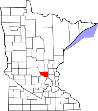 | |
| Townships | ||
| Unincorporated communities | ||
| Footnotes | ‡This populated place also has portions in an adjacent county or counties | |
This article is issued from Wikipedia - version of the 10/26/2016. The text is available under the Creative Commons Attribution/Share Alike but additional terms may apply for the media files.