Zimmerman, Minnesota
| Zimmerman, Minnesota | |
|---|---|
| City | |
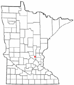 Location of the city of Zimmerman within Sherburne County, Minnesota | |
| Coordinates: 45°26′38″N 93°35′27″W / 45.44389°N 93.59083°WCoordinates: 45°26′38″N 93°35′27″W / 45.44389°N 93.59083°W | |
| Country | United States |
| State | Minnesota |
| County | Sherburne |
| Area[1] | |
| • Total | 3.56 sq mi (9.22 km2) |
| • Land | 3.42 sq mi (8.86 km2) |
| • Water | 0.14 sq mi (0.36 km2) |
| Population (2010)[2] | |
| • Total | 5,228 |
| • Estimate (2012[3]) | 5,246 |
| • Density | 1,528.7/sq mi (590.2/km2) |
| Time zone | Central (CST) (UTC-6) |
| • Summer (DST) | CDT (UTC-5) |
| ZIP code | 55398 |
| Area code(s) | 763 |
| FIPS code | 27-72238[4] |
| Website | zimmerman.govoffice.com |
Zimmerman is a city in Sherburne County, Minnesota, United States. The population was 5,228 at the 2010 census.[5]
Zimmerman is mostly a rural community. U.S. Highway 169 serves as a main route in the area.
The community is located 42 miles north–northwest of Minneapolis; and 33 miles east–southeast of St. Cloud.
History
The Village of Lake Fremont was incorporated in 1910. In 1967, the town was renamed the City of Zimmerman. Lake Fremont was named for the western explorer, John C. Frémont, and the name Zimmerman derives from Moses Zimmerman, a local farmer who was influential in promoting the idea of the Great Northern Railway coming through the area.
Events
Every year in Zimmerman on Memorial Day weekend there is a community event called the "Wild West Days".[6] This includes a carnival in Lion's Park, a parade, softball tournament, 5k charity run and many other activities. The parade usually includes the Middle/High School's band students (including Zimmerman High School Drumline), the fire department from Zimmerman and surrounding areas and floats from the area's many businesses. Also, the weekend after Labor Day the Zimmerman/Livonia Fire Dept. has their annual open house with tours of the fire station, safety demonstrations and other activities that are followed by a street dance in front of the station. This event is usually complemented by events involving many of the area churches and organizations.
Points of interest
Zimmerman is located close to many lakes. Lake Fremont is a spring fed lake located within the eastern most boundary of the city. Lake Fremont offers fishing, boating and swimming. Zimmerman is also the gateway to the Sherburne National Wildlife Refuge, which is one of the few natural oak savannas in the country. Zimmerman is also near the Sand Dunes State Forest, which features many miles of horse and snowmobile trails for one's enjoyment. The Sand Dunes State Forest also has camping, fishing, and swimming.
Schools
There are currently three school buildings in Zimmerman. The oldest is Zimmerman Elementary School. This school celebrated its 50th anniversary of operation in 2007 and underwent a renovation in 2009. It currently houses grades K-2. The other elementary school is Westwood Elementary School. It is one of the most energy efficient schools in the country. It has earned many awards for this, and news coverage for its extremely small energy bills. It contains a very efficient air filtration system, and the lighting is adjusted automatically. This school houses grades 3-5 and was completed in 2004. The other school is the combined Middle/High School. It was a middle school with the high school students attending Elk River High School. This continued until 2005 when the addition for the high school was added on. The High School sports teams are called the Thunder.
Geography
According to the United States Census Bureau, the city has a total area of 3.56 square miles (9.22 km2); 3.42 square miles (8.86 km2) is land and 0.14 square miles (0.36 km2) is water.[1]
Major highways
Demographics
| Historical population | |||
|---|---|---|---|
| Census | Pop. | %± | |
| 1910 | 175 | — | |
| 1920 | 240 | 37.1% | |
| 1930 | 206 | −14.2% | |
| 1940 | 188 | −8.7% | |
| 1950 | 169 | −10.1% | |
| 1960 | 302 | 78.7% | |
| 1970 | 495 | 63.9% | |
| 1980 | 1,074 | 117.0% | |
| 1990 | 1,350 | 25.7% | |
| 2000 | 2,851 | 111.2% | |
| 2010 | 5,228 | 83.4% | |
| Est. 2015 | 5,350 | [7] | 2.3% |
2010 census
As of the census[2] of 2010, there were 5,228 people, 1,802 households, and 1,344 families residing in the city. The population density was 1,528.7 inhabitants per square mile (590.2/km2). There were 1,944 housing units at an average density of 568.4 per square mile (219.5/km2). The racial makeup of the city was 95.4% White, 1.0% African American, 0.7% Native American, 0.9% Asian, 0.3% from other races, and 1.7% from two or more races. Hispanic or Latino of any race were 1.9% of the population.
There were 1,802 households of which 52.2% had children under the age of 18 living with them, 53.8% were married couples living together, 13.6% had a female householder with no husband present, 7.2% had a male householder with no wife present, and 25.4% were non-families. 18.0% of all households were made up of individuals and 3.8% had someone living alone who was 65 years of age or older. The average household size was 2.90 and the average family size was 3.28.
The median age in the city was 29.7 years. 33.8% of residents were under the age of 18; 7.6% were between the ages of 18 and 24; 36.9% were from 25 to 44; 16.9% were from 45 to 64; and 4.6% were 65 years of age or older. The gender makeup of the city was 49.2% male and 50.8% female.
2000 census
As of the census[4] of 2000, there were 2,851 people, 963 households, and 722 families residing in the city. The population density was 1,026.0 people per square mile (396.0/km²). There were 1,018 housing units at an average density of 366.4 per square mile (141.4/km²). The racial makeup of the city was 97.61% White, 0.11% African American, 0.25% Native American, 0.28% Asian, 0.35% from other races, and 1.40% from two or more races. Hispanic or Latino of any race were 1.30% of the population.
There were 963 households out of which 49.8% had children under the age of 18 living with them, 56.5% were married couples living together, 13.8% had a female householder with no husband present, and 25.0% were non-families. 17.9% of all households were made up of individuals and 5.4% had someone living alone who was 65 years of age or older. The average household size was 2.96 and the average family size was 3.39.
In the city the population was spread out with 36.0% under the age of 18, 9.2% from 18 to 24, 37.0% from 25 to 44, 13.2% from 45 to 64, and 4.7% who were 65 years of age or older. The median age was 27 years. For every 100 females there were 99.6 males. For every 100 females age 18 and over, there were 93.7 males.
The median income for a household in the city was $49,332, and the median income for a family was $51,275. Males had a median income of $37,298 versus $24,918 for females. The per capita income for the city was $18,528. About 4.3% of families and 6.3% of the population were below the poverty line, including 8.2% of those under age 18 and 17.3% of those age 65 or over.
Notable people
- Lisa Fobbe, former member of the Minnesota Senate.
References
- 1 2 "US Gazetteer files 2010". United States Census Bureau. Archived from the original on January 24, 2012. Retrieved 2012-11-13.
- 1 2 "American FactFinder". United States Census Bureau. Retrieved 2012-11-13.
- ↑ "Population Estimates". United States Census Bureau. Archived from the original on June 17, 2013. Retrieved 2013-05-28.
- 1 2 "American FactFinder". United States Census Bureau. Archived from the original on September 11, 2013. Retrieved 2008-01-31.
- ↑ "2010 Census Redistricting Data (Public Law 94-171) Summary File". American FactFinder. U.S. Census Bureau, 2010 Census. Archived from the original on July 21, 2011. Retrieved 23 April 2011.
- ↑ Wild West Days website
- ↑ "Annual Estimates of the Resident Population for Incorporated Places: April 1, 2010 to July 1, 2015". Retrieved July 2, 2016.
- ↑ "Census of Population and Housing". Census.gov. Archived from the original on May 11, 2015. Retrieved June 4, 2015.
External links
Municipalities and communities of Sherburne County, Minnesota, United States | ||
|---|---|---|
| Cities | 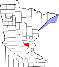 | |
| Townships | ||
| Unincorporated communities | ||
| Footnotes | ‡This populated place also has portions in an adjacent county or counties | |