Sawyer, Oklahoma
| Sawyer, Oklahoma | |
|---|---|
| Town | |
 Location of Sawyer, Oklahoma | |
| Coordinates: 34°0′46″N 95°22′20″W / 34.01278°N 95.37222°WCoordinates: 34°0′46″N 95°22′20″W / 34.01278°N 95.37222°W | |
| Country | United States |
| State | Oklahoma |
| County | Choctaw |
| Area | |
| • Total | 8.8 sq mi (22.7 km2) |
| • Land | 8.6 sq mi (22.4 km2) |
| • Water | 0.1 sq mi (0.3 km2) |
| Elevation | 423 ft (129 m) |
| Population (2010) | |
| • Total | 321 |
| • Density | 37/sq mi (14.3/km2) |
| Time zone | Central (CST) (UTC-6) |
| • Summer (DST) | CDT (UTC-5) |
| ZIP code | 74756 |
| Area code(s) | 580 |
| FIPS code | 40-65650[1] |
| GNIS feature ID | 1097856[2] |
Sawyer is a town in Choctaw County, Oklahoma, United States. The population was 321 at the 2010 census.[3]
Geography
Sawyer is located in eastern Choctaw County at 34°0′46″N 95°22′20″W / 34.01278°N 95.37222°W (34.012880, -95.372138).[4] The town center is on the east side of the Kiamichi River at Hugo Dam. The town limits extend north up the east side of Hugo Lake and west to touch the southwest side of the lake.
U.S. Route 70 passes through the town, leading west 8 miles (13 km) to the city of Hugo, the Choctaw County seat, and east 6 miles (10 km) to Fort Towson.
According to the United States Census Bureau, the town of Sawyer has a total area of 8.8 square miles (22.7 km2), of which 8.6 square miles (22.4 km2) is land and 0.12 square miles (0.3 km2), or 1.13%, is water.[3]
Demographics
| Historical population | |||
|---|---|---|---|
| Census | Pop. | %± | |
| 2000 | 274 | — | |
| 2010 | 321 | 17.2% | |
| Est. 2015 | 317 | [5] | −1.2% |
As of the census[1] of 2000, there were 274 people, 115 households, and 80 families residing in the town. The population density was 59.0 people per square mile (22.8/km²). There were 127 housing units at an average density of 27.4 per square mile (10.6/km²). The racial makeup of the town was 76.28% White, 0.36% African American, 17.15% Native American, 0.73% from other races, and 5.47% from two or more races. Hispanic or Latino of any race were 1.46% of the population.
There were 115 households out of which 27.0% had children under the age of 18 living with them, 61.7% were married couples living together, 6.1% had a female householder with no husband present, and 29.6% were non-families. 25.2% of all households were made up of individuals and 7.8% had someone living alone who was 65 years of age or older. The average household size was 2.38 and the average family size was 2.89.
In the town the population was spread out with 24.8% under the age of 18, 5.1% from 18 to 24, 29.6% from 25 to 44, 27.4% from 45 to 64, and 13.1% who were 65 years of age or older. The median age was 39 years. For every 100 females there were 97.1 males. For every 100 females age 18 and over, there were 100.0 males.
The median income for a household in the town was $24,375, and the median income for a family was $29,688. Males had a median income of $26,071 versus $19,375 for females. The per capita income for the town was $11,874. About 16.0% of families and 24.9% of the population were below the poverty line, including 24.7% of those under the age of eighteen and 60.9% of those sixty five or over.
References
- 1 2 "American FactFinder". United States Census Bureau. Retrieved 2008-01-31.
- ↑ "US Board on Geographic Names". United States Geological Survey. 2007-10-25. Retrieved 2008-01-31.
- 1 2 "Geographic Identifiers: 2010 Demographic Profile Data (G001): Sawyer town, Oklahoma". U.S. Census Bureau, American Factfinder. Retrieved February 20, 2015.
- ↑ "US Gazetteer files: 2010, 2000, and 1990". United States Census Bureau. 2011-02-12. Retrieved 2011-04-23.
- ↑ "Annual Estimates of the Resident Population for Incorporated Places: April 1, 2010 to July 1, 2015". Retrieved July 2, 2016.
- ↑ "Census of Population and Housing". Census.gov. Retrieved June 4, 2015.
Municipalities and communities of Choctaw County, Oklahoma, United States | ||
|---|---|---|
| City | 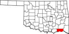 | |
| Towns | ||
| CDPs | ||
| Other unincorporated communities | ||