Selendi
| Selendi | |
|---|---|
| District | |
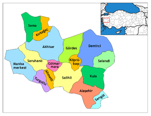 Location of Selendi within Turkey. | |
 Selendi Location of Selendi | |
| Coordinates: 38°45′N 28°52′E / 38.750°N 28.867°E | |
| Country |
|
| Region | Aegean |
| Province | Manisa |
| Area[1] | |
| • District | 700.97 km2 (270.65 sq mi) |
| Elevation | 431 m (1,414 ft) |
| Population (2012)[2] | |
| • Urban | 6,558 |
| • District | 22,273 |
| • District density | 32/km2 (82/sq mi) |
| Time zone | EET (UTC+2) |
| • Summer (DST) | EEST (UTC+3) |
| Postal code | 45xxx |
| Area code(s) | 236 |
| Licence plate | 45 |
| Website | www.selendi.bel.tr |
Selendi is a town and district of Manisa Province in the Aegean region of Turkey. According to the 2000 census, population of the district is 26,061 of which 8,095 live in the town of Selendi.[3] The district covers an area of 701 km2 (271 sq mi),[4] and the town lies at an elevation of 431 m (1,414 ft).
It was located in antiquity on a tributary of the Hermos River.[5]
Bishopric
The town remains a titular See in the Roman Catholic Church.
Notes
- ↑ "Area of regions (including lakes), km²". Regional Statistics Database. Turkish Statistical Institute. 2002. Retrieved 2013-03-05.
- ↑ "Population of province/district centers and towns/villages by districts - 2012". Address Based Population Registration System (ABPRS) Database. Turkish Statistical Institute. Retrieved 2013-02-27.
- ↑ Turkish Statistical Institute. "Census 2000, Key statistics for urban areas of Turkey" (in Turkish). Archived from the original (XLS) on 2007-07-22. Retrieved 2009-04-16.
- ↑ Statoids. "Statistical information on districts of Turkey". Archived from the original on 2010-05-26. Retrieved 2009-04-16.
- ↑ W. M. Ramsay, The Historical Geography of Asia Minor p122.
References
- Falling Rain Genomics, Inc. "Geographical information on Selendi, Turkey". Archived from the original on 2012-11-02. Retrieved 2009-04-16.
External links
- District municipality's official website (Turkish)
- Road map of Selendi and environs
- Various images of Selendi, Manisa
- Communication portal of Selendi (Turkish)
Coordinates: 38°44′40″N 28°52′04″E / 38.74444°N 28.86778°E
This article is issued from Wikipedia - version of the 11/21/2016. The text is available under the Creative Commons Attribution/Share Alike but additional terms may apply for the media files.