Fort Mill, South Carolina
| Fort Mill, South Carolina | |
|---|---|
| Suburban Town | |
|
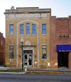
Fort Mill Historic District | |
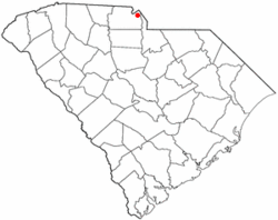 Location of Fort Mill in the state of South Carolina. | |
| Coordinates: 35°0′N 80°57′W / 35.000°N 80.950°WCoordinates: 35°0′N 80°57′W / 35.000°N 80.950°W | |
| Country | United States |
| State | South Carolina |
| Counties | York |
| Established | 1873[1] |
| Government | |
| • Type | Mayor-council |
| • Mayor | Guynn Savage, since 1/2016 |
| Area | |
| • Suburban Town | 4.6 sq mi (12.0 km2) |
| • Land | 4.6 sq mi (11.8 km2) |
| • Water | 0.1 sq mi (0.2 km2) |
| Elevation | 633 ft (193 m) |
| Population (2010) | |
| • Suburban Town | 10,811 |
| • Density | 1,662.7/sq mi (642.0/km2) |
| • Urban | 36,119 |
| Time zone | Eastern (EST) (UTC-5) |
| • Summer (DST) | EDT (UTC-4) |
| ZIP codes | 29715, 29716 |
| Area code(s) | 803 |
| FIPS code | 45-26890[2] |
| GNIS feature ID | 1247805[3] |
| Website |
www |
Fort Mill, also known as Fort Mill Township, is a suburban town in York County in the U.S. state of South Carolina, and a suburb of the city of Charlotte, North Carolina, and is near Rock Hill. Approximately 10,811 people live inside the town's corporate limits as of the 2010 Census with a total of 36,119 people residing within the entire urban area.[1]
Fort Mill township is home to notable businesses such as Continental Tire the Americas, LLC., Domtar, Mood Media, Springs Industries, AECOM, and serves as the headquarters of Carolina Crown Drum and Bugle Corps, DCI World Champions in 2013.
History
The town of Fort Mill was established in 1873, taking its name from a colonial-era fort built by the British and a grist mill on nearby Steele Creek. The Catawba Indians made their home in present-day Fort Mill for many years. Scotch-Irish settlers began arriving in the 1750s and 1760s and a small settlement soon developed. Fort Mill grew rapidly in the late 19th century as textile mills were established. After many textile mill shut-downs the town continued to grow rapidly and became a major suburb of Charlotte.
Highlights in Fort Mill's history include:
- In the mid-18th century, Thomas Spratt and his wife Elizabeth were traveling through upper South Carolina in their wagon. They spent a night among the friendly Catawba Indians and were invited to stay and live in the area on a large tract of land given to them. They became the first white settlers in the Fort Mill area and their descendants still reside there.
- The town of Fort Mill was the site of the last Confederate Government Cabinet meeting (1865).[1] Jefferson Davis and the Confederate Cabinet passed through the area during their flight from Richmond in 1865. The last meeting of the full Confederate Cabinet was held at the White Homestead in Fort Mill. Fort Mill's Confederate Park contains the nation's only monument to slaves fighting on the Confederate side of the American Civil War.
- In the 1980s, Fort Mill was the home to TV evangelist Jim Bakker's now defunct Heritage USA (now reopened as Heritage International Ministries).
The Banks-Mack House, Fort Mill Downtown Historic District, Mack-Belk House, Mills House, Nation Ford Road, National Guard Armory, Spratt Cemetery, Springfield Plantation House, Thornwell-Elliott House, Unity Presbyterian Church Complex, John M. White House, William Elliott White House, and Wilson House are listed on the National Register of Historic Places.[4]
Geography and climate
According to the United States Census Bureau, the town has a total area of 4.6 square miles (12 square kilometres), of which 4.6 square miles (12 square kilometres) is land and 0.1 square miles (0.26 square kilometres) (1.30%) is water. Interstate 77 passes through the western portions of the town, and exit 85 is signed "South Carolina Highway 160/Fort Mill." SC 160 is the main east-west street in Fort Mill.
The town of Fort Mill held a final public hearing in October 2008 on a proposed annexation that doubled the town's physical size.[5] Fort Mill has three golf courses. The city also maintains three parks, Harris Street Park, Steele Street Park, and Doby Bridge Park. All three parks have picnic shelters, children's playgrounds, and restrooms. Doby Bridge and Harris Street Parks have lighted baseball fields, Steele Street and Harris Street Parks have basketball courts, and Steele Street Park has a small water park.[1] The town also maintains a banquet hall rentable through the parks and recreation department.
Fort Mill is located in a humid subtropical climate, Cfa in the Köppen climate classification. This means that the city experiences four distinct seasons, although the variation between the seasons is not as pronounced as in other parts of the United States. Generally, daytime maximum temperatures in the summer are around 90 °F (32 °C), with nighttime low temperatures of approximately 70 °F (21 °C). In winter, daytime maxima average around 50 °F (10 °C) while nighttime low temperatures are near 30 °F (−1 °C). Occasional readings as high as 105 °F (41 °C) are seen, reaching a high of 108 °F (42 °C) in 2007 or as low as −5 °F (−21 °C) in 1989. Summers are generally humid and prone to thunderstorms, while winters are rainy with sleet and occasional snow. Snow might fall during the winter, but usually does not accumulate or persist as ground cover. Fort Mill experiences rainfall related to tropical cyclones but is generally too far inland to experience damaging winds. Fort Mill has not had any direct hits from any tropical systems since 1989, when Hurricane Hugo devastated the area.
The most common soil in Fort Mill is Cecil series.[6]
Government
The government of Fort Mill takes place within the framework of a mayor-council system. Currently, the town council of Fort Mill consists of six board members, two of whom serve from at-large districts, while the remainder of the council represent each of four wards. Elections are held in accordance with United States election regulations every two years, and council members serve staggered four year terms.[1] The town council meets the second Friday of each month. The town of Fort Mill currently has five boards and commissions. These are the Zoning Board of Appeals, the Planning Commission, the Historical Review Board, the Elections Commission, and the Housing Authority Board. Members of boards and commissions are appointed on a volunteer basis.
Fort Mill is the primary community within the Fort Mill School District, which also serves children from the nearby community of Tega Cay. The Fort Mill school district is considered one of the best school districts in the state of South Carolina.[1]
The current mayor is Guynn Savage, who was sworn in January 12, 2016.[7]
Fort Mill is currently represented by the following legislators:[1]
- US Senate: Senior Senator Lindsey Graham (R) and Junior Senator Tim Scott (R)
- US House: J. "Mick" Michael Mulvaney (R), as part of South Carolina's 5th congressional district
- South Carolina Senate: Chauncey K. Gregory (R) as part of South Carolina Senate District 16
- South Carolina House of Representatives: Deborah Long (R) as part of South Carolina House District 45
The northern portions of Fort Mill Township are represented in the South Carolina House by Carl L. Gullick (R) as part of South Carolina House District 48.[1]
Demographics
| Historical population | |||
|---|---|---|---|
| Census | Pop. | %± | |
| 1880 | 290 | — | |
| 1890 | 689 | 137.6% | |
| 1900 | 1,394 | 102.3% | |
| 1910 | 1,616 | 15.9% | |
| 1920 | 1,940 | 20.0% | |
| 1930 | 2,112 | 8.9% | |
| 1940 | 2,919 | 38.2% | |
| 1950 | 3,204 | 9.8% | |
| 1960 | 3,315 | 3.5% | |
| 1970 | 4,505 | 35.9% | |
| 1980 | 4,162 | −7.6% | |
| 1990 | 4,930 | 18.5% | |
| 2000 | 7,587 | 53.9% | |
| 2010 | 10,811 | 42.5% | |
| Est. 2015 | 13,662 | [8] | 26.4% |
As of the census[2] of 2010, there were 10,811 people, 4,168 households, and 2,184 families residing in the town. The population density was 661.6 people per square mile. There were 4,479 housing units at an average density of 676.9 per square mile. The racial makeup of the town was 77.6% White, 17.6% African American, 0.4% Native American, 1.3% Asian, and 2.1% from two or more races. Hispanic or Latino of any race were 2.9% of the population.
There were 2,890 households out of which 43.8% had children under the age of 18 living with them, 56.2% were married couples living together, 17.2% had a female householder with no husband present, and 24.4% were non-families. 21.8% of all households were made up of individuals and 8.4% had someone living alone who was 65 years of age or older. The average household size was 2.67 and the average family size was 3.14.
In the town the population was spread out with 31.1% under the age of 18, 6.1% from 18 to 24, 32.4% from 25 to 44, 20.0% from 45 to 64, and 11.1% who were 65 years of age or older. The median age was 33.7 years. For every 100 females there were 86.7 males. For every 100 females age 18 and over, there were 79.0 males.
The median income for a household in the town was $68,250, and the median income for a family was $79,495. Males had a median income of $58,986 versus $40,819 for females. The per capita income for the town was $36,548. About 7.2% of families and 9.5% of the population were below the poverty line, including 13.6% of those under age 18 and 8.1% of those age 65 or over.
Attractions
Fort Mill is home to numerous attractions and while a small town, Fort Mill has access to many amenities outside the town in nearby Charlotte and Rock Hill.
- Narroway Productions is Christian entertainment offering live theatre and dinner all year. Narroway is located in Fort Mill.
- Cedar Fair's popular Carowinds amusement park is located in Fort Mill.
- Upper Room Chapel a replica of Jerusalem's Upper Room where the Last Supper was held. Visitors can stop by for prayer during hours of operation or meditate along the Walk of Faith, a winding sidewalk through the tranquil wooded area.
- Downtown Fort Mill, SC Main St. - Home to Confederate Park, Memorial Park, and several Retail Shops including Hanauer Bowties, United Artisans of America, The Painted Parrot, Art Junk & Funk, Puckerbutt Pepper Company, and Crossings. The Fort Mill Times and Fort Mill Magazine also find their home on Main Street. This district has over 8 Hair Salons within a half mile of Main Street. The popular restaurant Local Dish that was established in 2012 with the farm-to-table concept is right on Main Street as well.
Fort Mill is also known for its peach orchards and the Anne Springs Close Greenway. The Greenway is an extensive protected natural area consisting of approximately 2,300 acres (9.3 km2) of lakes, forests, and pastures that provide trails for hiking, biking, and horseback riding.
Sports teams
Fort Mill is the Home of the PrimeTime Players a Minor League Basketball Franchise who currently plays in the East Coast Basketball League . The PrimeTime Players are a four time Minor league Champions having won Championships in the TRBL 2012-2014 and the ECBL in 2015. The PrimeTime Players play their home games at Banks Street Gym at 490 Academy Street.
Notable people
- Steve Byrnes — NASCAR on Fox reporter. He died of head and neck cancer on April 21, 2015.
- Randy Primas — First African-American Mayor of Camden, New Jersey (1981–1990)[10]
- Elliott White Springs — World War I flying ace, author, industrialist, and a member of the South Carolina Hall of Fame
- James E. Williams — A Medal of Honor recipient, the most decorated Sailor in the history of the U. S. Navy, a U.S. Marshal of South Carolina, USS James E. Williams
- Vance Walker — NFL defensive tackle for the Denver Broncos.
References
- 1 2 3 4 5 6 7 8 Town of Fort Mill official website, accessed September 27, 2007
- 1 2 "American FactFinder". United States Census Bureau. Retrieved 2008-01-31.
- ↑ "US Board on Geographic Names". United States Geological Survey. 2007-10-25. Retrieved 2008-01-31.
- ↑ National Park Service (2010-07-09). "National Register Information System". National Register of Historic Places. National Park Service.
- ↑ Allen, Jonathan. "Fort Mill 11 #5". The Herald. The Herald. Retrieved 17 June 2016.
- ↑ http://casoilresource.lawr.ucdavis.edu/gmap/ SoilWeb
- ↑ Marks, John. "Savage sworn in as Fort Mill's new mayor". Herald Online. The Herald. Retrieved 22 January 2016.
- ↑ "Annual Estimates of the Resident Population for Incorporated Places: April 1, 2010 to July 1, 2015". Retrieved July 2, 2016.
- ↑ "Census of Population and Housing". Census.gov. Retrieved June 4, 2015.
- ↑ Vargas, Clauia (2012-03-09). "Current and former S.J. politicos attend funeral of former Camden Mayor Randy Primas". Philadelphia Inquirer (Camden Flow). Retrieved 2012-03-11.
External links
|  | ||||||||||||||||||||
|
| |||||||||||||||||||||
Municipalities and communities of Lancaster County, South Carolina, United States | ||
|---|---|---|
| City | 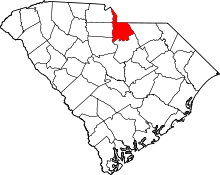 | |
| Towns | ||
| CDPs | ||
| Unincorporated communities | ||
| Footnotes | ‡This populated place also has portions in an adjacent county or counties | |
Municipalities and communities of York County, South Carolina, United States | ||
|---|---|---|
| Cities |  | |
| Towns | ||
| CDPs | ||
| Other unincorporated communities | ||
| Footnotes | ‡This populated place also has portions in an adjacent county or counties | |