McCormick, South Carolina
| McCormick, South Carolina | |
|---|---|
| Town | |
 Location in McCormick County and the state of South Carolina. | |
| Coordinates: 33°54′49″N 82°17′21″W / 33.91361°N 82.28917°WCoordinates: 33°54′49″N 82°17′21″W / 33.91361°N 82.28917°W | |
| Country | United States |
| State | South Carolina |
| County | McCormick |
| Area | |
| • Total | 3.8 sq mi (9.7 km2) |
| • Land | 3.8 sq mi (9.7 km2) |
| • Water | 0.0 sq mi (0.0 km2) |
| Elevation | 535 ft (163 m) |
| Population (2000) | |
| • Total | 1,489 |
| • Density | 396.4/sq mi (153.1/km2) |
| Time zone | Eastern (EST) (UTC-5) |
| • Summer (DST) | EDT (UTC-4) |
| ZIP codes | 29835, 29899 |
| Area code(s) | 864 |
| FIPS code | 45-43720[1] |
| GNIS feature ID | 1246583[2] |
| Website | www.townofmccormicksc.org |
McCormick is a town in McCormick County, South Carolina, United States. The population was 2,783 at the 2010 census. It is the county seat of McCormick County. The town of McCormick is named for inventor Cyrus Hall McCormick (1809–1884). The county was formed in 1916 from parts of Edgefield, Abbeville, and Greenwood counties.
This area was settled in the mid-eighteenth century by Scotch-Irish, French Huguenot, and German farmers. Some of the early inhabitants were massacred by Cherokee Indians at Long Cane in 1760, and the British subsequently built Fort Charlotte to protect the region; this fort was one of the first seized by the Americans in the Revolutionary War.
About 1850 gold was discovered where the town of McCormick now stands. The Dorn Gold Mine, which later also produced manganese, was bought by Cyrus McCormick in 1869; he donated land for the town, which was named for him in 1882. This mine continued to operate until the 1930s.
Several prominent South Carolinians have resided in the area that is now McCormick County, including U.S. Vice President, U.S. Senator, Secretary of State, SC Representative John C. Calhoun, Governor Patrick Noble, Governor and U. S. Senator George McDuffie (1790–1851), Unionist leader James Louis Petigru (1789–1863), and Moses Waddel (1770–1840), who taught many of the future leaders of the country and state at his Willington Academy.
The Dorn Gold Mine, Dorn's Flour and Grist Mill, Joseph Jennings Dorn House, Eden Hall, Farmer's Bank, John Albert Gibert M.D. House, Otway Henderson House, Hotel Keturah, McCormick County Courthouse, McCormick Train Station, and M.L.B. Sturkey House are listed on the National Register of Historic Places.[3]
Geography
McCormick is located at 33°54′49″N 82°17′21″W / 33.91361°N 82.28917°W (33.913565, -82.289154).[4]
According to the United States Census Bureau, the town has a total area of 3.8 square miles (9.8 km2), all of it land.
Demographics
| Historical population | |||
|---|---|---|---|
| Census | Pop. | %± | |
| 1900 | 237 | — | |
| 1910 | 613 | 158.6% | |
| 1920 | 1,284 | 109.5% | |
| 1930 | 1,304 | 1.6% | |
| 1940 | 1,456 | 11.7% | |
| 1950 | 1,744 | 19.8% | |
| 1960 | 1,998 | 14.6% | |
| 1970 | 1,864 | −6.7% | |
| 1980 | 1,725 | −7.5% | |
| 1990 | 1,659 | −3.8% | |
| 2000 | 1,489 | −10.2% | |
| 2010 | 2,783 | 86.9% | |
| Est. 2015 | 2,578 | [5] | −7.4% |
As of the census[1] of 2000, there were 1,489 people, 657 households, and 400 families residing in the town. The population density was 396.4 people per square mile (152.9/km²). There were 737 housing units at an average density of 196.2 per square mile (75.7/km²). The racial makeup of the town was 32.51% White, 64.07% African American, 0.13% Native American, 0.13% Asian, 1.41% from other races, and 1.75% from two or more races. Hispanic or Latino of any race were 1.54% of the population.
There were 657 households out of which 26.3% had children under the age of 18 living with them, 33.3% were married couples living together, 23.9% had a female householder with no husband present, and 39.1% were non-families. 37.4% of all households were made up of individuals and 16.0% had someone living alone who was 65 years of age or older. The average household size was 2.24 and the average family size was 2.95.
In the town the population was spread out with 24.0% under the age of 18, 8.6% from 18 to 24, 22.5% from 25 to 44, 26.3% from 45 to 64, and 18.7% who were 65 years of age or older. The median age was 41 years. For every 100 females there were 77.9 males. For every 100 females age 18 and over, there were 75.8 males.
The median income for a household in the town was $19,688, and the median income for a family was $34,375. Males had a median income of $26,027 versus $20,263 for females. The per capita income for the town was $14,338. About 20.7% of families and 26.8% of the population were below the poverty line, including 38.3% of those under age 18 and 18.4% of those age 65 or over. According to the 2010 Census, the population was 2,783. 1,900 (68.27%) were Black or African, 820 (29.46%) were White, 26 (0.93%) were two or more races, 14 (0.50%) were Asian, 13 (0.47%) were some other race, 5 (0.18%) were American Indian or Alaska Native, 5 (0.18%) were Native Hawaiian or other Pacific Islander. 45 (1.62%) were Hispanic or Latino of any race.[7]
Notable people
- John C. Calhoun - Vice President of the United States
- Johnny Letman - Musician
- Patrick Noble - SC Governor
References
- 1 2 "American FactFinder". United States Census Bureau. Archived from the original on September 11, 2013. Retrieved 2008-01-31.
- ↑ "US Board on Geographic Names". United States Geological Survey. 2007-10-25. Retrieved 2008-01-31.
- ↑ National Park Service (2010-07-09). "National Register Information System". National Register of Historic Places. National Park Service.
- ↑ "US Gazetteer files: 2010, 2000, and 1990". United States Census Bureau. 2011-02-12. Retrieved 2011-04-23.
- ↑ "Annual Estimates of the Resident Population for Incorporated Places: April 1, 2010 to July 1, 2015". Retrieved July 2, 2016.
- ↑ "Census of Population and Housing". Census.gov. Archived from the original on May 11, 2015. Retrieved June 4, 2015.
- ↑ http://censusviewer.com/city/sc/mccormick/2010
Municipalities and communities of McCormick County, South Carolina, United States | ||
|---|---|---|
| Towns | 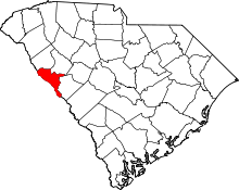 | |
| CDPs | ||