Springdale, Ohio
| Springdale, Ohio | |
|---|---|
| City | |
|
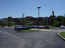
Part of the Maple Knoll Village retirement complex | |
| Motto: "Come Explore The Opportunities" | |
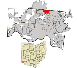 Location in Hamilton County and the state of Ohio. | |
| Coordinates: 39°17′35″N 84°28′59″W / 39.29306°N 84.48306°WCoordinates: 39°17′35″N 84°28′59″W / 39.29306°N 84.48306°W | |
| Country | United States |
| State | Ohio |
| County | Hamilton |
| Government | |
| • Mayor | Doyle Webster (R)[1] |
| Area[2] | |
| • Total | 4.97 sq mi (12.87 km2) |
| • Land | 4.96 sq mi (12.85 km2) |
| • Water | 0.01 sq mi (0.03 km2) |
| Elevation[3] | 738 ft (225 m) |
| Population (2010)[4] | |
| • Total | 11,223 |
| • Estimate (2012[5]) | 11,198 |
| • Density | 2,262.7/sq mi (873.6/km2) |
| Time zone | Eastern (EST) (UTC-5) |
| • Summer (DST) | EDT (UTC-4) |
| ZIP code | 45246 |
| Area code(s) | 513 |
| FIPS code | 39-74104[6] |
| GNIS feature ID | 1065369[3] |
| Website |
www |
Springdale is a city in Hamilton County, Ohio, United States. The population was 11,223 at the 2010 census.[7]
Geography
Springdale is located at 39°17′35″N 84°28′59″W / 39.29306°N 84.48306°W (39.293037, -84.483003).[8]
According to the United States Census Bureau, the city has a total area of 4.97 square miles (12.87 km2), of which 4.96 square miles (12.85 km2) is land and 0.01 square miles (0.03 km2) is water.[2]
Demographics
| Historical population | |||
|---|---|---|---|
| Census | Pop. | %± | |
| 1870 | 382 | — | |
| 1960 | 3,556 | — | |
| 1970 | 8,127 | 128.5% | |
| 1980 | 7,474 | −8.0% | |
| 1990 | 10,621 | 42.1% | |
| 2000 | 10,563 | −0.5% | |
| 2010 | 11,223 | 6.2% | |
| Est. 2015 | 11,182 | [9] | −0.4% |
| Sources:[10][11][6][12] | |||
2010 census
As of the census[4] of 2010, there were 11,223 people, 4,631 households, and 2,771 families residing in the city. The population density was 2,262.7 inhabitants per square mile (873.6/km2). There were 4,906 housing units at an average density of 989.1 per square mile (381.9/km2). The racial makeup of the city was 55.0% White, 29.9% African American, 0.3% Native American, 2.8% Asian, 0.4% Pacific Islander, 8.7% from other races, and 2.9% from two or more races. Hispanic or Latino of any race were 17.5% of the population.
There were 4,631 households of which 29.1% had children under the age of 18 living with them, 40.2% were married couples living together, 14.8% had a female householder with no husband present, 4.9% had a male householder with no wife present, and 40.2% were non-families. 34.9% of all households were made up of individuals and 19.5% had someone living alone who was 65 years of age or older. The average household size was 2.38 and the average family size was 3.07.
The median age in the city was 38.7 years. 22.6% of residents were under the age of 18; 9.4% were between the ages of 18 and 24; 25.1% were from 25 to 44; 22.9% were from 45 to 64; and 20% were 65 years of age or older. The gender makeup of the city was 46.5% male and 53.5% female.
2000 census
As of the census[6] of 2000, there were 10,563 people, 4,421 households, and 2,816 families residing in the city. The population density was 2,131.0 people per square mile (822.3/km²). There were 4,607 housing units at an average density of 929.4 per square mile (358.6/km²). The racial makeup of the city was 68.38% White, 25.63% African American, 0.11% Native American, 2.53% Asian, 0.02% Pacific Islander, 1.50% from other races, and 1.84% from two or more races. Hispanic or Latino of any race were 3.64% of the population.
There were 4,421 households out of which 29.0% had children under the age of 18 living with them, 46.7% were married couples living together, 13.7% had a female householder with no husband present, and 36.3% were non-families. 32.0% of all households were made up of individuals and 16.3% had someone living alone who was 65 years of age or older. The average household size was 2.33 and the average family size was 2.95.
In the city the population was spread out with 24.0% under the age of 18, 7.3% from 18 to 24, 27.0% from 25 to 44, 23.0% from 45 to 64, and 18.7% who were 65 years of age or older. The median age was 39 years. For every 100 females there were 82.9 males. For every 100 females age 18 and over, there were 76.6 males.
The median income for a household in the city was $44,732, and the median income for a family was $53,979. Males had a median income of $43,259 versus $29,763 for females. The per capita income for the city was $23,688. About 7.7% of families and 8.9% of the population were below the poverty line, including 13.2% of those under age 18 and 5.6% of those age 65 or over.
Economy
Kroger operates its Cincinnati-area regional offices at 150 Tri-County Parkway in Springdale; Kroger is headquartered in nearby Cincinnati.[13]
Institutions
- Cincom Systems
- Humana RightSourceRx
- Maple Knoll Village and WMKV
- Tri-County Mall
References
- ↑ "Hamilton County Officials 2016" (PDF). Hamilton County Board of Elections 2016. 27 January 2016. p. 23. Retrieved 1 February 2016.
- 1 2 "US Gazetteer files 2010". United States Census Bureau. Retrieved 2013-01-06.
- 1 2 "US Board on Geographic Names". United States Geological Survey. 2007-10-25. Retrieved 2008-01-31.
- 1 2 "American FactFinder". United States Census Bureau. Retrieved 2013-01-06.
- ↑ "Population Estimates". United States Census Bureau. Retrieved 2013-06-17.
- 1 2 3 "American FactFinder". United States Census Bureau. Retrieved 2008-01-31.
- ↑ "Profile of General Population and Housing Characteristics: 2010 Demographic Profile Data (DP-1): Springdale city, Ohio". U.S. Census Bureau, American Factfinder. Retrieved October 31, 2012.
- ↑ "US Gazetteer files: 2010, 2000, and 1990". United States Census Bureau. 2011-02-12. Retrieved 2011-04-23.
- ↑ "Annual Estimates of the Resident Population for Incorporated Places: April 1, 2010 to July 1, 2015". Retrieved July 2, 2016.
- ↑ "Number of Inhabitants: Ohio" (PDF). 18th Census of the United States. U.S. Census Bureau. Retrieved 22 November 2013.
- ↑ "Ohio: Population and Housing Unit Counts" (PDF). U.S. Census Bureau. Retrieved 22 November 2013.
- ↑ "Incorporated Places and Minor Civil Divisions Datasets: Subcounty Population Estimates: April 1, 2010 to July 1, 2012". U.S. Census Bureau. Retrieved 25 November 2013.
- ↑ "Contact Us." Kroger. Retrieved on April 30, 2009.
External links
Municipalities and communities of Hamilton County, Ohio, United States | ||
|---|---|---|
| Cities |  | |
| Villages | ||
| Townships | ||
| CDPs |
| |
| Other unincorporated communities | ||
| Footnotes | ‡This populated place also has portions in an adjacent county or counties | |