Stowe Township, Allegheny County, Pennsylvania
| Stowe Township | |
|---|---|
| Township | |
|
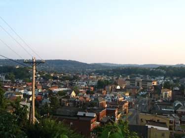
A small part of the West Park neighborhood in Stowe Township. Sto-Rox High School is visible. | |
 Location in Allegheny County and state of Pennsylvania | |
| Coordinates: 40°28′47″N 80°4′26″W / 40.47972°N 80.07389°WCoordinates: 40°28′47″N 80°4′26″W / 40.47972°N 80.07389°W | |
| Country | United States |
| State | Pennsylvania |
| County | Allegheny |
| Area | |
| • Total | 2.4 sq mi (6.1 km2) |
| • Land | 2.0 sq mi (5.1 km2) |
| • Water | 0.3 sq mi (0.9 km2) |
| Population (2010) | |
| • Total | 6,362 |
| • Density | 2,700/sq mi (1,000/km2) |
| Time zone | Eastern (EST) (UTC-5) |
| • Summer (DST) | EDT (UTC-4) |
| ZIP codes | 15136 |
| Area code(s) | 412 |
Stowe Township is a township in Allegheny County, Pennsylvania, United States. The population was 6,362 at the 2010 census.[1]
It is located in the Sto-Rox School District, which serves both Stowe Township and the neighboring borough of McKees Rocks.
Stowe Township has partnered with the Allegheny Together organization to revitalize its main business district on Broadway Avenue.
The area is well served by Port Authority bus routes 21A, 21B, 21C, 21D, 21F, CO, and 24A.
Geography
Stowe Township is located at 40°28′46″N 80°4′26″W / 40.47944°N 80.07389°W (40.479668, -80.07389).[2]
According to the United States Census Bureau, the township has a total area of 2.3 square miles (6.0 km2), of which 2.0 square miles (5.2 km2) is land and 0.4 square miles (1.0 km2), or 15.38%, is water.
Neighborhoods
- Island Heights, only accessible through Kennedy Township, located on a slope overlooking Neville Island
- Pittock, very small Italian neighborhood located just off PA 51 Northbound, before the Fleming Park Bridge
- West Park, a mixed residential and commercial neighborhood, where the majority of the buildings were built in the 1920s
- Pleasant Ridge, a mixed-income housing development
- Presston, a very small neighborhood of duplex townhomes, originally built as housing for the adjacent Pressed Steel Car Company
- Norwood, a small, older neighborhood of small, mostly 2 story homes. This section of Stowe Township is inhabited by many families that are 2nd and 3rd generation Italian.
Surrounding communities
Stowe Township is bordered by Kennedy Township to the west and McKees Rocks to the south. To the northeast, across the Ohio River, are the Pittsburgh neighborhood of Brighton Heights and the boroughs of Bellevue and Avalon. Neville Island in the Ohio River is to the north, via the Fleming Park Bridge.
Demographics
As of the census[3] of 2000, there were 6,706 people, 3,061 households, and 1,805 families residing in the township. The population density was 3,391.4 people per square mile (1,307.7/km²). There were 3,556 housing units at an average density of 1,798.3/sq mi (693.4/km²). The racial makeup of the township was 90.44% White, 8.04% African American, 0.21% Native American, 0.16% Asian, 0.22% from other races, and 0.92% from two or more races. 0.42% of the population were Hispanic or Latino of any race.
There were 3,061 households, out of which 21.9% had children under the age of 18 living with them, 38.0% were married couples living together, 15.8% had a female householder with no husband present, and 41.0% were non-families. 36.3% of all households were made up of individuals, and 16.7% had someone living alone who was 65 years of age or older. The average household size was 2.17 and the average family size was 2.83.
In the township the population was spread out, with 19.9% under the age of 18, 7.2% from 18 to 24, 27.1% from 25 to 44, 22.7% from 45 to 64, and 23.1% who were 65 years of age or older. The median age was 42 years. For every 100 females there were 87.9 males. For every 100 females age 18 and over, there were 84.7 males.
The median income for a household in the township was $29,688, and the median income for a family was $36,688. Males had a median income of $31,151 versus $28,221 for females. The per capita income for the township was $17,783. About 9.0% of families and 13.3% of the population were below the poverty line, including 19.2% of those under age 18 and 8.0% of those age 65 or over.
Notable residents
- Michael Musmanno, Justice for the Supreme Court of Pennsylvania
David S. Cercone Federal Judge
References
- ↑ "Race, Hispanic or Latino, Age, and Housing Occupancy: 2010 Census Redistricting Data (Public Law 94-171) Summary File (QT-PL), Stowe township, Allegheny County, Pennsylvania". U.S. Census Bureau, American FactFinder 2. Retrieved September 30, 2011.
- ↑ "US Gazetteer files: 2010, 2000, and 1990". United States Census Bureau. 2011-02-12. Retrieved 2011-04-23.
- ↑ "American FactFinder". United States Census Bureau. Retrieved 2008-01-31.
External links
- Stowe Township at Allegheny Together
- Sto-Rox School District
- Post-Gazette Articles - Stowe police to watch street on video cameras/Ceremony to start municipal building work
| Counties |  Map of the Pittsburgh Tri-State with green counties in the metropolitan area and yellow counties in the combined area. | |
|---|---|---|
| Major cities | ||
| Cities and towns 15k-50k (in 2010) | ||
| Airports | ||
| Topics | ||
| ||