Sulphur City, Arkansas
| Sulphur City, Arkansas | |
|---|---|
| Unincorporated community | |
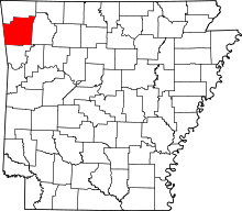
 Sulphur City, Arkansas Sulphur City's position in Arkansas. | |
| Coordinates: 35°57′54″N 94°03′2″W / 35.96500°N 94.05056°WCoordinates: 35°57′54″N 94°03′2″W / 35.96500°N 94.05056°W | |
| Country |
|
| State |
|
| County | Washington |
| Township | White River |
| First post office | 1882 |
| Elevation | 414 m (1,358 ft) |
| Time zone | Central (CST) (UTC-6) |
| • Summer (DST) | CDT (UTC-5) |
| Area code(s) | 479 |
| GNIS feature ID | 78490 |
| U.S. Geological Survey Geographic Names Information System: Sulphur City, Arkansas | |
Sulphur City (formerly Sulphur Springs and Mankins) is an unincorporated community in White River Township, Washington County, Arkansas, United States.[1] It is located at the intersection of Black Oak Road (Washington County Road 57 [CR 57]) and Whitehouse Road (CR 43).[2]
History
The area was first settler in the area was Peter Mankins Sr., who ran a prosperous livestock business. Upon his death in 1881, his son took over the business before joining the Confederate army. A post office was built in 1882, first known as Sulphur Springs, but the name was changed to Mankins since another community by that name already existed in Benton County, Arkansas. Shortly after the change, the community was renamed Sulphur City. The post office closed in 1960.[3]
References
- ↑ "Sulphur City, Arkansas". Geographic Names Information System. United States Geological Survey.
- ↑ Arkansas Atlas and Gazetteer (Map) (Second ed.). DeLorme. § 30.
- ↑ "Sulphur City". Retrieved January 15, 2013.